andyhb
-
Posts
20,454 -
Joined
-
Last visited
Content Type
Profiles
Blogs
Forums
American Weather
Media Demo
Store
Gallery
Everything posted by andyhb
-
https://www.facebook.com/tim.marshall.505/posts/pfbid02RJKCvrhXebooqJXuRpa5FchsPcWhtV4aS8GbgJS1gXVdyNGf1wCFNCZrZuVpsopl This damage in Matador is crazy.
-
Damage reported in Highlands Ranch via Aaron Rigsby.
-
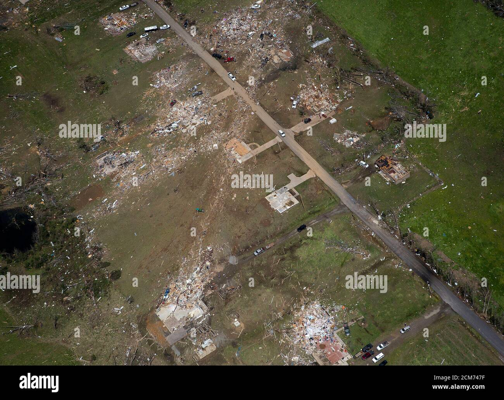
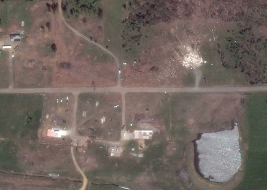
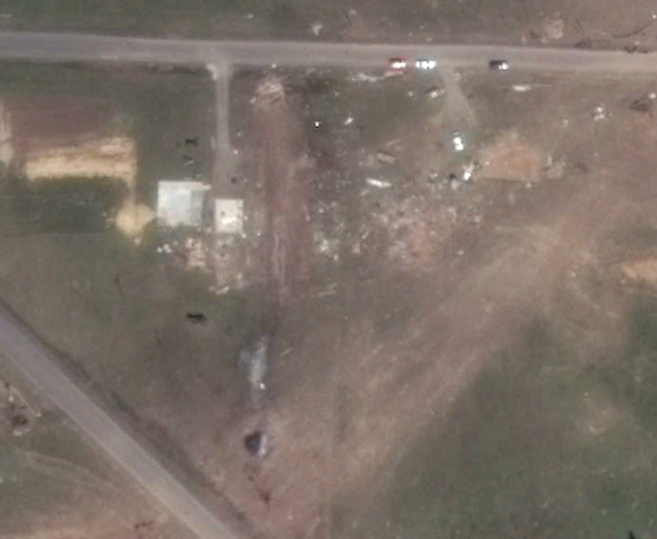
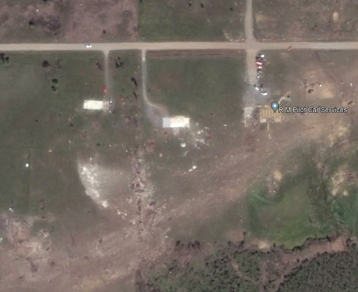
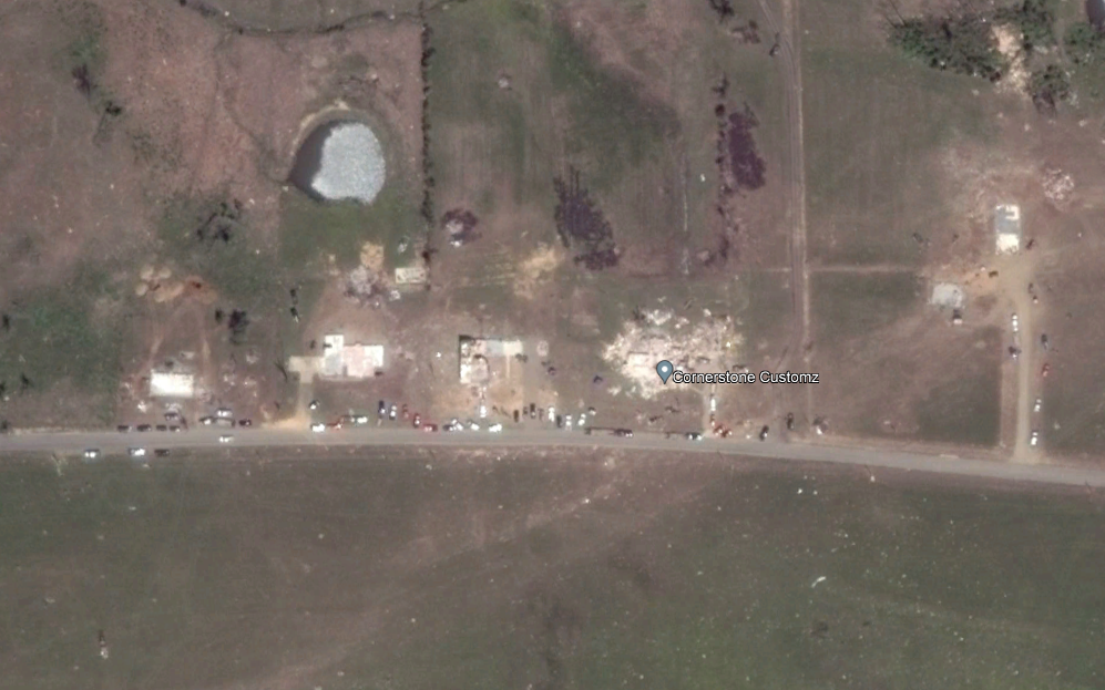
Now 4 deaths in Matador. Helicopter video from this morning shows a very intense damage path. Essentially all of the structures that were in the core of the damage path were leveled or swept away. Ground scouring present, major tree damage, and vehicles that look like they've been moved long distances and mangled. Pretty confident that there's EF4 damage in there somewhere. https://www.facebook.com/dustin.johnson.14811/videos/1763160690810064/?mibextid=jf9HGS
-
Meanwhile the Akron CO cyclic supercell from earlier is the storm of the year and perhaps decade so far in terms of photogenic tornadoes. Unbelievable video.
-
3 dead in Matador TX per New York Times and the town's mayor. That's now the second multi-fatality tornado in W TX this month.
-
Fatality confirmed in Matador per Val Castor's stream.
-
Trees absolutely shredded and vehicles mangled near Matador, this may have been a violent tornado.
-
Supercell near Akron CO looks like it might put on a show here.
-
That bow (about to become a derecho) coming into Tulsa might be the strongest one I’ve seen since 8/10/2020 (Cedar Rapids).
-
Pretty spectacular tornado/structure combo near Aspermont TX.
-
Lol Tues/Wed look done at this point, ULL over the Great Lakes is crushing/suppressing anything that tries to eject those two days.
-
Well the 00z GFS is certainly impressive for next Tuesday in the S Plains, potentially Monday as well further west. That's a hell of a shortwave ejecting for that far south in June.
-
 New estimate of 160 kts and 897 mb from ATCF. Dvorak technique maxed out at 8.0. This thing is an animal.
 -
Severe Weather 4-19-23 through 4-21-23
andyhb replied to cheese007's topic in Central/Western States
Chase account from yesterday in central OK. https://stormtrack.org/community/threads/2023-04-19-reports-ok-ks-ne-ia.32403/post-376460 -
Severe Weather 4-19-23 through 4-21-23
andyhb replied to cheese007's topic in Central/Western States
Well today was quite the day to say the least. First photo is the monstrous supercell and large tornado near Cole OK in the bottom right. This was, hands down, the best storm structure I've ever seen. At dusk prior to producing the Etowah OK tornado. More phenomenal structure.
- 43 replies
-
- 13
-

-
Better view here of the multiple EF4/5 candidates on Cemetery Road that were apparently not surveyed.
-
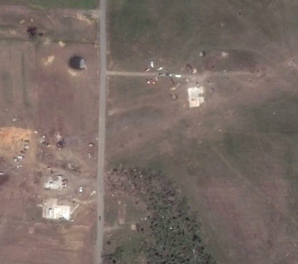
Just to reinforce the poor nature of the survey here, none of these structures in Vilonia were given DIs (reposted from another forum) except for the top image where they were given a "blanket" rating of EF3, i.e. the individual DIs were not rated as separate entities. This doesn't even include an entire neighborhood of homes along Cemetery Street south/southwest of downtown that was devastated, all of which had no DIs assigned. This overhead shot looking east with Main Street at left-center and Cemetery Street as the main N-S road at the center-foreground shows the extent of the high end damage in this area. The wind rowing here might be worse than that Rochelle picture you shared @RCNYILWX. I fail to see why the survey team would not assign DIs to this area considering that most buildings along Main Street were surveyed. I spy at least a half dozen EF5 candidates in that neighborhood alone pending construction, and all of them look like EF4 candidates at least.
-
To this exact point, this is from the ASCE report on Joplin...
-
But at the same time, there is a clear subset who wants to have some sort of constructive discussion regarding the topic, but I feel as though some who have expertise in the field do not. That's all well and good, but there's going to keep being questions until some answers are found, and saying "who cares" isn't really a response.
-
And so the million dollar question is, of course, "why"? I have strong suspicion that a similar thing happened with Vilonia. Some of this stuff seems down to personal/office politics. Of course this is emphasized by that quote suggesting that "some on the development team for the EF-scale felt that a house should never be given an EF5 rating".
-
Should probably add that both Chickasha and Goldsby from 5/24/2011 in OK should probably be EF5s as well.
-
Glad to see we're on the same page here, great post. I would really like to know the rationale behind "houses shouldn't be rated EF5" when they are, by far, the most common DIs that receive EF4-EF5 level damage. There's this centralization to cities that seems to be occurring with the EF5 rating where only high rises, shopping malls, and institutional buildings can get an EF5 rating at EXP bound, which essentially eliminates them from the climatology if that standard is followed. The other frustrating thing is seeing higher ups in NOAA or the academic community saying "who cares" or chastising people questioning the ratings (obviously trolls excluded here) when anyone with a decent knowledge and/or has been following along can tell that something weird is going on when there's an EF5 drought of nearly 10 years. Climatology and observed events suggest that shouldn't happen, and it probably shouldn't have happened with the Bridge Creek/Moore '99 to Greensburg drought either.
-
That entire article/response is full of subjective nonsense that isn't consistent with the original scale. I wrote something along these lines elsewhere: It's like the mentality has changed from "this house appears to be F5/EF5, now let's look at the surrounding context to make sure that is confirmed" to something like "this house is EF4, now let's look at the surrounding context to make sure it shouldn't be EF5", which are two very different statements. It's because of that EXP Bound DOD 10 being 200 mph EF4 that this is happening.
-
https://arktimes.com/arkansas-blog/2014/05/05/meteorologist-defends-ef4-rating-on-vilonia-tornado
-
Moisture killed by cutoff low over the SE, next.