

high risk
-
Posts
3,241 -
Joined
-
Last visited
Content Type
Profiles
Blogs
Forums
American Weather
Media Demo
Store
Gallery
Everything posted by high risk
-
Yes, the higher-end severe threat is definitely tomorrow.
-
The Day 3 risk for Wednesday is a MRGL for the Eastern Shore and northeast MD, but evening guidance suggests that they will have to move it back tomorrow (as the new Day 2 outlook) to the west to include the DC/Baltimore area. Could even argue for a SLGT, but I'll wait until the 13Z outlook on Wednesday for that to be added.
- 1,378 replies
-
- 1
-

-
- severe
- thunderstorms
- (and 2 more)
-
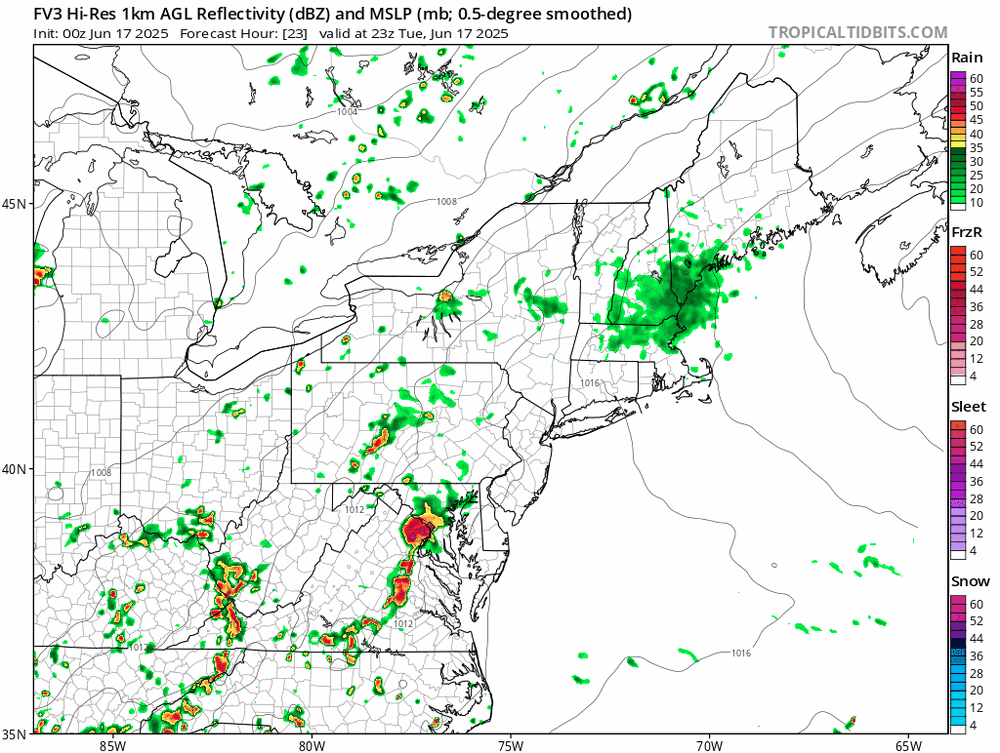
WTF is this? (It's just the FV3 doing its "huge storm" thing, but good lord.)
-
We haven't done squall lines well at all in the Mid-Atlantic in recent years, but this setup certainly favors very organized intense convection. Pop-up stuff occurs with weak forcing, and the cold front arriving during peak heating (and it should plenty hot with high dew points) with a modestly strong upper level trough will provide strong forcing.
- 1,378 replies
-
- 3
-
-
- severe
- thunderstorms
- (and 2 more)
-
Could be, or it could just be low-level speed convergence which is kind of hinted at on a few HRRR 850 mb images. Regardless, us Howard County folks look to be left out of the show again......
-
a number of recent HRRR runs break out an area of heavy precip over north-central and northern Maryland later this evening. It doesn't appear to be a northward propagation of the existing rainfall. Curious to see whether the HRRR is onto something.
-
I was more booming my call for a MRGL than excited about severe potential, but I thought we’d do ok with rain this evening. It looks like a miss now, and you’re correct that we will quickly return to drought if this persists.
-
Boom!
- 1,378 replies
-
- 3
-
-
- severe
- thunderstorms
- (and 2 more)
-
Sunday might not top 70 over much of the area.
-
Thinking we have a shot at a MRGL on Saturday for a few localized wind events. Lapse rates are lousy, but there will be decent instability and modest deep layer shear.
- 1,378 replies
-
- 1
-
-
- severe
- thunderstorms
- (and 2 more)
-
Lots of things obviously need to align, but that's certainly what we want to see if we're hunting derechos. We would be well within the hot, humid air mass, but also just barely within the faster flow aloft, giving organized convective systems the opportunity to race to the east-southeast.
- 1,378 replies
-
- 4
-
-
- severe
- thunderstorms
- (and 2 more)
-
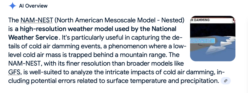
Experience, for sure. I always look at as much available guidance as I can, and when they don't agree, I make mental notes on which ones did well and which didn't. It's not as tough to keep track of as it sounds. Or you can just cheat and use AI:
- 1,378 replies
-
- 2
-

-
- severe
- thunderstorms
- (and 2 more)
-
The NAM Nest is the gold standard. The HiresW ARW2 is decent. HRRR and especially the HiresW FV3 are the worst. When they both showed the warm front staying south of DC yesterday, I started writing off severe potential up our way.
- 1,378 replies
-
- 3
-
-
- severe
- thunderstorms
- (and 2 more)
-
But that's climatology. There are certain models that depict warm front movement very well, and none of them today had it getting nearly as far northeast as DC. The only model that had good UH tracks this far north was the 12Z HiResW ARW, but it showed DC at 80 degrees at the time the watch was issued. Guidance *and* observational trends were clear this was not the day when the front would move quickly northeast. In fairness, though, SPC's focus today was on the Southern Plains, so I can't really fault them for not working more to pinpoint the size of the Mid-Atlantic watch box.
- 1,378 replies
-
- 5
-
-
- severe
- thunderstorms
- (and 2 more)
-
Having the tornado watch cover as far northeast as the DC metro area was somewhat silly. The warm front was never going to make it this far.
- 1,378 replies
-
- 1
-
-
- severe
- thunderstorms
- (and 2 more)
-
I still don't know what to make of this setup. Few CAMs have a handle on the band of showers currently pushing southwest to northeast across the area. The ones that do have these showers don't really do a whole with convection lot later today. The HRRR looks more interesting, but it isn't handling the current stuff well, and while its reflectivity looks good later, there isn't much instability. The shear (both deep layer and low level) is intriguing for sure, but I wonder if it's just going to be too stable for much of the area to really have a threat. My best guess is that any severe threat stays south and west of a Winchester to Culpeper to Quantico line, but we'll see how temperatures evolve for the DC-Baltimore corridor.
- 1,378 replies
-
- 5
-
-
-
- severe
- thunderstorms
- (and 2 more)
-
That Euro run yesterday was on the right track with the best chance of rain today being during the late morning / early afternoon along the warm front boundary. That area of rain is there, but it's fairly splotchy and progressive, so while some localized areas will get soaked, it doesn't appear that widespread big totals are likely.
-
I think that the original meso occluded - you can see a northwest motion in loops. A new one has been trying to form over Columbia but has struggled to organize. The rain is legit, though. Incredible flooding in my neighborhood
- 1,378 replies
-
- 7
-
-
- severe
- thunderstorms
- (and 2 more)
-
I want to use the HRRR to figure out the evolution, but it has zero handle on the large batch of storms around Fredericksburg.
- 1,378 replies
-
- 1
-
-
- severe
- thunderstorms
- (and 2 more)
-
It’s definitely worth watching. Once the trough axis passes, winds just above the surface shift to northwest, and the speeds rocket up (50+ kt) just above the ground. The question always is whether those speeds can be mixed downward. Some of the guidance shows an additional round of showers after midnight with some very weak low-level instability. Can that get it done? Not sure, but it could.
-
The more northern track of the surface low likely reduces the flash flood threat for most of us, but it definitely increases the severe threat. Surface winds may end up too light, but if they’re not, some of the morning guidance does show enough turning in the low levels to generate favorable hodographs. The 12z HREF reflects this with a notable increase in the probabilities for good UH values into the DC/Baltimore region, relative to earlier guidance, and I would not be surprised if the 1630 outlook brings the 5% TOR further north.
- 1,378 replies
-
- 6
-
-
-
- severe
- thunderstorms
- (and 2 more)
-
I’m far from confident in this, as there will probably be a narrow corridor of big rainfall models that the models are struggling to place, but there seems to be a trend to place the heavy rain axis more up into northern MD and southern PA. This would reduce the flood threat in and around DC, but it would increase the severe threat.
-
Yeah, forecast soundings along the warm front certainly support at least transient supercell structures. The question is where the warm front will reside, as there isn't good model agreement. If there is a weak consensus, it's for the warm front to set up just south of DC. Saturday could be a hail threat throughout the area, as very cold temperatures aloft will be in place, and the secondary front looks to move through at a favorable time of day.
- 1,378 replies
-
- 4
-
-
- severe
- thunderstorms
- (and 2 more)
-
Based on the 00z CAMs, much of the area will have a flash flood risk Friday late afternoon through early Saturday, and at the least, areas along and south of I-66 in VA and Rt 50 in MD will have severe potential early Friday evening. The exact track of the surface low will determine the mesoscale corridors of threat, but a tornado or two certainly seems possible along the warm front.
- 1,378 replies
-
- 11
-
-
- severe
- thunderstorms
- (and 2 more)
-
The synoptic wind is near the end of and after the precip, but yeah, the 500 map is super impressive.


