-
Posts
3,150 -
Joined
-
Last visited
Content Type
Profiles
Blogs
Forums
American Weather
Media Demo
Store
Gallery
Everything posted by high risk
-

January Medium/Long Range: A snowy January ahead?
high risk replied to mappy's topic in Mid Atlantic
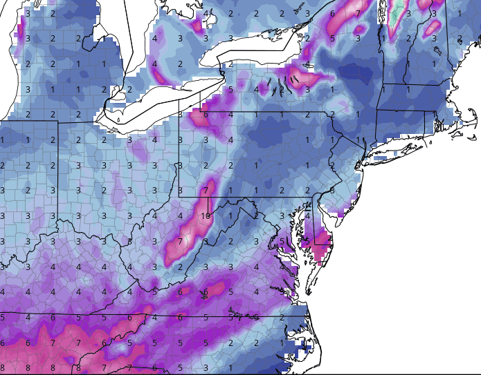
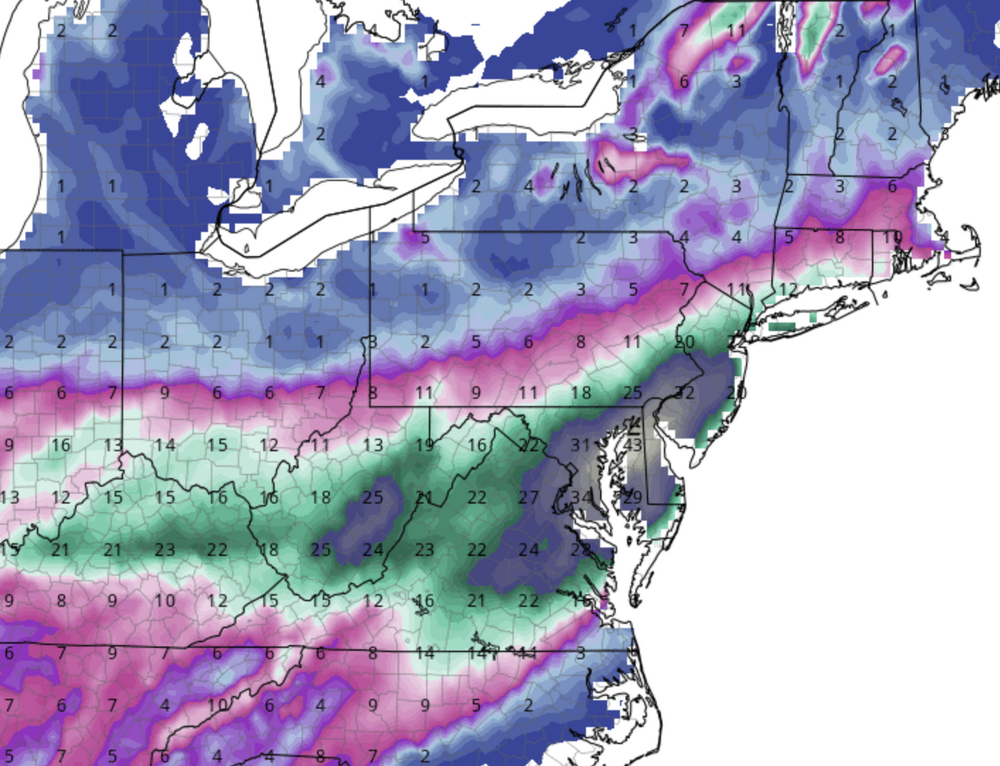
It's driven by lower-atmosphere temperatures. It's great at chopping amounts in marginal temperature environments, and the premise that SLRs will be better than 10:1 in cold environments has some truth, but it's not as simple as colder=better SLR, so it goes nuts when the air mass is cold. -

January Medium/Long Range: A snowy January ahead?
high risk replied to mappy's topic in Mid Atlantic
Thank you. The Kuchera drives me nuts. It always feels like this is 10:1 and this is the same case with Kuchera: -

January Medium/Long Range: A snowy January ahead?
high risk replied to mappy's topic in Mid Atlantic
I'm in the "00Z NAM at f84 looks closer to the 18Z Euro at f90" camp. -
Up to 6" here in southern Howard County, with moderate snow falling under this good band.
-
You should have just said that you were looking at the NAM (which is 2 hours slower than most other guidance).
-
It actually matches the HRRR (and several other models quite well), although I'd lean towards the latter parts of those time periods. The NAMs have a clear bias towards too slow of an onset in precipitation, and that is true whether it's summer convection or a winter storm.
-

January Medium/Long Range: A snowy January ahead?
high risk replied to mappy's topic in Mid Atlantic
Yeah, by hour 96, the 00Z cycle handled the shortwave over Montana quite differently than the previous 2 cycles. -
Note that this run does not include any of the 00Z model runs, and no NBM snow product contains any Canadian data. No NBM product at all contains any UKMET data.
-
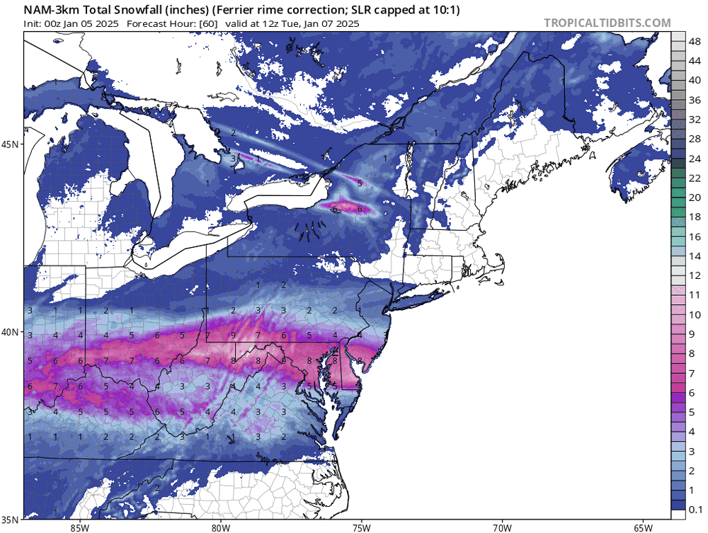
Agreed. In areas that stay all snow, a blend of the Ferrier product and the Kuchera product might work pretty well.
-
When looking at 3k NAM output, it's worth looking at the Ferrier snow accumulation product. This one is connected directly to the model microphysics, so it knows exactly what the model is doing with the falling precipitation. It can actually run a bit low for areas that stay all snow, but it's terrific at sorting out where the model thinks that the sleet will be mixing or other interference to pure snow accumulation.
-
The 3k is a far superior model.
-
00Z HRRR does *NOT* have the 00Z raob data. Edit: to be clear, this cycle can never have them, as its start time is too early
-
The NAM tends to do funky things with placement of coastal lows and such, but once it has the synoptics nailed, there is no better model for identifying warm layers in warm advection events and dry slots. The question, though, is whether it has nailed the synoptic details for this system. It's probably slightly early to think with confidence that it has, but it shouldn't be immediately tossed onto the garbage heap. The 3km version, though, is FAR superior to the 12 km.
-
10:1 is always underdone in a cold storm, but Kuchera tends to run really high. Splitting the difference makes sense in areas that will stay all snow.
-
I'm trying to make sense of these WB maps. It appears that they are NOT forecasts of precip type right at the particular time. The label says "6 hr QPF by type (in.)", and legend below notes that it's liquid equivalent. But since there is no way to plot amounts of each type on a single map when precip types varies during a 6h period, we have to figure out what they're doing. The GFS does not parse amounts by type, so my guess is that WB does some sort of internal tallying by using hourly precip type data and hourly QPF, and they plot whichever type is the highest over the previous 6h, but that's admittedly an assumption. Regardless, no one should interpret this map as "it's sleeting or freezing rain at 18Z over most of the area."
-
It's really an EMC question, but you nailed it. The HiResW FV3 can in some ways be considered a hi-res GFS, but the GFS has been tuned a fair amount in recent years, with none of those upgrades making it into the HiResW FV3.
-
I've never seen this much attention paid to the timing of availability of a NAM run 2.5 days out from an event..... Everyone needs to remember that the model almost always runs at the exact speed it does every other day. Dissemination of the data via various platforms and then generation and loading of graphics at the various display sites is what has almost all of the variability.
-
MAYBE in 2026.
-
I'll spare everyone the NBM history, but right now, the winter suite at this range actually uses all ECMWF and GEFS ensemble members, along with 10 SREF ARW members and the GFS. We're now coming into the range where it will start using the NAM Nest and HiRes Window FV3.
-
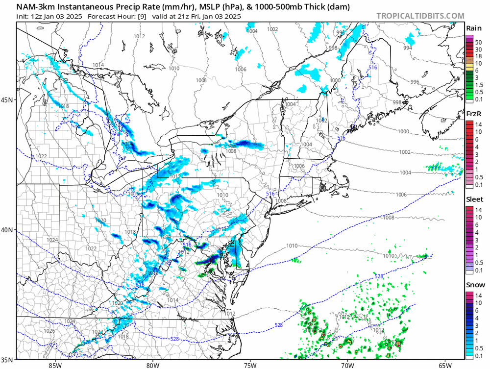
For those caught off guard by this and expecting snow TV, whenever you have an arctic front and simulated reflectivity in the hi-res models that has localized cells with heavy snow, you definitely need to take note: The timing and placement may be off (the timing was off a bit in this forecast, but it was decent with the location), but signatures like those really caught my attention. Inspection of soundings revealed non-zero instability and good low-level lapse rates, and that is game on even with marginal sfc temperatures. I'm impressed here too that the outer edges of some of these features are green (with blue cores), accurately showing that light rain would quickly turn to heavy snow as temperatures quickly fell.
-
legit here in southern Howard County. Everything immediately turned white.
-
That stuff won't make it. It's the cells forming up by HGR that have the best shot to affect north-central MD.
-
Very jealous of the reflectivities over northern VA, but the HRRR keeps the idea of some better stuff moving through north-central MD later this afternoon.
-
Friendly reminder that any "total snowfall" maps will accumulate sleet as snow.
-
Exactly. The initial lighter stuff will be either light rain or light white rain, but the heavier reflectivities closer to the front will be brief bursts of heavy snow.


