All Activity
- Past hour
-
Yea I never said that at all or alluded to it dumbass
-
We have been fortunate from Philly to Boston that it hasn’t happened yet. But it has come close at Philly. They managed to narrowly miss a complete shutout twice with 0.3” in 19-20 and 22-23. So they avoided the T from 72-73. NYC also has avoided a complete shutout with their lowest season out of the last 7 coming in at 2.3” in 22-23. Boston was able to stay over 5” with their low season coming in at 9.8” in 23-24. People would really start to say it’s never going to snow again if Philly had a T or their first 0.0”. With a T to 0.9” in NYC and under 5.0” at Boston. Thankfully we are yet to see a snowfall season this low from Philly to Boston.
-
Two gorgeous days in a row. Humidity ain’t as bad as the weather media was acting like. .
-
Understood! There is always a bright side……. As always ….

-

July 2025 Obs/Disco ... possible historic month for heat
ineedsnow replied to Typhoon Tip's topic in New England
Ya looks that way but by humid in the 60 to 65 range most days.. with a couple higher mixed in -

E PA/NJ/DE Summer 2025 Obs/Discussion
donsutherland1 replied to Hurricane Agnes's topic in Philadelphia Region
87 degrees at Longwood Gardens.
-

July 2025 Discussion-OBS - seasonable summer variability
Wannabehippie replied to wdrag's topic in New York City Metro
Wouldn't rooftop stations give us inaccurate readings due to elevation? -
Yet another meteorologically unremarkable tropical system overperforms in the impacts/fatalities department due to freshwater flooding.
-

2025 Lawns & Gardens Thread. Making Lawns Great Again
Chrisrotary12 replied to Damage In Tolland's topic in New England
Just noticed today, that lawns are starting to burn out all around. -

July 2025 Obs/Disco ... possible historic month for heat
Damage In Tolland replied to Typhoon Tip's topic in New England
Nice humid week - Today
-

2025-2026 ENSO
40/70 Benchmark replied to 40/70 Benchmark's topic in Weather Forecasting and Discussion
I'd kill for 2016-2017 right now...featured about normal snowfall and I haven't seem that since 2017-2018. -

2025-2026 ENSO
PhiEaglesfan712 replied to 40/70 Benchmark's topic in Weather Forecasting and Discussion
16-17 had a very sharp cutoff right around PHL, which had 15 inches of snow that year (which was even below the 18-19 total). DC and Baltimore had about 3 inches of snow the entire winter, which puts it as one of the Top 10 least snowiest winters for those cities. I personally don't want that type of season again. The next time, the cutoff may be further north, and it may make 01-02/11-12 look like child's play. -
The 5 pm advisory shifts the track of Chantal 40 miles west at Raleigh by Monday. Possible Va/DC impact slightly increases.
-
2025-2026 ENSO
40/70 Benchmark replied to 40/70 Benchmark's topic in Weather Forecasting and Discussion
There are a couple of posters in this thread that are passive aggressively hunting that very response. -
Okay I get your point. It’s never going to snow again.
-
.thumb.png.4150b06c63a21f61052e47a612bf1818.png)
July 2025 Obs/Disco ... possible historic month for heat
HIPPYVALLEY replied to Typhoon Tip's topic in New England
I think it’s a great outfit. The most important thing in life is to have fun. -
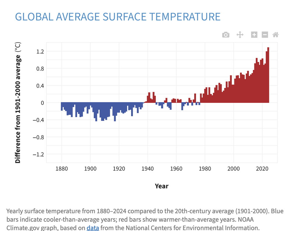
This dataset stands on its own. You can spin it, cherry pick "micro-areas", argue about its veracity or deny it exits. But in the real physical world- this dataset is corraborated by actual events and changes that one can visit, see and touch...that only this trend can explain. Lets continue to keep a macro view, shall we?
-
July 2025 Obs/Disco ... possible historic month for heat
HIPPYVALLEY replied to Typhoon Tip's topic in New England
Screw that, I wanna chill on the Cape in dry weather. -
July 2025 Obs/Disco ... possible historic month for heat
ineedsnow replied to Typhoon Tip's topic in New England
Hopefully we stay cloudy and showery later this week from this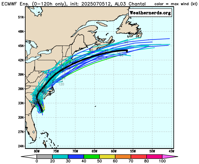
-
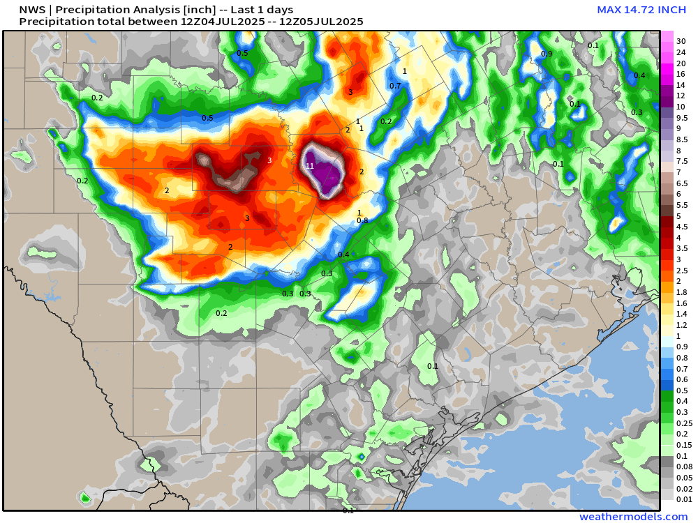
unbelievable 14"+ of rain in 24 hours in central texas, with some areas seeing 19" over 3days
-
2025-2026 ENSO
40/70 Benchmark replied to 40/70 Benchmark's topic in Weather Forecasting and Discussion
I just gave a reason why it didn't snow despite a +PNA and -WPO....the PNA ridge was too far west. How am I placing too much stock in the teleconnections??? You are the one that just said it didn't snow despite a -WPO period last season.... I would argue that the subtropical ridge won't remain so robust should the WPO flip negative....we argee the west Pacific warmth is largely responsible for that ridge, which is synonymous with a +WPO. This is largely why the past -PNA\-NAO intervals worked out better.....they were -WPO. -

July 2025 Obs/Disco ... possible historic month for heat
weatherwiz replied to Typhoon Tip's topic in New England
It’s been a wild year and expensive year. It happened almost exactly a year ago. He was in the hospital for a week and before he came home we had to drive an hour each day to learn how to express his bladder. We really struggled with it so we had to hire someone to come over the first week he came home to help us. The first two months my girlfriend and I alternated sleeping in the living room with him since he can’t get into the bed anymore. He’s come along way, but unfortunately won’t ever get 100% but we do what we can to make him happy -
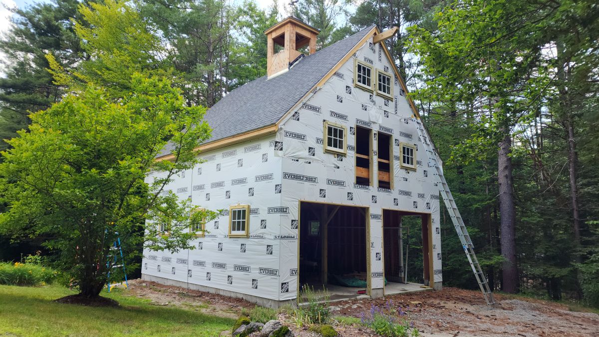
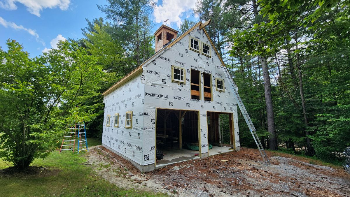
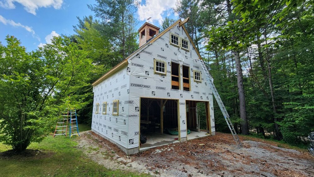
Barn update. Should be done by summer's end. I recommend checking for paper wasp nests before sticking your hands up underneath trim, especially when you are at the very end of a 32' extension ladder. Only the second time I've ever been stung, and I can confirm that it still hurts like a m'fer.

-
WE blew some off last night at my friends but there was no debris in anyone's yard other than his which we cleaned up. Treehouse put on quite a display of fireworks last night. Every time we thought it was the finale they kept on going.
-

July 2025 Obs/Disco ... possible historic month for heat
DavisStraight replied to Typhoon Tip's topic in New England
You're a mensch to take care of your dog after all that.