All Activity
- Past hour
-
-

July 2025 Obs/Disco ... possible historic month for heat
powderfreak replied to Typhoon Tip's topic in New England
It’s tough at times, but we find a way. Us and the bears. A couple days ago a family returned to their multimillion dollar Robinson Springs home in Stowe and a bear was sitting in their kitchen eating food from their freezer. Opened an unlocked door and walked right in. -
1.05
-
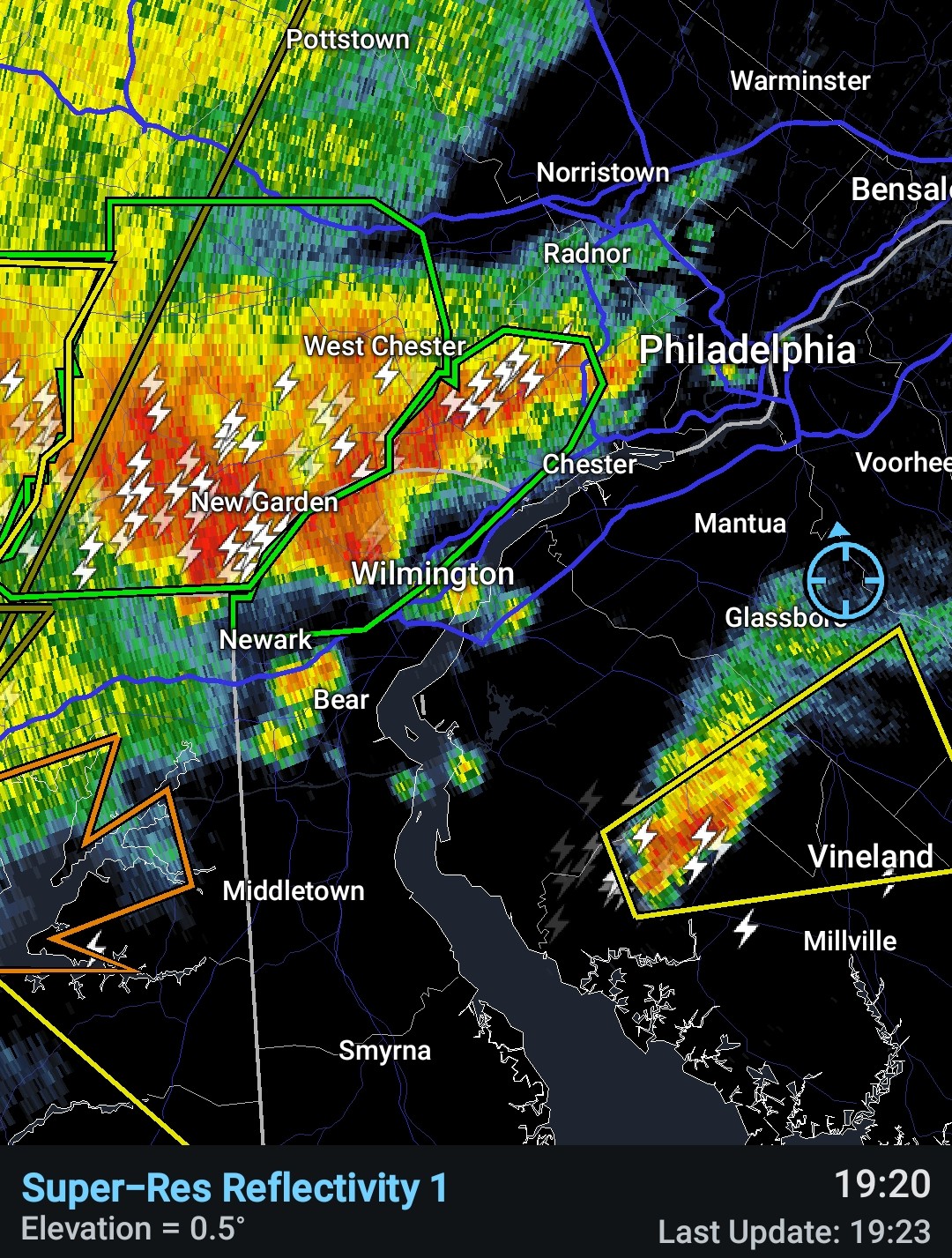
That line is bowing out as it comes eastward.
-
260 WUUS51 KPHI 092317 SVRPHI MDC011-029-035-041-100030- /O.NEW.KPHI.SV.W.0171.250709T2317Z-250710T0030Z/ BULLETIN - IMMEDIATE BROADCAST REQUESTED Severe Thunderstorm Warning National Weather Service Mount Holly NJ 717 PM EDT Wed Jul 9 2025 The National Weather Service in Mount Holly NJ has issued a * Severe Thunderstorm Warning for... Talbot County in eastern Maryland... Queen Anne's County in northeastern Maryland... Caroline County in eastern Maryland... Kent County in northeastern Maryland... * Until 830 PM EDT. * At 716 PM EDT, severe thunderstorms were located along a line extending from Crofton to near Chesapeake Beach to near Sheridan Point, moving northeast at 35 mph. HAZARD...60 mph wind gusts. SOURCE...Radar indicated. IMPACT...Damage to roofs, siding, trees, and power lines is possible. * Locations impacted include... Easton, Centerville, Talbot, Chestertown, Denton, Centreville, Romancoke, Federalsburg, Greensboro, Oakland, Ridgely, Rock Hall, Trappe, St. Michaels, Church Hill, Preston, Oxford, Sudlersville, Goldsboro, and Queen Anne.
-

E PA/NJ/DE Summer 2025 Obs/Discussion
BBasile replied to Hurricane Agnes's topic in Philadelphia Region
Eat it up! Enjoy, you lucky SOB!!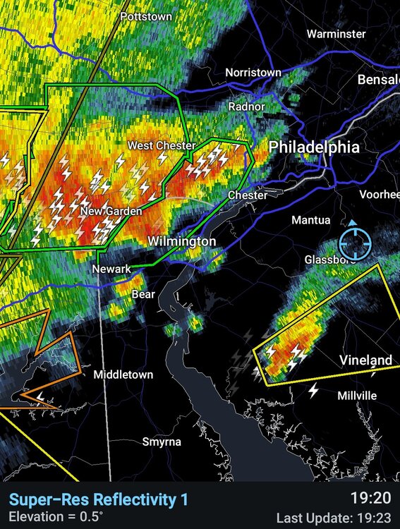
-
Got my shower in, phew! Actually the wind hasn't been too bad, just heavy rain.
-
Pretty much a swing and a miss here in 21057. .03 so far.
-

July 2025 Discussion-OBS - seasonable summer variability
Wannabehippie replied to wdrag's topic in New York City Metro
I don't think it will last long with higher dew points rolling in over the next few days. Getting in to the dog days of summer, hazy, hot, humid. -

July 2025 Obs/Disco ... possible historic month for heat
ma blizzard replied to Typhoon Tip's topic in New England
latest HRRR targets the pike region tonight with heaviest rains -

July 2025 Obs/Disco ... possible historic month for heat
Damage In Tolland replied to Typhoon Tip's topic in New England
Hmmmmm -
July 2025 Obs/Disco ... possible historic month for heat
Damage In Tolland replied to Typhoon Tip's topic in New England
SSGWDLT -

E PA/NJ/DE Summer 2025 Obs/Discussion
ChescoWx replied to Hurricane Agnes's topic in Philadelphia Region
Truth!! -
July 2025 Discussion-OBS - seasonable summer variability
Wannabehippie replied to wdrag's topic in New York City Metro
ConEd made $1,820 million in profit in 2024. That is $1.82 billion. And they want to raise prices, and transmission costs. Which means even if you choose a 3rd party provider for gas and electric, you still will pay more due to the higher transmission fees. They should get zilch, zip, nada for gas and electric increases. In fact their prices should be rolled back a good 5%. -

July 2025 Obs/Disco ... possible historic month for heat
ineedsnow replied to Typhoon Tip's topic in New England
I don't mind the dews.. its the high heat I cant stand. -
I guess I'm not complaining, but lol
-
July 2025 Obs/Disco ... possible historic month for heat
powderfreak replied to Typhoon Tip's topic in New England
Beautiful 81/55 to start the dog loop, 79/57 to end it. Dews in the 50s felt nice.
-

E PA/NJ/DE Summer 2025 Obs/Discussion
LVLion77 replied to Hurricane Agnes's topic in Philadelphia Region
Even across the street at times. It is a fascinating time of the year. The difference between the winners and losers is a lot greater than the other seasons . -
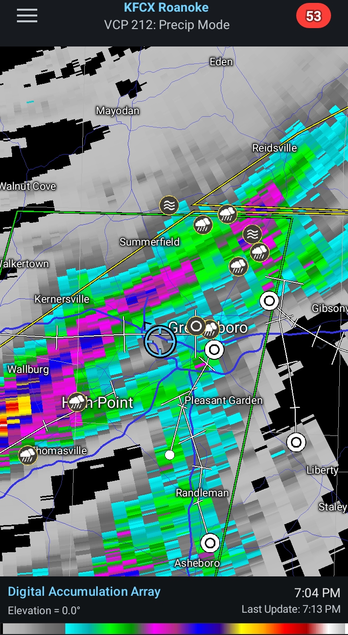
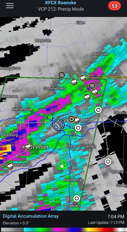
This line creeping SE over the Piedmont looks gnarly. Ominous as hell sky. .
-

E PA/NJ/DE Summer 2025 Obs/Discussion
KamuSnow replied to Hurricane Agnes's topic in Philadelphia Region
Getting into some pretty heavy rain here. Very dark, radar looks good, a little thunder and lightning, no wind to speak of. Lots of rain, a quarter inch in the last 5 minutes. Eta - make that 1/2" in 8 minutes! Let's make that 3/4" in 10 minutes, lol. Getting windy now too! Now 1" in 12 minutes! -
Power is going in and out. Thinking I really should have taken a shower before the storm arrived.
-
July 2025 Obs/Disco ... possible historic month for heat
Damage In Tolland replied to Typhoon Tip's topic in New England
Love to see you enjoying this special dew stretch ! -
Best lightning and thunder show we've had for a while here in silver spring. Cool storm. Not much wind where I am.
-
I got season tickets for the upcoming season so I’m hoping they are. And it’ll be bittersweet seeing his last game (although he hasn’t’ officially said this is his last year).
-

July 2025 Discussion-OBS - seasonable summer variability
winterwarlock replied to wdrag's topic in New York City Metro
I think we sun both Friday and Saturday and good deal of sun Sunday