All Activity
- Past hour
-
Compared to the runs of the last 5 days+ of the Gefs, there's finally some life in the 18z snowfall total. I didn't go into how or when. I'm looking for totals >1"!
(30).thumb.png.392082cd7b99ed05396c81d66ffe9edb.png)
-
18z GEFS looks good! Fwiw
-

January 2026 regional war/obs/disco thread
CoastalWx replied to Baroclinic Zone's topic in New England
Normally on paper, it would look good, but it's kind of WNW flow in the mid levels and then you got the southeast Ridge That's trying to split the lower anomaies at 500 on either side of it. That just kind of look meh to me. Based on EPS I dunno, something seems off to me. I hope I’m wrong. -
no watches/advisories for most areas
-
Don't forget the warm napes.
-
I love it!
-
We missed you.
-
January 2026 regional war/obs/disco thread
CoastalWx replied to Baroclinic Zone's topic in New England
Looks like nothing to look forward to for a long time. Soon it will be sun angle season. -

January 2026 regional war/obs/disco thread
UnitedWx replied to Baroclinic Zone's topic in New England
So, Fenway Park weather -
No high pressure to the north to impart better cold air advection. Heavier precip rates overcome a marginal profile and turn precip to frozen, elsewhere, it's rain. Very believable.
-
I think it was last year or the year before, JB was hyping the spire when they first started showing it on WB. Haven't heard him reference it since then...
-

January 2026 regional war/obs/disco thread
WinterWolf replied to Baroclinic Zone's topic in New England
Exactly. -
January 2026 regional war/obs/disco thread
WinterWolf replied to Baroclinic Zone's topic in New England
Keep the 60’s and 70’s. We’ll take them in April, and they’ll be nowhere to be had. You know this. -
How does this model have rain north west of the snow lol
-

January 2026 regional war/obs/disco thread
Typhoon Tip replied to Baroclinic Zone's topic in New England
Lol Jesus guys…let it marinate a little bit -

January 2026 regional war/obs/disco thread
dendrite replied to Baroclinic Zone's topic in New England
16 weeks from 40s and drizzle -
You always take what you don’t have.
-

January 2026 regional war/obs/disco thread
weatherwiz replied to Baroclinic Zone's topic in New England
We are about 10 weeks from 60's, 12 weeks from 70's, 15 weeks from 80's, and about 18 weeks from getting some severe weather threats -
I can't remember if it was last year or the year before, but about ALL the south facing flowers/bulbs came up, then disappeared in Feb when a couple near zero nights took care of them.
-
74 at 3:10pm.
-
On pivotal hr 384 just gave up. .
-
January 2026 regional war/obs/disco thread
weatherwiz replied to Baroclinic Zone's topic in New England
doesn't work :/ edit: working now! -
January 2026 regional war/obs/disco thread
CoastalWx replied to Baroclinic Zone's topic in New England
Garbage pattern -

January 2026 regional war/obs/disco thread
Ginx snewx replied to Baroclinic Zone's topic in New England
Remember this line kids. -
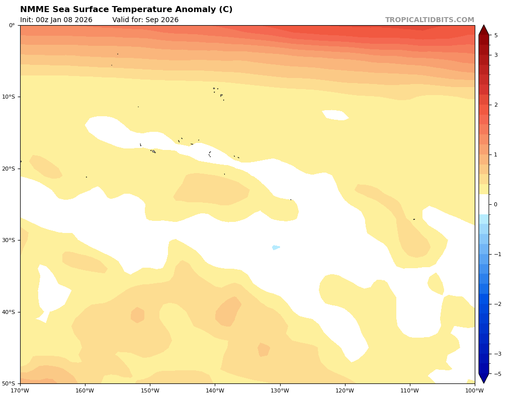
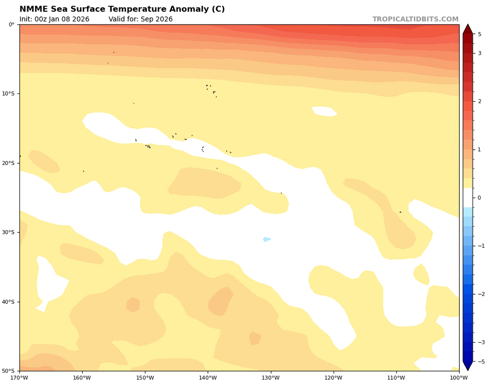
The new NMME has an even stronger El Niño for later this year by ~0.2C. The end of the run, Sept of 2026, peaks at ~+1.3C (moderate) and still was warming. So, it was more than likely headed to a strong. It has it centered on 115W:

(30).png.20c5da5716f368318ca703cd4857a801.png)