All Activity
- Past hour
-
WB 12Z GEFS....next 10 days are nada...

-
Torch

-

Central PA Winter 25/26 Discussion and Obs
Itstrainingtime replied to MAG5035's topic in Upstate New York/Pennsylvania
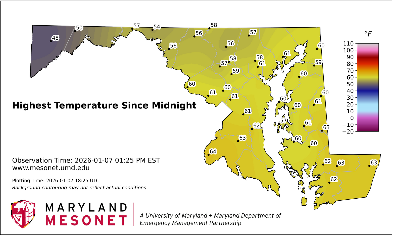
Overachieving temps out there today...up to 57 in Maytown. -
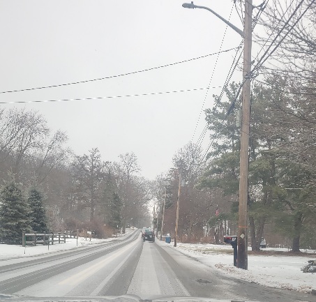
Hit a pretty good squall. Snow covered roads.
-
CPF...but too much -EPO. Always something.
-
Give me that pipeline continuing w/ the incoming trough from the 11th-21st, and let's roll.
-
Canada looks incredibly frigid late in the Euro run.
.thumb.png.ad919845eec5b352d9f58c4eb7a762d9.png)
-

January 2026 regional war/obs/disco thread
weathafella replied to Baroclinic Zone's topic in New England
Snowing nicely now. I looked up from my reading so I’m not sure when it started-probably within the past 10 minutes. -
1/6 was probably it for me, especially considering it stuck around so long. The February storm was nice - I ended up jogging something like 4 miles in my snow boots to meet my buddy at the bar. Was my last storm in FFX county before I moved. I'll also second MillvilleWx that we had one of the nicer Augusts I can remember.
-
That NW flow is killin' us.
-
On another note, I sure hope JB referenced @GaWx w/ his phase 6 "isn't always warm" backtrack(from warmth) post. Did he? If he didn't, he needs to.....
-
Its always something, thats how we roll. If it ain't a sloppy phase then its a GL lp, or a kicker, or some rogue shortwave diving out of Nunavut that mucks things up. But seriously, one of these will eventually work out. Expect the worst, hope for the best. Expectations in check, patience, and all those other caveats apply.
-

January 2026 regional war/obs/disco thread
ORH_wxman replied to Baroclinic Zone's topic in New England
It’s going to be mostly CNE. Doubt much ice at all gets into SNE over the weekend. Maybe far N MA could see some marginal icing if things trended colder. -
A great trend is the "re-stocking" of cold for NA. During many recent La Ninas, NA would get emptied of cold, the trough would drop into the West, and winter was over outside of the Rockies. I really don't see that pattern at all right now. If anything, winter may just be getting started.
-
Euro was about to do something D10-11 and then it sheared it to hell
-
Close to something nice Day 10 on the Euro. Northern stream kinda shears the southern stream out.
-
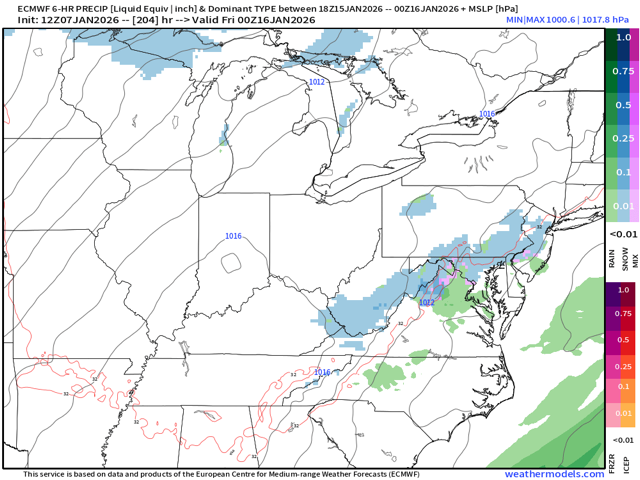
The 12z Euro is one small, wintry system after another for our forum area. It has some nice systems embedded. I would be surprised if some in the forum don't score 1-2x w/ this trough... The Euro is loaded up as well.
-
That's ice, their algorithm handles snow poorly. That said, it's a big winter storm East, South and West of us, so I wouldn't be shocked if it came true.
-

January 2026 regional war/obs/disco thread
weatherwiz replied to Baroclinic Zone's topic in New England
One wild card is going to be how quickly temperatures can drop though Friday night...it's going to be quite mild Friday. Wet bulb temperatures may not get much below freezing so even within the interior it may end up with alot of 33-34's. Might just be very localized areas but its something to watch -

January 2026 regional war/obs/disco thread
LSC97wxnut replied to Baroclinic Zone's topic in New England
A quick coating on everything from this little burst. Easily 1/2S @ 33.7* -
I’m booking this IECS
-

Central PA Winter 25/26 Discussion and Obs
Mount Joy Snowman replied to MAG5035's topic in Upstate New York/Pennsylvania
Sure does. The airmass is in place to hit your 60 degree prediction but I wonder if there will be enough clouds and rain around to keep us just shy. Could be close. -

January 2026 regional war/obs/disco thread
ineedsnow replied to Baroclinic Zone's topic in New England
yup we ice -
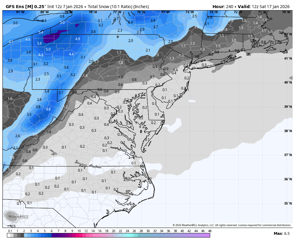
Euro increases Augusta qp from .69" to 1.08" Saturday. More moderate rates east of cyclogenesis over Tenn./Ky.
-

January 2026 Medium/Long Range Discussion
NorthArlington101 replied to snowfan's topic in Mid Atlantic
It always works out when we're rooting for the storm to create it's own cold air


.png.2cc2b9b3cdf2e145fd2654d251becabb.png)


