All Activity
- Past hour
-

2026-2027 El Nino
snowman19 replied to Stormchaserchuck1's topic in Weather Forecasting and Discussion
All i have to say is wow -
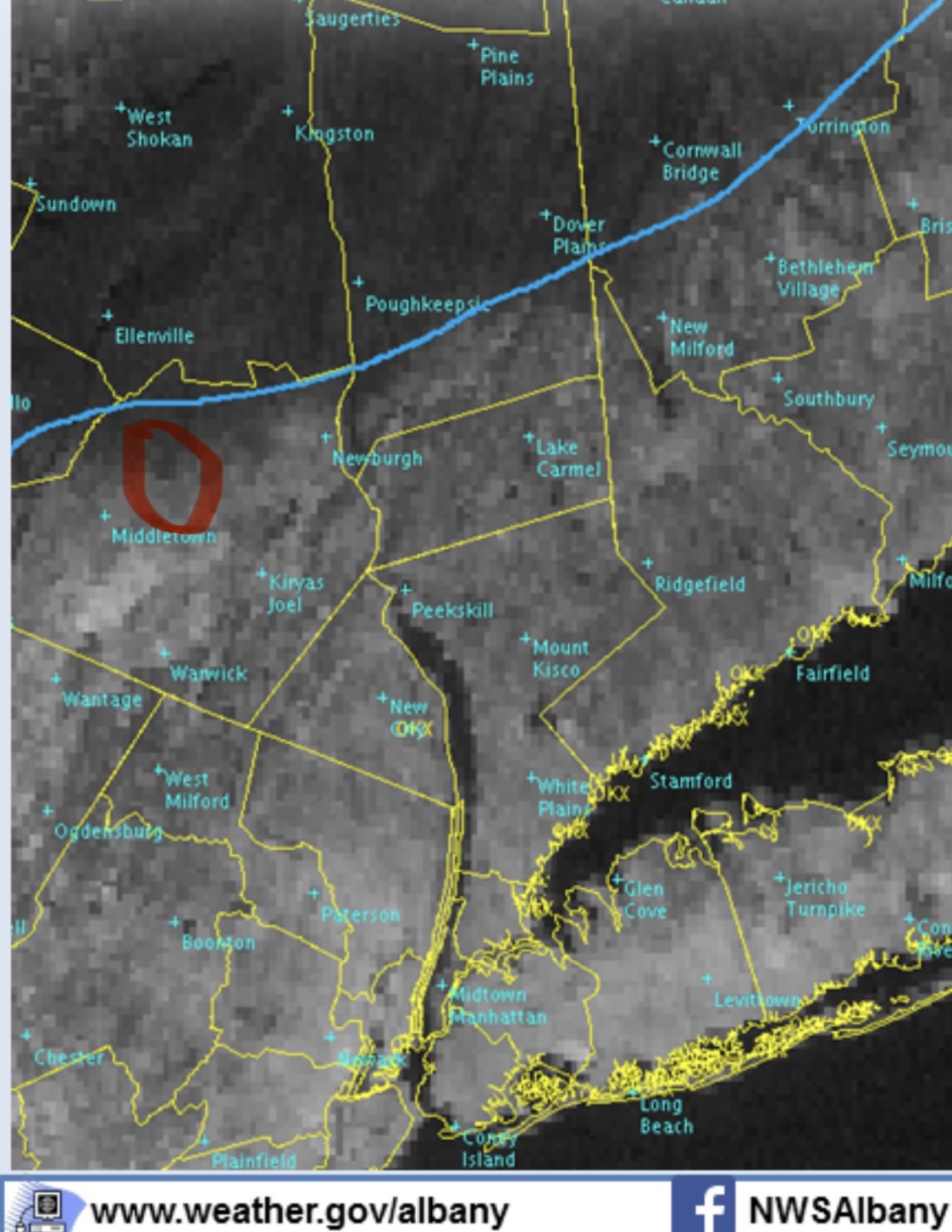
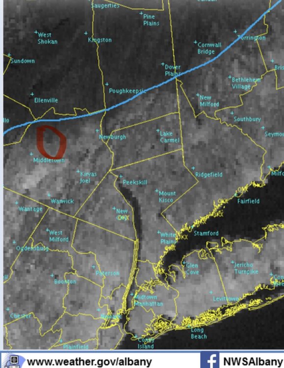
Yeah, crazy! I don't think there were many northern Orange County official reports out of frustration with that storm LOL. Albany's map for that storm comes close to showing how the cutoff went. You can see in this satellite shot from their page that I'm was in the black hole.
- Today
-
.thumb.jpg.6a4895b2a43f87359e4e7d04a6fa0d14.jpg)
Central PA Spring 2026 Discussion/Obs Thread
Yardstickgozinya replied to Voyager's topic in Upstate New York/Pennsylvania
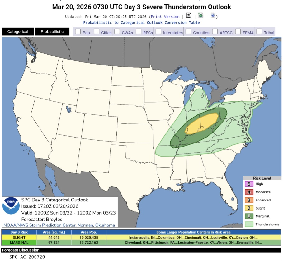
Spc brings back the chance of some thunderstorms on sunday. Right now they have idea of deeper convection in far western pennsylvania. Hopefully plenty of sunshine breaks through Saturday and Sunday.for those of us who need it. SPRINGS BACK BABY !!! https://www.spc.noaa.gov/products/outlook/day3otlk.html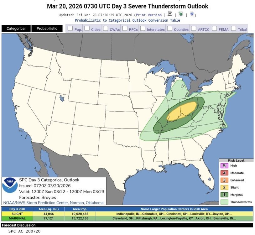

-
Took a while but BTV got on board. Projecting 4” here with tomorrow but I think 5-6” is possible if we don’t get any last minute shifts. Sunday-Monday still up in the air.
-
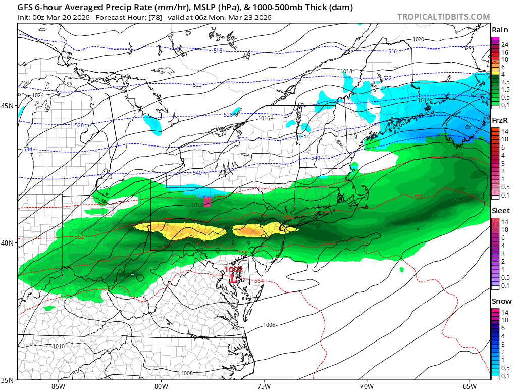
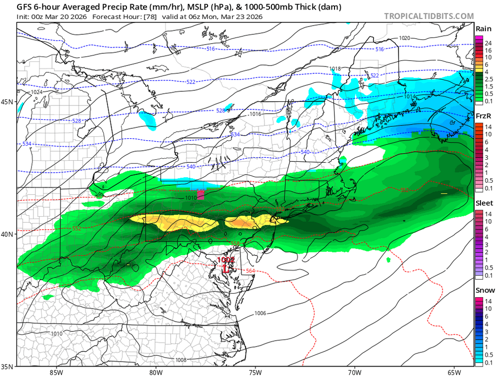
Gfs/ai gfs looked good
-
Nice track but no cold

-
Gfs is further south and has no snow for SNE.
-
He's an early riser so I'll stub.
-
Jesus 0.4 from Campbell Hall to 11.2 in Highland Mills
-
it was sometime in the mid-late 90s I think. but yeah - feels like we got freezes every year at least into early May.
-
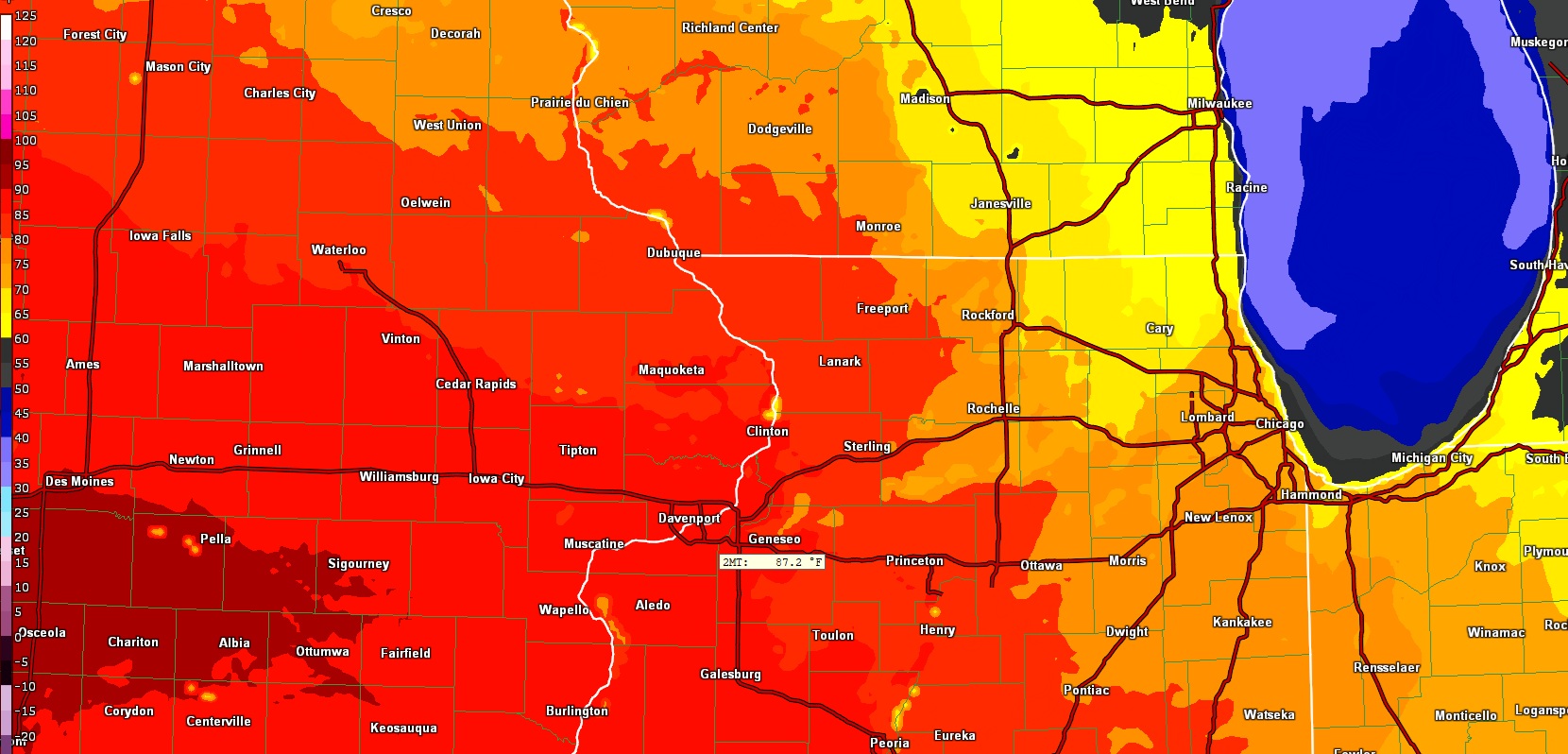
00z HRRR going bonkers and showing 87 for the QC on Saturday.

-
I received 11.2 from that storm. Just far enough south to catch the north end of a few heavy bands but to far north to stay in them and missed out on the 25-30 inch amounts just to the south.
-
@ineedsnow
-
105 today in Phoenix
-
The cold pattern in the Eastern US feels like it's already broken this month. Many places are several degrees above average for March.
-
I'm generally a fan, but it's going to take some education. The TLDR is that SPC now has a way to highlight low coverage but high potential intensity events. I think about 6/1/11. Back then there was only a slight risk, but you could make an argument that coverage was reasonable for a slight only not enhanced. You can now add CIG zones to highlight significant tornado risk even in a 2% or 5%. That just wasn't possible before without a 10% hatched. There was complaining about the miss in MI on day 1. But there was literally no way in the old outlook system to put a significant tornado risk there without upgrading the entire outlook.
-
Very sad to hear. I will miss his updates.
-
Luckily its past 300 on an AI model
-
Im a weenie . What do you expect. Im still looking at the models but there is nothing exciting on them. No negative NAO No negative AO
-
Thank god we dont live there.
-
lol yeah - hey man, at least it's not 110F or whatever bullshit they are seeing in the SW
-
Must’ve been 1992, the year after Pinatubo? My Oceanography professor recalled frost on his car in Harrisonburg in June of that year.
-
Or high humidity lol
-
we live in the lower Mid-Atlantic - 80s in Spring with low humidity is pretty common.
-
I remember a freeze close to Memorial Day one year back in the 1990s in Staunton