All Activity
- Past hour
-
All of our chips are on the table for a lee side trough. Without it, nothing, with it……
-

Central PA Fall Discussions and Obs
Voyager replied to ChescoWx's topic in Upstate New York/Pennsylvania
That's the same with me for summer thunderstorms. When I lived in Bethlehem, all the best storms were northwest of me up in the coal region. I moved to Tamaqua, and now the Lehigh Valley gets smoked. -
As far as February being canonical Niña? Nope and if I do change it, it won’t be until we are into January
-

2025-2026 ENSO
Stormchaserchuck1 replied to 40/70 Benchmark's topic in Weather Forecasting and Discussion
I posted in this thread like 4-5 times a long time ago that weak-negativeENSO and strong -QBO has this strange coincidence of having super cold December's. 1989 and 2005 were examples. QBO is a stratosphere index so I didn't want to make the physical connection, but mentioned that it would be something if it happened again. And sure enough, it did happen again. This December is looking like one of the coldest in the eastern 1/2 since 2005. -
Euro has a light clipper next Friday but the H5 is such a mess I doubt its going to be even close to what we end up with as we have 5 different H5 vorticity max areas all interacting with each other. Sorta reminds me of this with how it plays out
-
Our hopes and dreams are always determined by random wave interactions and timing. Normal people don't get why we do this lol.
-
-

December 2025 regional war/obs/disco thread
WinterWolf replied to Torch Tiger's topic in New England
Lol. Fantasy range anyway…13th/14th is our focus obviously. -
Day 14 on the operational 18z GFS
-
Dec 2009ish feel
-
.thumb.png.4150b06c63a21f61052e47a612bf1818.png)
December 2025 regional war/obs/disco thread
HIPPYVALLEY replied to Torch Tiger's topic in New England
Great, Kevin’s lawn tools can come up with new and creative ways to violate him. -
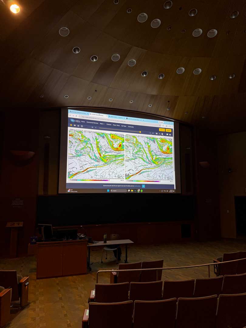
I also think I win when it comes to my setup for analyzing the various potential storms we got on our radars. Its a bit of a weather nerds dream to have a whole projector to yourself.

-
December 2025 regional war/obs/disco thread
HIPPYVALLEY replied to Torch Tiger's topic in New England
Nope, no joke. 0.0.....not even a flake (that I'm aware of). It's been quite a winter so far!!! Oh, I meant the pouring rain part. I had no idea it was precipitating east of here today. We were Sunny most of the day. -
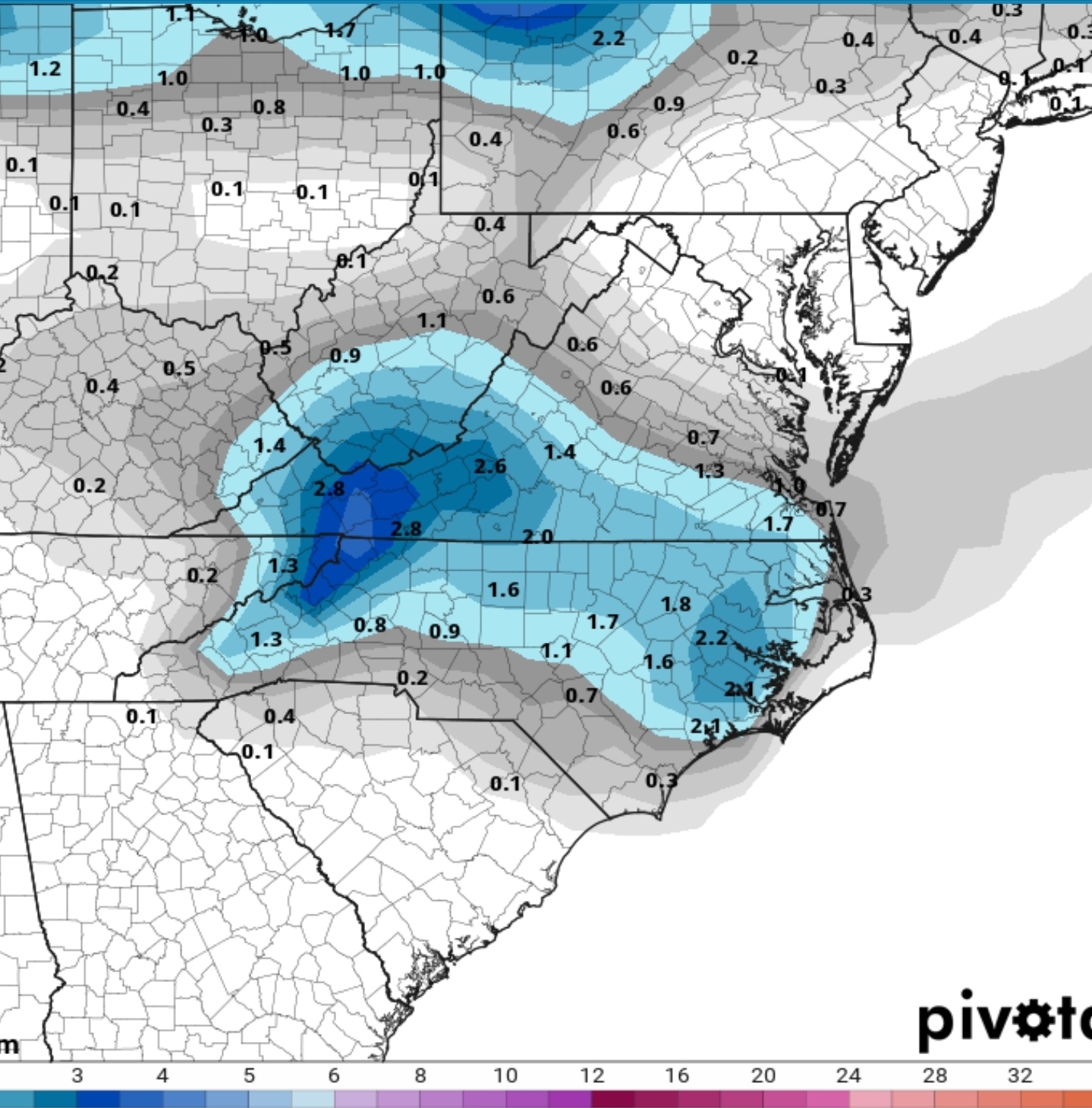
You can see another area of vorticity just barely escape out ahead of our wave. I mean this is the GFS at hour 147 and just look at how close our waves are to creating something truly special Instead it escapes and its all the NS doing work Ngl for whatever reason I'm feeling this one. We got all the stuff setup at the H5 level and just need something to combine together.
-
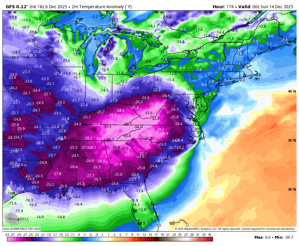
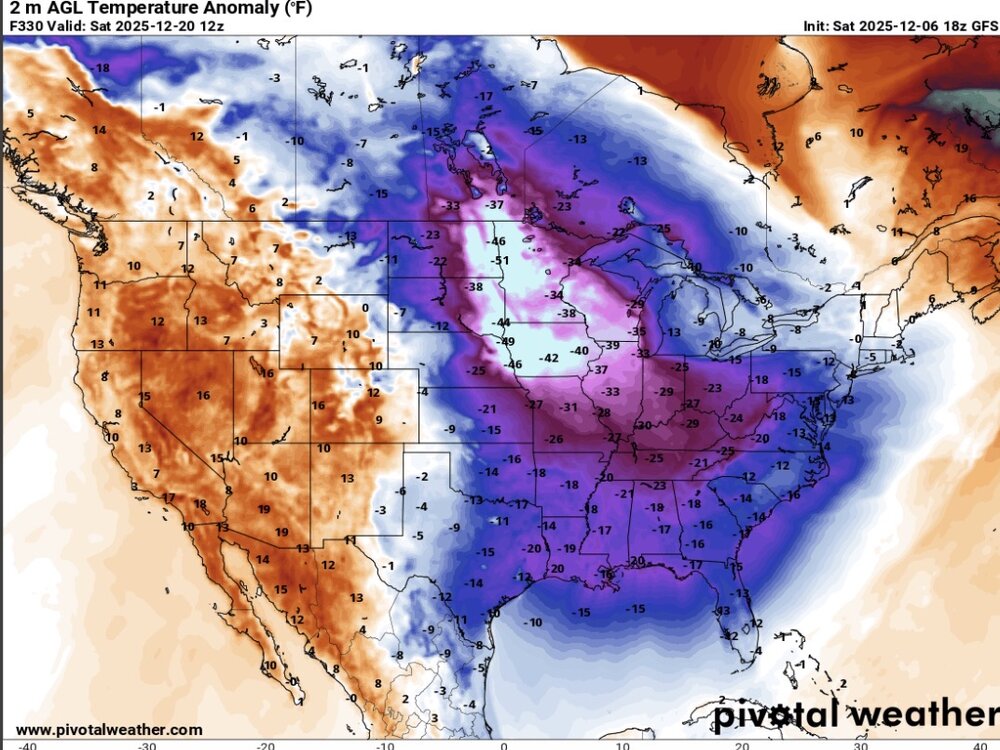
A week later, from the same run. 40 to 50° below normal across the upper Midwest.
-
what are you going to do with the snowmans weenies ? Lets see if the storm shows up on the 0ZGFS and other models ? Or in 18Z we trust ?
-
Reminds me of a messier Feb 11, 2010 storm. We're so close to magic here.
-
18z GEFS for Mondays Potential
-
18Z GFS: 2m anomalies for 0Z on 12/14:

-
HP over Chicago 12z Monday will allow northward transition of southern moisture more efficiently than southern suppression from Scranton/NYC HP Thursday night. It could make a difference.
-
-

-
Mostly clear. 27°
-

Dec 6-7th (It's not a clipper) Clipper
mimillman replied to Chicago Storm's topic in Lakes/Ohio Valley
Those are some serious returns around Ames -
December 2025 regional war/obs/disco thread
WinterWolf replied to Torch Tiger's topic in New England
Lol…who cares..we concentrate on this for now.