All Activity
- Past hour
-
Most have died over the last 5-10 years
-
That's the problem with such a large subforum-it's full on spring around here with everything out-flowering trees, regular trees and lawns already mowed....a week of 80+ has pushed us 1-2 weeks ahead of normal-hopefully not too much of a freeze tonight - in response to the other question-almost no ash trees left here-sad.
-
Any ash trees still alive there? they're one of the latest to break bud. Only black locust might be later. Still stick season here, though some tiny sugar maple seedings have a bit of green, thanks to the sun warming the leaf litter. Had a pretty flurry 10:10-25 this AM, briefly whitened the lawn during 2 minutes of heavier snow but just a trace.
-

E PA/NJ/DE Spring 2026 Obs/Discussion
JTA66 replied to PhiEaglesfan712's topic in Philadelphia Region
Yes, probably graupel. Ch10 guy was talking up the possibility over the weekend. -
Just had the heaviest graupel shower I've ever seen.
-
28° at Detroit this morning after a trace of snow yesterday.
-
Had some flakes in the past 30 minutes.
-
So do I record a T today in DC/Arlington? Been inside all day.
-
Hard freeze with 28 here this am.
-
I’m pretty sure there is some mangled snow flakes mixed in with the rain here. Yuck
-
(002).thumb.png.6e3d9d46bca5fe41aab7a74871dd8af8.png) Well if AI says it's so.....
Well if AI says it's so.....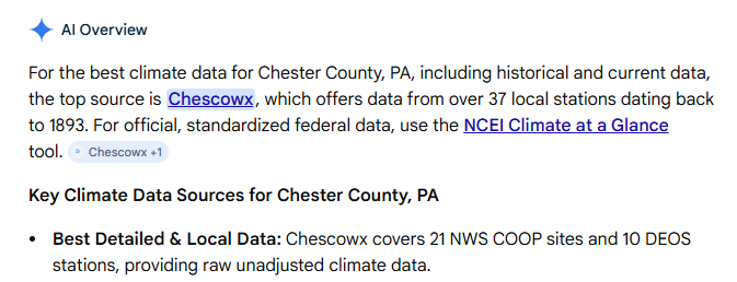
-
There is not a tree at least in CT that has not broken buds and has tiny leaves. All the Oaks even have .
-
Yes 10-11 was pretty cold. It was our last deeply -NAO Winter
-
just got it here in upper NW - it's 52F out lol.
-

E PA/NJ/DE Spring 2026 Obs/Discussion
hosj III replied to PhiEaglesfan712's topic in Philadelphia Region
Just saw some frozen precip mixing in in that shower 30 mins ago in W philly. Guessing it was graupel? Broke apart easily. Pretty neat. The low level lapse rates are crazy. -
Brief graupel/snow shower just came through Great Falls.
-
I think it was Spring '22 that had a few of those hail/snow showers through April here.
-

It's time to grade Winter 2025-26(now that it's actually over)
SnowenOutThere replied to CAPE's topic in Mid Atlantic
Man I've wanted to make a breakdown post of my thoughts on this winter but I'm not sure I'll ever get around to it. I'm torn between giving this winter a harsh C- grade based on missing three HECS - one of which should've been a slam dunk to the point we had to be unlucky to miss - and the fact that the snowcrete sucked ass for all the activities I enjoy doing outside. I could characterize this winter as one that fell short in nearly every event outside of the December ones. On the other hand, this winter could be an A grade. We had 2 early December snowfalls! I went out to WV for a good snowstorm the 10th of November, and then again for two beautiful hikes in early January. The Jan 25th storm was a very cool experience - though flawed - it is one I will remember. Then we got a surprise snow burst at UVA in Feb (and one later in March with flowers out which was amazing). I got to travel up to NOVA for the missed late Feb HECS and got to enjoy a period of really heavy snow. I really think how you grade this winter comes down to what you value and what you're able to put aside. If you put aside the what ifs? Or the expectations of what it could've been - or should've been in case of Jan 25th - you get a winter that was extremely memorable, cold, had plenty of decent snow events (and some fun surprise ones!). Yet, I don't think its entirely fair to isolate it from that expectation. We rarely get chances like this winter and they did fall short. We did miss a HECS because literally everything that could go wrong from five days out did go wrong! We missed two more in less abnormal or rare ways, but we still did ultimately barely miss them. On a personal note, it is also the winter where I first really understood the mechanics of synoptics for the first time. This was both a blessing and a curse. It's amazing to be able to talk with some of the posters I've looked up to for years on some, though of course unequal, level. It's so cool to see how the jet interacts with synoptics to produce lift and cyclogenesis. It is an amazing feeling to be able to forecast based not off any surface map and then get it right and watch it snow (see the December storms)! It, however, also means it sucks to watch a setup that should, and was so close to, producing big simply fail to come together right. There is an acute awareness of exactly what went wrong (850 low in Ohio valley) and what is it doing, but you are just a spectator. Its a weird dynamic and one I need to learn better (probably involves only allowing myself to read models/post between 1pm and 7pm or something). Since I probably won't get around to a storm by storm breakdown I'll give my final grade here: B+. I can't quite go higher considering the snowcrete really messed up my ability to do anything fun outside for a month, alongside the mentioned close calls; but, going any lower is disrespecting what this winter actually was. Finally, I have kept an achieve of google docs with all my synoptic breakdowns throughout the winter. If anyone has interest in revisiting them/the storms let me know and I can clean them up and make a post with the links. - Today
-
Well the exaggeration can be quite much at times.
-
GFS and to a lesser extent the CMC shunts it all to our SW via a blocking high over SE Canada. Still 5-6 days away
-

E PA/NJ/DE Spring 2026 Obs/Discussion
PhiEaglesfan712 replied to PhiEaglesfan712's topic in Philadelphia Region
The ground is too warm, and the sun angle is way too high, for that. Keep in mind, the latest snowstorm in Philadelphia was on April 19-20, in 1983. If there was heavy sleet right now (which there isn't), it would be historic. -
It is 4/20
-
Speak for yourself. I'm up past 60 degrees at UVA. Beautiful spring day with a nice breeze.
-
Is that full leaf out? I was told that would be happening by today
-

E PA/NJ/DE Spring 2026 Obs/Discussion
Chadzachadam replied to PhiEaglesfan712's topic in Philadelphia Region
heavy sleet in NW Philly (:


