All Activity
- Past hour
-

October Comes Early: Late September Multi-Hazard Hybrid Storm
vortex95 replied to WxWatcher007's topic in New England
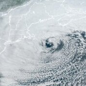
Despite being such a "warm" storm, it still managed to get that classic SE quad cool/cold air instability CU over the ocean we see so often in the weenie classics! When I first swt a VIS image of the Bliz of 78 as a kid, that cold air CU always stuck in my mind! One of more crazy cold air CU wraps was the Bliz of 97. @CoastalWx PT! -

October Comes Early: Late September Multi-Hazard Hybrid Storm
40/70 Benchmark replied to WxWatcher007's topic in New England
.71" rainfall on the day in Methuen, 1.06" Sunday, .58" Saturday, .03" Friday for a 4-day event total of 2.38" -
October Comes Early: Late September Multi-Hazard Hybrid Storm
vortex95 replied to WxWatcher007's topic in New England
"communicated quite well," yah, to the point that ppl were ticked that so many *indoor* events were cancelled and ppl treated it like a snowstorm raid the grocery store! From a fcst model perspective, they nailed it, as you said. It indeed did end up being the biggest Sep nor'easter on record for the region, not only for rain/wind, but also for duration as well. Sometimes I find this overlooked, which is should not be. Our ability to fcst high-end, outlier wx events has become excellent in the last 10-15 years and that has translated to a lot of $$ and lives saved. Contrary to popular belief, the wx is not becoming less forecastable or "unrecognizable" w/ warmer mean temps. I have to state this at times in discussions -- the laws of physics and thermodynamics do not change b/c temps on avg change (up or down). Water still freezes at 0 C, latent heat of fusion/vaporization/sublimation remains the same, the sun angle at any given latitude is still the same every year on any given date, etc. -

Strong Nor'Easter/Hybrid Storm Late September 2026
Prue11 replied to Rjay's topic in New York City Metro
It was memorable but nothing we haven’t seen -
As with all things rain in south central Texas ---- By now I have learned to take these predictions with about 41,000 grains of Dead Sea salt. I've been here for 8 years. Rain related heartbreak is as common down here as soul-wrenching taxes. With that said...... ( https://forecast.weather.gov/product.php?site=EWX&issuedby=EWX&product=AFD&format=CI&version=1&glossary=1 ) By Tuesday the upper level low will continue to push eastward towards the desert southwest thus shunting the subtropical ridge currently over our area and pushing it off to the east. As this happens lee side surface troughing east of the rockies will help to bring in stronger southeasterly winds at the surface. This in turn will help pull in more moisture up from the Gulf giving us a better shot at rain and storm chances during the day along with our typical seabreeze. For now have capped rain chances at 30 percent for areas mainly along and east of the I-35 Corridor. By Tuesday night we could start to see rain/storm chances increase as we begin to see the beginning effects of the upper level low over the desert southwest as it slowly deepens and progresses eastward towards the Southern Plains. Additionally, significant amounts of moisture from the remnants of Hurricane Polo and Odalys will be pulled into our area in the upper levels along with lower level moisture being brought in from the Gulf. We could see PWATS approaching and even exceeding 2 inches. As such any storms that do form will be tropical in nature and capable of very heavy rainfall. WPC currently has Val Verde and parts of Edwards counties in a level 1 of 4 risk of excessive rainfall for Tuesday with the risk shifting eastward and increasing further as we get beyond Tuesday night. More about that in the long term portion below. The advertised pattern change is on track for mid to late week with increased showers and thunderstorm chances beginning Wednesday and continuing through late week and beyond. An upper low will be located over the Four Corners region Wednesday, eventually moving east across the Central and Southern Plains late week bringing a Pacific cold front across our area. Abundant moisture will be available ahead of this system with some guidance showing PWATs around 200 percent above normal.
-
I’ll believe it when I see it
-
October Comes Early: Late September Multi-Hazard Hybrid Storm
vortex95 replied to WxWatcher007's topic in New England
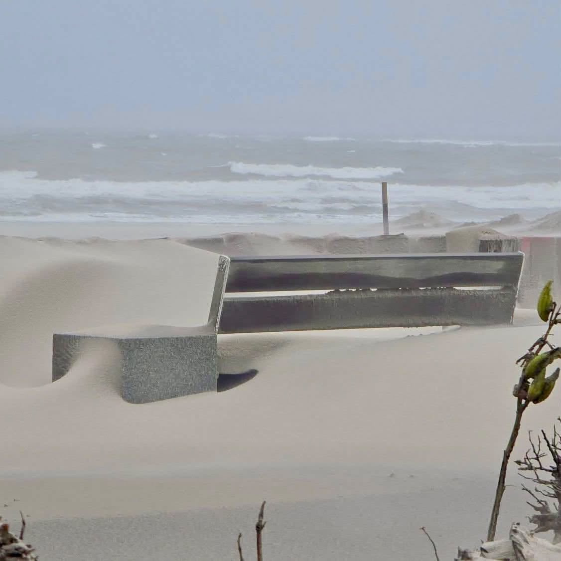
Had a weenie friend go to Hampton Beach today. Sand drifts along the boardwalk were NUTZ! Has @CoastalWx ever seen such before in GHG????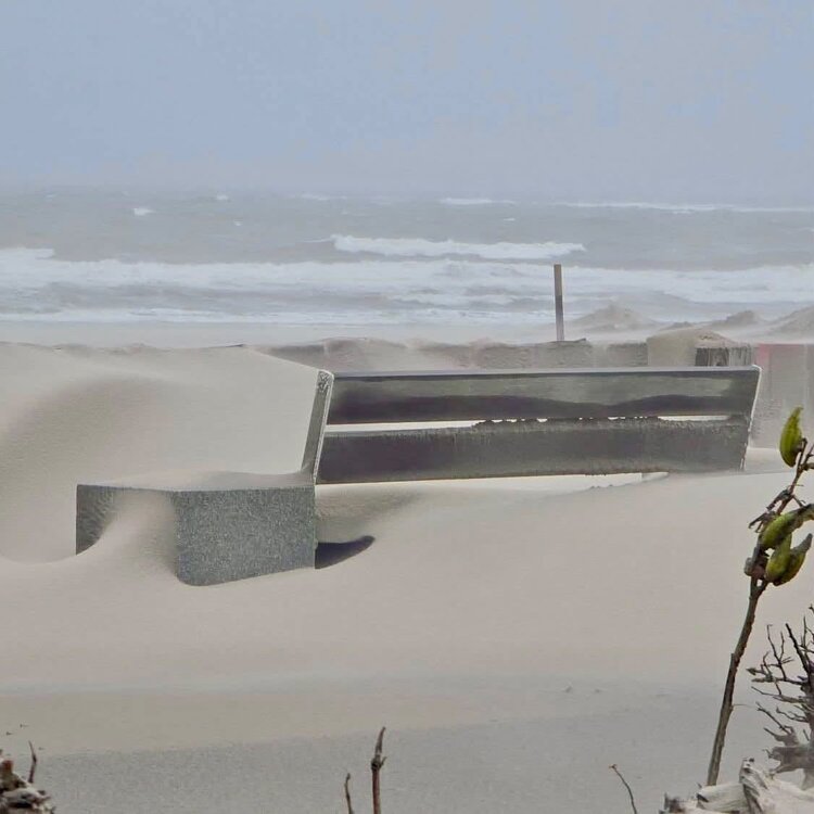
-
That is odd. Usually every ERC, the radii of TS and HU winds expands somewhat.
-

2026-2027 Record-breaking El Nino
LakePaste25 replied to Stormchaserchuck1's topic in Weather Forecasting and Discussion
Yeah it’s not as simple as “if I have competing cool ENSO influences, I am subtracting from the super El Niño which makes the pattern better for the east.” By that logic, 2023-24 should’ve been cold but it wasn’t. I am actually disappointed that the -PDO keeps dropping further because that’s bad for us. Although I still maintain that the PDO won’t really matter so much in a season like this either way. -
QB's playing in/or against the NFC North having a tough run. Black n Blue division rocks!
-
1.24" today.. 2.18" for the event
-
2026 Atlantic Hurricane Season
vortex95 replied to Stormchaserchuck1's topic in Tropical Headquarters
Hanna is another case of a TS that would have highly likely been totally missed prior to the satellite era, and even during the satellite era, not declared. NHC was not aggressive in naming many short-lived "throwaway" systems through the early 1990s. For instance, there are 5 systems in 1992 that will likely be included in the reanalysis once it gets to the 1990s (at least one will be a short-lived HU). One thing that changed by the 00s is ASCAT. When you had a highly sheared system like Hanna, it was hard to know if winds were min TS strength and if the LLCC was closed. Now, much easier to tell from remote sat products like ASCAT what the winds are. SAR is making it even better now. Also, what we call a TC has evolved over time. We now know that there is a wide spectrum of TC types and seasons like 2005 showed us how far that spectrum can be pushed! And in a seasonal perspective, what is happening this season matches well w/ what to expect during strong or very strong El Nino. MDR squashed and high-latitude developments primarily. Some ppl here probably getting sick of the "nickel and dime" ACE progress! - Today
-
2026 Atlantic Hurricane Season
vortex95 replied to Stormchaserchuck1's topic in Tropical Headquarters
Fay is going to upgraded again to a 35 kt TS at 03z. The ATCF 00z position notes this and Tropical Tidbits pulls the ATCF so it already says "Tropical Storm Fay" for its floater WIill not go away! -

October Comes Early: Late September Multi-Hazard Hybrid Storm
Brewbeer replied to WxWatcher007's topic in New England
dude, you have a weather station and still make stuff up pretty sad in all "seriousness" -
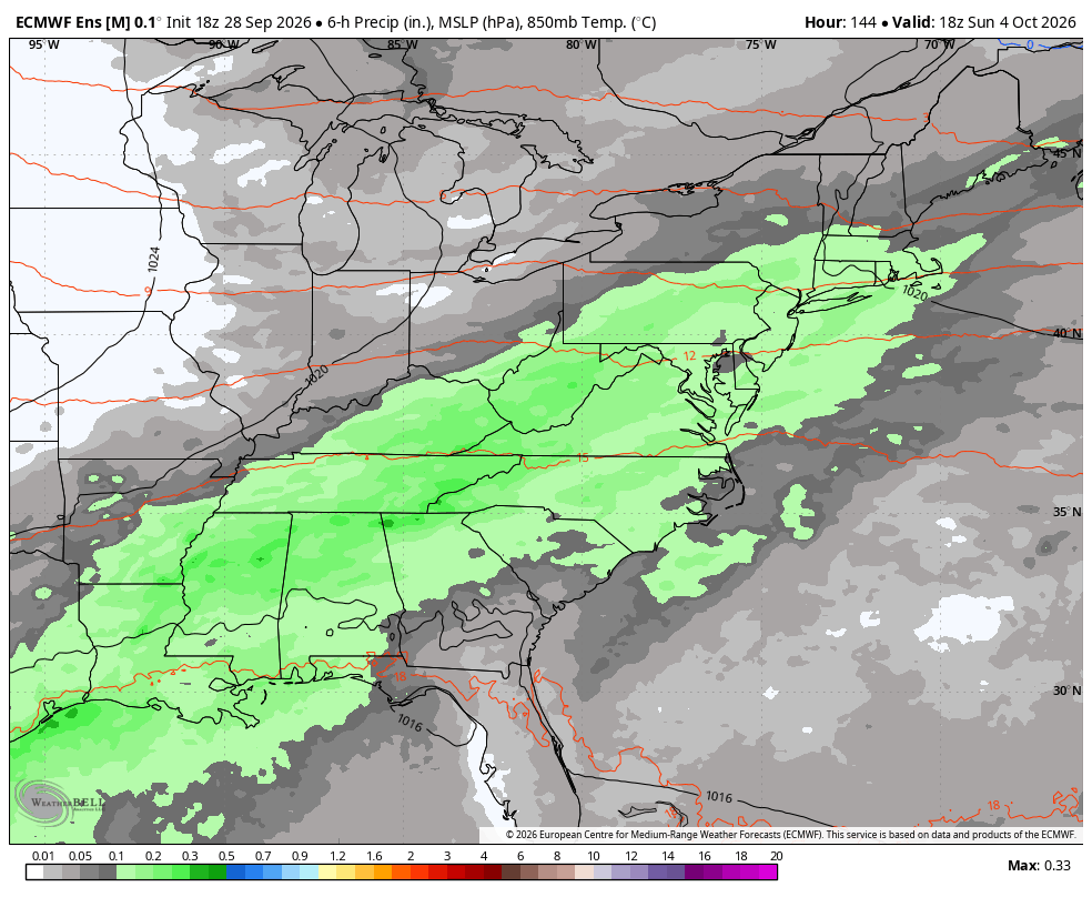
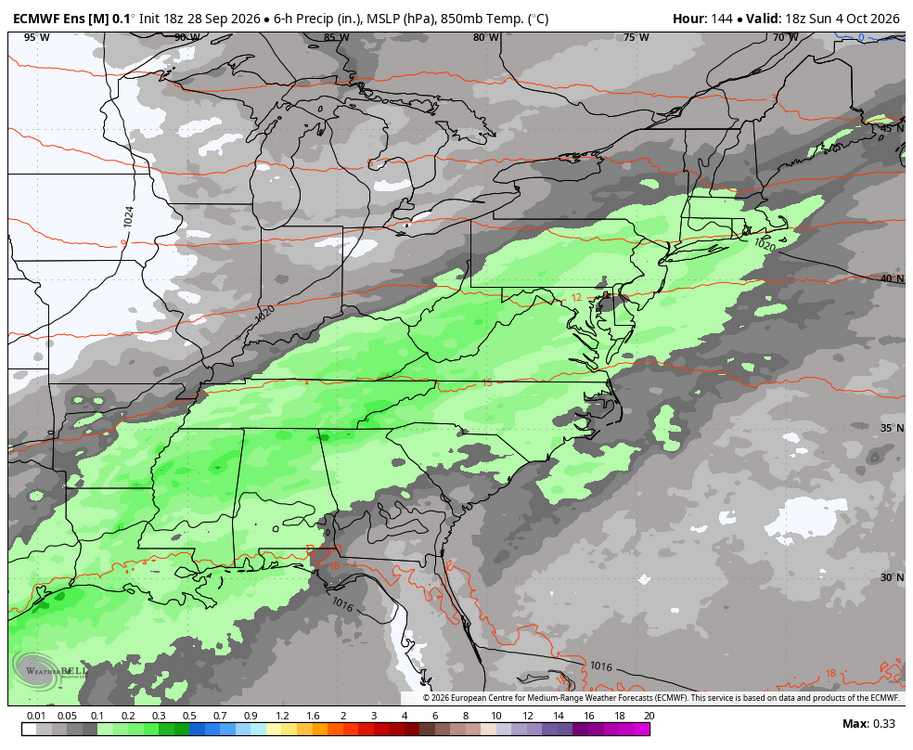
WB 18Z EPS. Euro is back on board for Sunday.
-
 Viagra generic over the counter: SildenDirect - Cheap Viagra 100mg
 -
The Bears third string quarterback looks like Joe Montana. Our second string quarterback looks like a steaming pile of crap!
-
I have a garage where I'll do the painting, but once the paint is on, i'll need good weather since it doesn't fit all 3 cars I'm working on: my daily driver '97 Accord which is eucalyptus green pearl, wife's '00 Camry which is antique sage pearl, and the '03 Accord, which is satin silver metallic it's kind of interesting, both Accords rusted in the front sections of the rear wheel wells and up the running boards underneath the rear doors; the Camry rusted behind the rear wheel wells, and not nearly as much as the Accords
-
I was camping at Big Meadows on Skyline Drive in October, 1979 when we woke up to thunder, lightning and rain that quickly turned to sleet then snow. We literally barely made it out in time before they closed Skyline Drive (we were in Sperryville when we heard it was just closed.) The ridge tops quickly accumulated 3"+ with heavy snow still falling making driving an absolute nightmare. Still wonder to this day how my friend's 1970 Ford Torino, an absolute boat with rear wheel drive, made it up and down the hills. By the time we made it to Rt. 211 (I think that's 211 that takes you to Sperryville), it was rain with still some thunder. Long story to simply confirm that I believe your map! Lol
-

October Comes Early: Late September Multi-Hazard Hybrid Storm
kdxken replied to WxWatcher007's topic in New England
Proved my point thank you. -
2026-2027 Record-breaking El Nino
40/70 Benchmark replied to Stormchaserchuck1's topic in Weather Forecasting and Discussion
A couple of guys online, Ryan Hall and Mark Margavage, seem to think the -PDO could have a colder influence in the east because the monster GOA low that triggers the huge Pac jet may not be. I don't think that make sense....-PDO/El Niño is worse heights are higher in the se and any cool ENSO influence is like a Modoki La Niña constructively interfering with east-based El Niño, so the any Aleutian riding would likely not be poleward. Weenie-logic. I'm with Chris on that. -
October Comes Early: Late September Multi-Hazard Hybrid Storm
kdxken replied to WxWatcher007's topic in New England
"We had vandalism. Vandalism—all you know, we have a—hundred—and we have a, I think, 290, 300-foot slit right through it. Probably a box cutter or a knife of some kind." "We had a 40, maybe 50, I'd say 60 mph wind. It's ripping!" -
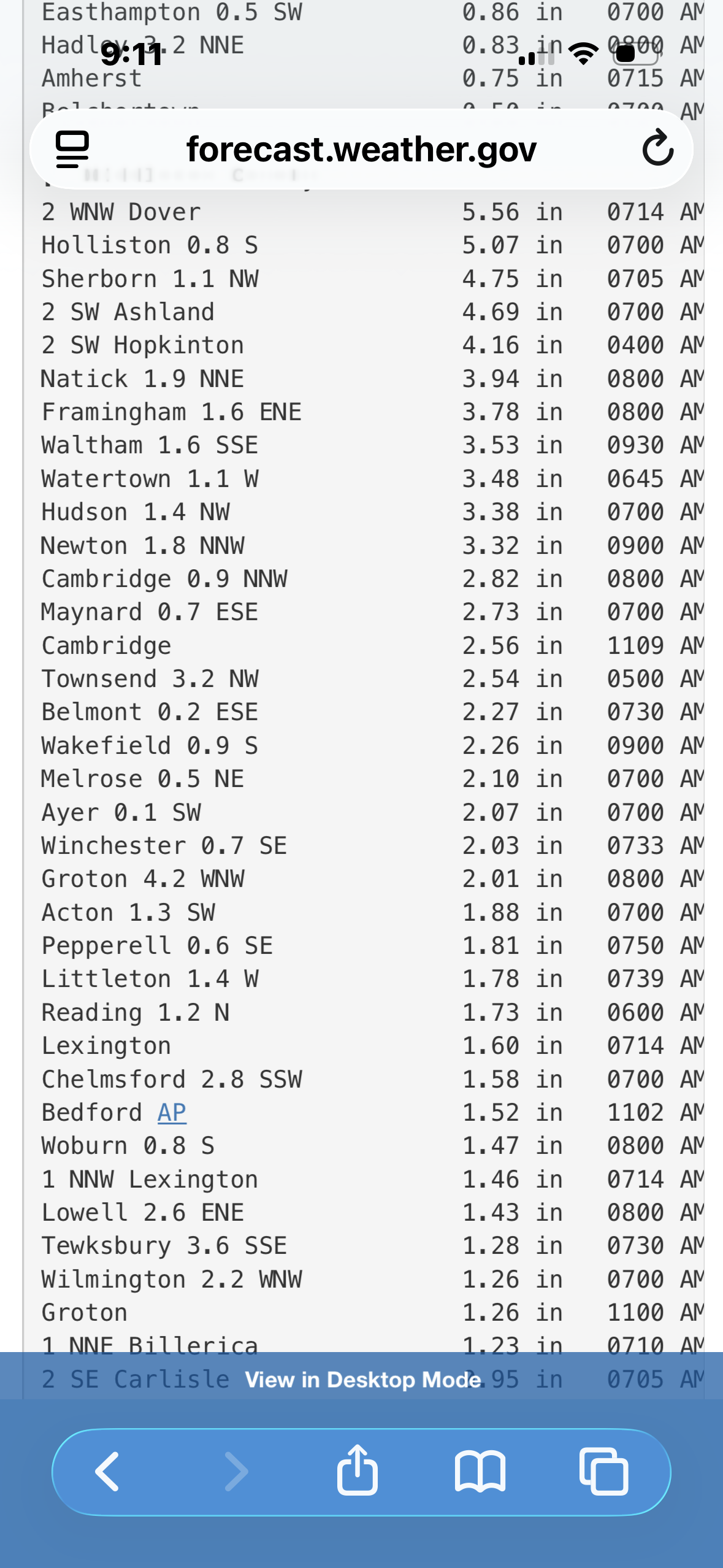
 You don’t have a wx station . No one in your area had anywhere near 7”. Just making stuff up . Pretty sad in all seriousness
 -
October Comes Early: Late September Multi-Hazard Hybrid Storm
bristolri_wx replied to WxWatcher007's topic in New England
Stealing from the weather station up the street from me: FR: 0.18 SA: 2.04 SU: 2.30 MO: 0.71 T: 5.23