All Activity
- Past hour
-

"Don’t do it" 2026 Blizzard obs, updates and pictures.
tavwtby replied to Ginx snewx's topic in New England
nice band forming along 84ish, main stuff looks like it's about over LI right now, Tom's River radar is lit -

“Cory’s in NYC! Let’s HECS!” Feb. 22-24 Disco
40/70 Benchmark replied to TheSnowman's topic in New England
Can you explain this to me? Never really understood what that is... -
Did u actually read my comment??? Geez. WTF
-
Went from all-day drizzle to moderate snow with the large flakes, temp down to 34, high 38
-

Feb 22nd/23rd "There's no way..." Obs Thread
Interstate replied to Maestrobjwa's topic in Mid Atlantic
32.5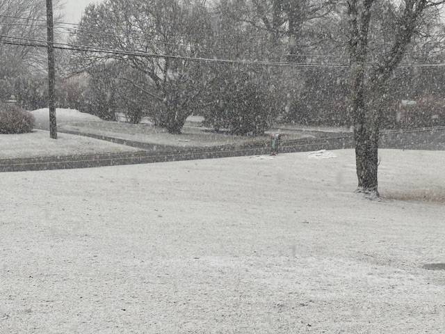
-

Feb 22nd/23rd "There's no way..." Obs Thread
grhqofb5 replied to Maestrobjwa's topic in Mid Atlantic
I think I might be in that heavy new orleans band thing. -
2/22 18z GFS Snow
-
Please add your links from earlier in that thread.
-

“Cory’s in NYC! Let’s HECS!” Feb. 22-24 Disco
Typhoon Tip replied to TheSnowman's topic in New England
oh you guys beat me to it -
North shore Nassau, currently 30, snow is sticking to road surfaces and grass. Wind is increasing
-
Light snow for the past 15 mins trees caking, cars and grass, colder pavement also starting to get a dusting.
-
Mixing here
-
“Cory’s in NYC! Let’s HECS!” Feb. 22-24 Disco
40/70 Benchmark replied to TheSnowman's topic in New England
My take is that it did it's job sniffing out the larger scale synoptic landscape that will allow this historic impact around here.....but it's passed the baton at this point because it's not designed to handle the shorter-term nuances and mesoscale features of cyclogenesis, banding etc. -

Feb 22nd/23rd "There's no way..." Obs Thread
EastCoast NPZ replied to Maestrobjwa's topic in Mid Atlantic
I tried to warn you. -
I was impressed how much snow you had down there, close to an inch...while we had just a few wet snowflakes
-

Richmond Metro/Hampton Roads Area Discussion
rbrewbaker replied to RIC Airport's topic in Mid Atlantic
All rain still near Carytown 23221 -
0.5", +0.3" in the last 15 minutes!
-
“Cory’s in NYC! Let’s HECS!” Feb. 22-24 Disco
Typhoon Tip replied to TheSnowman's topic in New England
MAUL popping up on some recent guidance tools. Will and I were anticipating this a couple days ago. It's interesting that it seemed almost less evident yesterday but is here now. -

Feb 22nd/23rd "There's no way..." Obs Thread
mitchnick replied to Maestrobjwa's topic in Mid Atlantic
Just can't beat snow on snow piles. -

Central PA Winter 25/26 Discussion and Obs
pasnownut replied to MAG5035's topic in Upstate New York/Pennsylvania
Ground just starting to cave here. Steady snow. Yay -

Feb 22nd/23rd "There's no way..." Obs Thread
NorthArlington101 replied to Maestrobjwa's topic in Mid Atlantic
Roads caving -

Feb 22nd/23rd "There's no way..." Obs Thread
Eskimo Joe replied to Maestrobjwa's topic in Mid Atlantic
Statewide mesonet data shows the sun angle and it's impacts should be done. It's all snow and accumulations from here on out. -

Feb 22nd/23rd "There's no way..." Obs Thread
dailylurker replied to Maestrobjwa's topic in Mid Atlantic
Im at seas level and have 3"+ otg lol. Just messing with ya. I get what you mean. -

Feb 22nd/23rd "There's no way..." Obs Thread
Ravens94 replied to Maestrobjwa's topic in Mid Atlantic
I gotta work a boat show in AC NJ or id be comfy at home after being in Miami last week lol. -

Feb 22nd/23rd "There's no way..." Obs Thread
ravensrule replied to Maestrobjwa's topic in Mid Atlantic
Grass is all white, damn that was fast.