All Activity
- Past hour
-

Spooky Season (October Disco Thread)
ineedsnow replied to Prismshine Productions's topic in New England
Ive been liking the winters around here.. even below normal seemed good I can't wait for a normal to above winter -
I’m rubbing the hose again
-

E PA/NJ/DE Autumn 2025 Obs/Discussion
Hurricane Agnes replied to PhiEaglesfan712's topic in Philadelphia Region
That pre-frontal rain was stingy as hell here. I got up this morning expecting to have had something and there was nada until about 7 am when some droplets finally fell from the sky. Grand total was 0.18" and that has been all for the month so far (September was 2.39" IMBY). My high was 70 at midnight and I bottomed out with the front to 61 at 10:45 this morning. It's currently mostly sunny and 69 with dp 53. -
closely monitoring this weekend system. Beaches for the most part up in Northern Ocean/Monmouth survived the offshore hurricanes quite well. The spring/summer replenishment from Lavallette to Bay Head held as well. I would be concerned about unprotected beaches like Belmar/Avon/Asbury Park if this holds. Will Walt be starting a thread on this?
-
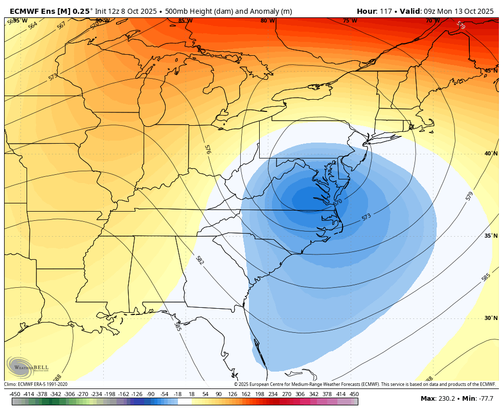
Some of your EPS members swing west after heading out
-
Ok, just to start getting warmed up for winter, some WB 12Z EPS probability maps:


-
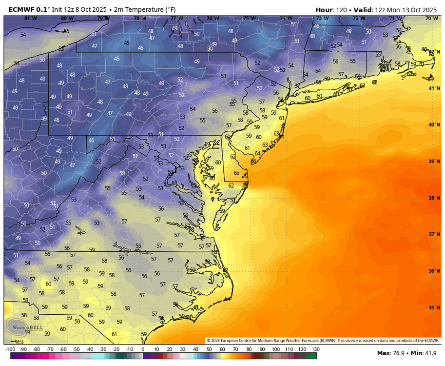
Unfortunately for him we won't be mixing anything close to 850 lol.
-
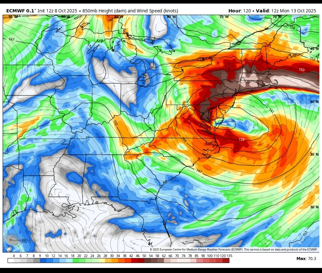
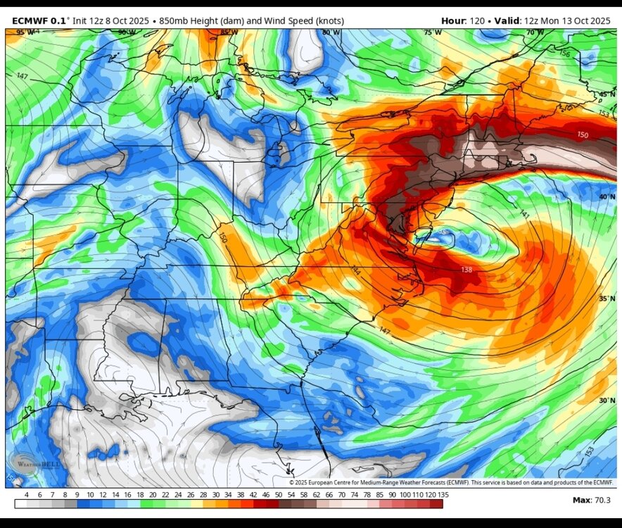
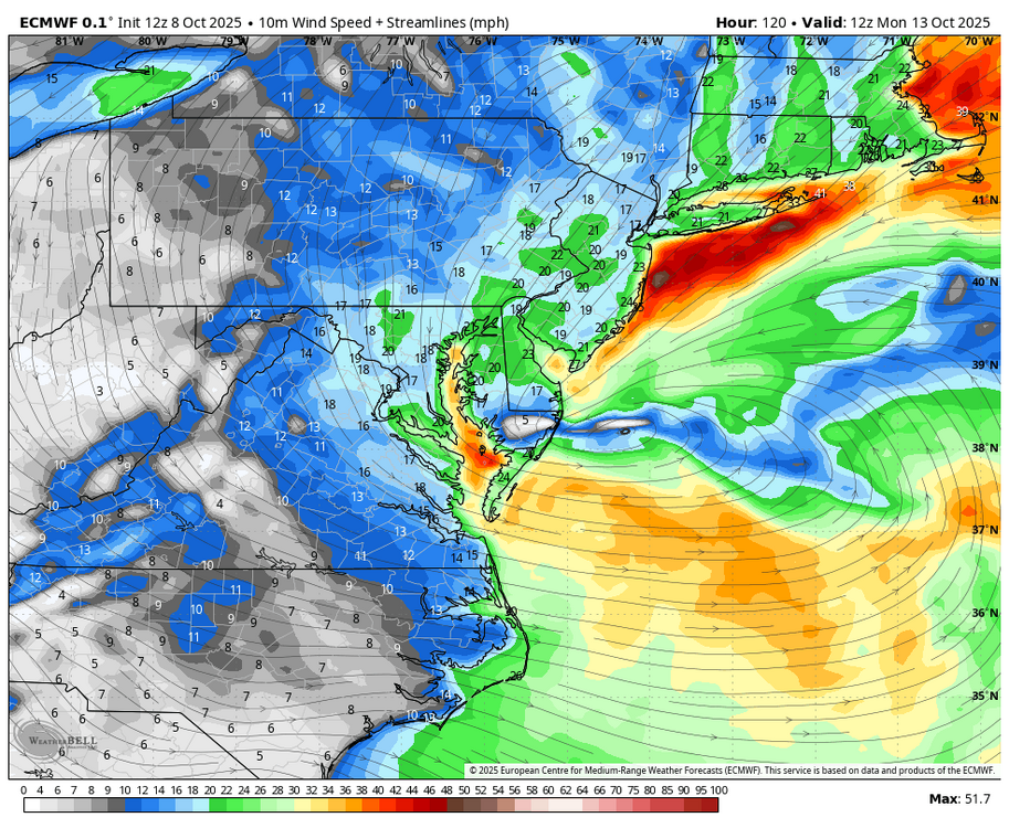
You can ignore the exact low placement when you have a massive low with the LLJ and moisture train well to the north. Check out the area around the low pressure and how baggy it is, then look how tight the isobars are north of the warm front over SNE.
-
EPS seems to be north it's coming
-
12z Euro AI


-
Quite a different picture for our friend in Dayton, where a daily record rainfall of nearly 2 1/2" of rain converted a small annual deficit into a surplus of nearly 2 inches. This was also the 67th most precipitation for any day on record - dating back to the 19th century! It may always be sunny in Philadelphia, but it's always cloudy in Dayton.
-
.48 Not bad.
-
I’m looking at pivotal and I thought the EURO op seemed pretty south with the low compared to the GFS no?
-
This ought to send ditty into a lather.
-
Note to our younger members - we haven't had one in so long you might not know what one of these is. We used to get these from time to time and generally involves wind and rain/snow.
-
Everybody's in.
-
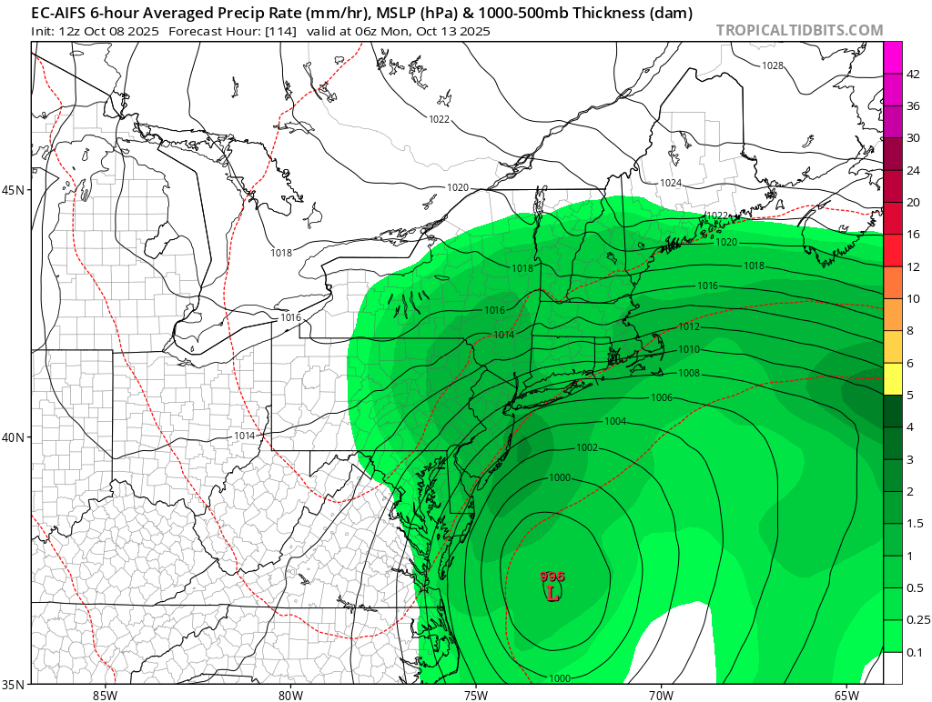
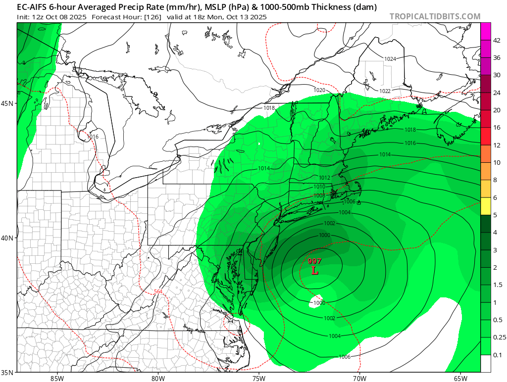
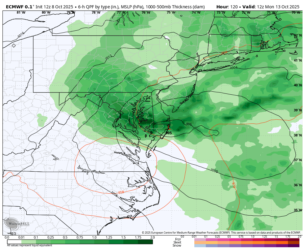
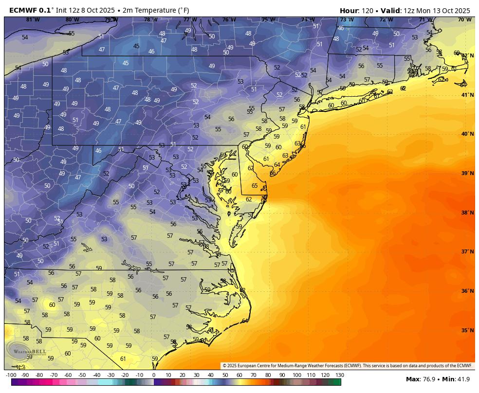
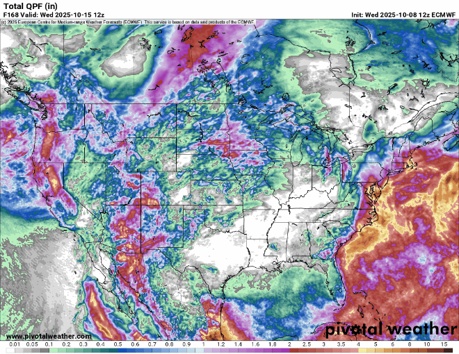
Beneficial rains on the 12z Euro. Maybe for once we can get a short term NW trend next few days. That way the heaviest axis of rain could shift from CNJ to NYC to Southern CT And LI. But I will take any prolonged soaking rains I can get at this point. Glad to see the coastal storm track showing more life than we have seen in over a year.
-
WB 12Z EPS supports the global at Day 5.

-

Central PA Fall Discussions and Obs
Superstorm replied to ChescoWx's topic in Upstate New York/Pennsylvania
-
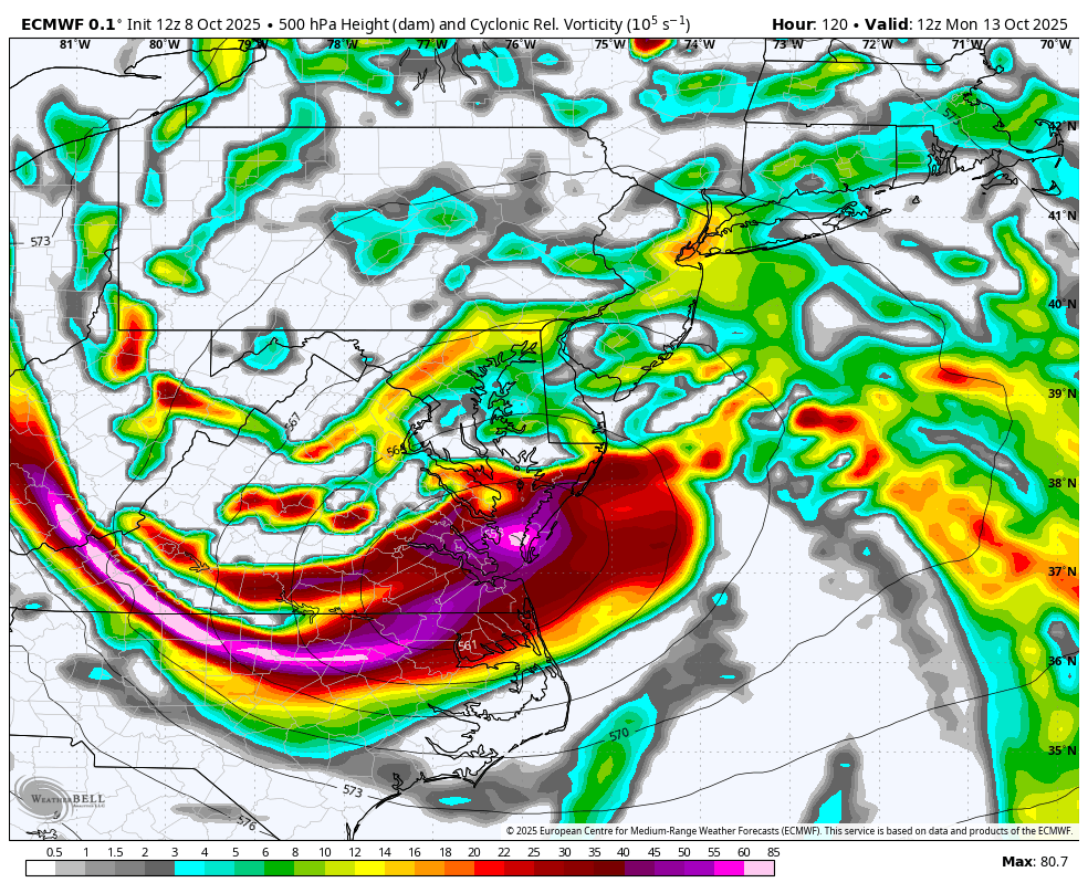
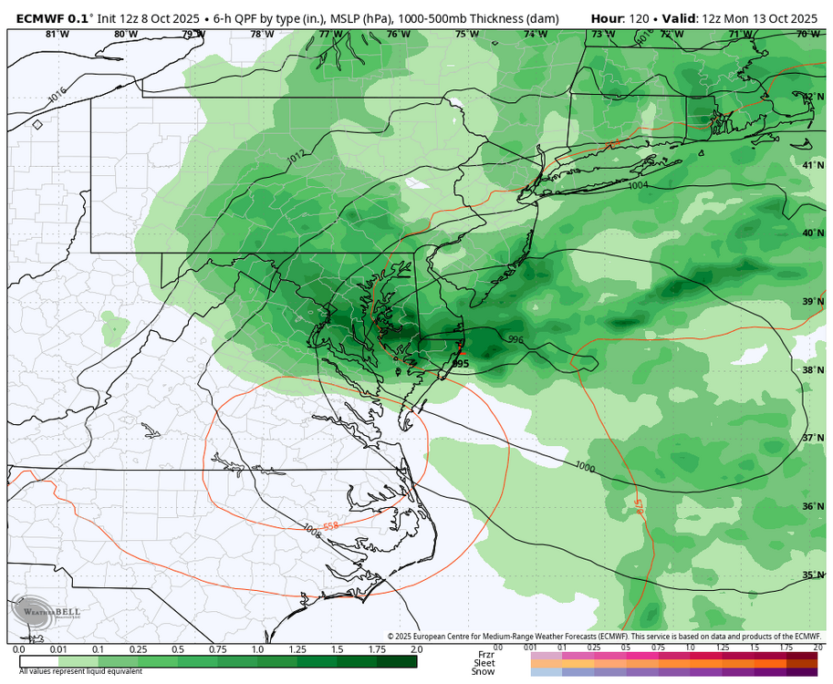
WB 12z EURO at Day 5; old-fashioned nor'easter....

-
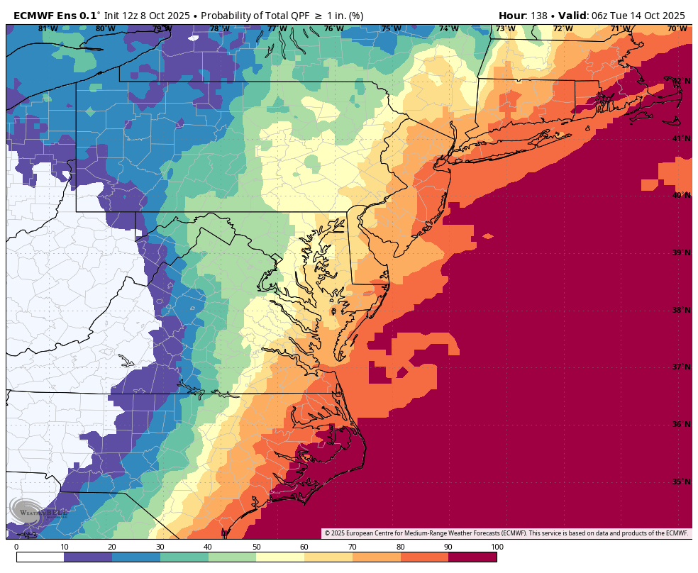
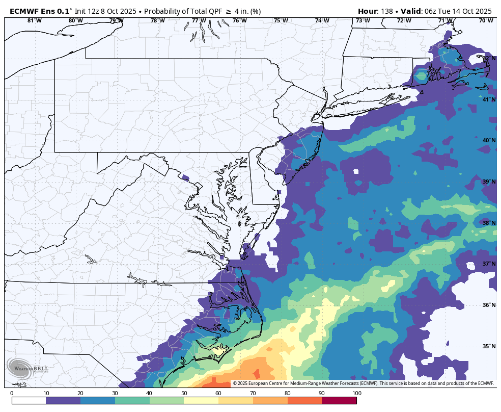
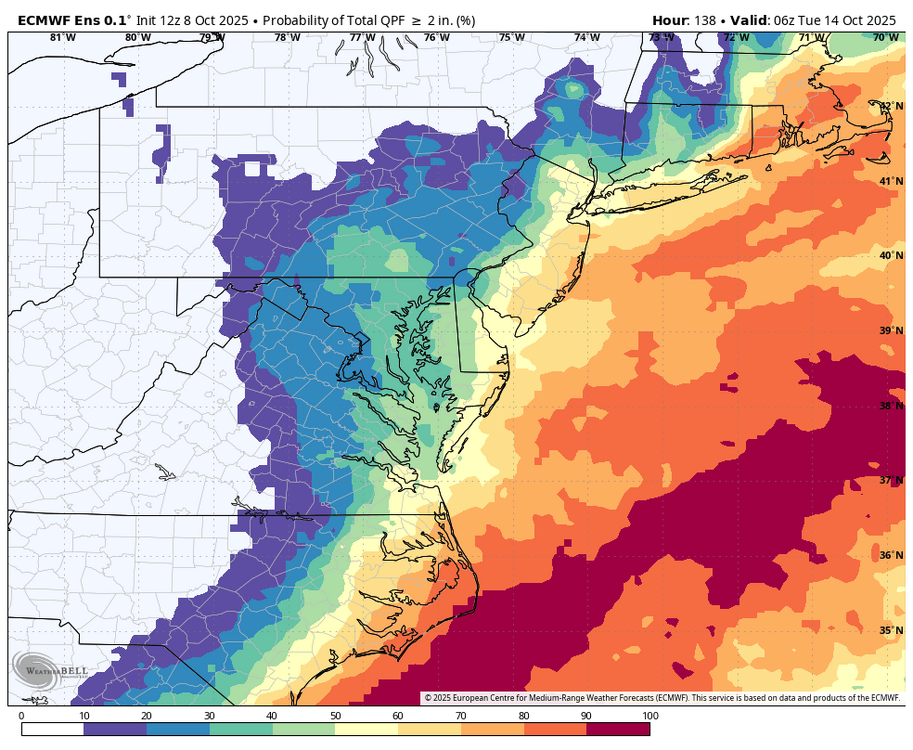
models showing up to 5 inches of rain for the central/south NJ Shore, 1-3 elsewhere with less far north
-

Central PA Fall Discussions and Obs
WmsptWx replied to ChescoWx's topic in Upstate New York/Pennsylvania
ALLLLLLEEEEEEEEEEEEEEEEEEEEEEEEEEEEEEEEEEEEEEEEEEEEEEEEEEEEEEEEEEEEEEEEEE3EEEEEEEEEEEEEEEEEEEEEEEEET! -
Yeah, must be the really strong subtropical winter ridge expansion in conjunction with the faster Pacific Jet leading to all these winter into early spring -NAO -AO Southeast ridge link ups. Been noticing that during other seasons like we are seeing next few days we can avoid the Southeast ridge link ups at times. The last really solid -NAO -AO block that delivered a classic KU event was 1-31-21. The Jan 22 events were mostly Pacific driven with +PNA -EPO +AO +NAO.
-
Grand total here: .29 inches. DIT was right, for my area. Heh. Kudos.
-
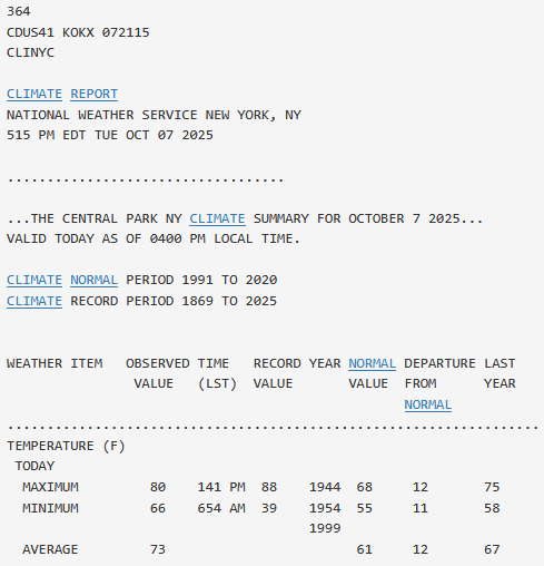
No adjustment. The high of 80 occurred early in the afternoon. The station never checked the preliminary climate report before going on air.