All Activity
- Past hour
-
-
That step down process really worked for us last year.. we got nailed before the gulf coast got theirs.. oh wait
-
First Winter Storm to kickoff 2025-26 Winter season
radarman replied to Baroclinic Zone's topic in New England
That double lobe thing mostly gone this run, with the primary low moving NE off Delmarva and deepening. Nice looking run. -
More in line with Rgem outcome now. And more matches nws forecast.
-

First Winter Storm to kickoff 2025-26 Winter season
powderfreak replied to Baroclinic Zone's topic in New England
Pretty good consensus on somewhere in Middlesex or Worcester County, north of the mix line, is where the best chances are at a jackpot. -
Nam isn't, but Rgem is, though not as good as Gfs. Still, like I posted earlier, I would like to see the Nam and icon come for the ride.
-
First Winter Storm to kickoff 2025-26 Winter season
dryslot replied to Baroclinic Zone's topic in New England
Looked pretty similar to the 06z run -
That’s not correct. Rgem is and hrrr at hour 48 12z was heading towards a snow solution.
-
Bit of a step back. Just don't want it to be the start of a trend.
-
The red flag, however, is not one mesoscale model is forecasting snow.
-
First Winter Storm to kickoff 2025-26 Winter season
Kitz Craver replied to Baroclinic Zone's topic in New England
How about temperature profile? -

Central PA Fall Discussions and Obs
Itstrainingtime replied to ChescoWx's topic in Upstate New York/Pennsylvania
Moderate sleet falling here now and 35. What a wonderful wintry morning after a period of non-accumulating light snow earlier. Looking forward to work-related scheduling headaches Tuesday! -
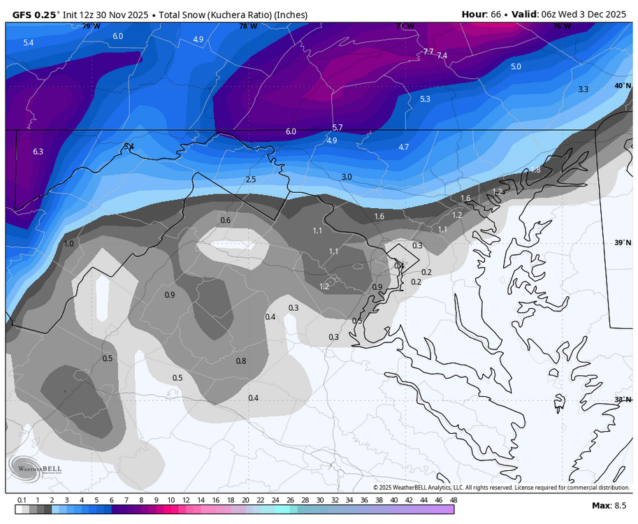
WB 12Z GFS basically the same, a tick warmer, but if you are looking for a 1-3 inch event you are still in the game.
-

Nov 28-30th Post Turkey Day Winter Storm
michsnowfreak replied to Chicago Storm's topic in Lakes/Ohio Valley
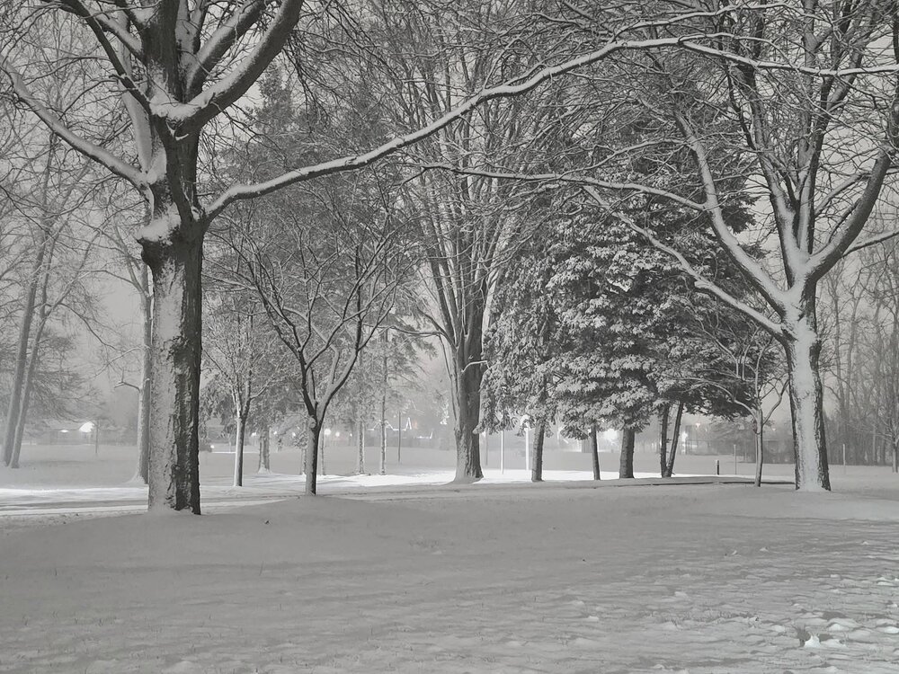
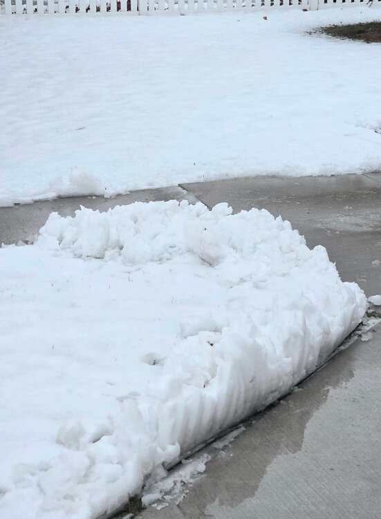
The storm was disappointing here due to marine air and bad ratios on the far east side. Although with a low track well west in late November its not a surprise. Northwest suburbs towards Ann Arbor had 4-6". Some areas of west and mid Michigan had 6-8". I had 3.1" but compacted to about 2" of wet cement. I finish November at 5.7". DTW had 3.6", finishing November at 5.9". It was certainly a spread the wealth for the western sub tho. Pic shows last night vs this morning. -

E PA/NJ/DE Winter 2025-26 Obs/Discussion
Birds~69 replied to LVblizzard's topic in Philadelphia Region
Rain. All the snow washed away... 36F -
GFS actually starts as SNOW in the metros. Not as good for northern crew tho
-
This probably is a snow event for NYC in January, even without a true high to the north but 12/2 is too early for that setup. The temps are cold enough but the DPs are not due to the airmass in place
-
First Winter Storm to kickoff 2025-26 Winter season
dryslot replied to Baroclinic Zone's topic in New England
Looks like the 12z GFS is a tic or so west of 06z with the precip field, Bit stronger down to 983mb too. -

Central PA Fall Discussions and Obs
Blizzard92 replied to ChescoWx's topic in Upstate New York/Pennsylvania
Thanks! I am back local again and hoping these signs (which are still looking good) for a wintry December pan out too. -
Meh. Not as good as the 6z for most folks. I will still take it though.
-
temp never really got below 34 here last night for any of the flurries to stick, then a changeover to rain stopped any hopes of accumulations. Still, really fun storm to track and I wasn't really expecting much down here anyways.
-
You know you can just have a bot make this post every day through March and save yourself the trouble.
-
(002).thumb.png.6e3d9d46bca5fe41aab7a74871dd8af8.png)
Central PA Fall Discussions and Obs
ChescoWx replied to ChescoWx's topic in Upstate New York/Pennsylvania
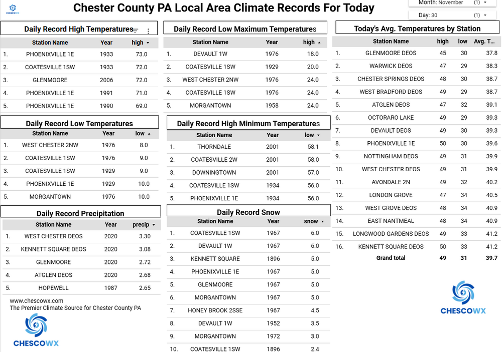
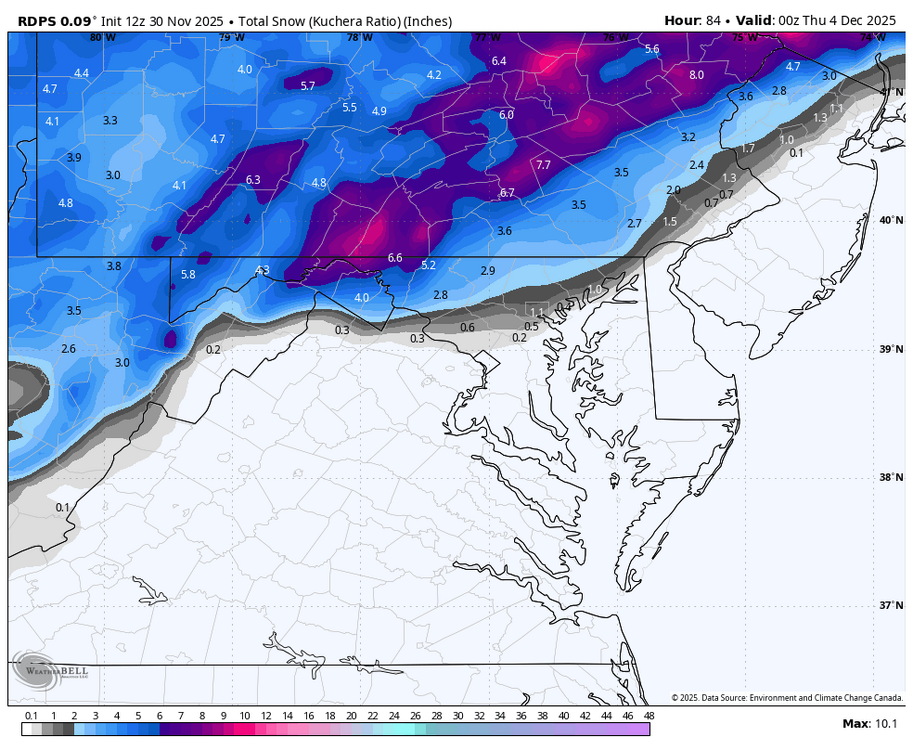
Following our 0.5” of snow this morning - some light rain will continue into early this afternoon. We clear up tonight and remain chilly with well below normal temperatures for the entire upcoming work week. Our next winter event looks to arrive as snow toward Tuesday morning before a slow transition from snow to rain from southeast to northwest across the area. Some models are showing a plowable event for NW Chesco and into Berks and Lehigh counties. But as we all know we do not shovel model snow. The current NWS early forecast has 2 to 4" possible for NW Chesco to about 1 inch down toward Chadds Ford in SE Chesco. Snow should turn to rain by late morning. We could see more snow arriving on Friday night, so an early season arrival of winter type weather is on the way. -
Interesting it shows an AK vortex but still ridging over the west coast. Probably because it is pos tilted. Orientation matters.
-
(002).thumb.png.6e3d9d46bca5fe41aab7a74871dd8af8.png)
E PA/NJ/DE Winter 2025-26 Obs/Discussion
ChescoWx replied to LVblizzard's topic in Philadelphia Region
Following our 0.5” of snow this morning - some light rain will continue into early this afternoon. We clear up tonight and remain chilly with well below normal temperatures for the entire upcoming work week. Our next winter event looks to arrive as snow toward Tuesday morning before a slow transition from snow to rain from southeast to northwest across the area. Some models are showing a plowable event for NW Chesco and into Berks and Lehigh counties. But as we all know we do not shovel model snow. The current NWS early forecast has 2 to 4" possible for NW Chesco to about 1 inch down toward Chadds Ford in SE Chesco. Snow should turn to rain by late morning. We could see more snow arriving on Friday night, so an early season arrival of winter type weather is on the way.




.thumb.jpg.ad3a2e31d30aff035044689b311a0540.jpg)
