All Activity
- Past hour
-

January 2026 regional war/obs/disco thread
40/70 Benchmark replied to Baroclinic Zone's topic in New England
Well, only if you went with a generic, ENSO-boiler plate forecast....really immaterial AFAIC because I did not....that said, the RONI and MEI are still down there, so that would give me pause before summarily declaring it dead. That said, the sensible weather moving forward probably won't hurt your argument if you want to claim that...but I would argue the inverse of what you say when we have ENSO congruent sensible weather by chance, which belies the fact that isn't actually coupled. -

January 2026 regional war/obs/disco thread
HoarfrostHubb replied to Baroclinic Zone's topic in New England
GFS, NAM, and HRRR (plus the Euro to a lesser extent) keeps tonight's weather all snow,ice , or freeing rain for my area... tomorrow morning's drive might suck. -
100%. The STJ has been virtually non existent so far. Definitely one (top) factor, the other being the very southward displaced Gulf Stream and very cold waters off shore along the northeast and mid-Atlantic coast from all the arctic cold and very strong NWerly wind events we’ve been seeing. In response, the baroclinic zone is way south and east along the anomalously displaced Gulf Stream
-
Canada really warms up end of the week due to the jet extension. Some anomalies there over 30 degrees above normal.
-

Central PA Winter 25/26 Discussion and Obs
Itstrainingtime replied to MAG5035's topic in Upstate New York/Pennsylvania
Huh. If I quoted you to my wife, I'd likely have no joy left in my life... -

2025-2026 ENSO
donsutherland1 replied to 40/70 Benchmark's topic in Weather Forecasting and Discussion
The Gulf Stream has an impact on storms/storm tracks. if the warmth is farther south, than all things being equal, storm tracks should be farther south. Another likely factor is how quiet the subtropical jet has been. That further reduces Miller A-type opportunities. -

January 2026 regional war/obs/disco thread
Typhoon Tip replied to Baroclinic Zone's topic in New England
Repetitive WWBs are pretty damming, nonetheless Also, recently the MJO desk has cited comments that the NINA atmosphere appeared to be contained just to the immediate region around the Equatorial band - which in a large spatial sense implies it is largely decoupled from the hemisphere. SO, WWBs ... decoupled states ? I dunno. Sounds a little like it's dead before it hits the floor. Suppose that is true ... all it really means is that ENSO is less useful from here on out.. because "decoupled" is what happens when you ain't geddin any -
most people i meet at parties hate winter
-
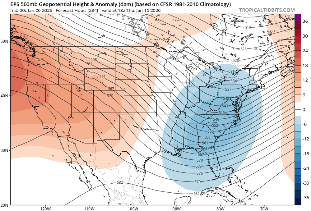
@40/70 Benchmark @Bluewave @DonSutherland1 I’m wondering if this accounts for part of the lack of KU events? It’s been occurring since 2022. Look at how far off shore and south it forces the baroclinic zone
-

January 2026 regional war/obs/disco thread
moneypitmike replied to Baroclinic Zone's topic in New England
For me, it's all about having seasons. Outside of a non-existent spring, the Midcoast region gets it done. True winter, typical fall, and tempered summer. Mattapoisett wins for the summer, but the spring is still crappy and winter is more of an idea than an actual thing. -
Euro is struggling to find anything in the STJ and is shearing out everything coming from the NW. very Nina look. Very dry. We will continue to see the dry looks unless we find a way to eject some energy east from the Baja lows that keep showing up. What has/continues to worry me is the complete and utter failure of the southern stream and wave breaking even if we get a decent PNA ridge. One would think some energy would slide under it as the NS is constricted but we keep seeing cutoff Baja lows that never move east
-
January 2026 regional war/obs/disco thread
40/70 Benchmark replied to Baroclinic Zone's topic in New England
He has some bizarre preoccupation with ENSO events ending early....always hammers that every year and it never happens. -

January 2026 regional war/obs/disco thread
mahk_webstah replied to Baroclinic Zone's topic in New England
DT is honking -
Happy Anniversary! Yes on feb 2010, but I was just going back to 2012.
-
1996: THE BLIZZARD OF JANUARY 7-8, 1996 The storm began on Saturday the 6th and continued at an amazingly steady rate until mid-afternoon Sunday, January 7th. By that time, 13 to 17 inches of snow had accumulated in most areas with up to 20 inches in the distant western suburbs. The snow bands were accompanied by lightning, thunder and whiteout conditions at times. Monday morning January 8th, the snow squalls had tapered off leaving the Washington metro area buried in 15 to 25 inches of snow. The blizzard of 1996 was just the first of 3 snowstorms to hit the Washington area during the snowy week of January 7-12. On the 9th an Alberta clipper storm center passed directly over the region, dropping another quick shot of surprising heavy snowfall in the area. The western suburbs were dusted with only an inch of snow while up to 6 inches of snow fell in eastern areas such as Prince George's and Charles Counties. January 10th was a nice sunny day with high temperatures reaching a rather balmy 34 degrees at National Airport. The third and final snow took place on the 12th as a quick moving coastal storm dropping 5 to 12 inches of snow across the region. This storm was incredibly massive and truly historic in its scope as many all-time snow records were broken over a large area. Records included 24.9 inches in Roanoke, Virginia; 30.7 inches in Philadelphia, Pennsylvania; 27.8 inches Newark, New Jersey; and 14.4 inches as far away as Cincinnati, Ohio. The snowfall at National Airport measured 17.1 inches while the snowfall at Dulles accumulated to 24.6 inches. Other snowfall totals included 21 inches in Fredericksburg, Virginia; 22.5 inches in Baltimore, Maryland; and 25.7 inches in Rockville, Maryland. Generally snowfall amounts between Washington and Boston were between 17 to 30 inches. (p. 96-101 Washington Weather Book 2002 by Ambrose, Henry, Weiss)
-
January 2026 regional war/obs/disco thread
40/70 Benchmark replied to Baroclinic Zone's topic in New England
I'll sell any big coastal mid-month. -
Records: Highs: EWR: 72 (2007) NYC: 72 (2007) LGA: 72 (2007) JFKK : 71 (2007) Lows: EWR: 6 (2018) NYC: -2 (1896) LGA: 8 (2018) JFK: 7 (2018) Historical: 1821: A major snowstorm finally came to a end across the Mid-Atlantic States into southern New England. 18 inches of snow fell at Philadelphia, PA, 14 inches at New York City, NY and 12 inches at Washington, DC. (Ref. AccWeather Weather History) 1856: Thoreau’s 'long and snowy winter' continued with the season’s deepest snowfall. 18 inches fell at Providence, RI and 12 inches of snow fell at Boston, MA. (Ref. AccWeather Weather History) 1880 - Seattle, WA, was in the midst of their worst snowstorm of record. Hundreds of barns were destroyed, and transportation was brought to a standstill, as the storm left the city buried under four feet of snow. (David Ludlum) 1884 - The temperature dipped to one degree below zero at Atlanta, GA. It marked the final day of a severe arctic outbreak in the South and Midwest. (David Ludlum) 1886: The "Great Blizzard of 1886" struck the Midwest with high winds, subzero temperatures, and heavy snowfall. These conditions caused as many as 100 deaths, and 80% of the cattle in Kansas perished. 1918: A major snowstorm hit parts of the Midwest. Officially Chicago, IL recorded 14.4 inches of snow with 1.44 inches of liquid equivalent. This established a new daily precipitation record. This contributed to January 1918 as having the greatest monthly snowfall with a total of 42.5 inches, nearly four times their monthly average. This storm gave Rockford, IL one of their largest snow amounts ever recorded. A record 16.3 inches blanketed the town, their greatest single storm total. This contributed to their snowiest January on record with 36.1 inches just 0.2 inches shy of an entire normal winter season. (Ref. Wilson Wx. History) 1942: Not a good pothole day in Pipestone, MN. Temperature rose from 32 °F below zero to 41 °F above a 73 °F temperature rise in 24 hours. (Ref. AccWeather Weather History) 1950: The maximum temperature for the date in Washington, DC is 72°F. (Ref. Washington Weather Records - KDCA) 1968: International Falls, Minnesota: The all-time record low is set in International Falls. Temperatures on this day drop to a bone-chilling minus 46° F. (Ref. Wx. Doctor) 1983: All 50 states had at least one location that was below freezing on this date, an unusual occurrence.(Ref. Wilson Wx. History) (Bob Ryan's 2000 Almanac) (Ref. AccWeather Weather History) 1987 - A storm moving across the western U.S. spread heavy snow into the Central Rockies. Casper WY received 14 inches of snow in 24 hours, a January record for that location. Big Piney WY reported 17 inches of snow. (National Weather Summary) (Storm Data) 1988 - It was a bad day for chickens. Heavy snow in Arkansas, with totals ranging up to 16 inches at Heber Springs, claimed the lives of 3.5 million chickens, and snow and ice up to three inches thick claimed the lives of another 1.75 million chickens in north central Texas. Up to 18 inches of snow blanketed Oklahoma, with Oklahoma City reporting a record 12 inches of snow in 24 hours. (National Weather Summary) (Storm Data) 1989 - A "bonafide blizzard" ripped through south central and southeastern Idaho. Strong winds, gusting to 60 mph at the Fort Hall Indian Reservation, whipped the snow into drifts five feet high, and produced wind chill readings as cold as 35 degrees below zero. The blizzard prompted an Idaho Falls air controller to remark that "the snow is blowing so hard you can't see the fog".(National Weather Summary) (Storm Data) 1990 - Rain and gale force winds prevailed along the Northern Pacific Coast. Winds at Astoria OR gusted to 65 mph. Unseasonably warm weather prevailed over Florida. Five cities reported record high temperatures for the date, including Miami with a reading of 86 degrees. The hot spot in the nation was West Palm Beach with a high of 87 degrees. (National Weather Summary) 1992: The sun peeks out in Milwaukee, WI, for the first time since December 21, 1991, setting a city record for consecutive cloudy days. (Ref. AccWeather Weather History) 1993: A nearly continuous 5-day snowstorm brought a record 23.3 inches of snow to Salt Lake City, UT, and left a record 26 inches of snow on the ground. A state of emergency was declared. (Ref. AccWeather Weather History) 1994: 55.5 inches of snow fell in twenty-four hours at Alta UT, setting a new record for the location. A total of seventy inches fell between the 4th and the 6th. (Ref. AccWeather Weather History) 1996: A severe nor'easter paralyzed the East Coast from January 6 to the 8. In Washington D.C., this storm is also known as the "Great Furlough Storm" because it occurred during the 1996 federal government shutdown. Snowfall amounts from this event include 47 inches in Big Meadows, Virginia; 30.7" in Philadelphia; 27.8" in Newark; 24.6" at the Dulles International Airport; 24.2" in Trenton; 24" in Providence; 22.5" in Baltimore; 18.2" in Boston; 17.1" in D.C.; and 9.6" in Pittsburgh.
-
-
Let's see if the Euro's rain predictions at this range are as overblown as it's snow predictions at this range. My guess is Yes!
-
2025-2026 ENSO
40/70 Benchmark replied to 40/70 Benchmark's topic in Weather Forecasting and Discussion
Not happening DJF in the east this season. Take that to the bank. Only shot if March if the SSW didn't materialize for some reason, but it should. -
Wow they over 100 inches over there.
-
One minute its SER, the next its cross polar flow and snowfall again for the oil rigs in the Gulf. Hoping we find some balance here soon (we won’t).
-
Lots of players on the field in the long range. I like (Borat voice).
-
We’ve had what…. 1 fantasy run all season? When you can’t even buy snow on the long-range models in peak climo… remember when we were “setting the stage” with the Virginia snow in early Dec?
-
31 / 28 cloudy. Warmup commenced today with areas into the upper 30s - low 40s. 50s for many Wed - Thu and Fri ahead of a general 1 inch (ish) rainfaill Saturday. Beyond there near normal 1/12 - 1/16. Likely a back and forth below - near - above normal - tilted below beyond there 1/17 - beyond.


