All Activity
- Past hour
-
BOS won't do it. Early high after midnight lol. 48 at that time here too.
-
Good day to install...beat the heat.
-
Further east models usually verify in these coastal storm setups. This would be a Boston 24” storm and most of us 10-12”.
-
Record low maxes for today… ORH 46 BOS 47 PVD 48 PWM 48 BDL 49 BTV 49 CON 51 All except BTV occurred in 1909.
-
Yeah the couple of sunny days were pretty good. If the new growth doesn't drown, on the next 75° day you'll probably be able to see stuff growing!
-
They need to fix that 5/20 high for JFK. It is most definitely wrong
-
It's f00king raining cats and dogs.

-
Remember when one person in NE CT bought the GFS stein solution a week ago? Yeah...I do too.
-
The storm track through the Great Lakes again greatly reduced the snowfall potential around the NYC Metro and other coastal regions. This is a great storm track for areas away from the coast as was the case with the record snows from Toronto to Montreal. The cold focusing closer to the center of the North American continent has been a repeating theme since the big step up in global temperatures in 2015-2016. My guess is that the shrinking cold pool has been limiting the geographic coverage of these Arctic outbreaks. We haven’t had a top 10 coldest month in the Northeast since February 2015.
-
Have to dress like its winter today...not going to be fun sitting outside in the rain and cold.
-
Probably a top 5 episode
-
EWR: 5/19: 73 / 52 (-1) 5/20: 71/50 (-3) 5/21: 59 / 50 (-10) NYC: 5/19: 69 /51 (-4) 5/20: 67 / 49 (-6) 5/21: 59 / 49 (-11) LGA: 5/19: 70 / 52 (-4) 5/20: 68 / 50 (-6) 5/21: 59 / 49 (-11) JFK: 5/19: 74 / 53 (+3) 5/20: 76 / 50 (+1) 5/21: 58 / 50 (-8)
-
Man what a violent track that would be on HRRR.
-
Haha. The fact that some models were east would be a warning flag but would people heed it?
-
Records: Highs: EWR: 98 (1992) NYC: 96 (1941) LGA: 94 (1992) JFK: 94 (2021) Lows: EWR: 44 (2002) NYC: 42 (1907) LGA: 47 (1950) JFK: 43 (1990) Historical: 1876 - Denver CO was drenched with 6.53 inches of rain in 24 hours, an all-time record for that location. (The Weather Channel) 1911 - The temperature at Lewiston ME soared to 101 degrees. It was the hottest temperature ever recorded in New England during the month of May. (David Ludlum) 1987 - A powerful tornado virtually wiped the small southwest Texas community of Saragosa off the map. The twister destroyed eighty- five percent of the structures in the town killing thirty persons and injuring 121 others in the town of population 183. The tornado hurled trucks and autos through adobe and wood- frame homes, with some vehicles blown 500 feet. (The National Weather Summary) (Storm Data) 1988 - Thunderstorms produced severe weather over the Central Gulf Coast States. Tennis ball size hail was reported at Ripley MS. Showers and thunderstorms in southern Missouri produced 3.20 inches of rain at Springfield to easily surpass their rainfall record for the date. (The National Weather Summary) (Storm Data) 1989 - Unseasonably hot weather continued in southern Texas and parts of the southwestern U.S. Seven cities reported record high temperatures for the date, including El Paso TX with a reading of 100 degrees. Presidio TX was the hot spot in the nation with a high of 111 degrees. (The National Weather Summary) 1990 - Late afternoon and evening thunderstorms developing ahead of a cold front in the north central U.S. produced severe weather from northwestern Kansas to central Minnesota and southeastern North Dakota. There were twenty-nine reports of damaging winds, or dime to golf ball size hail. Strong thunderstorm winds gusted to 69 mph at Alexandria, MN. Showers and thunderstorms over eastern North Carolina soaked Wilmington with 2.91 inches of rain, which established a record for the date. (The National Weather Summary) (Storm Data) 2011: The Joplin Tornado was reported to have developed directly over Joplin with the first report of the tornado in Joplin at 5:41 pm CDT, 5/22. Latest reports from mid-day Tuesday 5/24 indicate an estimated 118 fatalities and several hundred injured in the Joplin, MO area. The Joplin tornado is the deadliest since modern record keeping began in 1950 and is ranked 8th among the deadliest tornadoes in U.S. history. The tornado surpassed the June 8, 1953, tornado that claimed 116 lives in Flint, Mich., as the deadliest single tornado to strike the U.S. since modern tornado record keeping began in 1950. The deadliest tornado on record in the U.S. was on March 18, 1925.
-
If this was winter…. Oh boy the wolves would be howling.
-
The 6 to 10 day period looks wet and below normal. No real heat on the horizon. Coolest air / above normal precip matches our area from some of the seasonal model runs.
.thumb.png.19040caf56be5ab6f745aa35d3e9d9ef.png)
-
We chase already fallen snow tomorrow morning
-
Up to .7” for the event. Most all of that fell last night.
-
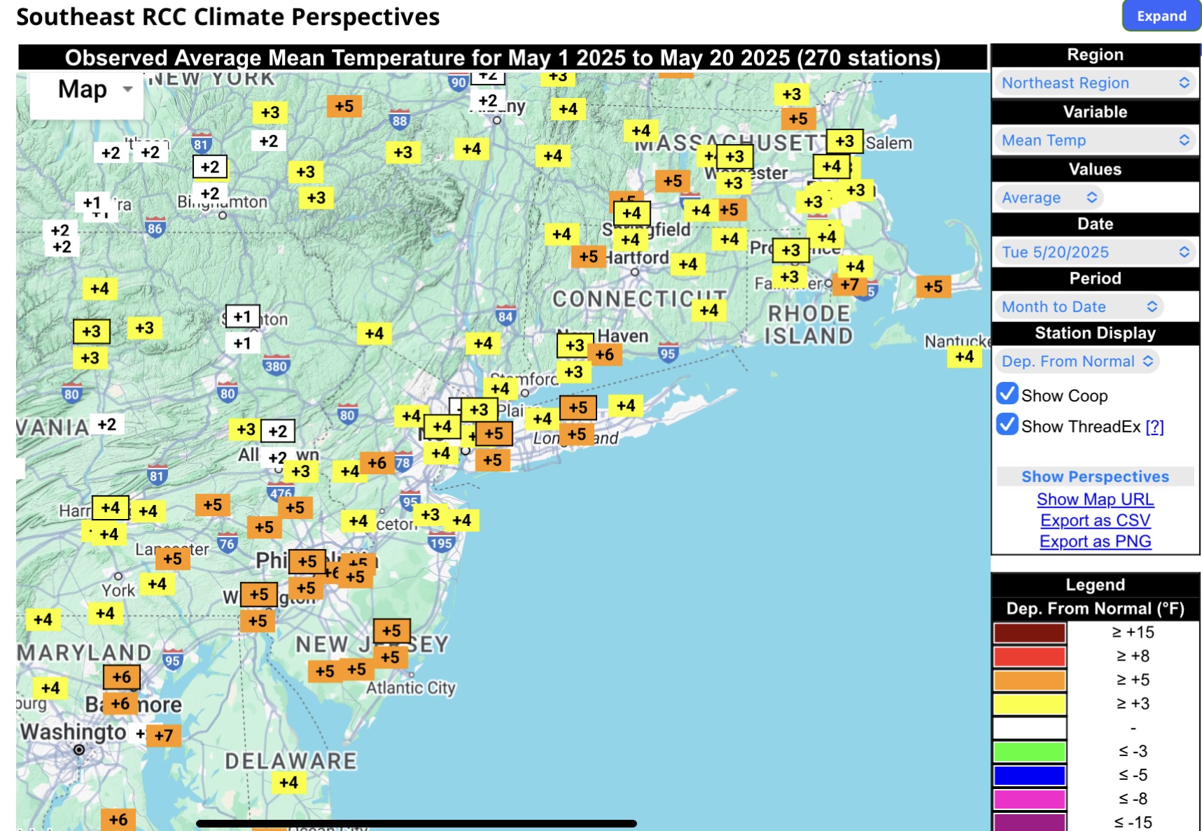
These +5 departures will get significantly smaller with this very cool pattern to close out the month.

-
Beyond the surf zone the Western Atlantic is warming up fast, and compared to last year at this time the Western Atlantic, Carribean and the Gulf are all much warmer. This raises the odds of closer to home tropical development and it could start as soon as in a few weeks. Temperature 60°F surf zone 59ºF air temp 3/2mm wetsuit
-
We're hosting an event on Sunday afternoon June 1st that we hope can be outdoors in our backyard (but is small enough to move inside our house if the weather is bad, but outdoors would be nicer). Euro and Euro-AI show the period from Saturday night through Monday morning being dry, while the GFS shows it mostly dry with just a few spritzes possible on Sunday - I know it's a long way out, but it's at least nice to have the models largely on our side at this point. I rarely ever look at the weather beyond 7-8 days, outside of general patterns (CPC 8-14 day forecast shows generally normal temps and precip for the period around 6/1), since specific forecasts are usually pretty inaccurate that far out, but I'm following this one on a couple of the long range "forecasts" just out of curiosity. Was interesting to see both the AccuWeather and MyWeather forecasts were showing some rain on Sunday for the last several days, until yesterday, when both switched to mostly sunny/dry forecasts with seasonable temps (highs near 80F) - and today they still show that. I've tracked a few other events this far out and the forecasts and models flip-flopped a ton from 10-15 days out, but sometimes they'll show consistent solutions, especially from about 10-11 days in. Hoping this is one of those cases. Comments welcome.
-
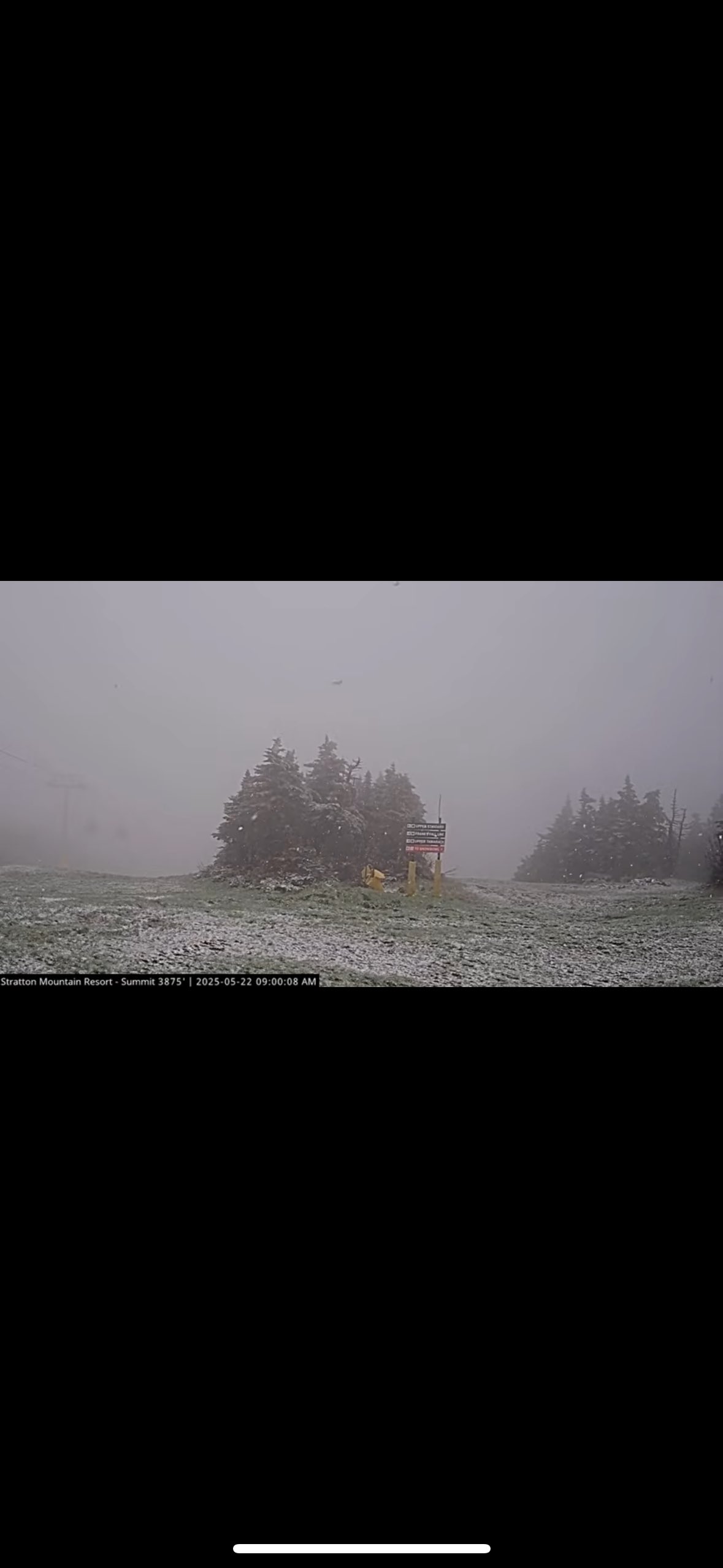
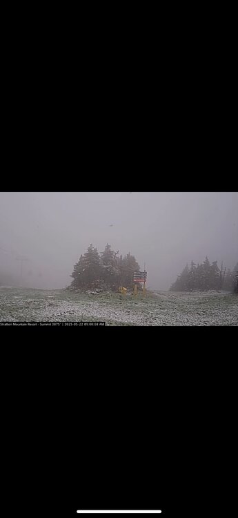
Stratton
-
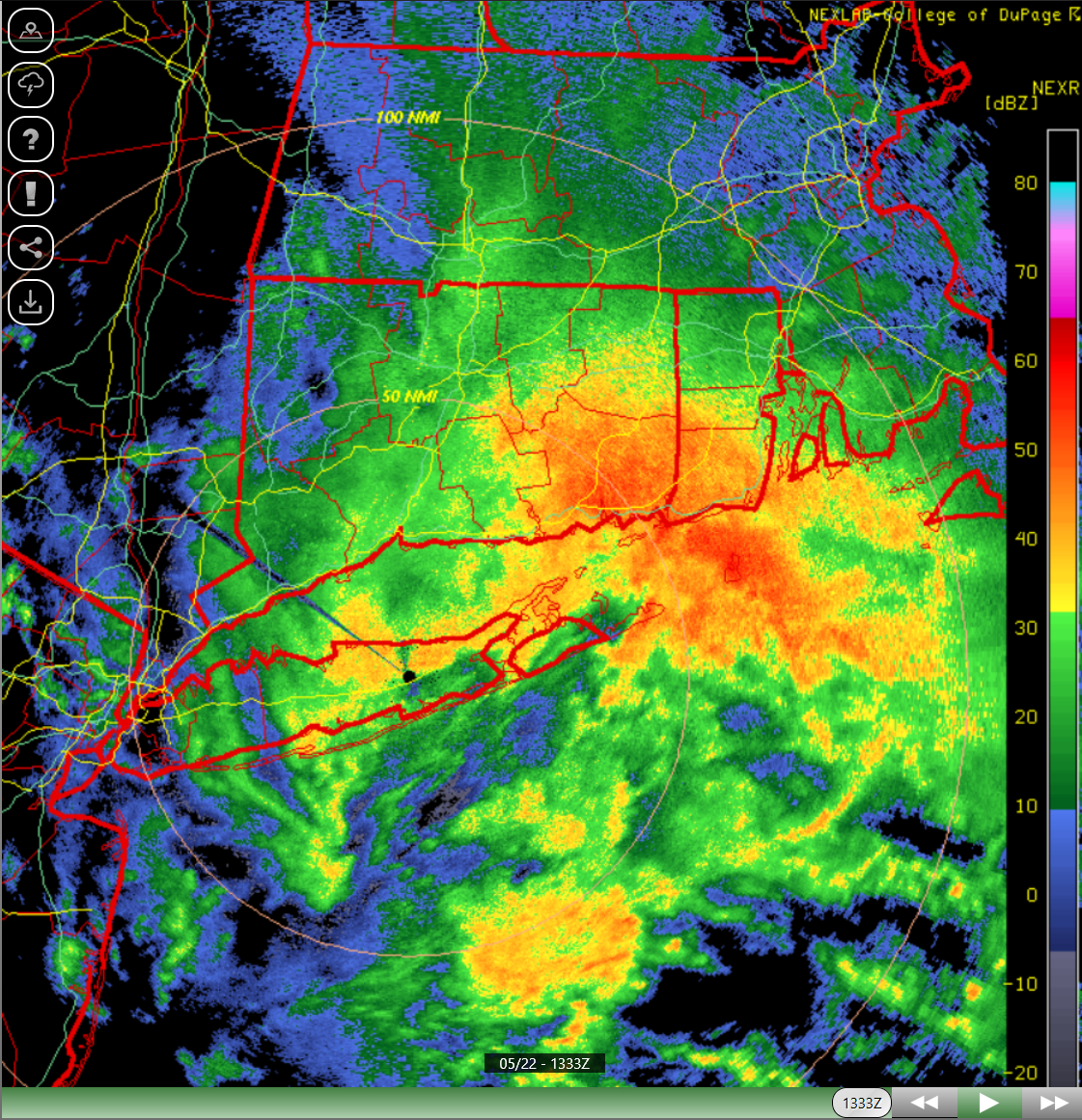
.70 here, more to my far SW in @CAPE 's hood, and its not over yet. More showers and even a thunderstorm is possible this afternoon.
-

2025 Atlantic Hurricane Season
BarryStantonGBP replied to BarryStantonGBP's topic in Tropical Headquarters
At least they're being more reasonable than TSR Have you seen the UKMO forecast?


.png.10e66653e46cf5fd83f95f324d3908c9.png)