All Activity
- Past hour
-
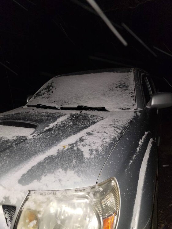
 Can’t wait to go all of January and February without a trough like this
 -
See how this impacts operations. https://www.facebook.com/SnowologyWx/posts/there-was-an-explosion-at-the-sunday-river-pump-house-on-barker-this-morning-pub/1453010636829121/
-
 55F and moist.
 -
Starting to think we’re cursed in McDowell. I didn’t even get a real chill last night, hovered around 39-40 for my low.
-

11/8-11/10 First Snow and Lake Effect Event
sbnwx85 replied to Geoboy645's topic in Lakes/Ohio Valley
We currently have 9.5” on the ground. 9” came from the lake effect yesterday. Could get another 6” this afternoon into tonight. -
.40" overnight brings me to .75" since Friday.
-
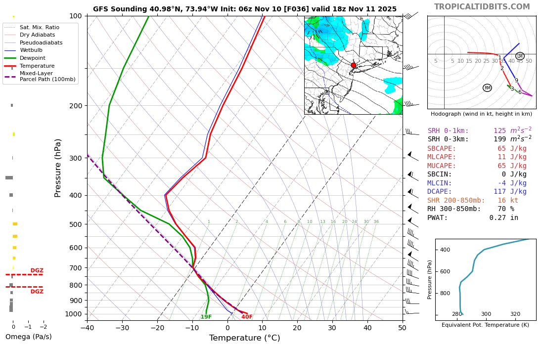
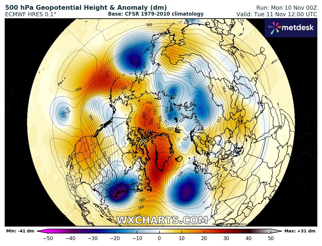
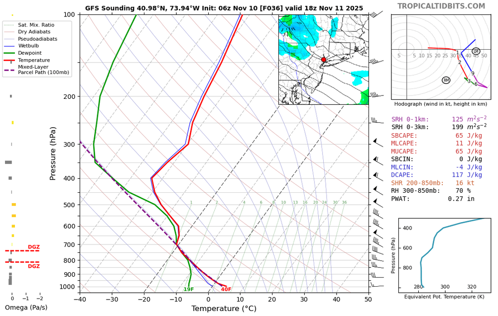
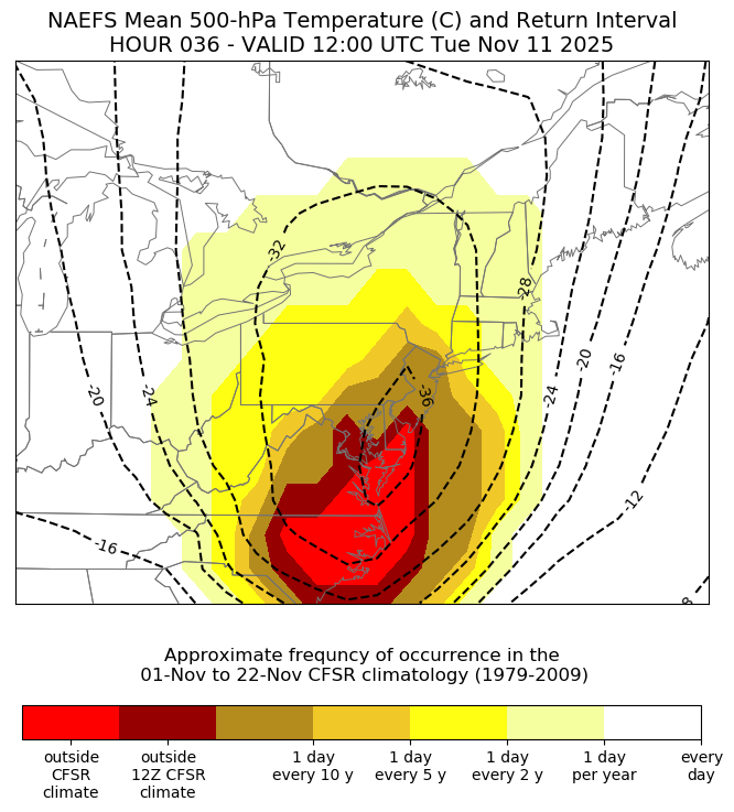
Models have a -4 sigma upper low crossing the area tomorrow with record low 500 mb temperatures just to our south. There could even be a few wet snowflakes in mix getting close to the coast. Unusually deep mixing to 700mb gives the potential for momentum transfer of higher winds to surface. So don’t be surprised if we see some 40-50 mph gusts. NYC will probably get very close to its first freeze of the season around 32-33°.

-

Fall 2025 WX Discussion Thread
Holston_River_Rambler replied to Carvers Gap's topic in Tennessee Valley
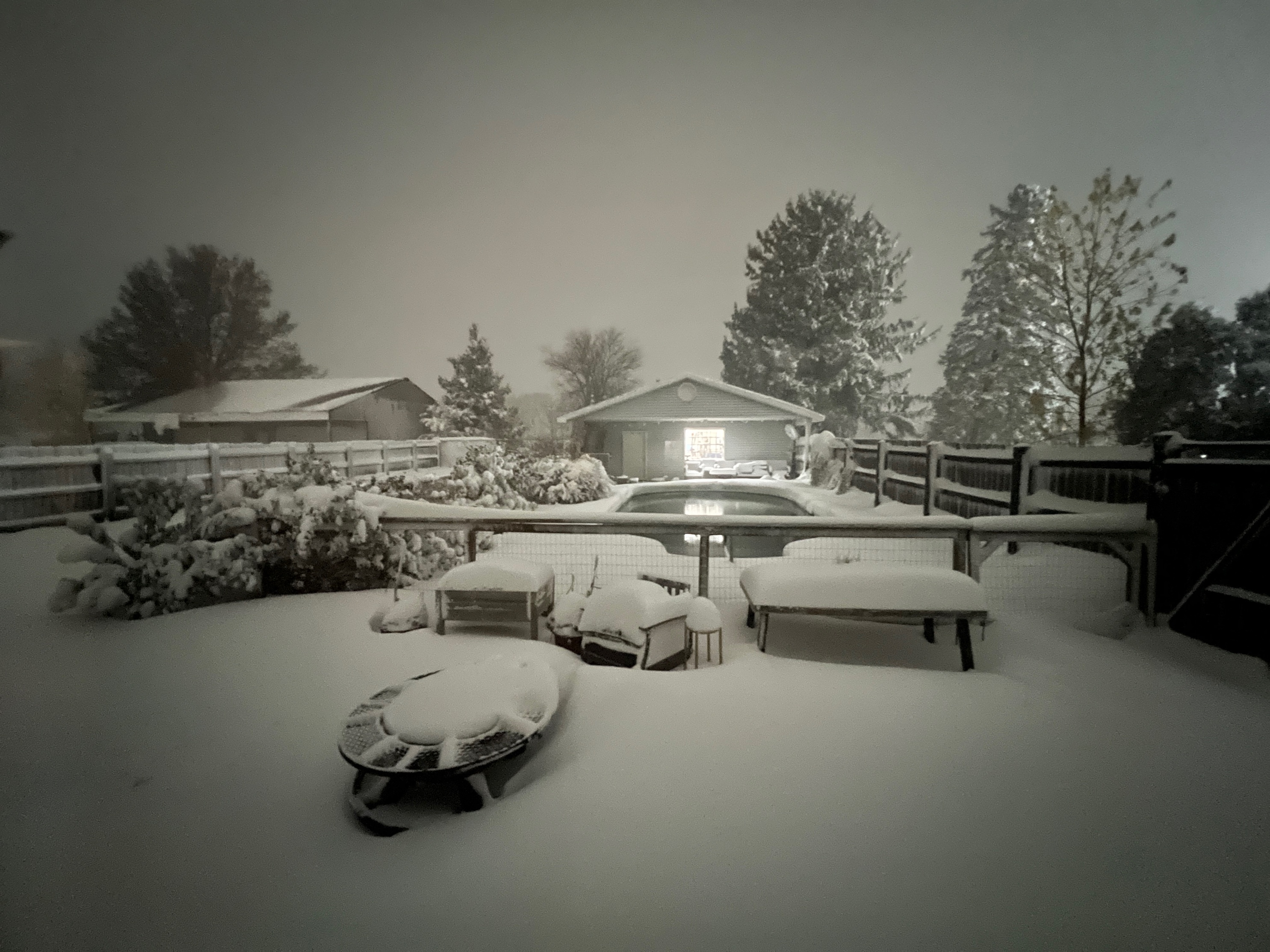
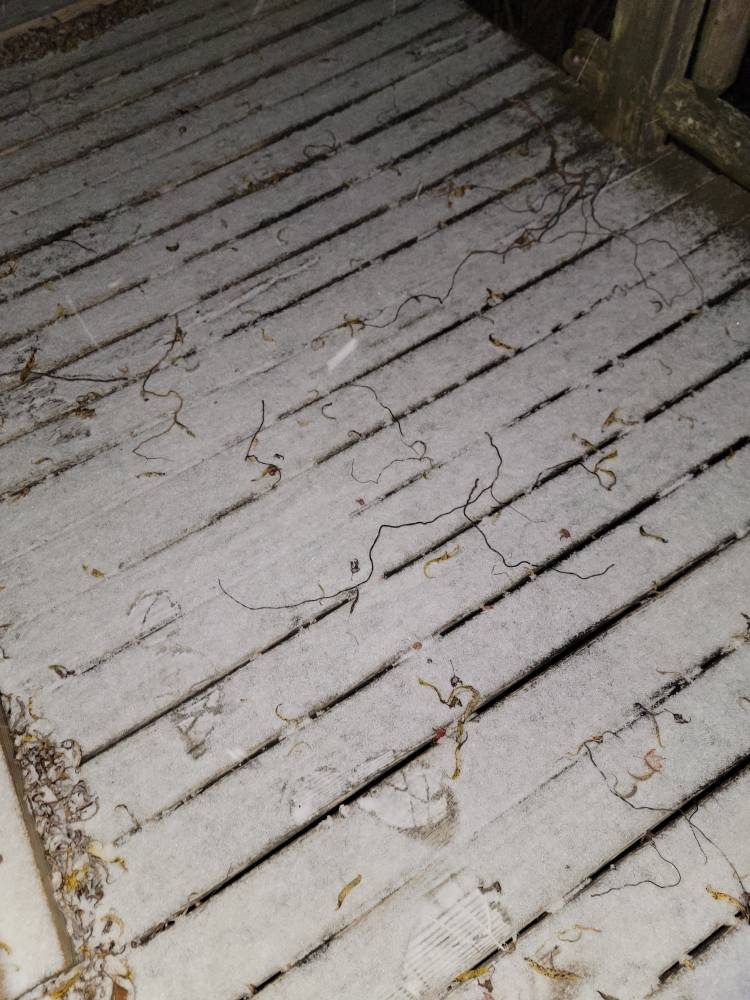
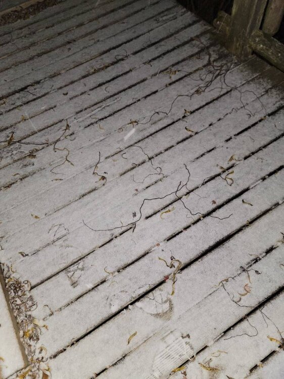
I have something between a heavy frost and a crustellation of snow. Man the shortwave looks strong: Hopefully someone gets a nice surprise in the valley. -
https://x.com/webberweather/status/1987600888471634277
-

E PA/NJ/DE Autumn 2025 Obs/Discussion
pl0k00n111 replied to PhiEaglesfan712's topic in Philadelphia Region
Loud storm. Kept me up. Tired this morning. Odd to see thunder storms in November. -

2025-2026 Fall/Winter Mountain Thread
Maggie Valley Steve replied to Buckethead's topic in Southeastern States
Light snow and a dusting with 27 at the house. GSP says the potent vort max will bring heavier snow this afternoon and evening than previously expected. -

11/8-11/10 First Snow and Lake Effect Event
Chicago WX replied to Geoboy645's topic in Lakes/Ohio Valley
Jackpot. Congrats. Snowing hard here right now with this last gasp. -

11/8-11/10 First Snow and Lake Effect Event
KeenerWx replied to Geoboy645's topic in Lakes/Ohio Valley
100%. Especially as you are outside of the typical zone to cash in on lake snow. This was pretty much the perfect scenario and outcome for your area. Absolutely incredible. -

11/8-11/10 First Snow and Lake Effect Event
King James replied to Geoboy645's topic in Lakes/Ohio Valley
I win? -
11/8-11/10 First Snow and Lake Effect Event
Chicago WX replied to Geoboy645's topic in Lakes/Ohio Valley
Totally different set up, but the results kinda reminds me of this one, Feb 24, 2016. RC has fond memories. https://www.weather.gov/lot/2016feb24_snow -
11/8-11/10 First Snow and Lake Effect Event
King James replied to Geoboy645's topic in Lakes/Ohio Valley
Momence IL .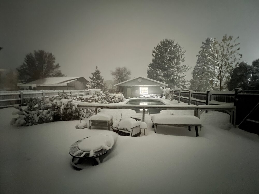
-
11/8-11/10 First Snow and Lake Effect Event
KeenerWx replied to Geoboy645's topic in Lakes/Ohio Valley
Yeah. Lowell in Lake County (IN) has reported 10” and the best returns seemed to have been slotted west of them towards the Momence area. Wild event nonetheless. Even with the localized totals, quite a spread the wealth scenario across the southern Lake Michigan region. Now up to 5” overnight with event total at 7.1”. Seem to be about finished at this point. We’ll see what else the lake will provide as the primary moves back east over the next few hours. -
Temp down to 23 and snow still coming down. Sent from my SM-G998U using Tapatalk
-
11/8-11/10 First Snow and Lake Effect Event
King James replied to Geoboy645's topic in Lakes/Ohio Valley
Yeah we got smoked lol -
Ouch.
-
11/8-11/10 First Snow and Lake Effect Event
Chicago WX replied to Geoboy645's topic in Lakes/Ohio Valley
Measured 3.5" at 4:00 am. Still snowing, but fairly light. Just to put the put the Momence total in context, they're 13 miles to the east of IKK. Will be some varying storm totals from west to east in the county, to say the least. - Today
-
In other news, the -IOD definitely peaked last week as expected by BOM (almost -2) and is starting to bump up again….ended up being strongest negative event since the fall of 1996. And it seems we have westward moving ER waves from the La Niña interfering with the MJO’s eastward propagation
-

November 2025 general discussions and probable topic derailings ...
Modfan2 replied to Typhoon Tip's topic in New England
54F and balmy this am, that will not be the case tomorrow at this time. A week of colder temps then back to seasonal like temps next week. -
11/8-11/10 First Snow and Lake Effect Event
KeenerWx replied to Geoboy645's topic in Lakes/Ohio Valley
What have you grabbed so far? -
11/8-11/10 First Snow and Lake Effect Event
Chicago WX replied to Geoboy645's topic in Lakes/Ohio Valley
Wow, awesome. This one just missed MBY. I mean I'll take what I got, but a foot...