All Activity
- Past hour
-
Nice summer afternoon, one of the few remaining. :(
-
No summer here. Dews dippin into the 30s.
-
Dry. Warm. Dry. Sunny. Dry. Colors continue to pick up steam despite the warmer weather. Did I mention dry?

-
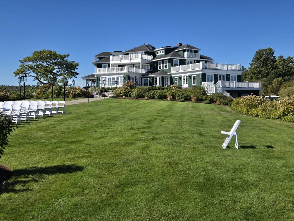
Cool wedding venue around corner from friends place Sent from my SM-S921U using Tapatalk
-
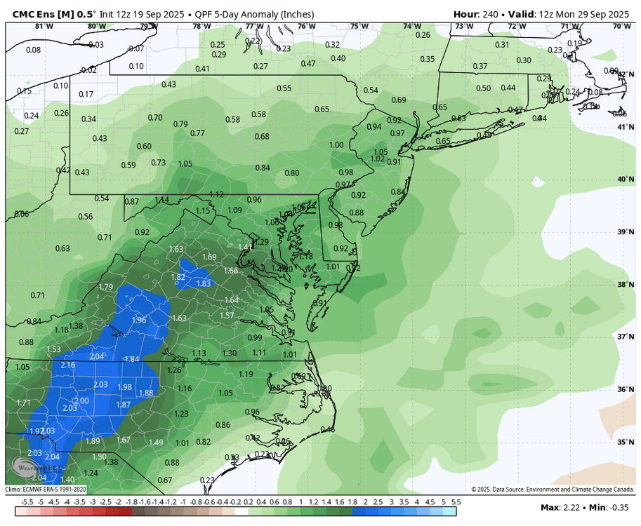
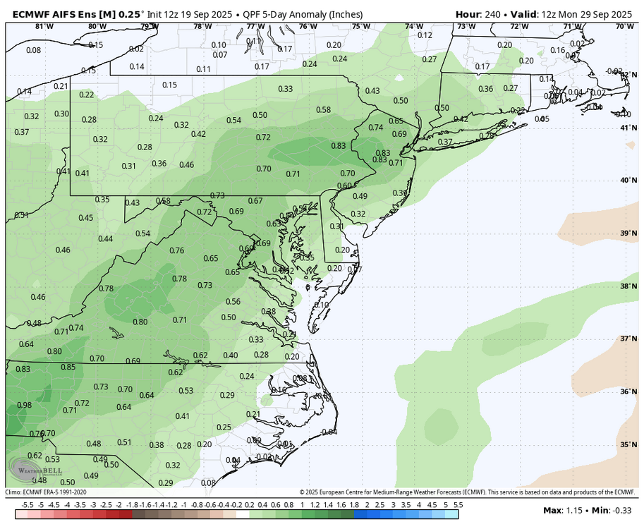
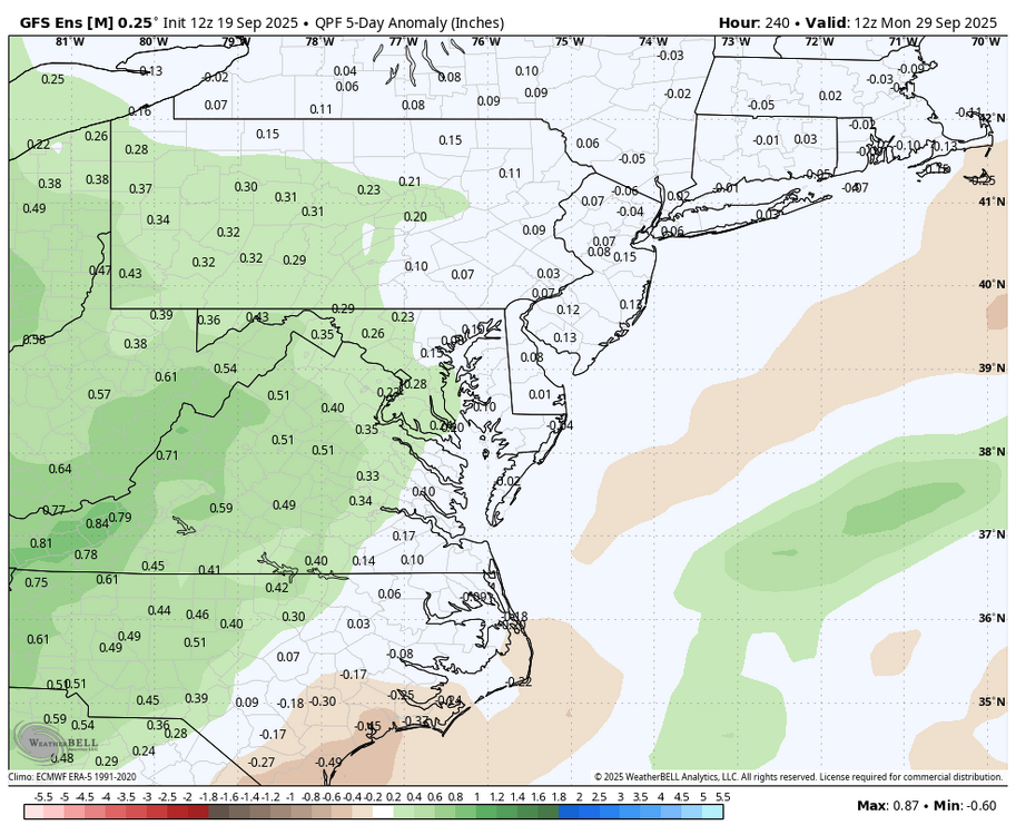
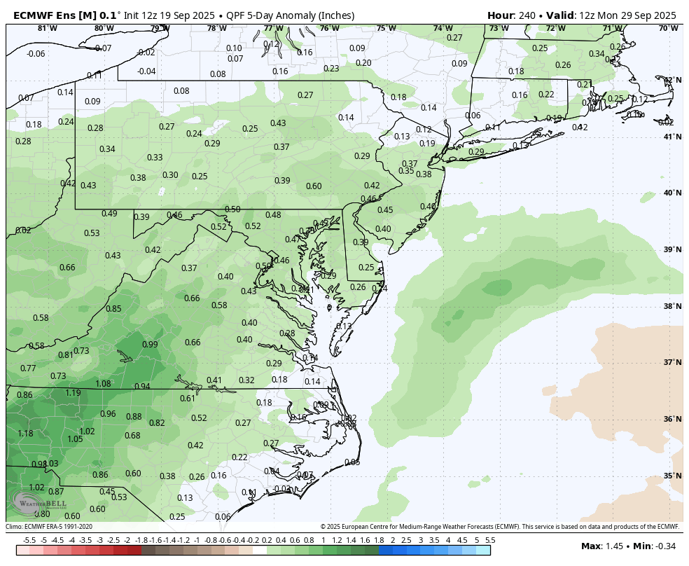
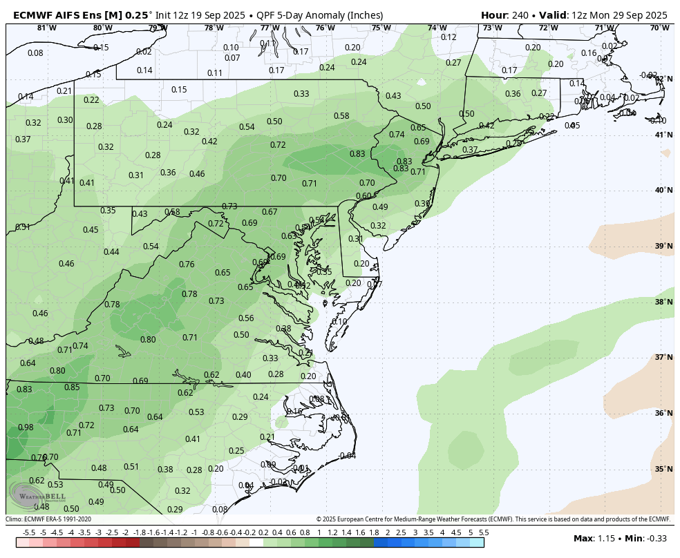
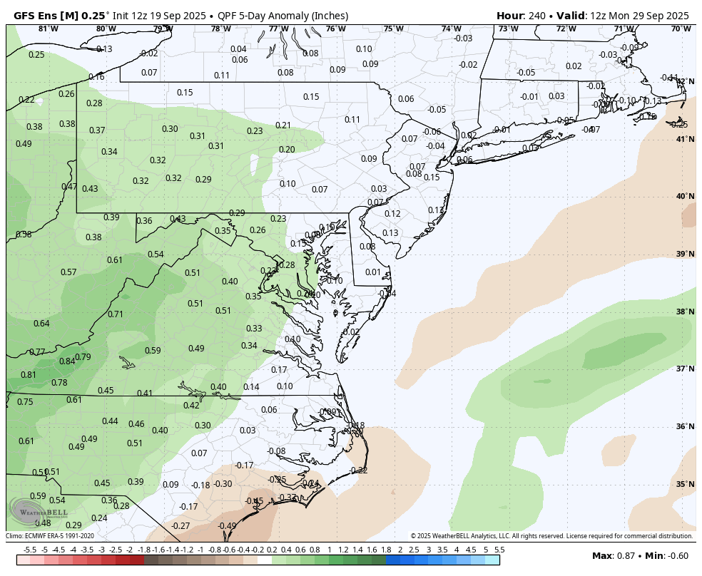
WB 12Z ensembles: 5 day period ending next Sunday is looking promising for more rain.

-
Nice summer like day here in New Haven as well in the mid 80's with some nice dews.
.thumb.png.c8f63acfce3117bc59f387f005770b8c.png)
-
Cookout at Mark Margavage’s?
-
Deep summer in PA where I am. Mid 80s and low 60s dews
-

September 2025 OBS-Discussion centered NYC subforum
donsutherland1 replied to wdrag's topic in New York City Metro
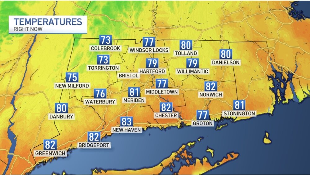
Westhampton has reached 83°. That ties the daily record for September 19th that was set in 1967 and tied in 1983. Records go back to 1951. -

September 2025 OBS-Discussion centered NYC subforum
the_other_guy replied to wdrag's topic in New York City Metro
We really dont. The weather is lovely. The reservoirs are fine. There’s no wildfires raging. Lets stop creating a crisis where there is none. Its been a little dry. and after several years of ridiculously wet weather in the area, it’s just nature balancing itself out. -
Temp up to 87 at both home and at MU. Warmest day in some time.
-
Wonder if I’ll even break 50
-

September 2025 OBS-Discussion centered NYC subforum
LibertyBell replied to wdrag's topic in New York City Metro
it's fine even here with a temperature of 84 and a dew point of 60 some people just like cold weather =\ -

September 2025 OBS-Discussion centered NYC subforum
winterwx21 replied to wdrag's topic in New York City Metro
Euro really brings in the humidity and rain chances for mid to late next week. I hope that will be correct since we really need the rain. -
September 2025 OBS-Discussion centered NYC subforum
LibertyBell replied to wdrag's topic in New York City Metro
very similar, and 100 degree days was 3 vs 2 -
September 2025 OBS-Discussion centered NYC subforum
donsutherland1 replied to wdrag's topic in New York City Metro
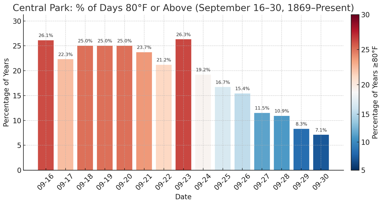
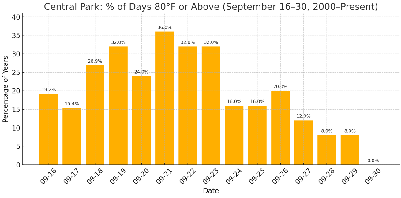
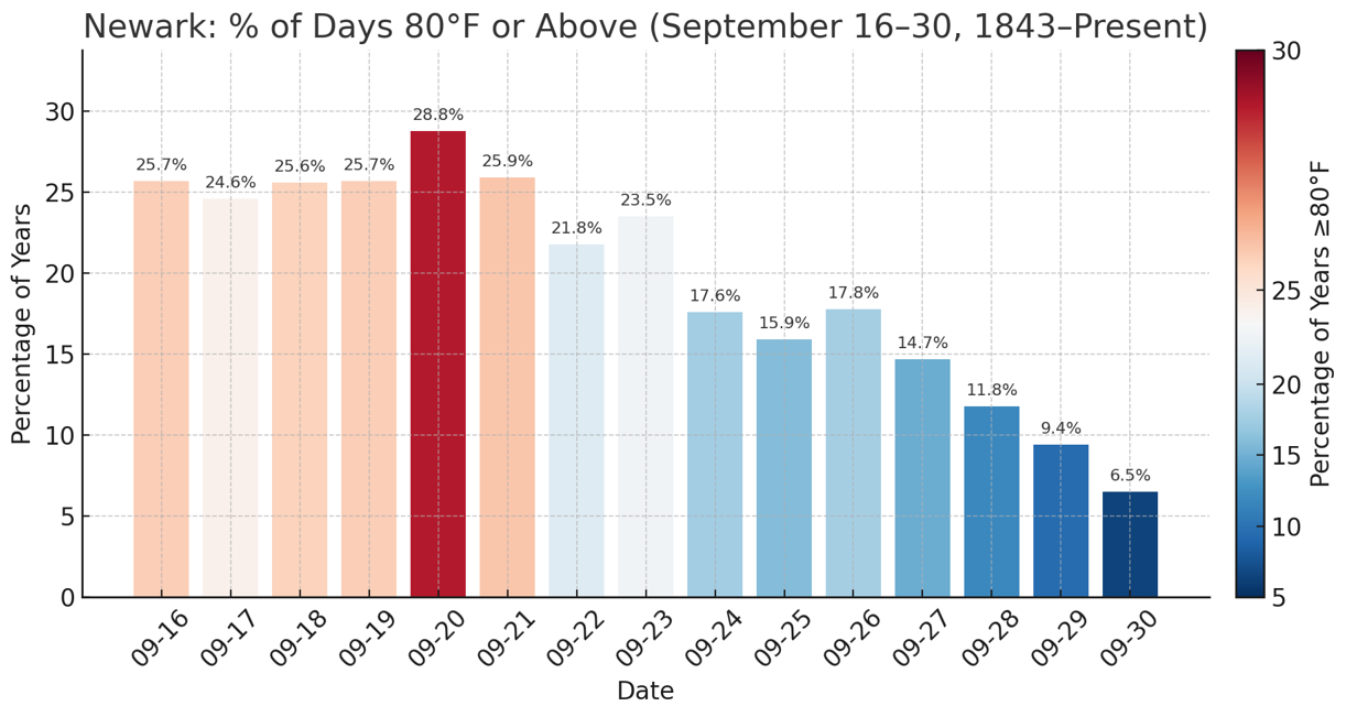
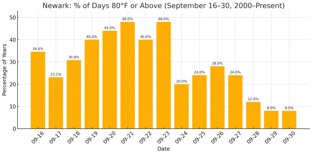
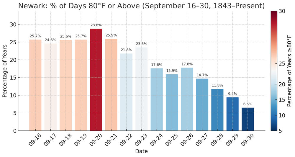
At Central Park, the temperature has reached 83° so far after yesterday's 83°. Through September 23, New York City has seen at least one-in-five years reach 80° or above on each date in the second half of September. The frequency of such warmth decreases afterward. Even during the shorter 2000-present timeframe, there has been a drop in the frequency of such warmth after September 23: At Newark, the temperature has reached 86° so far after yesterday's 87°. Newark takes a step down in the frequency of 80° or above warmth after September 23 and again after September 26. Since 2000, the frequency of such warmth has increased on all but September 17 (likely to have more to do with sample size issues rather than a genuine cooling). Note: All charts include September 16-18, 2025 data.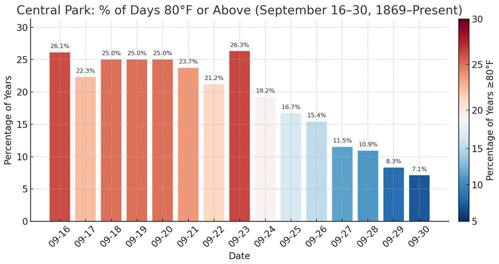

- Today
-
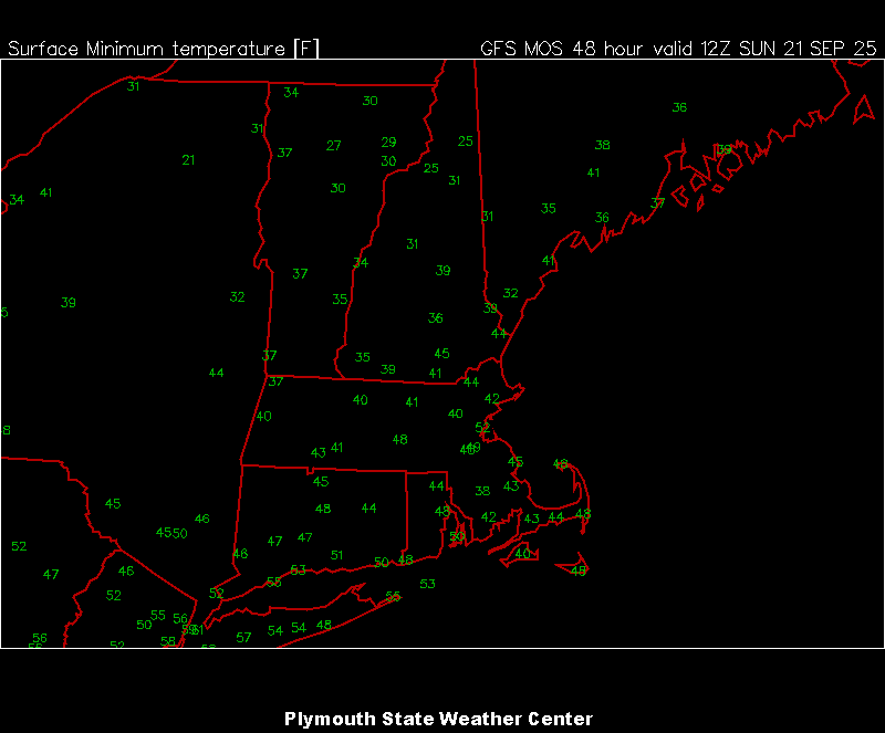
Current MEX for Sun AM. Getting a little close for comfort when I see 31° at 1P1 and very dry ground.
-
The itch to post here is coming back… first digital snow when?
-
81.8/54.4 at almost 2 pm, looks like a 30 degree spread is in the works for today. Brillant sunshine!
-
 I’ll take my position. Another year of #itneverhits100.
 -
 texasflange joined the community
 -
Agreed on that, but I think exactly how December progresses and evolves will play a larger factor in the remaining months. So December essentially sets up the rest of the way...but then of course you start introducing other wild cards that will come into play.
-
Also keep in mind 1.2 is the most volatile region so when assessing changes in SST structure you must factor in what the contributions are to that.
-
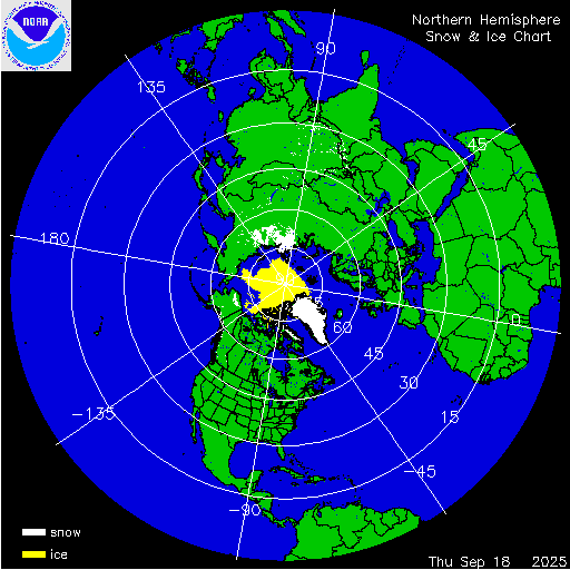
Snow cover getting off to an early start, with favorable conditions for expansion during the next 2 weeks.
-
I think that is a larger problem in December..not so much late season.
-
I think you have it backwards accordingly to the weeklies,,,eastern zones recently caugt up-this is supported by JAMESTEC EMI data. East-to-west 23JUL2025 22.2 0.6 25.5-0.1 27.0-0.2 28.7-0.1 30JUL2025 21.8 0.4 25.3-0.2 26.7-0.3 28.6-0.1 06AUG2025 21.9 0.8 25.2-0.1 26.7-0.3 28.7 0.0 13AUG2025 21.6 0.6 25.2 0.0 26.6-0.3 28.6-0.1 20AUG2025 20.8-0.1 24.7-0.3 26.4-0.4 28.6-0.1 27AUG2025 20.5-0.3 24.3-0.6 26.3-0.4 28.5-0.2 03SEP2025 20.5-0.2 24.5-0.4 26.4-0.3 28.5-0.2 10SEP2025 20.5-0.2 24.4-0.5 26.2-0.5 28.3-0.3


.png.3a22a4ff2c153b5e57a51607705203b8.png)