All Activity
- Past hour
-

Wounded Duck Strikes Back: Dec 26 & 27th Winter Storm Obs
HoarfrostHubb replied to WxWatcher007's topic in New England
Ray should be getting some good banding in a little while. -

Wounded Duck Strikes Back: Dec 26 & 27th Winter Storm Obs
CoastalWx replied to WxWatcher007's topic in New England
Steadier here now. -
Pretty cool. Coming in off the ocean. Excuse the breathing I'm cold haha 20251226_223155.mp4
-
Wounded Duck Strikes Back: Dec 26 & 27th Winter Storm Obs
WeatherGeek2025 replied to WxWatcher007's topic in New England
hope you guys cashing in, looking good -

Wounded Duck Strikes Back: Dec 26 & 27th Winter Storm Obs
TheSnowman replied to WxWatcher007's topic in New England
Absolutely Crushing in Northern RI. I Finally… FINALLY get to say that. Roads are a Disaster! -

Wounded Duck Strikes Back: Dec 26 & 27th Winter Storm Obs
bristolri_wx replied to WxWatcher007's topic in New England
CODNEXLAB-GOES-East-subregional-New_England-comp_radar-03_15Z-20251227_map_noBar-100-1n-10-100.mp4 -
Balmy 51 degrees…some good gusts to low 30s earlier tonight
-

Wounded Duck Strikes Back: Dec 26 & 27th Winter Storm Obs
Baroclinic Zone replied to WxWatcher007's topic in New England
Don’t doubt it but that also tosses those QPF graphics of 0.5” still to come. -
Host your gifs on Imgur and link them.
-

Wounded Duck Strikes Back: Dec 26 & 27th Winter Storm Obs
TauntonBlizzard2013 replied to WxWatcher007's topic in New England
1/2” or so down -
Last post of the night for me, and I may post slightly less over the weekend. I am gonna sit back and enjoy watching model run chaos. So, if you see fewer posts...don't assume the modeling has been poor. But I will leave you with this. Some things I see and then I don't post about(hard to believe, right?!). I think at some point, there is a good chance that we see this. LC has been banging the drum for late January into early February. Low and behold, the control shows this today. Have a great weekend, everyone!
-
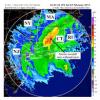
Fascinating late evening radar on Long Island, with synoptic snow moving west-northwest to east-southeast, while ocean-effect snow streams from south to north across Long Island.
-
My size limit is 40.99kb. Thats less resolution than an NES
-
It's snowing at a decent clip here again
-
Meteorologist Rich Hoffman weather geek stuff. islip airport metar: METAR KISP 270156Z 07007KT 1/4SM R06/3000V5000FT -SN BR VV003 M03/M06 A2996 RMK SFC VIS 3/4 PRESFR SLP146 SNINCR 1/4 P0013 T10331056 at 9pm 4 inches of snow( its rounded so could be 3.8 for exampl) 1 inch of snow the last hour. Temperature is minus 3 Celsius. Pressure is falling rapidly
-
.thumb.png.4150b06c63a21f61052e47a612bf1818.png)
Wounded Duck Strikes Back: Dec 26 & 27th Winter Storm Obs
HIPPYVALLEY replied to WxWatcher007's topic in New England
It’s a little bit better than Arctic sand here but definitely smaller flakes. Coming down pretty good right now and it looks like some heavier bands might rotate in soon. -
4.2 inches as of 10:00 PM. 20° with light snow. By looks of the current radar I'm doubting we make 6 inches which I was figuring would be our minimum threshold here. The morning will tell.
-

Winter 2025-26 Medium/Long Range Discussion
sbnwx85 replied to michsnowfreak's topic in Lakes/Ohio Valley
Just read the GRR forecast disco and it has my attention. Hoping we can get that lake effect into Indiana to have some major impacts locally. As for the snow, synoptic scale rain will switch to lake effect snow Sunday night into Monday. Lake effect snow will continue from Monday into Tuesday with accumulations expected. The snow will be spread across all of Lower Michigan given the strength of the wind. As colder air pours in on Monday and the snow becomes drier and more powdery visibility concerns will develop. Winter headlines will obviously be forth coming with later shifts as Monday approaches. All headlines will be on the table given the strength of the wind, which when combined with accumulating lake effect snow will make for major travel concerns. -

Wounded Duck Strikes Back: Dec 26 & 27th Winter Storm Obs
tavwtby replied to WxWatcher007's topic in New England
nice little reinforcement band overhead, picked up nicely with great growth for a bit, west seems to be backfilling some, whether it stays together is the question -

Wounded Duck Strikes Back: Dec 26 & 27th Winter Storm Obs
HoarfrostHubb replied to WxWatcher007's topic in New England
Would love to see that. -

Wounded Duck Strikes Back: Dec 26 & 27th Winter Storm Obs
Ginx snewx replied to WxWatcher007's topic in New England
Saw reports of 17 to 1 in that 4/5 per hour band. Probably 12 to 1 here -

Wounded Duck Strikes Back: Dec 26 & 27th Winter Storm Obs
TauntonBlizzard2013 replied to WxWatcher007's topic in New England
Escalating quickly here. Really coming down -
About 2 inches here and snowing decently again.
-
The old days in Queens. Guido dudes on ATVs in the streets during a blizzard. Good memories
-

Wounded Duck Strikes Back: Dec 26 & 27th Winter Storm Obs
ineedsnow replied to WxWatcher007's topic in New England
starting to think 5 or 6 is reachable


.thumb.jpeg.f5c6ba9d911ec96b3b124f8606aee58e.jpeg)

