All Activity
- Past hour
-
May have some of that with the weenie out and all...
-

Central PA Spring 2025
Itstrainingtime replied to canderson's topic in Upstate New York/Pennsylvania
Had a light shower at home but not enough to move the gauge past 0.00" yet. MU seems to think that today is a bust, but the developing coastal gives us a period of rain overnight. -
Probably the last higher elevation snow potential for the season.

-
Happy Birthday @H2O!! Hopefully you get that pony you asked for
-
I don't think there is enough booze to make the past 7 years palatable.
-
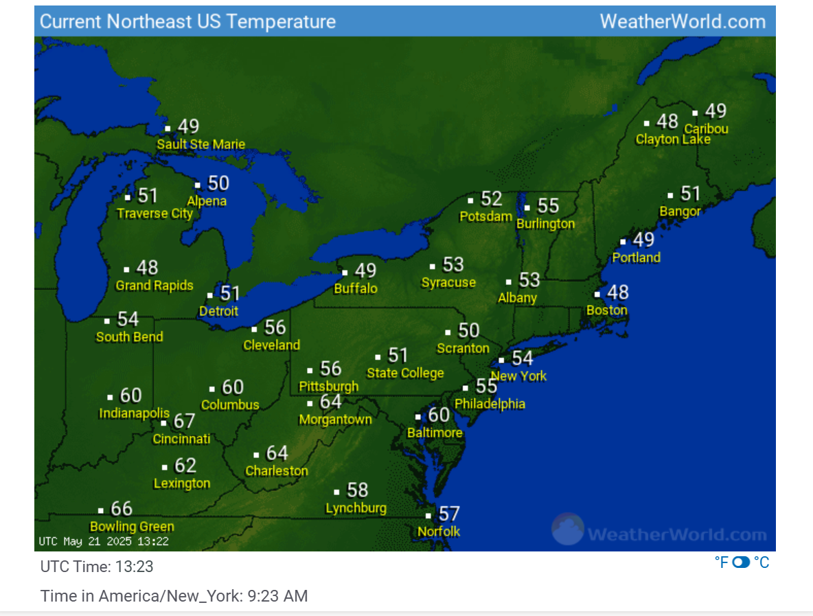
Not possible. if you look ata the 5 minute rapid refresh for JFK, there is a gap in the data. I highly doubt the temp jumped 7 degrees from the previous recorded temp on this list and then quickly dropped back down to the 60s. It must be an error:
-
And another one 5 miles north of me that I didn't even realize happened until yesterday. There was some buzz about lack of a warning for it since it started as a landspout and by the time NWS got any radar or human eyes on it, it was too late.
-
50/42 This is no way to run a Summah.
-
Oooh, that's why no weather-related melt downs from Scott this week so far... I wondered how in the hell it could be that this time in Count Rugen's torture chamber wasn't triggering moaning and outrage ... I give it until late afternoon.
-
Installs will be late this year, I'm thinking July the earliest.
-
Sad but true. You have kicked my butt as well.
-
How did I not know you were in Aruba?
-
Thanks. Getting more snow than @mappythe last two years has revitalized me
-
A cool March (i mean May) 21

-
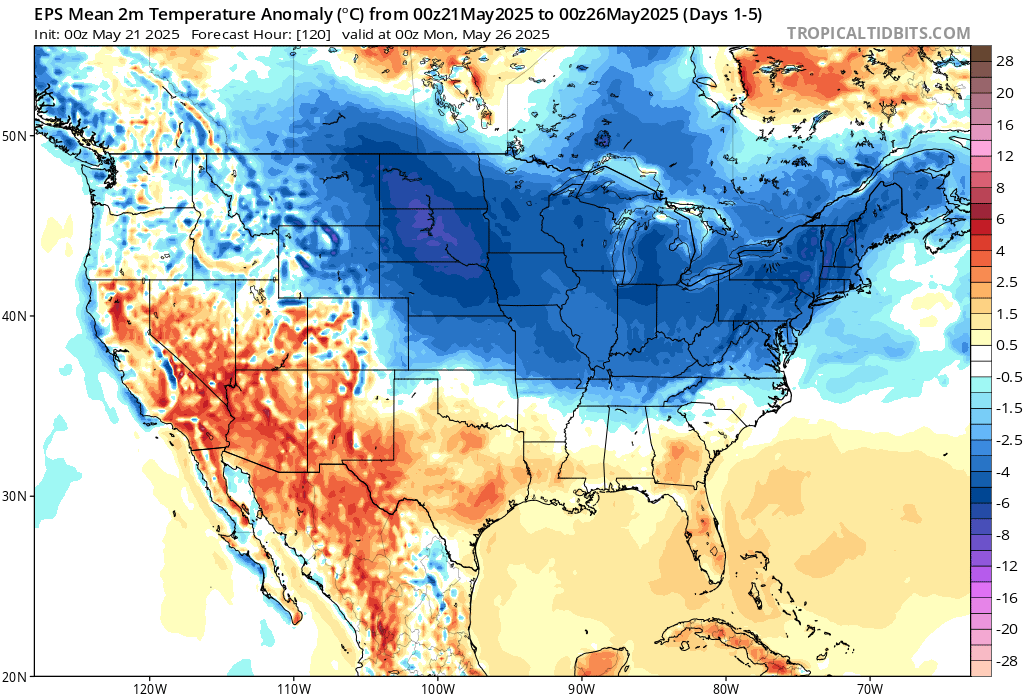
Rain has begun. Timing again with rain looks to salvage the weekend, albeit it'll be very cool Saturday. A week ago the timing was more Thu- Sat and at one point looked to be the 3 day weekend.
-
Just got back from TNCA last evening. What a disaster this is.
-
Yeah it was nice to see the sun for a few seconds… just to reassure it’s still there.
-
Happy Birthday @H2O. You look damn good for 97.
-
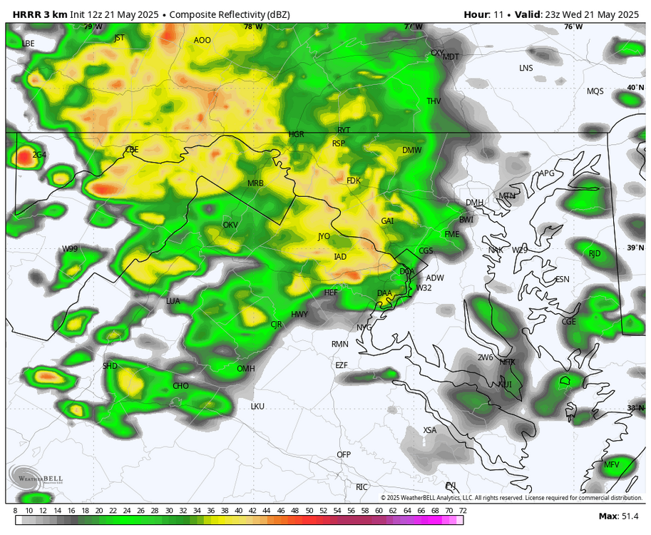
WB 12Z HRRR does bring in another round of heavier showers east of the mountains after 6pm.
-
I saw a 10 second splash ... but yeah, it's hard to imagine even that much happening given this, https://weather.cod.edu/satrad/?parms=subregional-New_England-02-24-0-100-1&checked=map&colorbar=undefined ...which, that's pretty interesting to see that massive retrograde flow from the NE like that directly opposing that vortex-related flow arriving from the OV. Obviously the one from the west will ultimately win... but the battle will require the depths of misery
-
I'd say that after a 12 pack too.
-
12-18” with lollis to 24” and blizzard conditions at times.
-
thicc weekend is fine
-

2025-2026 ENSO
40/70 Benchmark replied to 40/70 Benchmark's topic in Weather Forecasting and Discussion
Keep in mind when I say "weak El Nino", that is a broad, general classification of the protptypical weak El Nino paradigm....once we actually get into the season, I will dig in more...obviously if we still have a Pacific cold phase/-RONI, then it probably wouldn't work. I incorporate all of that later in the fall. Yea, 2018-2019 was a tough one...I went big that season, but the early Jan SSW (focused on other side of globe) just served to lock the residual MC forcing from prior cool ENSO into place. This was also evident by the very paltry mid season MEI. El Nino wasn't running the show. -
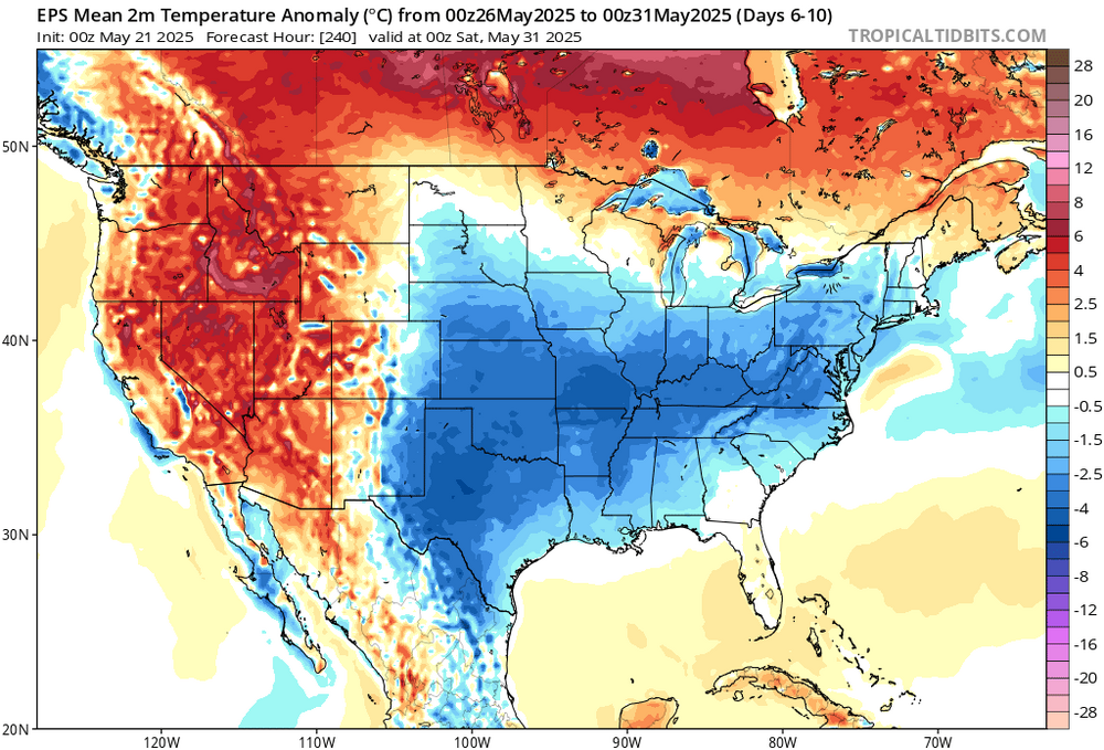
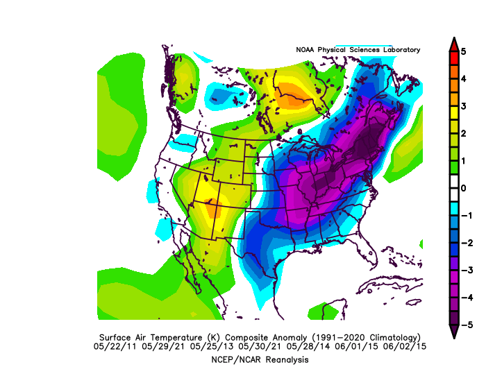
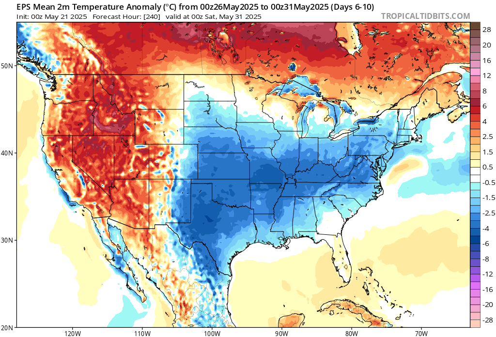
This end of May cool down has become a repeating feature over the last 10-15 years.