All Activity
- Past hour
-

November 2025 general discussions and probable topic derailings ...
CoastalWx replied to Typhoon Tip's topic in New England
FAF -
Only .21" measured after it sprinkled and lightly to at times moderately rained for 12 plus hours yesterday. Makes .63" for the month now. Temp was 41.3 at 7 am report time, warmed to 40-41 around midnight and stayed there all night after being in the 30's majority of the day. Currently 51.8/46.7 at 10:45 under partly cloudy skies.
-
still warm enough for brunch on the patio ...

-
I mean yeah, deriving the effect of an SSW is a much more complex problem, but no one's debating whether or not it will occur. That's what I find comical about this post.
-
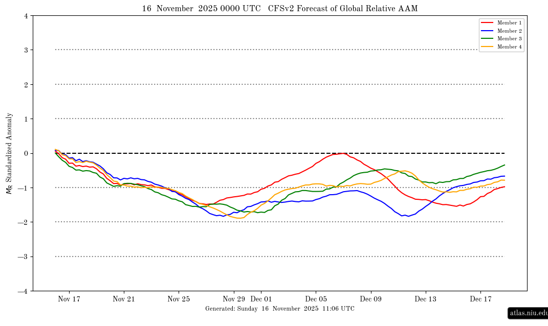
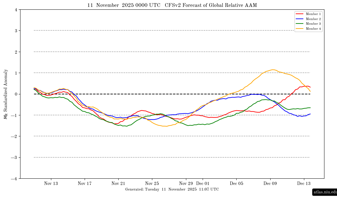
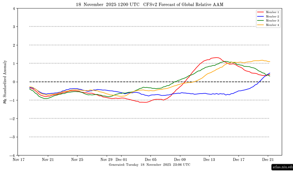
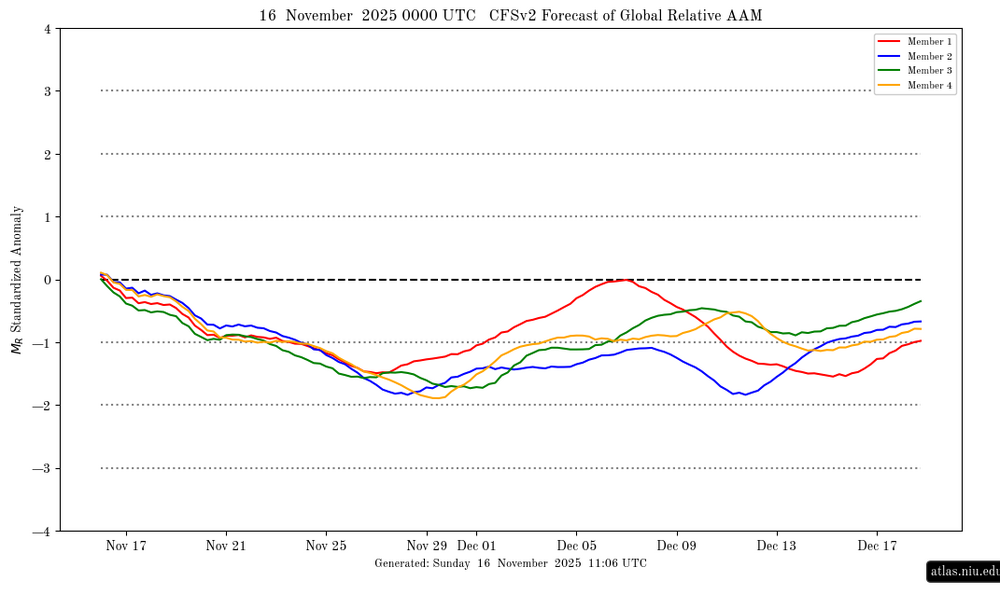
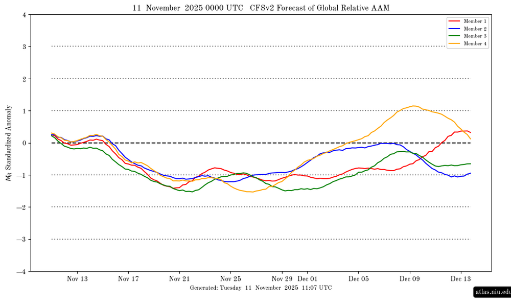
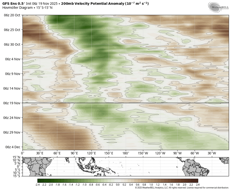
AAM forecast (CFS ensemble): big change for mid Dec vs forecast from two days earlier (warning: these are highly volatile on right side of graph): 11/18/25 AAM forecast: suggests it may go + (El Ninoish) in mid-Dec?!? 11/16/25 AAM forecast: 11/11/25 AAM forecast: @snowman19
-
There is a reason Judah is a well respected meteorologist. He doesn't jump on cold because he knows it's hard for us now. If you bet against sustained cold in winters in the mid atlantic/NE nowadays you'll be right 9 times out of 10.
-

November 2025 general discussions and probable topic derailings ...
bairn replied to Typhoon Tip's topic in New England
Spot on re:acorns. They are demolishing my new sprigs of fall seeding grass. -
Agree Pattern is in the transition stage.
-
Lol what's nail-biting about it? Every single ensemble member supports it and about 90% are on board for a full reversal. Seems a bit clickbaity
-
.36". It's something at least.
-

November 2025 general discussions and probable topic derailings ...
dryslot replied to Typhoon Tip's topic in New England
That camera is behind the 3 fields in the area where i'm hunting, And only 40 yds from where i park my truck, , With no acorns, It looks like there in the fields eating grass, There was another buck and a doe in the first 90 mins there, Even if i would've been there this morning, I would have been 10 mins further NE of there at my blind where my 3rd camera is, But, Tomorrow, I'll be there, That's 2 days in a row there moving thru. -

November 2025 general discussions and probable topic derailings ...
Flying MXZ replied to Typhoon Tip's topic in New England
Credit cards work as scrapers in a pinch. Or so I've been told... -

November 2025 general discussions and probable topic derailings ...
kdxken replied to Typhoon Tip's topic in New England
Oh my! -
Overnight rainfall here only 0.06". Most of the precip was to our S and SW.
-
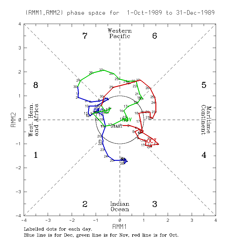
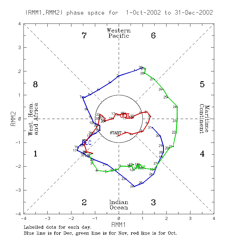
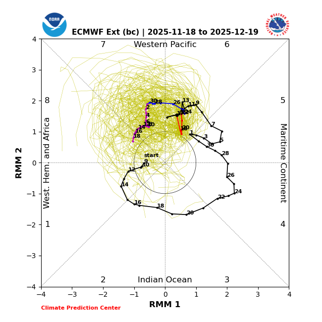
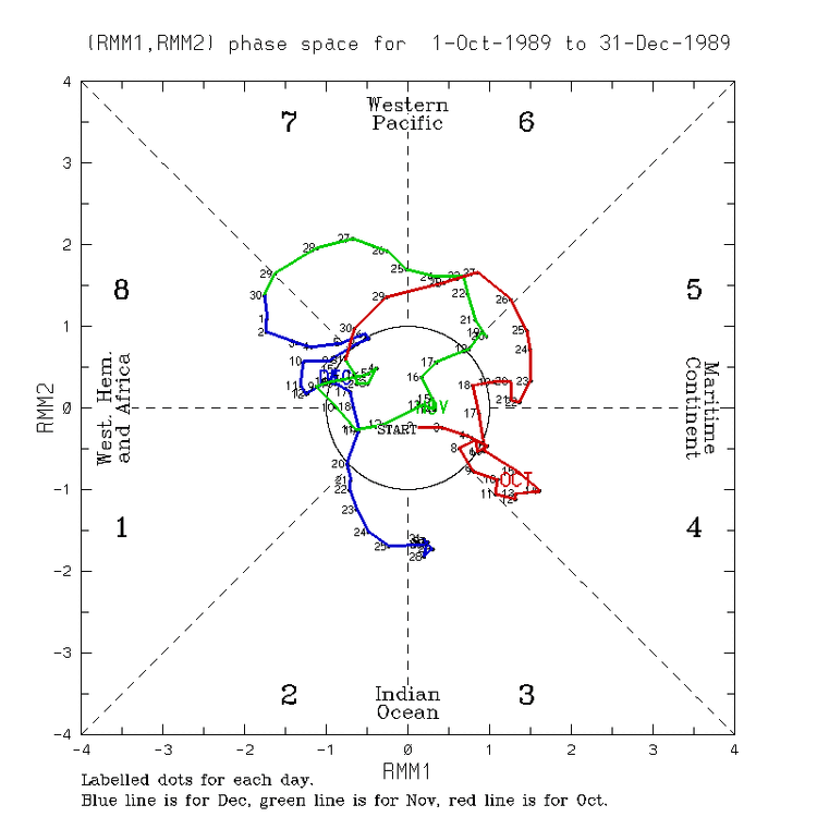
More stuff related to weak to moderate Dec phase 8 having been the coldest Dec phase 8 MJO on average: Dec 9-18 of 1989 was frigid/~tied for the coldest Dec phase 8 in the E US since 1974 along with 5.5” of snow at Baltimore (2 events) and it was weak/near the circle and slow moving: also note that it stayed frigid through this very weak phase 1 and the moderate phase 2: About tied with the frigid 1989 was the very cold 12/6-9/2002. Note that this phase 8 wasn’t too far outside of the circle (moderate phase 8): Temperatures are based on Baltimore as an E US proxy.

-

2025-2026 ENSO
brooklynwx99 replied to 40/70 Benchmark's topic in Weather Forecasting and Discussion
like this is just a fail. the stronger Pacific jet actually helps in Ninas most of the time, not hurts
-
.37 last night .81 for November somethings gotta give soon…
-
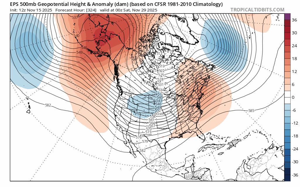
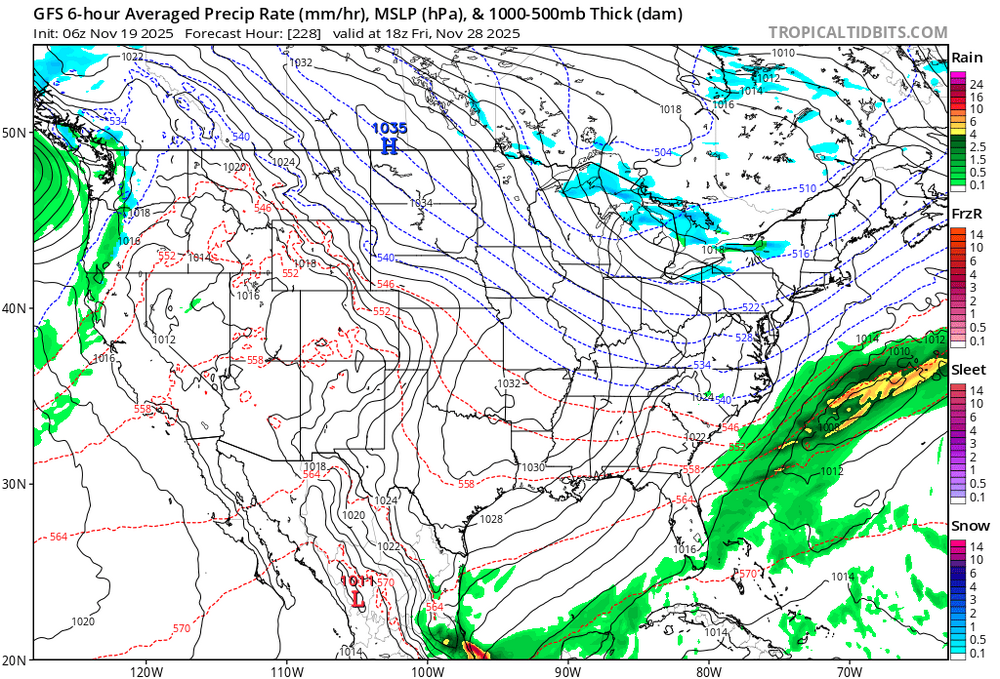
Back to the future: Ensemble qpf storm track more or less southern Plains to the northeast USA next 16 days. Ensembles have no snow prior to D10. but between D10-16 all ensembles try to bring snow accumulation down to the coasts (climo influence?). Nov 30th for now is the EPS next target day for a possible wind advisory. That's D11. Let see if I cant get D1 right... NAEFS has us chilling a bit in early Dec. Have a good day! Thanks for all the overnight reports.
-

Central PA Fall Discussions and Obs
Voyager replied to ChescoWx's topic in Upstate New York/Pennsylvania
Can you all guess where I was??? lol -
-
2025-2026 ENSO
brooklynwx99 replied to 40/70 Benchmark's topic in Weather Forecasting and Discussion
that's transient. models have vastly underdone the cold spell near Thanksgiving already and whatever brief warmup occurs around the start of the month won't last long -
LOL stop posting
-

November 2025 general discussions and probable topic derailings ...
dendrite replied to Typhoon Tip's topic in New England
Ginxy AI coming in 3, 2, 1… -
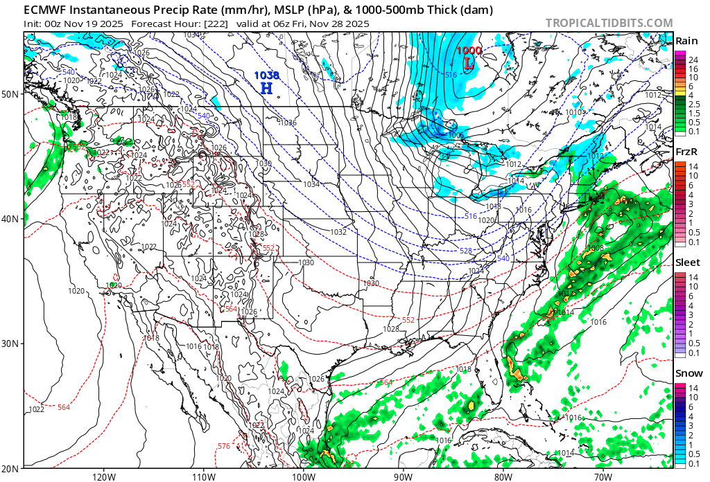
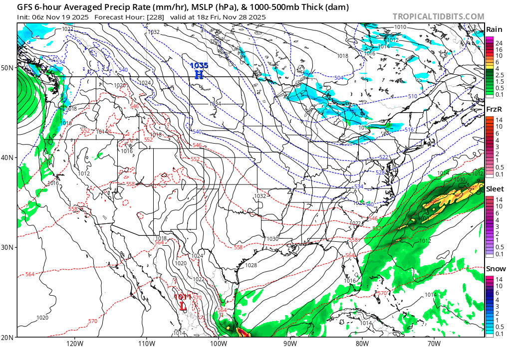
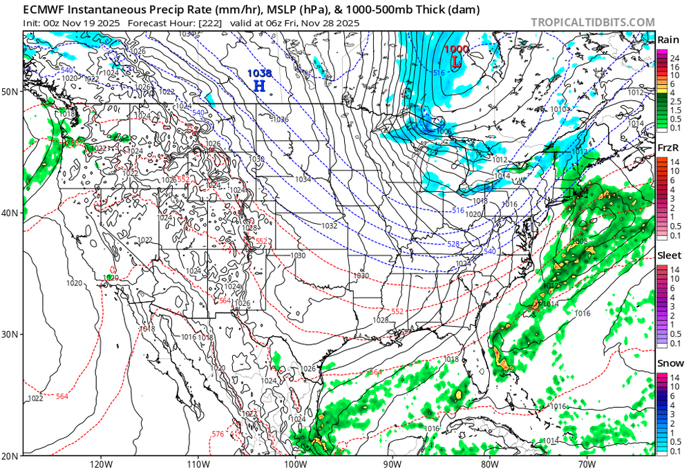
For the people who are confused or don't know what potential means: 6z GFS: 0Z Euro:
-
.43" of rain. Wasn't expecting that.


.thumb.jpeg.406ecda2eec9e267302c22b9f128fe3c.jpeg)