All Activity
- Past hour
-

Central PA Spring 2026 Discussion/Obs Thread
Blizzard of 93 replied to Voyager's topic in Upstate New York/Pennsylvania
Well, I was told earlier that there was no evidence that the pattern could turn colder… -

Southern MD / Lower Eastern Shore weather discussion
SnowtoRain replied to PrinceFrederickWx's topic in Mid Atlantic
Maybe 1.5" total not enough to motivate a measurement -

Outta gas and Outta Time: Early March Winter Storm finale
ravensrule replied to Ji's topic in Mid Atlantic
Can you imagine how much you would have gotten 30 years ago. Probably 50". -

2026-2027 El Nino
so_whats_happening replied to Stormchaserchuck1's topic in Weather Forecasting and Discussion
For reference this was the hovmollers 850mb u wind anomaly look leading into the 23-24 Nino event. If we do indeed get the westerlies over that warm pool around the dateline we should start to push the ocean to Warm neutral territory. Ill wait to see if the AAM does want to switch things up going forward strength of the event is still in question but it should be safe to say we get to at least warm if not weak Nino status by summer. I would like to see some actual propagation of the anomalies and not have them just sit west of the dateline like we have seen the last 2 months.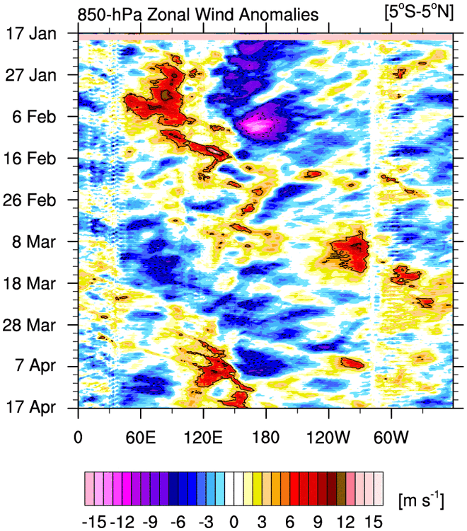
-
It was supposed to snow but 36.1 and rain.
-

Central PA Spring 2026 Discussion/Obs Thread
Itstrainingtime replied to Voyager's topic in Upstate New York/Pennsylvania
I don't think a single person in here doesn't think it will turn colder. Getting snow will be the challenge. -
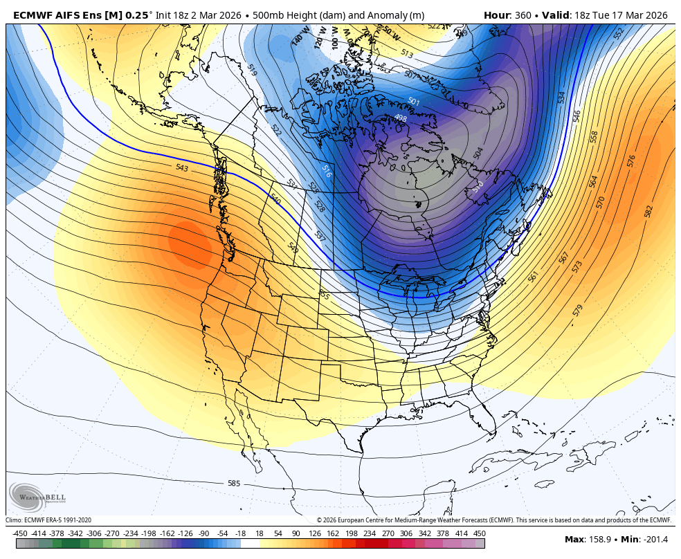
Central PA Spring 2026 Discussion/Obs Thread
Blizzard of 93 replied to Voyager's topic in Upstate New York/Pennsylvania
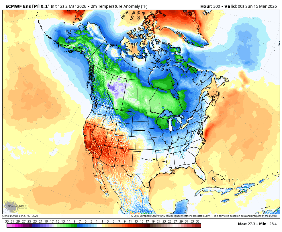
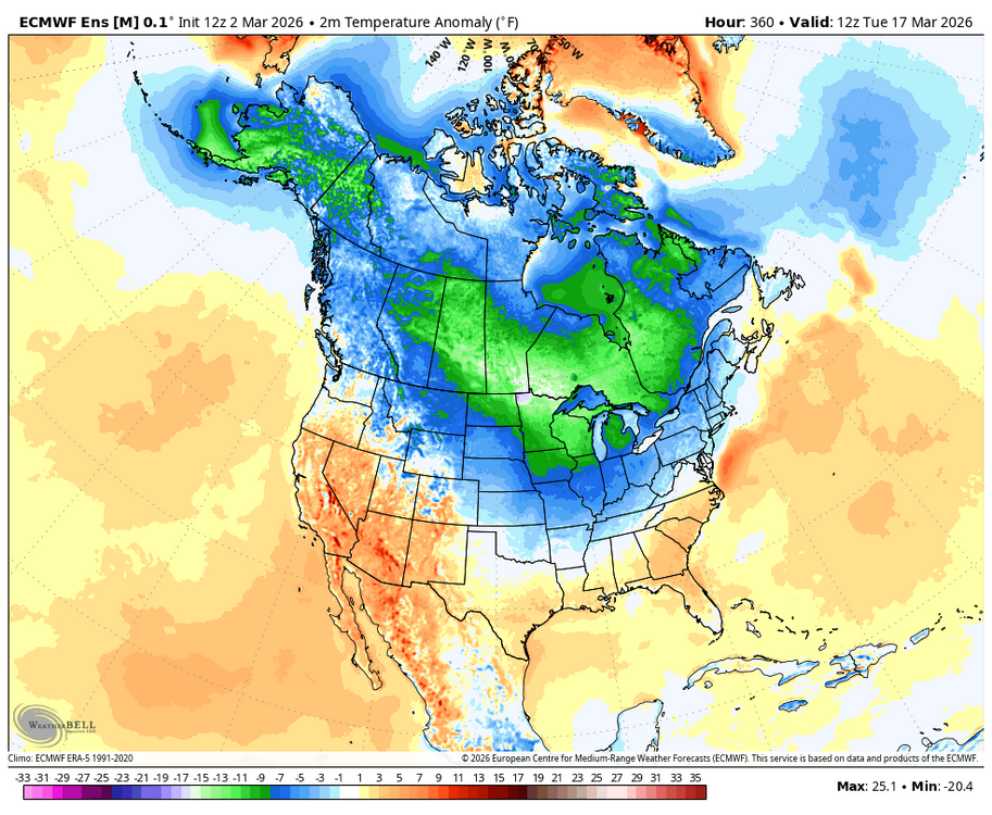
How about more “evidence” on the highly regarded 18z AI EPS. Lots of cold green temps showing up nearby on St. Patty’s Day.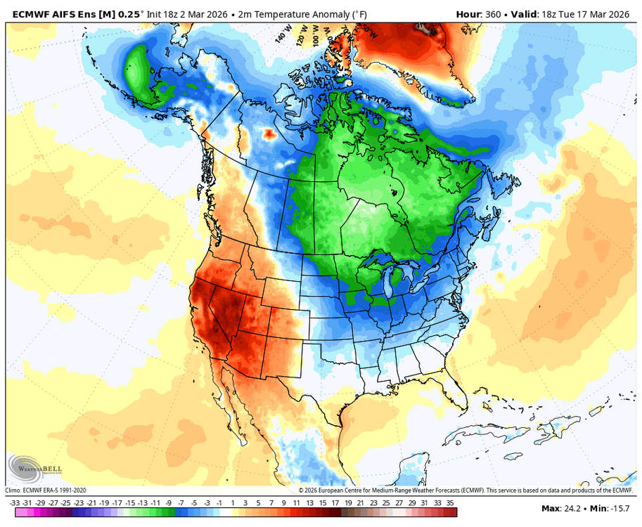

-
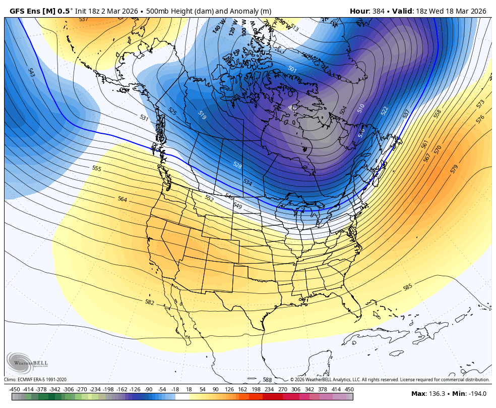
Central PA Spring 2026 Discussion/Obs Thread
Blizzard of 93 replied to Voyager's topic in Upstate New York/Pennsylvania
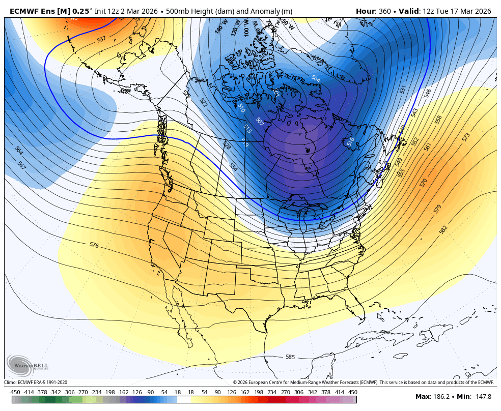
More “evidence” on the 18z GEFS towards mid month.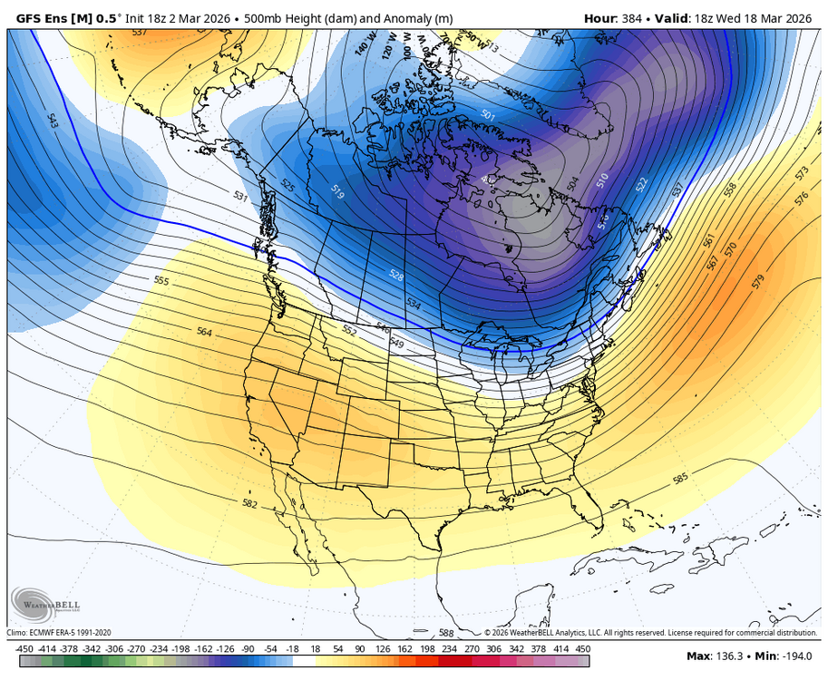
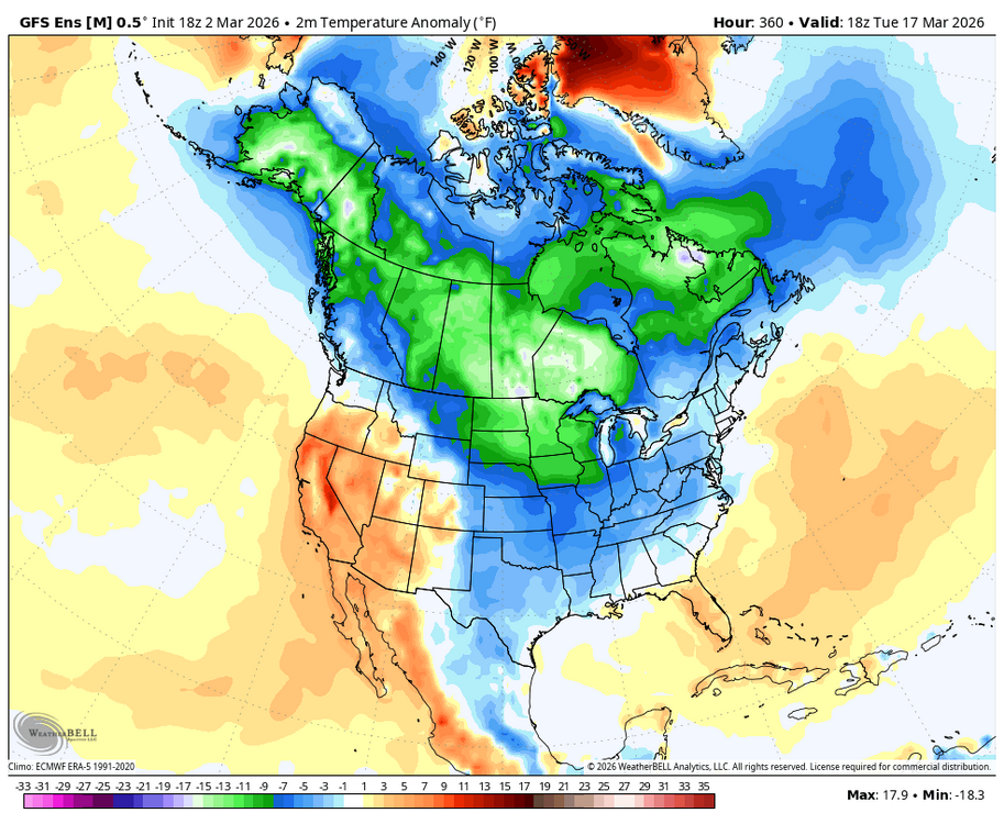
-
Clouds will increase tonight and cloud cover will likely impede viewing of the lunar eclipse near sunrise tomorrow. Periods of mixed precipitation giving way to periods of rain are likely later Tuesday and Tuesday night. The temperature will reach the upper 30s and lower 40s. A sustained warming trend will commence on Wednesday. The second week of March could feature springlike readings. Long Island and coastal sections could be noticeably cooler than interior sections on a number of days on account of a chilly onshore flow. The ENSO Region 1+2 anomaly was +1.0°C and the Region 3.4 anomaly was -0.1°C for the week centered around February 25. For the past six weeks, the ENSO Region 1+2 anomaly has averaged +0.62°C and the ENSO Region 3.4 anomaly has averaged -0.28°C. Neutral ENSO conditions have now developed. Neutral ENSO conditions will continue through at least mid-spring. The SOI was +16.18 today. The preliminary Arctic Oscillation (AO) was -0.670 today.
-

E PA/NJ/DE Spring 2026 Obs/Discussion
The Iceman replied to PhiEaglesfan712's topic in Philadelphia Region
Shocker with the water temps. I know people want the warmth, I’m among them, but it’s going to be a struggle to see serious sustained warmth. -
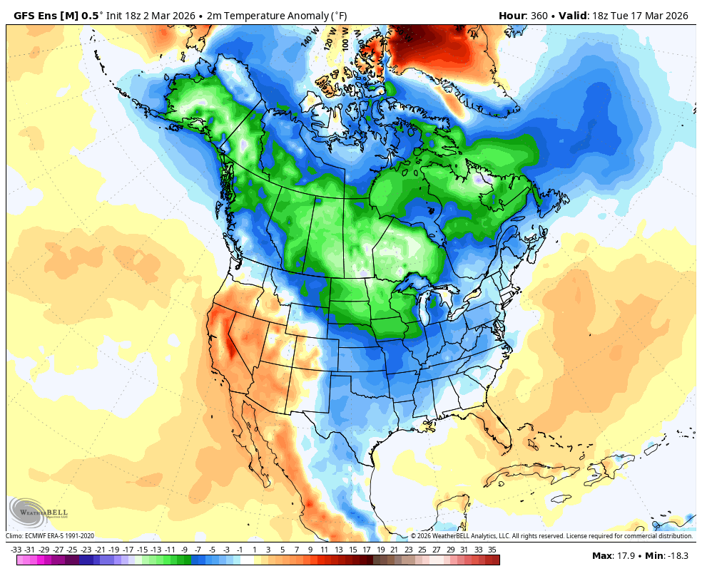
Central PA Spring 2026 Discussion/Obs Thread
Blizzard of 93 replied to Voyager's topic in Upstate New York/Pennsylvania
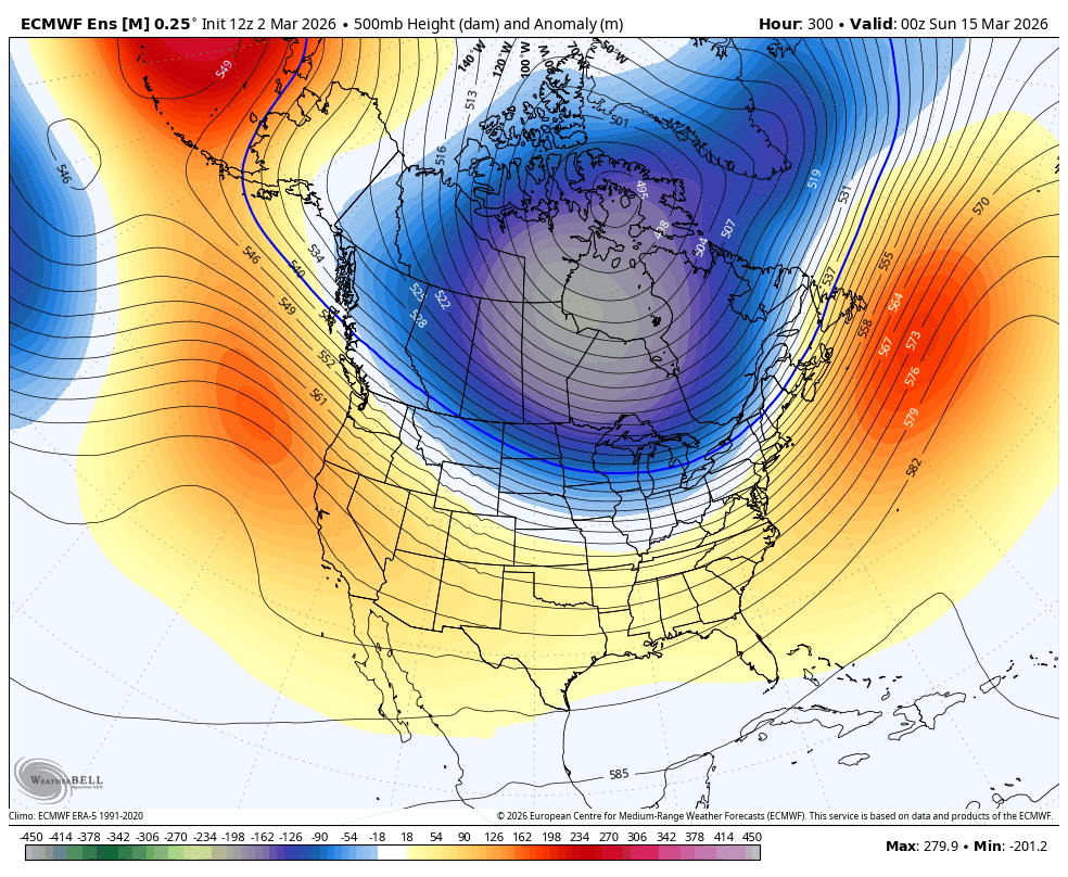
How about the “evidence” on the best ensemble in the world, the EPS from 12z today. By March 14, the colder pattern is emerging & remains in place at the end of the run on day 15.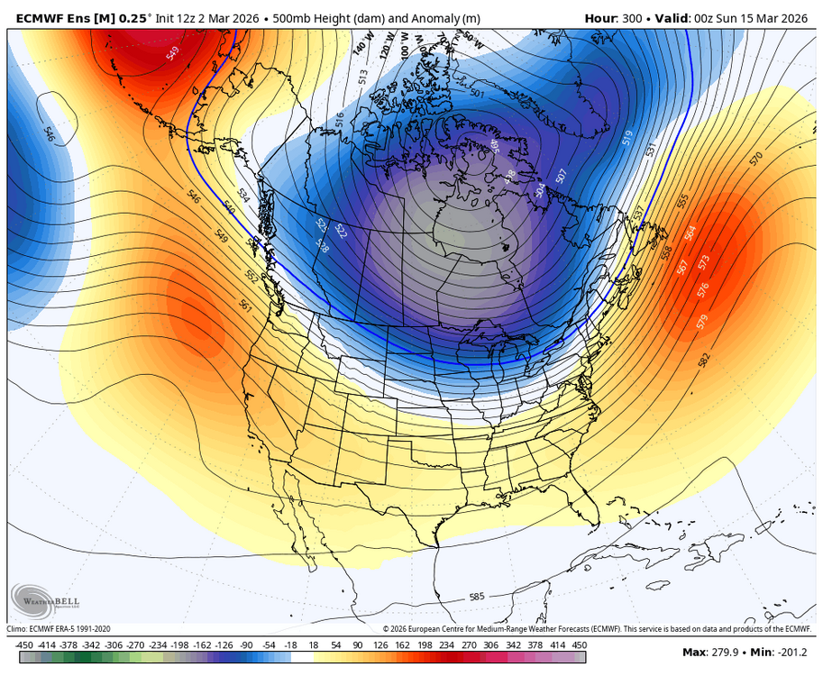


-
E PA/NJ/DE Winter 2025-26 Obs/Discussion
The Iceman replied to LVblizzard's topic in Philadelphia Region
Probably the last night or two with partial snow cover. Remarkable that we’ve had cover since 1/16. 45 days. Highly unlikely we make 50 with the rain and temps the next few days but still a month and a half straight of snow cover here. Another rarity around here. -
Don - do you have access to the winter season severity index specific rankings for cities like NYC and Philly? Both are listed as "extreme" for both cities (and most in the NE), which means top 20% (top 33 or so out of ~165), but I'm curious where this winter ranks exactly. TIA. Also curious how close your scores are to these. chrome-extension://efaidnbmnnnibpcajpcglclefindmkaj/https://journals.ametsoc.org/view/journals/apme/54/8/jamc-d-14-0217.1.pdf
-

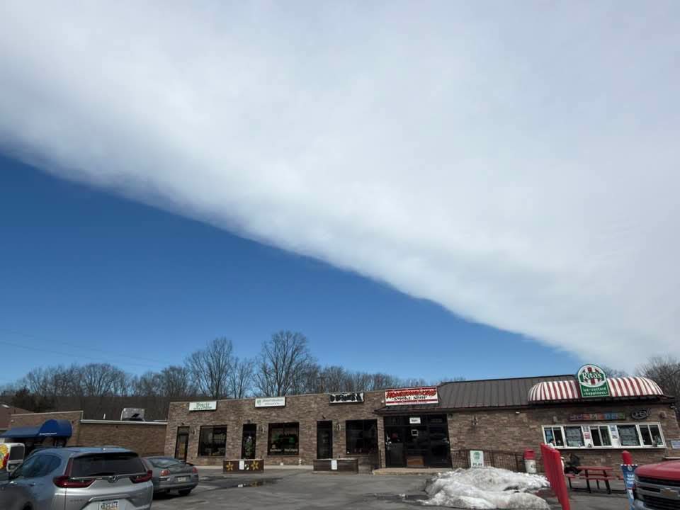
Central PA Spring 2026 Discussion/Obs Thread
Lucy Pull replied to Voyager's topic in Upstate New York/Pennsylvania
I did see this today. I even mentioned to myself that it was one of the cleanest contrast differences I’ve seen. -

Pittsburgh/Western PA WINTER ‘25/‘26
EVLINC64 replied to Burghblizz's topic in Upstate New York/Pennsylvania
He said it would be a blowtorch & then cold around the 15th Good Lord did he steal your woman or something -
Less than a week.
-

"Don’t do it" 2026 Blizzard obs, updates and pictures.
Ginx snewx replied to Ginx snewx's topic in New England
https://www.facebook.com/share/v/187kWsNfAc/ -
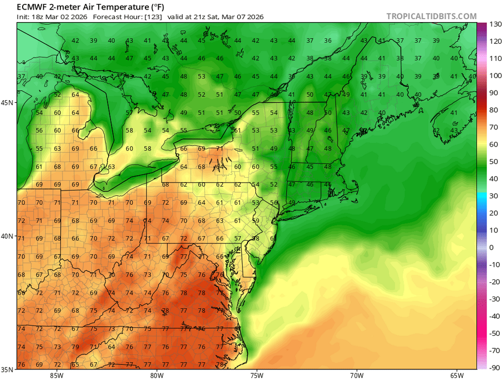
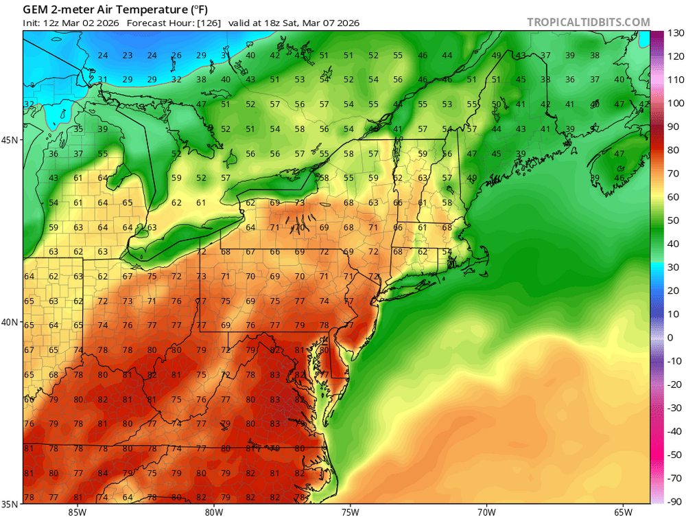
Only really shows up like that on the GFS op. All the ensembles, Euro, GEM, show a toasty Saturday.
-
I thought I was the only one who hates later sunsets. Nothing better than those early December sunsets
-

Outta gas and Outta Time: Early March Winter Storm finale
mappy replied to Ji's topic in Mid Atlantic
I’m expecting norrisville to have gotten the same -

Outta gas and Outta Time: Early March Winter Storm finale
Terpeast replied to Ji's topic in Mid Atlantic
Think mby is done for today, 2.1” final. Brings me to 17.4”, close to my median climo (which is lower than mean climo). Beating last year’s 16.9” by a hair.- 911 replies
-
- 10
-

-

Outta gas and Outta Time: Early March Winter Storm finale
PrinceFrederickWx replied to Ji's topic in Mid Atlantic
Measured 0.5” here. Light sleet currently. -
12/5: 1.5” 12/14: 1.0” 1/1: 0.2” 1/17: 0.3” 1/25: 9.5” (5.5 sn 4.0 ip) 2/6: 0.3” 2/22: 2.5” 3/2: 2.1” Total: 17.4”
- Today
-
12/5: 1.3" 12/14: 1.8" 12/31: 0.2" 1/1: 0.1" 1/18: 0.4" 1/25: 7" snow/sleet (plus 0.3" zr) 2/23: 10" 3/2: 1.1" T: 21.9"
-

Central PA Spring 2026 Discussion/Obs Thread
Voyager replied to Voyager's topic in Upstate New York/Pennsylvania
Did anyone else see this at the northern edge of the overcast cloud deck today? It's like someone took a straight edge, drew a line across the sky, and colored the bottom blue. I saw it, but this is NOT my photo.