All Activity
- Past hour
-

Central PA Winter 25/26 Discussion and Obs
MickeyTim6533 replied to MAG5035's topic in Upstate New York/Pennsylvania
CMC says not so fast -

1/24-1/25 Major Winter Storm - S. IL, IN, and OH
michsnowfreak replied to A-L-E-K's topic in Lakes/Ohio Valley
You dont even live here in winter. You essentially hate winter. Oh and this storm was a great storm for the central ohio crew but it was short of 20" so if it was here you'd be complaining. I know, because you had many critiques when Detroit had a 16.7" storm in 2015. -

The “I bring the mojo” Jan 30-Feb 1 potential winter storm
mstr4j replied to lilj4425's topic in Southeastern States
That's what they said this last storm...until we were dry-slotted for 6-8 hours - No telling the glacier we could have had. Granted this is a different storm setup- but it seems as of late whatever models say, it's always way overdone. I think at one point for today the low was supposed to -8, ended up at 12 (20 degree difference) - Granted it's cold as all get out, but nothing is verifying as modeled. Again, that is more upstate of SC, it maybe verifying perfectly everywhere else, but here - not close. -
I'd lock that mfer up right now and wouldn't gamble.
-
CMC a step back
-

Central PA Winter 25/26 Discussion and Obs
Jns2183 replied to MAG5035's topic in Upstate New York/Pennsylvania
I hope we score something because right now most models give .10 qpf the next 10-15 days. That ranks in bottom 10% of all periods with a mean temperature at or below what they are predicting for averag temperature Sent from my SM-S731U using Tapatalk -
I think the AFD is by far the best and most succent analysis of this setup possible: KEY MESSAGE 3...Monitoring the potential for a coastal system this weekend. Very favorable storm patten in terms of analogs for big snows in the Mid-Atlantic this weekend. A 50/50 low & -NAO, Idaho Ridge, blocking over the Hudson Bay, and trough moving into the east Pac. Couldn`t ask for a better synoptic setup, but the formation of a storm remains in the details of this highly sensitive pattern. Guidance continues to show a Miller A type Nor`easter (it has been a while for one to form, let alone show up in model guidance). While the ceiling is certainly high for this storm, there is equally if not higher odds it just skirts out to see as indicated by the latest 00Z guidance and ensembles. Future runs will have to be seen if this is a trend or noise. How the TPV evolves will be one of the biggest factors on if this storm comes to fruition or not and impacts land. Regardless, expect fluctuations over the next day or two until the pattern is better sampled as associated energy is onshore across the western US.
-

Possible coastal storm centered on Feb 1 2026.
WxWatcher007 replied to Typhoon Tip's topic in New England
Absolute thermonuclear potential with this. -
A long way to go. Maybe it ends up being a whiff. But this is where I want the GFS at this stage.
-
We need NoGaps back.. always a good model to know if models are too far east… weenie book page 6 .
-
Army Mike started following January 2026 Medium/Long Range Discussion
-
The “I bring the mojo” Jan 30-Feb 1 potential winter storm
eyewall replied to lilj4425's topic in Southeastern States
Another blockbuster run but I of course I do not expect this to hold. -
The “I bring the mojo” Jan 30-Feb 1 potential winter storm
greendave replied to lilj4425's topic in Southeastern States
47.9" in Delmarva?!?! Book it! -
The “I bring the mojo” Jan 30-Feb 1 potential winter storm
Ravens94 replied to lilj4425's topic in Southeastern States
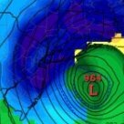
CMC says the gfs is crazy -
102h- closed off low over east TN Looks like it's about 50 miles east across the board
-
cmc will be out to sea
-
-
Richmond Metro/Hampton Roads Area Discussion
overcautionisbad replied to RIC Airport's topic in Mid Atlantic
No way Wait, that reminds me of the Canadian last night -

Central PA Winter 25/26 Discussion and Obs
pasnownut replied to MAG5035's topic in Upstate New York/Pennsylvania
lower Chessy I see a 28" max that was 150 miles south 2 runs ago. lower astern shore went kaboom -
i do not think i have ever seen a model run that extreme since the days of the DGEX for 2016.
-
don't tell him SBY got 4'
-
Gfs is on its own.
-
January 2026 Medium/Long Range Discussion
SomeguyfromTakomaPark replied to snowfan's topic in Mid Atlantic
If you consider 14 inches for dc back…..yes it’s back. -

Central PA Winter 25/26 Discussion and Obs
GrandmasterB replied to MAG5035's topic in Upstate New York/Pennsylvania
Read more and post less for now. There are dozens of model runs throughout the day and locking in any one model solution 72+ hours out is foolish. I suggest reading the NWS discussions each day and learning from the seasoned folks on this board. Saying “congrats X location” or “way east” after each run will get a lot of buns thrown your way.


