All Activity
- Past hour
-
I grew up climbing Mount Washington and The Presidential Range. I have skied Tuckerman Ravine three years straight the years after college. Final time from the lip. Wicked cool, and scary as hell, going up and down. Took the left gully down, didn't fall. Have pix on my FB page. One shot climbing in the summer, "This mountain has some of the worst weather in the world. Turn back now if you are unprepared." I paraphrase, will dig up the photo. Highest wind speed ever recorded: 230 some odd MPH. Mount Washington is no joke.
-

Central PA Fall Discussions and Obs
mahantango#1 replied to ChescoWx's topic in Upstate New York/Pennsylvania
25 this morning. -
Yep, that Nov 2018 SWFE snow was totally unexpected and had the impact of a MECS given it was during rush hour and no one planned for it. Driving back to Long Beach from Melville was like a car zombie apocalypse. And it was bad all the way to the immediate shore. I think it was supposed to be a half hour of white rain that’s it.
-
You might not get out of the 30s today.
-
That was a great run of early season snowfall from 2008 to 2018. The higher elevation event later in October 2008 followed by the historic late October 2011 snowstorm. Then the post Sandy snowstorm in 2012 and the SWFE in November 2018.
-
It's 24/23 here, probably minus a couple degrees compared with KEEN A little nip in the air!
-
You posted the 15 day change map. The anomaly map looks quite a bit different for better or for worse.

-

2025-2026 Fall/Winter Mountain Thread
Buckethead replied to Buckethead's topic in Southeastern States
Yup, it's gonna be a raw day. 35 here in Wolf. Sent from my SM-S908U using Tapatalk -
No words. Just a beast this morning
-
Notwithstanding what the Control shows, yesterday's Eps weeklies are not really warm over that same period if you scroll through the link below. https://charts.ecmwf.int/products/extended-anomaly-2t?base_time=202510260000&projection=opencharts_north_america&valid_time=202511030000
-
That’s fine. I can’t afford playoff tickets anyway.
-
36.2, consistent with the other PWS in the area. A few of the colder local spots got down to 33/34, but nowhere closeby got to 32
-
PWS nearby has 32. May be a little low, surrounding stations have 36-38.
-
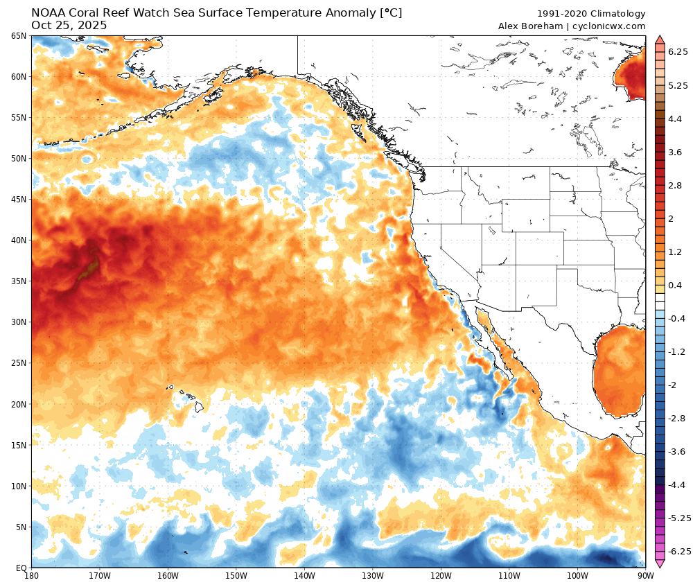
We have reached the point where people using 2013 as an SST analog (SST analog) have an issue. Not commenting on any other factors being used as an analog to that year, just SSTs. But as it stands now, we are not even in the ballpark of going into a Victoria mode PDO, not even close, whereas we were into a Victoria mode PDO by the beginning of November back in 2013….
-
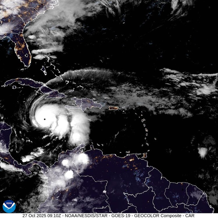
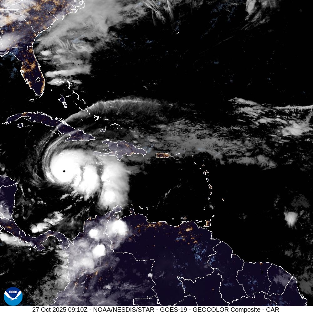
Most recent long-range radar scan. The eyewall remains uniform and intense. It does appear a concentric outer band is trying to form around the periphery of the eyewall. We still have 24-28 hours until landfall. That is plenty of time for an EWRC to begin. The forecast is for Melissa to be a Category 5 at landfall, but internal structural changes could still bring down that intensity to Category 4. But again, that is not necessarily a good thing for the island, as the windfield would expand east towards higher populated areas. I actually do think the intensity will fluctuate down by landfall as I still think outer banding will get its act together and weaken the small eye by tonight. It is very difficult for a high-end TC like this to maintain that intensity for that many hours without fluctuations. Time will tell.
-
A raw morning out with a low of 39 and rain knocking on the door.
- Today
-
Another hard freeze here currently 27
-
I downloaded these this morning.
.thumb.jpg.f667505794bbb478fdb726c9ab7250d4.jpg)
-
Here's my winter outlook. (more of the same...)
-
My outlook. May do Edition 2 if things change in November. Or maybe not.
-
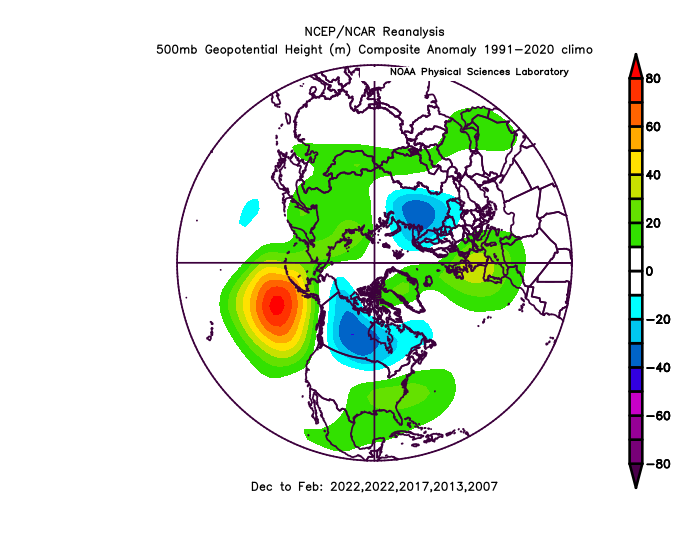
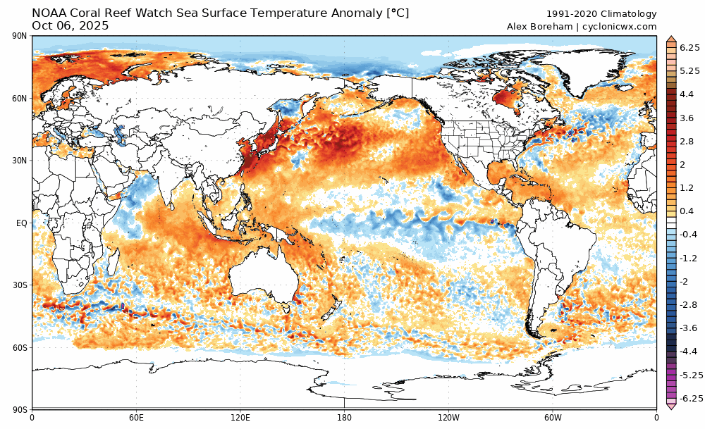
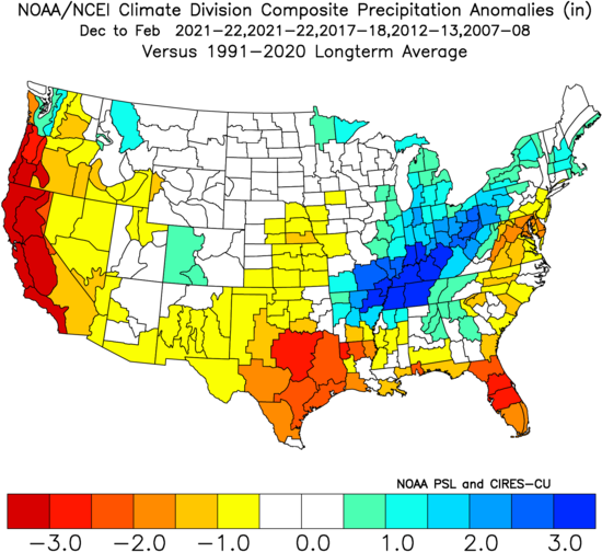
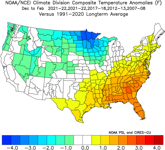
Not a whole lot has changed this month, so I decided to go ahead and issue my outlook for this winter. I'll keep it brief and simple: Overall winter feel: Meh, but not full-on blowtorch. Cool ENSO/weak basin-wide Nina coupled with -QBO Strong -PDO trying to turn the corner but not quite getting there -IOD bracketing MJO activity to phases 3-7 with limited 8-1-2 activity More weak troughing east of Japan pushing N. Pac High east into GOA (this helps us) Mostly -PNA, but with some +PNA episodes with plenty of Canadian cold air to tap into Weakly +NAO on the means with at least 2 or 3 bonafide -AO/-NAO blocking episodes Snowfall guess: 9-11" for the forum, maybe a few inches more for CAPE and northward of him Predicted mean DJF NH Pattern based on listed analogs (2021-22 weighted twice): SST changes last 15 days: Extrapolating cool SST/troughing east of Japan while warm blob pushes to the east. Cool area in GOA probably will not last. Atlantic pattern seems neutral towards NAO bias, but increased risk of SE ridge linkage with -NAO. Temp and Precip DJF Maps: Warmer and drier across the SE. Mild East Coast, but not torchy, plenty of cold air to tap into, but timing and SE ridge linkage will be an issue to contend with at times. Rockies, Upper MW, Great Lakes, and non-coastal SNE and all of NNE are poised to have a great winter.
-
Third cat 5 of the season. Absolutely insane.
-
5:00 AM EDT Mon Oct 27 Location: 16.4°N 77.8°W Moving: W at 3 mph Min pressure: 917 mb Max sustained: 160 mph .
-
5:00 AM EDT Mon Oct 27 Location: 16.4°N 77.8°W Moving: W at 3 mph Min pressure: 917 mb Max sustained: 160 mph .
-

Spooky Season (October Disco Thread)
Damage In Tolland replied to Prismshine Productions's topic in New England
The screamer is Thursday / Thursday night with dry slot Friday. Helloween is saved for Scooter


.jpg.b6b906d42ee52f748882238f5ba4cfda.jpg)


