All Activity
- Past hour
-
There is a very weird obsession with the HREF...ever since it nailed some event a few years back (forgot what it was). But that's what forecasting is evolving into...pick a model and output source that displays beautiful visuals and construct what its showing into a "forecast".
-
Too early, plus there is a thread in the Tropics section.
-
The gfs holds. It insists 94L swamps the SE while we smoke cirrus. Come on Euro!
-
It’s all BOX uses
-

Fall 2025 Medium/Long Range Discussion
SchaumburgStormer replied to Chicago Storm's topic in Lakes/Ohio Valley
Dont hate WAD october, but start to get concerned that we roll right into WAD winter. Pretty damn boring locally, and the gulf is recurve city. -
I wouldn't call that excellent.
-
.04" here. 72/71. disgusting out.
-
I think the HREF is kind of meh overall. I mean there are times it does great but there are many times it way overdoes things
-
HREF had it
-
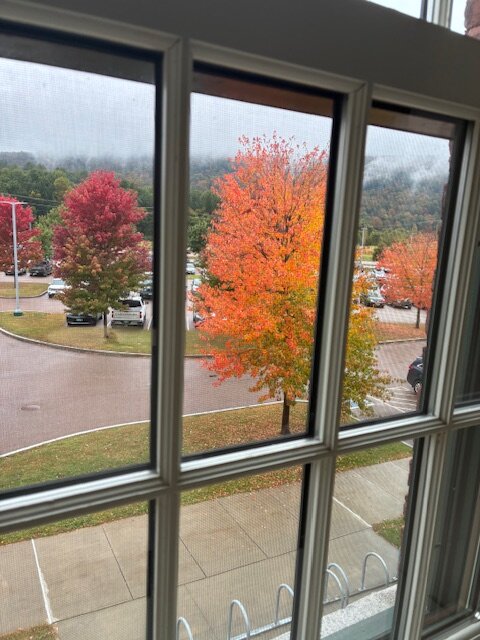
Even in a blah foliage year, there are still pops of color.
-
We might do medians better than mean.
-
Amen brother!! I'll take some wind and a nice deluge!!!!
-
In regards to Invest 94. NWS is waiting on NHC which is in a wait and see mode... Latest from Charleston S Carolina. NWS.. The forecast becomes exponentially uncertain into early next week as a complicated set up begins to take shape over the southeastern states and adjacent western Atlantic waters. The National Hurricane Center continues to monitor invests 94L in the western Atlantic for potential tropical development over the next 7 days. TS Humberto formed in the late afternoon hours Wednesday, with models struggling to agree on track/intensity, especially as majority of guidance has it interacting with invest 94L which further complicates the forecast. For now, The extended forecast will remain closely monitored over the next several days.
-

September 2025 OBS-Discussion centered NYC subforum
steve392 replied to wdrag's topic in New York City Metro
Just had some nice downpours! -
There should be a decent soaking in the interior this aftn though.
-
I don’t recall models giving 2-4” in interior sne
-
Climate Depot's Marc Morano comments on President Trumps incredible UN speech. "will go down in history as the most powerful, honest, and accurate climate speech ever given by a world leader. Trump's speech --delivered face-to-face to a stunned UN General Assembly -- was awesome -- historically awesome! Trump eloquently mocked UN climate tipping points and the climate catastrophes that never happened. Trump hit every central tenet of the climate movement, from failed doomsday predictions, to the 'green scam' to the 'hoax' of 'carbon footprints,' to past warnings about global cooling, to how 'the radicalized environmentalists' want to 'kill all the cows,' to how Net Zero 'redistributes manufacturing' to China. Trump reached the pinnacle of his speech by summing up climate change as 'the greatest con job ever perpetuated on the world.' Historians will look back at Trump's climate masterstroke as heralding the long-overdue end of the UN/Gore climate narrative. It was not long ago that most GOP politicians were terrified to challenge 'climate change', but now we finally have a U.S. president who is leading the world in beating back the unscientific climate nonsense." Finally we are moving past the fear mongering of the climate religion!
-
Looking at the trajectory of the returns from PA, The bulk of that precip looks to be heading off to the NW of here and going to go into the foothills.
-
1.49 since 7AM with more to come.
-
There will be a window for significant intensification but idk how long it’ll be open for. You have near record warmth near the Bahamas and critically this should establish a nice outflow channel with a ULAC over the region and cutoff to the west. It’ll be in near ideal conditions. However, nearing the coast southerly shear could impart dry air and the immediate coastline has cooler SSTs. Folks should remember that major EC strikes are rare. Since 1990 it’s only been Andrew ‘92, Fran ‘96, and Jeanne ‘04.
-
After nearly 6 weeks of nothing... picked up just under an inch in the past 24 hours. Feast or famine has been the theme for the last couple years. Prolonged dry is followed by too much lol. I doubt the 0z euro for down here (10 inches over 6 days lol) but i have a hunch my area will get peppered pretty good. Dust bowl to mud bowl in a blink lol
-
I was skeptical of the 2-4” mesos had for most of interior SNE. HREF was awful
-
That stuff in PA will pillage NNE. Scattered Stein for the rest in SNE with some downpours flying around.
-
12z models had barely anything here, including HRRR. Over an 1" in the last 2 hours.
-

September 2025 OBS-Discussion centered NYC subforum
jm1220 replied to wdrag's topic in New York City Metro
I have the maybe 0.5” now from the one batch of rain. Lucky swath through Nassau has about 1”. Looks like maybe a few showers to go then done.


(002).thumb.png.6e3d9d46bca5fe41aab7a74871dd8af8.png)


