All Activity
- Past hour
-
73/51 Back in the sweet spot for temps/dews.
-

June 8 Southern Plains Severe Outbreak
Powerball replied to Powerball's topic in Central/Western States
In addition to the squall line itself, CAMs have hinted at some discrete supercells ahead of it impacting the northern DFW suburbs. That will have to be watched closely as well. -
I still don't know what to make of this setup. Few CAMs have a handle on the band of showers currently pushing southwest to northeast across the area. The ones that do have these showers don't really do a whole with convection lot later today. The HRRR looks more interesting, but it isn't handling the current stuff well, and while its reflectivity looks good later, there isn't much instability. The shear (both deep layer and low level) is intriguing for sure, but I wonder if it's just going to be too stable for much of the area to really have a threat. My best guess is that any severe threat stays south and west of a Winchester to Culpeper to Quantico line, but we'll see how temperatures evolve for the DC-Baltimore corridor.
-

June 8 Southern Plains Severe Outbreak
Chinook replied to Powerball's topic in Central/Western States
The latest HRRR has a large heavy squall line heading towards Fort Worth tonight. I think these could be storms with a higher chance of wind damage. Parameters are going to be very high for supercells in the area where storm-relative helicity gets locally higer. -
June 8 Southern Plains Severe Outbreak
Powerball replied to Powerball's topic in Central/Western States
This made me laugh (I think it was their delivery)... https://x.com/TheShawnHendrix/status/1931718406912311314?t=DexunR-LH_Bybk9Bix1nMQ&s=19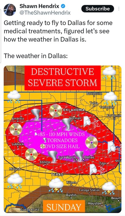
-
Clouds won out here CNJ 80% cloudy but no rain temp dropped from 76 to 72.
-
That Euro run yesterday was on the right track with the best chance of rain today being during the late morning / early afternoon along the warm front boundary. That area of rain is there, but it's fairly splotchy and progressive, so while some localized areas will get soaked, it doesn't appear that widespread big totals are likely.
-
Light rain showers moving in. Heavier band rolling through now. I will take it!
-
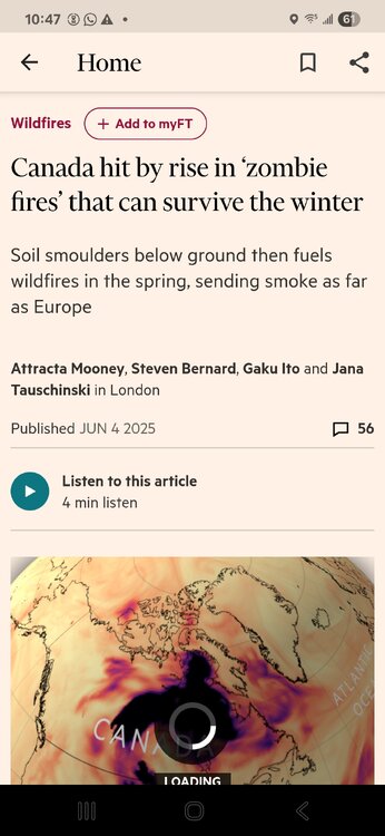
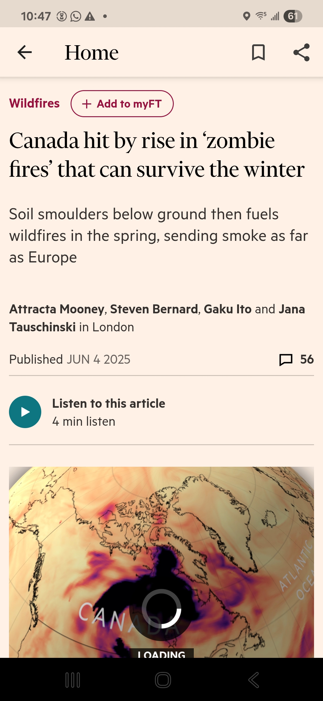
Actually… it apparently was Zombies! https://www.ft.com/content/f87c4c4f-41de-4951-9bdf-286da55aac0f
-
0.63" of rain last night. Smoky skies today with another round of stms possible. Pretty seasonable June so far. Had one hot day on the 2nd, but other than that, pretty decent. Precip is most welcome. Forecast looks good.
-
Maybe once we complete the switch back to -AMO we will have summers like 1993 and 1999 and 2002 and 2010 again.
-
Did you see the temperatures I posted from 2010? WOW, we just need a summer as dry as that to get some nice dry heat.... 101 degrees with a dew point of 45 is some of the cleanest air we can ever get around here. High water vapor in our air is a recipe for air pollution in the summer.
-
https://x.com/capitalweather/status/1931724389088710750
-
Radar not looking good for flooding rains today. Have picked up .40" since overnight, though.
-
It’s just too wet in this new climate to ever see the reservoirs run a low as they did back in 2001-2002 leading to water rationing in NYC. We’ll have to monitor this pattern as the summer progresses. Since more Gulf Hurricane activity riding north inland along the APPS like recent years could create major flood concerns heading through the summer and fall. https://www.nyc.gov/site/dep/water/reservoir-levels.page
-
2:51 PM 99 °F 45 °F 16 % WNW 17 mph 22 mph 29.94 in 0.0 in Partly Cloudy 3:51 PM 99 °F 48 °F 18 % W 18 mph 24 mph 29.92 in 0.0 in Partly Cloudy
-
"Multiple rounds of scattered severe thunderstorms look to push across the region this afternoon and evening (between 2-9pm) as a warm front lifts through. The primary threat with storms will be damaging winds and locally heavy rainfall. An isolated tornado or two is possible mainly south & east of DC. Have a way to get warning via phone, tv, or computer. #MDwx #VAwx #WVwx #DCwx" From LWX Facebook page posted an hour ago
-
and a high of 101 with a dew point of 45 wunderground lists the temp as 99 on this fateful day but in between hours JFK hit 101 as shown in the records July 4th 2010 was my favorite July 4th of all time, in a stretch of 3 out of 4 days at or above 100 degrees and a nice dry heat!! https://www.wunderground.com/history/daily/us/ny/new-york-city/KJFK/date/2010-7-4 Summary Temperature (°F) Actual Historic Avg. Record High Temp 99 82.9 101 Low Temp 70 67.6 59 Day Average Temp 84.43 75.2 - Precipitation (in) Actual Historic Avg. Record Precipitation (past 24 hours from 04:51:00) 0.00 5.20 - Dew Point (°F) Actual Historic Avg. Record Dew Point 55.87 - - High 63 - - Low 45 - - Average 55.87 - - Wind (mph) Actual Historic Avg. Record Max Wind Speed 18 - - Visibility 10 - - Sea Level Pressure (in) Actual Historic Avg. Record Sea Level Pressure 30.01 - - Astronomy Day Length Rise Set Actual Time 14h 59m 5:30 AM 8:30 PM Civil Twilight 4:57 AM 9:03 PM Nautical Twilight 4:15 AM 9:45 PM Astronomical Twilight 3:26 AM 10:34 PM Moon: waning crescent - 1:23 PM Daily Observations Time Temperature Dew Point Humidity Wind Wind Speed Wind Gust Pressure Precip. Condition 11:51 PM 72 °F 63 °F 73 % WSW 7 mph 0 mph 30.02 in 0.0 in Fair 12:51 AM 73 °F 62 °F 68 % WSW 8 mph 0 mph 30.01 in 0.0 in Fair 1:51 AM 71 °F 60 °F 68 % SW 6 mph 0 mph 30.00 in 0.0 in Fair 2:51 AM 70 °F 62 °F 76 % SW 7 mph 0 mph 30.00 in 0.0 in Fair 3:51 AM 74 °F 57 °F 55 % W 9 mph 0 mph 30.00 in 0.0 in Fair 4:51 AM 73 °F 56 °F 55 % W 8 mph 0 mph 30.01 in 0.0 in Fair 5:51 AM 71 °F 59 °F 66 % WSW 9 mph 0 mph 30.01 in 0.0 in Fair 6:51 AM 74 °F 58 °F 57 % WSW 8 mph 0 mph 30.01 in 0.0 in Fair 7:51 AM 76 °F 60 °F 58 % WSW 8 mph 0 mph 30.01 in 0.0 in Fair 8:51 AM 82 °F 56 °F 41 % W 9 mph 0 mph 30.01 in 0.0 in Fair 9:51 AM 88 °F 54 °F 31 % W 9 mph 0 mph 30.00 in 0.0 in Fair 10:51 AM 93 °F 52 °F 25 % NW 10 mph 0 mph 29.99 in 0.0 in Partly Cloudy 11:51 AM 95 °F 51 °F 22 % WNW 14 mph 21 mph 29.98 in 0.0 in Fair 12:51 PM 95 °F 50 °F 22 % W 15 mph 22 mph 29.96 in 0.0 in Fair 1:51 PM 97 °F 51 °F 21 % SW 15 mph 23 mph 29.94 in 0.0 in Fair 2:51 PM 99 °F 45 °F 16 % WNW 17 mph 22 mph 29.94 in 0.0 in Partly Cloudy 3:51 PM 99 °F 48 °F 18 % W 18 mph 24 mph 29.92 in 0.0 in Partly Cloudy
-
Legitimately got surprised overnight, probably the best thunderstorm in a year or 2 here ... 1.25
-
I'm so glad it's not here.
-
clouds will come in later in the day. we're fine through at least 2 pm
-
Is it just high thin clouds or are we smoky in western mass today?
- Today
-
There's a solid easterly flow advocating a decent marine layer across the lowlands.
-
I'm never going to Florida in June again. Jesus Christ...
-
The ground has remained damp from the .03” that came overnight. Had some farm sitting to take care of this morning then came home and planted some flowers. Going to head downtown for the Arts Festival but feels like it will be a sticky afternoon.


.thumb.png.4150b06c63a21f61052e47a612bf1818.png)


