All Activity
- Past hour
-

Central PA Fall Discussions and Obs
Itstrainingtime replied to ChescoWx's topic in Upstate New York/Pennsylvania
Thoughts on Grunkemeyer? I'm pleased with his progress over 3 starts, especially given who he's faced. -

November 2025 general discussions and probable topic derailings ...
mreaves replied to Typhoon Tip's topic in New England
The drop off from Chicago to Joliet would me maddening. -

November 2025 general discussions and probable topic derailings ...
WinterWolf replied to Typhoon Tip's topic in New England
It’s felt quite autumn like for a good month now..so yes. -

November 2025 general discussions and probable topic derailings ...
dendrite replied to Typhoon Tip's topic in New England
The last month has averaged a hair AN, but we haven’t had anything absurd since the first week of October. Of course everyone know’s my opinion about the new normals, but we don’t need to go there after Friday. -
November 2025 general discussions and probable topic derailings ...
WinterWolf replied to Typhoon Tip's topic in New England
What are you trying to do? You obviously feel the need to keep stirring the pot. Why? This is a weather forum. Obviously we all have different ideas on things. I suggest you stop the instigating, and stick to weather discussions. If you want to talk politics or what not, we have a thread for those things. So you can Take it there. -
November 2025 general discussions and probable topic derailings ...
WinterWolf replied to Typhoon Tip's topic in New England
I don’t understand some of these people. Yesterday was gorgeous…but other than that, it’s been very autumnal for weeks. 56 here now..feels nice. But then it’s showers and very cool coming up. -
November 2025 general discussions and probable topic derailings ...
dendrite replied to Typhoon Tip's topic in New England
There’s an inverted trough that swings through there N to S. The mesos initially push a convective band (horizontal to the flow) southwestward through the city and then behind that it aligns into a typical LES streamer where it slowly shifts east from the city to IN. But I agree with Scoot. I think the heaviest is more east toward the IN/IL border. But it should be pretty cold on the west side of the LES with NW sfc flow. -

November 2025 general discussions and probable topic derailings ...
powderfreak replied to Typhoon Tip's topic in New England
I was thinking that… that’s a huge area of 12”+ for a mesoscale style event. -
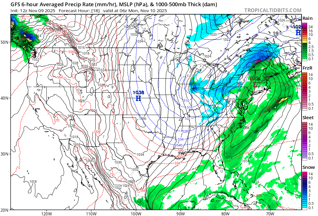
 Actually... They are calling for 10"-16" in Chicago proper tonight and another 2"-4" tomorrow.
 -
This is one of the more impressive lake effect events on Lake Michigan this time of year as a lobe of the TPV tracks behind the synoptic low just east of the Great Lakes.

-

November 2025 general discussions and probable topic derailings ...
CoastalWx replied to Typhoon Tip's topic in New England
Think I would want to be near IL/IN border -
November 2025 general discussions and probable topic derailings ...
CoastalWx replied to Typhoon Tip's topic in New England
It didn’t look impressive on hrrr or nam for the city. Maybe further SE? -
November 2025 general discussions and probable topic derailings ...
powderfreak replied to Typhoon Tip's topic in New England
Silver dollar aggregates.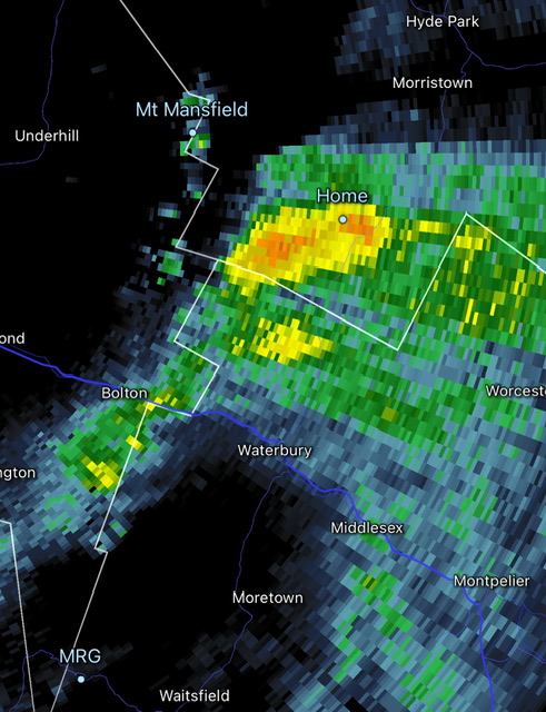
-
It was still too brief a phase 8 last January to significantly weaken the Pacific Jet. So the kicker shortwaves coming into Western North America prevented the record Gulf Coast snowstorm from coming up the coast. Our last impressive MJO 8 was back in January 2022 allowing the Pacific Jet to relax and the great snowstorms to affect ACY-ISP-BOS.
-
 62f, Sunny.....torch-like?
 -
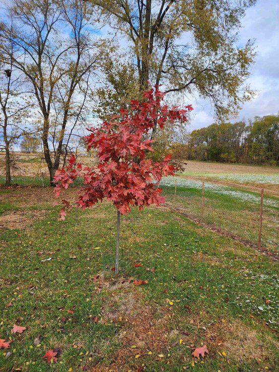
Northern red is at full peak. Oaks running a little behind this year in color, but most are nearing peak now.
-
Great Notre Dame football game last night in the snow showers!
-
The LES event will follow from the circulation of a synoptic event that brought snow from Chicago to Detroit and will deliver an appreciable/significant snowfall in Ottawa, Montreal and Quebec City.
-

11/8-11/10 First Snow and Lake Effect Event
cyclone77 replied to Geoboy645's topic in Lakes/Ohio Valley

-

Central PA Fall Discussions and Obs
canderson replied to ChescoWx's topic in Upstate New York/Pennsylvania
Chicago is about to get hammered by a huge winter storM. Holy crap. Feet of snow possible. -
Thanks, Chris. It still was a 6 day long phase 8 last January (Jan 7-12) that peaked at a decent amplitude of 2.1. I consider that near an average length phase 8 in January rather than brief. Phase 8’s 6 days was as long or longer than any other phase last January as it went around to phase 4. Granted, the average amplitude of the 6 days in phase 8 wasn’t nearly as high as that of phases 1-4, which were closer to 2 and thus not as pronounced an amplitude as those as you said, but it still averaged ~1.3, a moderate phase 8. I consider weak to be <1, moderate 1-2, and strong 2+. So, I have it as an avg length near avg amplitude phase 8 during last Jan. I have phases 1-3 of last Jan at higher than average amp and fairly close to an avg length overall. Phase 4’s amp was closer to avg. *Edited last 2 sentences
-
It’s all lake effect
-
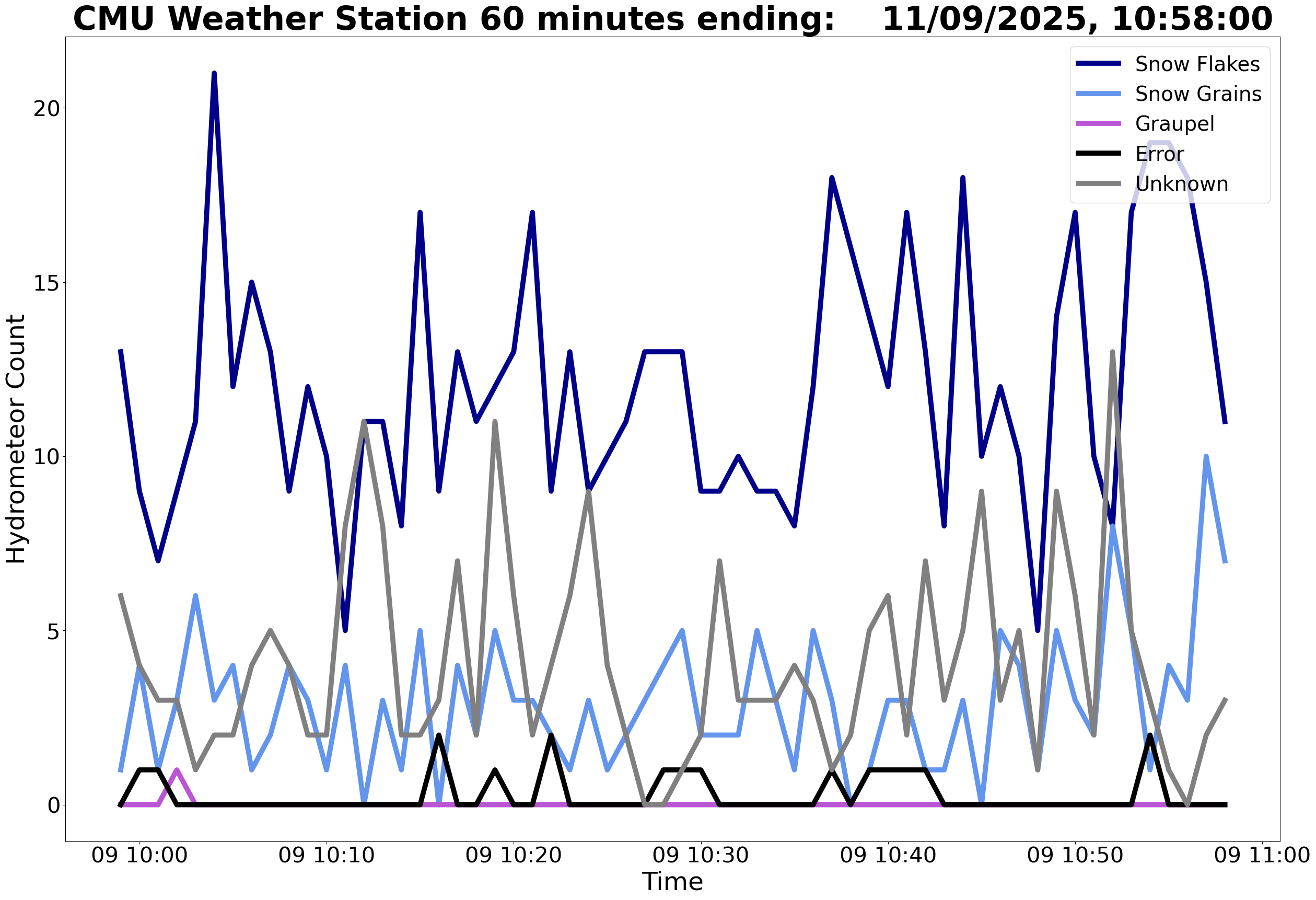
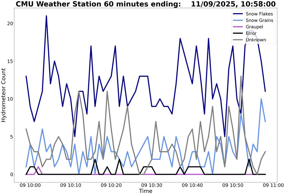
I've been occasionally browsing these myself. Nice of him to provide an explanation here of how it works/what it does/what it's doing.
-
Nice downpour happening.
-
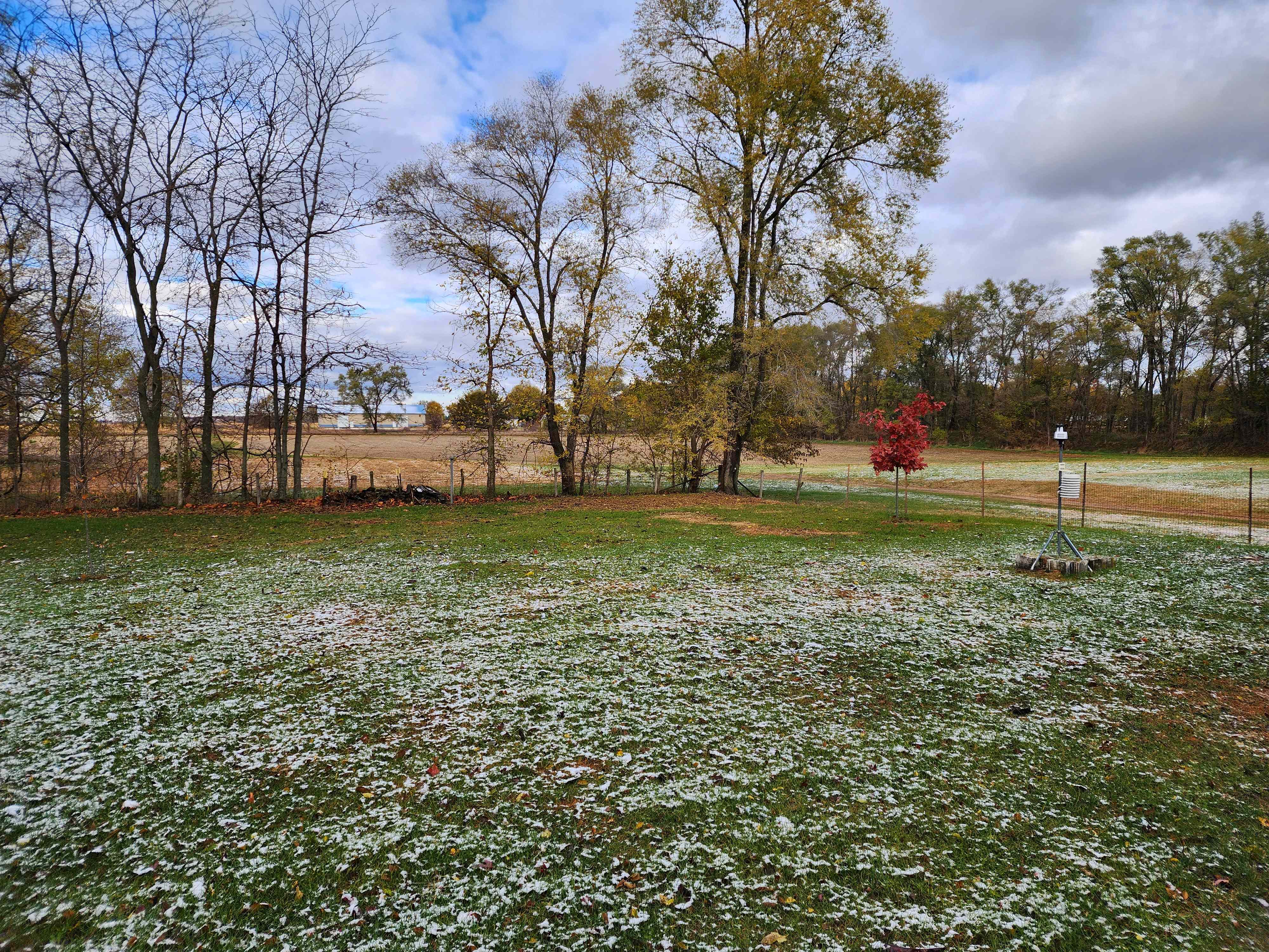
happy for you all in the lake effect bands, grass is partially covered here, and we've had some steady flakes over the past hour.


.thumb.jpg.ad3a2e31d30aff035044689b311a0540.jpg)