All Activity
- Past hour
-
URGENT - WEATHER MESSAGE National Weather Service Baltimore MD/Washington DC 112 PM EDT Sat May 24 2025 MDZ509-VAZ503-WVZ501-505-250115- /O.NEW.KLWX.FR.Y.0005.250525T0500Z-250525T1300Z/ Western Garrett-Western Highland-Western Grant-Western Pendleton- 112 PM EDT Sat May 24 2025 ...FROST ADVISORY IN EFFECT FROM 1 AM TO 9 AM EDT SUNDAY... * WHAT...Temperatures as low as 34 will result in frost formation, especially in valleys. * WHERE...In Maryland, Western Garrett County. In Virginia, Western Highland County. In West Virginia, Western Grant and Western Pendleton Counties. * WHEN...From 1 AM to 9 AM EDT Sunday. * IMPACTS...Frost could harm sensitive outdoor vegetation. Sensitive outdoor plants may be killed if left uncovered. PRECAUTIONARY/PREPAREDNESS ACTIONS... Take steps now to protect tender plants from the cold
-
Real old at this point. Been teased with some brief blue sky and hints of sun, but showers move back in Sent from my SM-S921U using Tapatalk
-
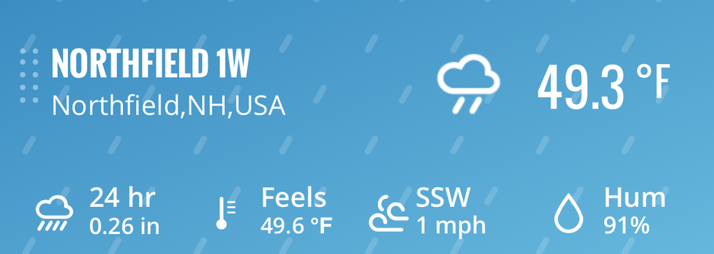
Another dark overcast day 8C/43F, first rays of sunlight briefly in about 100 hours early in aft. This is the shittiest May 18-24 I've ever lived through!
-
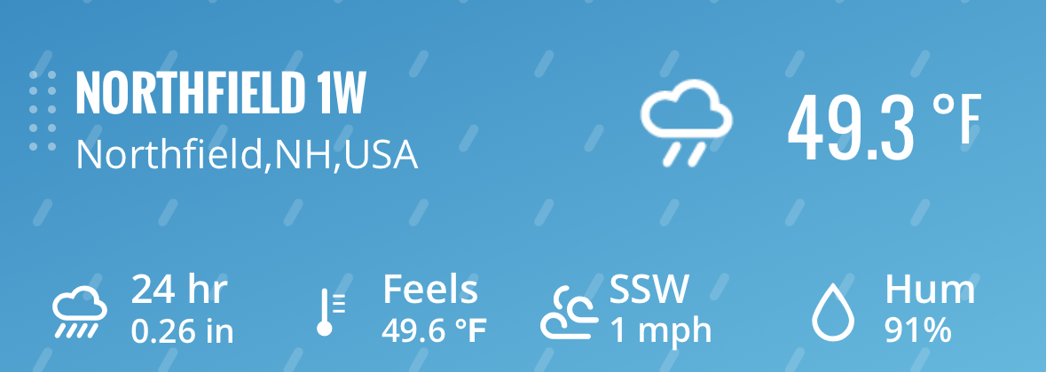
43.0 low here after a 59.8 high. Sun came out and warmed us to 68 earlier, but the clouds and wind have returned in last 2 hours. Currently 65.5/37.6 with a NNW wind at 11 gusting to 19 mph. The 59.8 set a new record 'cool max' for the date breaking 2017's 60.2 degree reading.
-
hopefully it cleared up for you now. the winds are blowing the clouds away lol
-
wow how loud is that? it must be absolutely amazing to be there!
-
nice, did you guys clear up around 2:30 too?
-
What clouds lol
-
and none of those summers were hot either If you go back to 1990 you can see there's even more of these.... 19! You missed the third place finish in 2017.
-
Congrats dude. You rebounded quick. Get crumped…
-
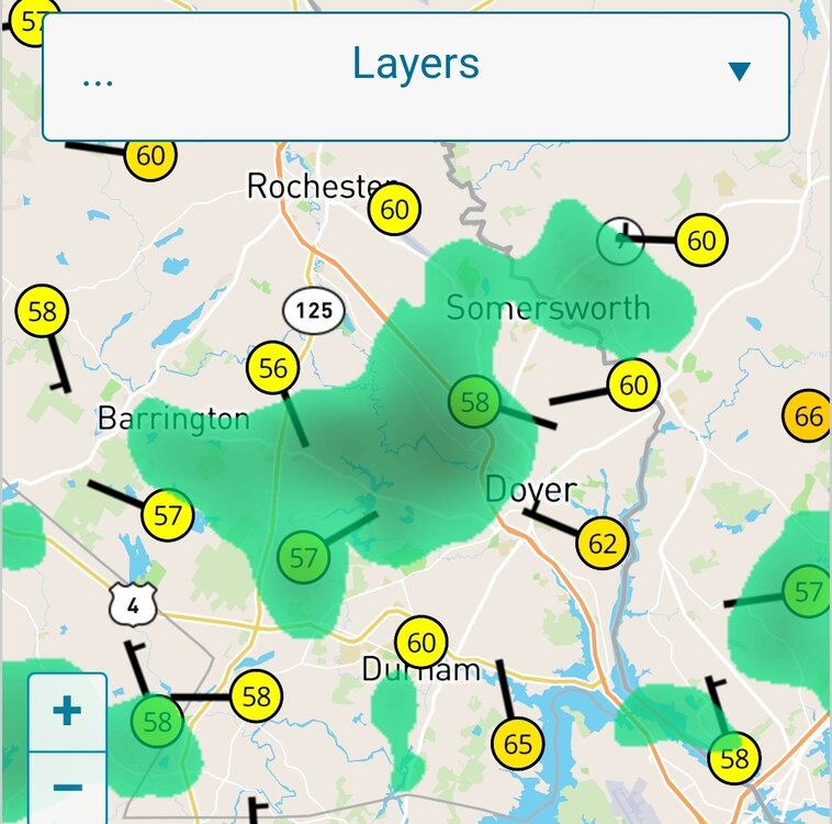
I'm not sure about that, it's been mostly sunny here in SW Nassau since 2:30
-
yes the sun has been out a lot since 2:30 but still very windy
-
it's a relief that the sun has been out a lot since 2:30, no rain here since yesterday
-
this is why we need weather modifications to get rid of ULL. I've seen many mets even talk about this, the ULL is the bane of the existence of the meteorological community.
-
Natl guard should be deployed for crowd control. Sent from my Pixel 9 using Tapatalk
-
I don't know. It seems the winds have been more prevalent the last 10 years ago, or so. I think someone on this site has posted some data, suggesting that this is true...
-
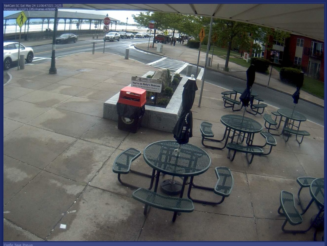
Folks kicking off the holiday at Kelly's on Revere Beach.

-

E PA/NJ/DE Spring 2025 Obs/Discussion
RedSky replied to PhiEaglesfan712's topic in Philadelphia Region
Radar is a popcorn explosion again as the atmosphere is so cold for the season 60F and mostly cloudy, windy Forecast for tomorrow- increasing clouds... -
Wheelies.
- Today
-
As the showers rotate through they are bringing down some strong gusts. Wind, there's something different this year...
-
Have hit snowflakes at 2,900ft.
-
Plenty of sun at jones beach
-
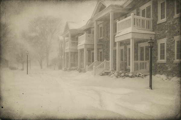
Something to ponder after a third consecutive winter with dismally low snowfall in New York City: Long after winters fade into dreary rain and the wettest of snow that melts on contact with the ground, a daguerreotype might offer the strongest symbol of winters past. Tarnished at the edges, but intact, it will provide a more powerful and permanent testament to the last great snowfall than any faded photo or digital image. Winter's final cold and snowy breath will be preserved for the duration of humanity's existence. In that single image, the passage of time will offer a timeless memory of what winters once were. Daguerreotype-style image recreated from a photo taken at Patchogue, NY during a blizzard on January 29, 2022. Fortunately, for the foreseeable future, such a nightmare does not appear likely in the New York City area and its surrounding suburbs. Even as average seasonal snowfall totals will likely decline as winters warm, there will continue to be occasionally snowy winters and periodic big snowstorms.
-
3rd straight 2pm in late May with rain and 40s
-
Hell, at this point, that’s almost beach weather for me.