All Activity
- Past hour
-

Rise of the Machines: January 18-19 Winter Storm Obs Thread
hooralph replied to WxWatcher007's topic in New England
Forgive me for asking "how much in Drake's back yard?" but I can't sort this out - what's the 3-6 PM forecast for Foxboro? -

Storm potential January 17th-18th
Snowlover11 replied to WeatherGeek2025's topic in New York City Metro
Light snow still falling despite nothing on radar. -

First Legit Storm Potential of the Season Upon Us
BombsAway1288 replied to 40/70 Benchmark's topic in New England
This is not gonna be good for the general public’s perception of weather forecasts in this city. This is gonna be another short-term bust. What is with the near-term modeling this season? Flow too fast? At least it looks entertaining in the long-term -
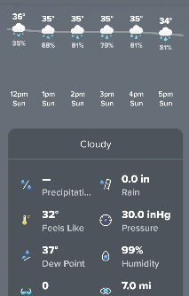
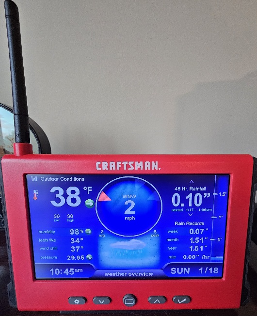
Don't know if we will get an inch or so. As the system swings through the backend snows here for a few hours noon to 7 p.m.. We will have to see if the radar is good for it and the hourly forecast, as temps climbed to 38F.
-
Ah ok I was confused myself. I didn’t know Greyshat was also in pa threads haha. Yes onto the weather!
-
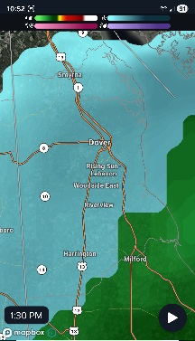
1-1.25” Marianna, FL, just SW of GA/FL/AL corner!1042 AM SNOW MARIANNA 30.78N 85.24W 01/18/2026 M1.3 INCH JACKSON FL PUBLIC ABOUT 1 TO 1.25 INCHES OF SNOW MEASURED AS A FINAL ACCUMULATION.
-
Rise of the Machines: January 18-19 Winter Storm Obs Thread
CarverWX replied to WxWatcher007's topic in New England
Wow we got an inch out of it. What is the temp down there? -

Pittsburgh/Western PA WINTER ‘25/‘26
RitualOfTheTrout replied to Burghblizz's topic in Upstate New York/Pennsylvania
I got about a half inch, maybe a little more. Bare ground is covered. Another light snow tonight into tomorrow morning before the core of the really cold sets in looks to be on tap. -

Rise of the Machines: January 18-19 Winter Storm Obs Thread
Sey-Mour Snow replied to WxWatcher007's topic in New England
HREF is extremely bullish layer.. widespread snow rates around 1”. With 4-8” for all of SNE. And the much needed jack for Scott 8-10” along the emass shore south of Boston -
Wait, I thought he was takling about GreyHat, not you! We're keeping you and Ralph. And Mitch. But to keep this weather related, GFS is basically the same, although that s/ws out just off the pacific coast looks like its trying to do that hook up thing it did yesterday
-
Same with HRRR and HREF
-

Storm potential January 17th-18th
sussexcountyobs replied to WeatherGeek2025's topic in New York City Metro
Light snow continues. Just measured 1.6" new. Temperature is slowly falling from a high of 31.7 to currently 31.1° -

Rise of the Machines: January 18-19 Winter Storm Obs Thread
moneypitmike replied to WxWatcher007's topic in New England
That band crushed Mattapoisett!
-

Central PA Winter 25/26 Discussion and Obs
Jns2183 replied to MAG5035's topic in Upstate New York/Pennsylvania
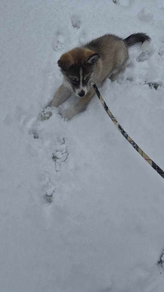
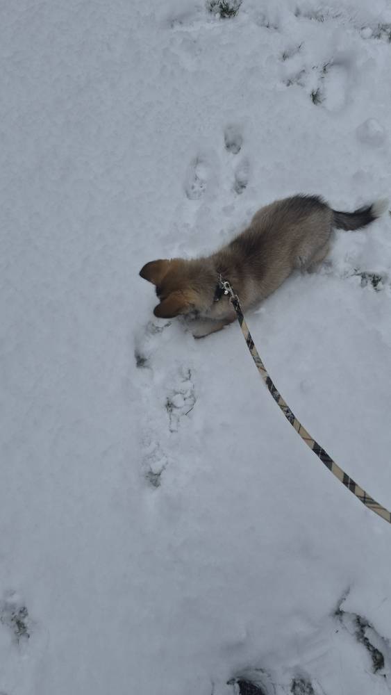
Spent an hour outside with him happy as can be Sent from my SM-S731U using Tapatalk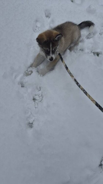

-
I'm in Columbia and haven't seen any snow either.
-
That backend snow line is impressive! Wonder how far east it can go?
-
Central PA Winter 25/26 Discussion and Obs
Jns2183 replied to MAG5035's topic in Upstate New York/Pennsylvania
Any chance you have the original uncompressed images for the first 5 Sent from my SM-S731U using Tapatalk -
Pittsburgh/Western PA WINTER ‘25/‘26
RitualOfTheTrout replied to Burghblizz's topic in Upstate New York/Pennsylvania
If a storm cuts to far NW, for SW PA its fairly easy to scour out cold air absent a well placed high to funnel cold dry air down and even then we usually end up with sleet or freezing rain. Areas in central PA and east of the Appalachian mountains can dam up cold air thanks the mountains. In a good CAD setup its not uncommon for us to rain, while well South into VA still has frozen. -
Upton lowered high temp here from 36 to 33, and my temp had actually dropped back a bit in the past 20. So I don’t see rain being an issue at the coast either. Just gotta get the dynamics to pop for a bit
-

First Legit Storm Potential of the Season Upon Us
dryslot replied to 40/70 Benchmark's topic in New England
Saw this coming last night, I never got onboard this had a west limit once this was spread out and just weak waves of LP along the boundary. -
What did I do? lol
-

Storm potential January 17th-18th
EastonSN+ replied to WeatherGeek2025's topic in New York City Metro
GFS still to come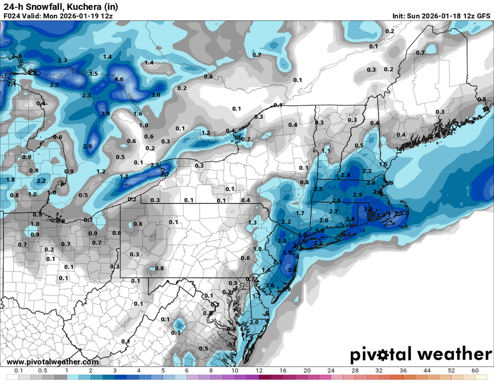
-
Getting liquid snow here
-
Model guidance shows this is doable
-
That's very bullish from upton. But really highlighting how the shorelines will only have an inch or two. And considering we have around 1" in parts of NYC, they believe we'll only have 2 more by the time the storm is done. HRRR is big on the moderate-heavy snow this evening, but most other guidance only has 1-2" more inches for most of us.