All Activity
- Past hour
-
 Last week? This week just started. You seem to be in for hibernation this week.
 -
We got caught up the last storm cause it was so cold coming into it. WAA events are notorious for us to under perform for ratios. @MN Transplantbasically had 10-1 for the snow push in the morning. Coastals are better but again, unless we are deformed to death I’m never assuming anything more than 12-1 at most.
-

The “I bring the mojo” Jan 30-Feb 1 potential winter storm
CaryWx replied to lilj4425's topic in Southeastern States
-
 WE WEENIE!!!
 -
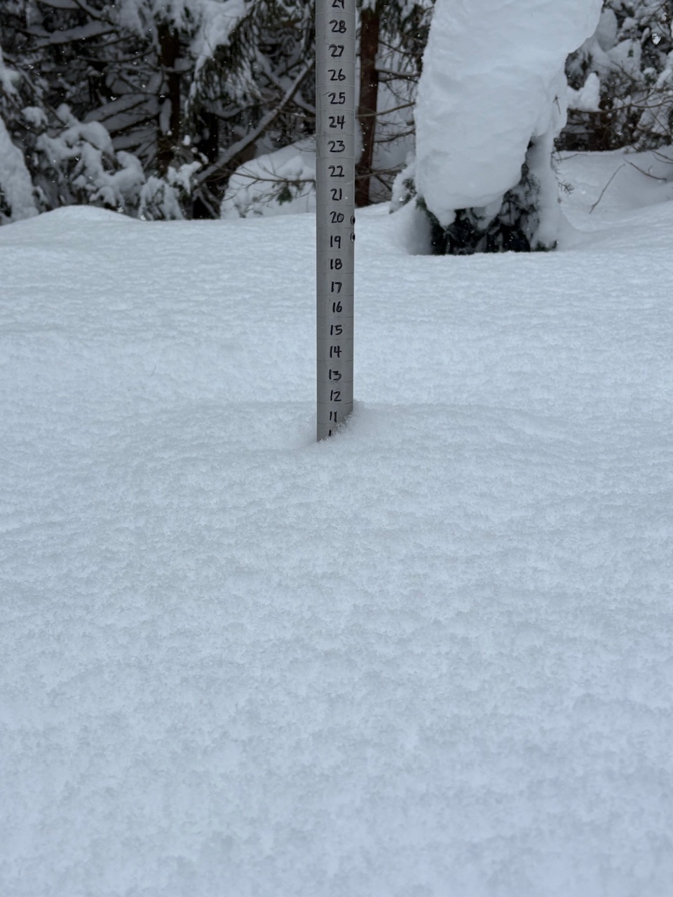
 Tried to grab a pic of how it’s stacking. Not as good as Dave’s but same idea
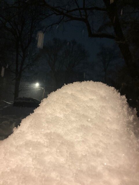
-
Nice
-
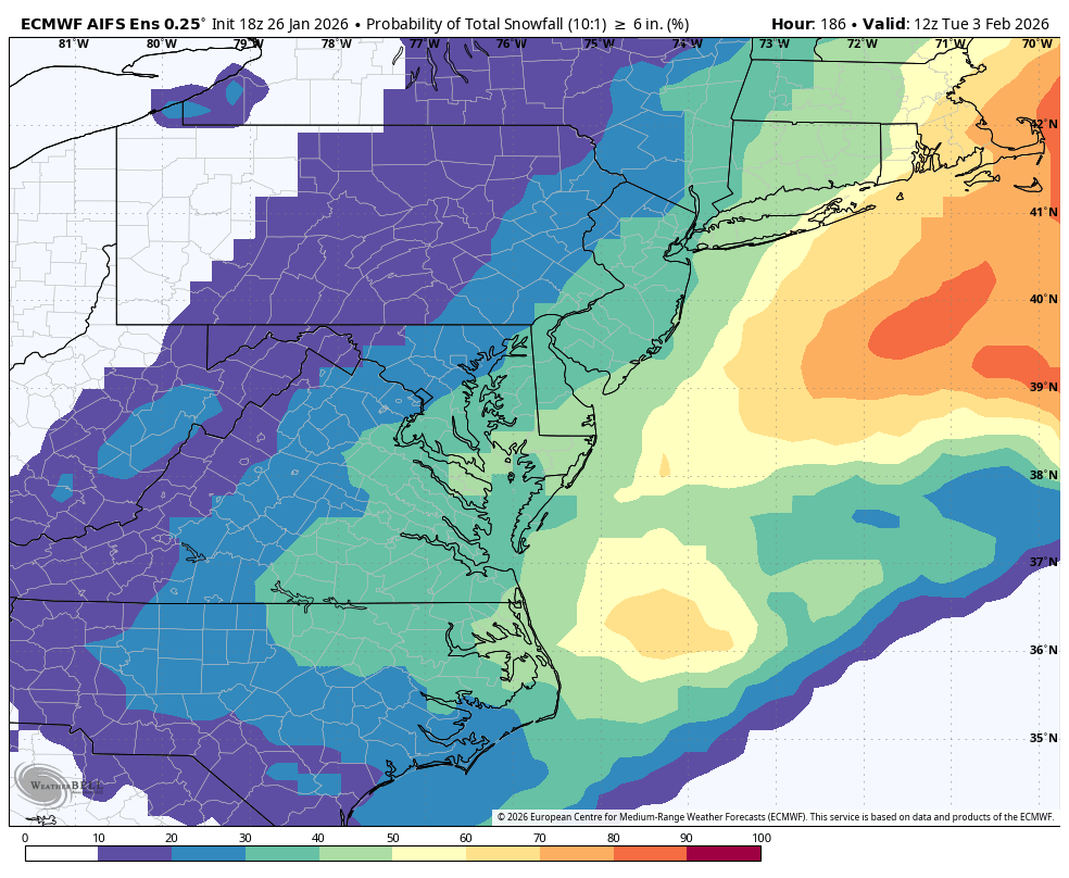
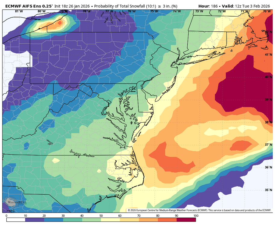
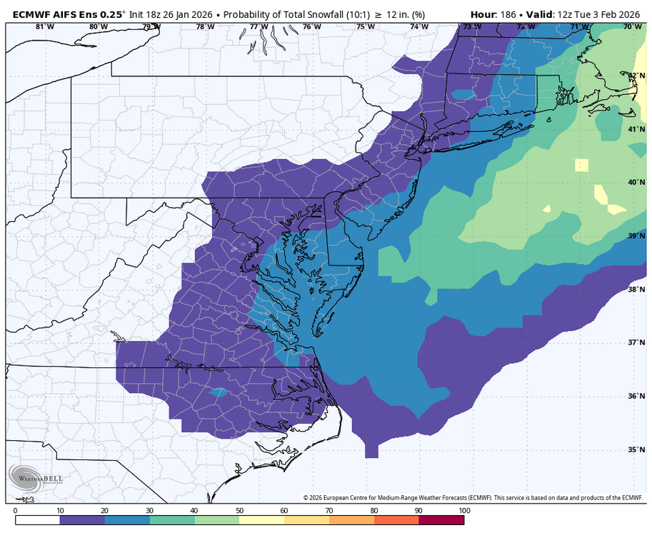
WB 18Z AI snow prob..

-
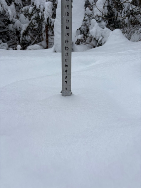
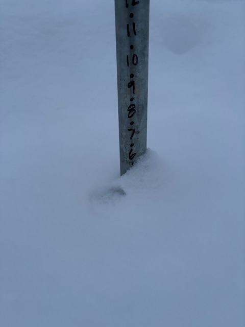
Added 5” today for 16” total. 1,500ft was 10” + 6”… or like 10.5” and 5.5”. Either way 16” at all elevations.

-

Central PA Winter 25/26 Discussion and Obs
Blizzard of 93 replied to MAG5035's topic in Upstate New York/Pennsylvania
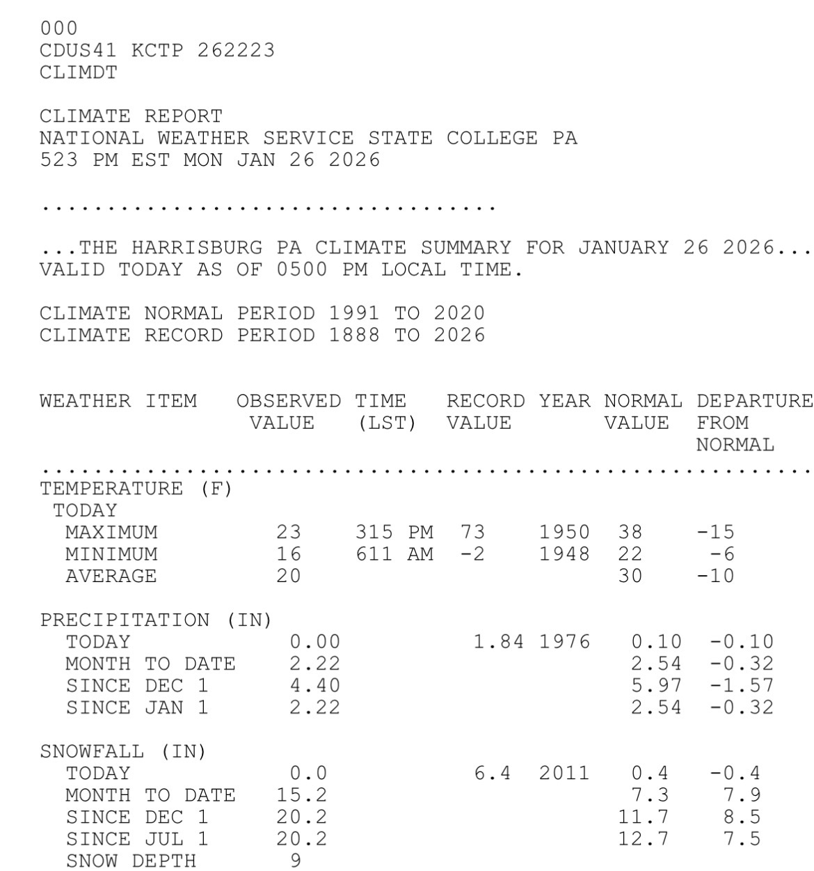
Side note, when CTP revised it down to 12.5 for the event, they didn’t revise the month & year to date snow properly. Today with the 5 pm summary, the month to date & seasonal snow to date are now all correct.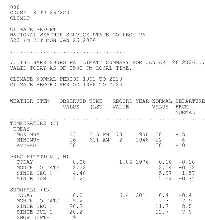
-

The “I bring the mojo” Jan 30-Feb 1 potential winter storm
BornAgain13 replied to lilj4425's topic in Southeastern States
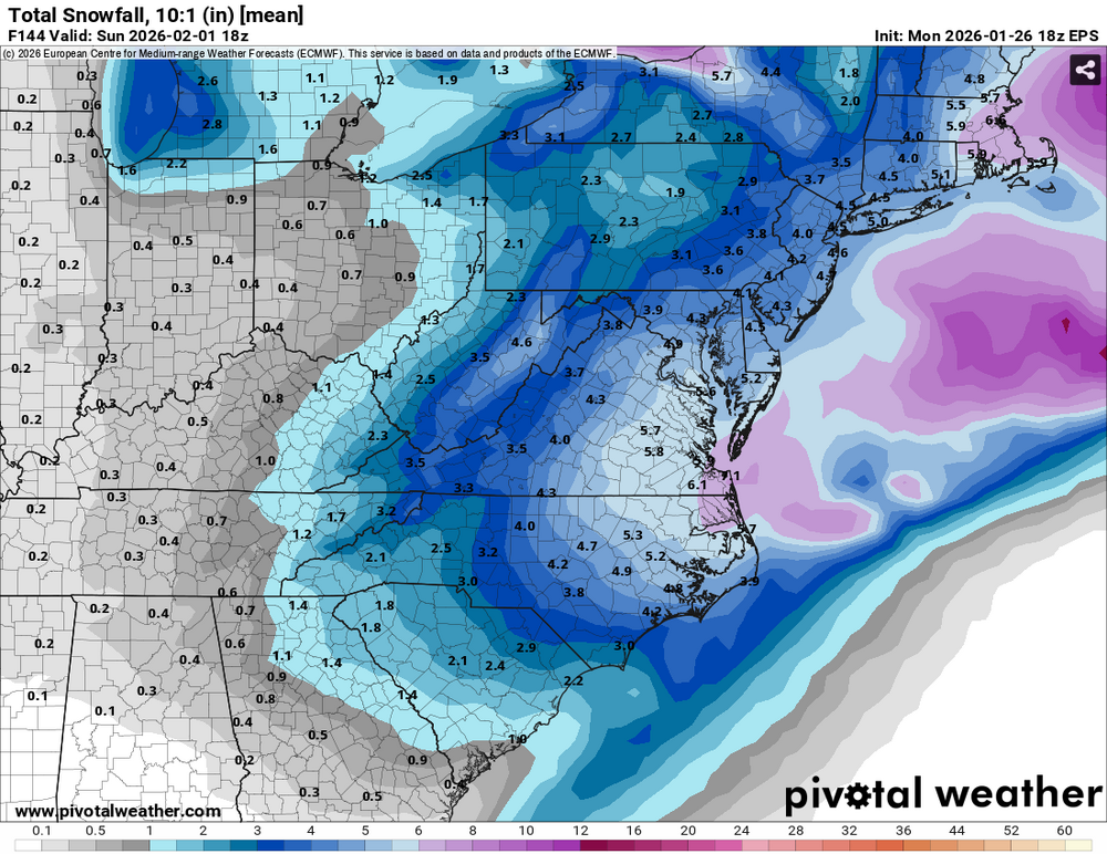
18z Euro and Euro AI are big hits. -
catwrestle.mpg
- Yesterday
-

The “I bring the mojo” Jan 30-Feb 1 potential winter storm
HKY_WX replied to lilj4425's topic in Southeastern States

-
EPS-AI is about the same as 12z, which means it's a good signal
-
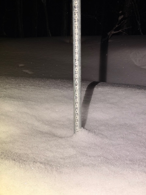
About the same here in Stowe. Also had 16” at both 1,500ft and 3,000ft snow plots on Mansfield. Very even snowfall distribution with no change in elevation.
-
 eyeballing a little over 2” since 5 pm
 -

January 2026 Medium/Long Range Discussion
SomeguyfromTakomaPark replied to snowfan's topic in Mid Atlantic
I would LOVE 3-6 or 4-8 snow on snow in an arctic pattern with good ratios. But heck let’s get this to trend back to a blizzard, still possible. -

Central PA Winter 25/26 Discussion and Obs
AccuChris replied to MAG5035's topic in Upstate New York/Pennsylvania
18z Euro Op was a tad better than the 12z. Damn, 963mb low…tuck that into the coast and bombs away . -
 Stacking up quickly. BOS may be able to pull off a top-10 storm after all.
 -
 Long nap I was exhausted after this week.. ripping here still looks like we might reach or 2ft storm total
 -

Richmond Metro/Hampton Roads Area Discussion
RVASnowLover replied to RIC Airport's topic in Mid Atlantic
The way this last storm went I won’t feel comfortable until probably Thursday -

Possible coastal storm centered on Feb 1 2026.
Baroclinic Zone replied to Typhoon Tip's topic in New England
18z EPS pretty similar to 12z. Bit deeper MSLP, so slight bump up in precip total. -
 Great flakes now. We stack
 -

The “I bring the mojo” Jan 30-Feb 1 potential winter storm
Omen replied to lilj4425's topic in Southeastern States
Nice uptick on the EPS for those of us in Virginia.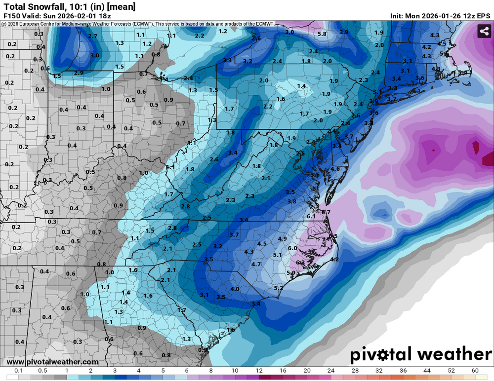
-
That's not bad for this far out. Models are clearly still working it out.
-
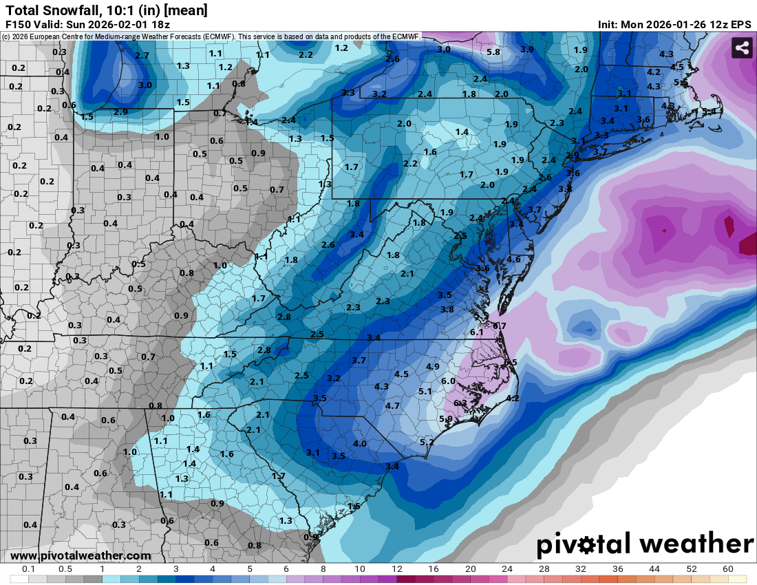
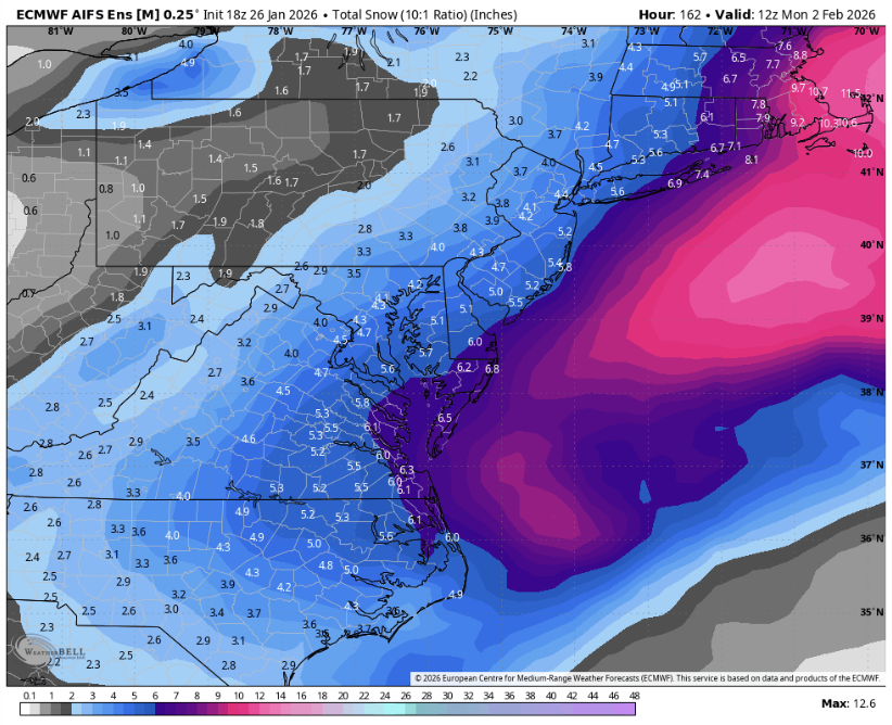
Reminder that 3-6" shown there is more like 5-10" with ratios