All Activity
- Past hour
-

Pittsburgh PA Fall 2025 Thread
TheClimateChanger replied to TheClimateChanger's topic in Upstate New York/Pennsylvania
Will be interesting to see whether the Youghiogheny River Lake approaches the lows of last autumn. Currently, around 1415.8' ASL. Looks like it fell to around 1,369' in early November 2024, although I'm not sure of the exact low. Further research suggests a low of about 1,362' in December 1998, and a value in 1991 of about 6' higher than that. The December 21, 1998 low was said to have been exceeded twice, in 1954 & 1957. Source: A bridge to the 19th century Not sure we reach as low as last fall unless October is dry, but decent odds of dropping below 1,400' again. Not sure when the "ghost bridge" becomes visible. -

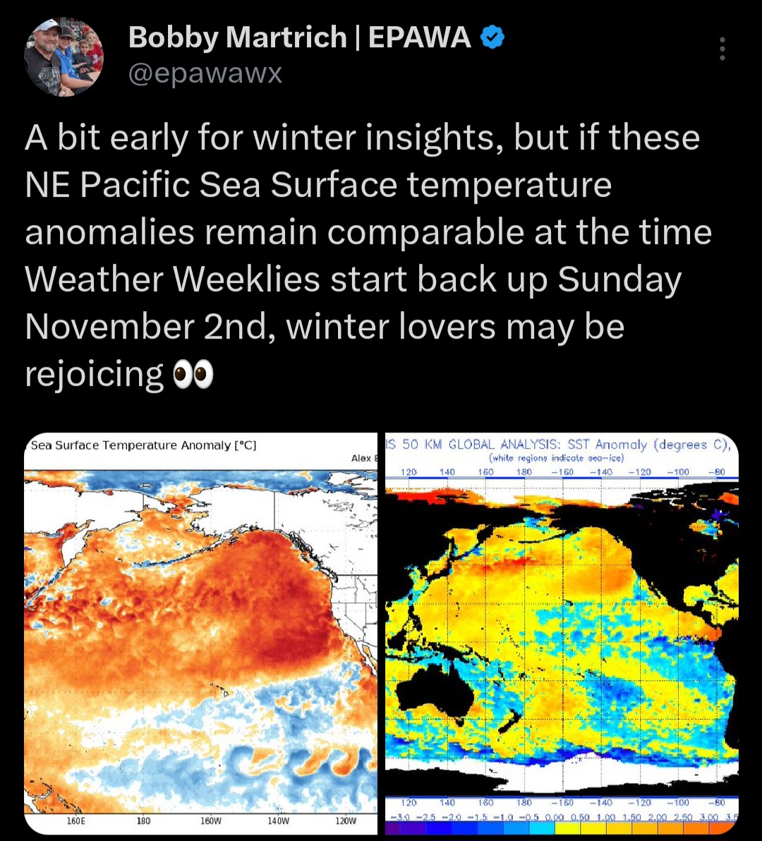
2025-2026 ENSO
Stormchaserchuck1 replied to 40/70 Benchmark's topic in Weather Forecasting and Discussion
The Apr-May SLP pattern in the Atlantic was a giveaway.. something to look at in future years. Pattern never really supported a major warming of tropical Atlantic SSTs. -
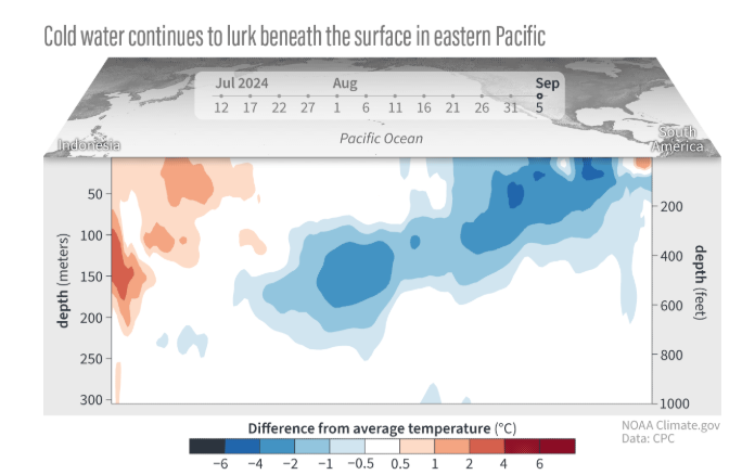
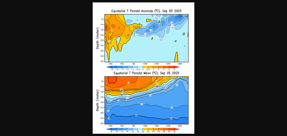
@bluewave @donsutherland1 Lack of eastward MJO propagation, -IOD and persistent strong trades has lead to a deep -AAM and La Niña like regime
-
Top 10 afternoon
-

-
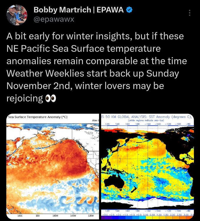
Maybe the time has come to rethink parameters such as SSTs/AMO and ENSO for seasonal hurricane forecasts….
-
Congrats Maine!!!
-

September 2025 OBS-Discussion centered NYC subforum
Brian5671 replied to wdrag's topic in New York City Metro
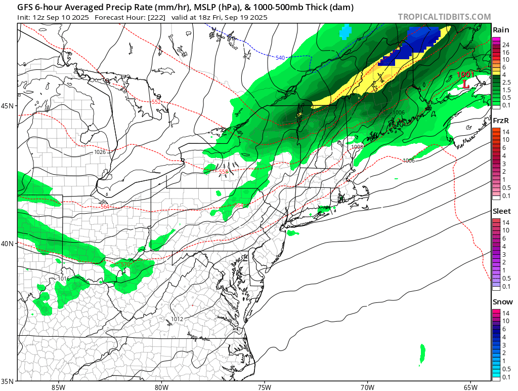
Cutoff lows notoriously difficult with precip placement. But would be nice to get another dump of rain and on a Monday-that would be great -

September 2025 OBS-Discussion centered NYC subforum
FPizz replied to wdrag's topic in New York City Metro
CMC wet east of NYC, drier west, but other models have nothing -
September 2025 OBS-Discussion centered NYC subforum
Brian5671 replied to wdrag's topic in New York City Metro
Euro wet for next Monday - Today
-
https://www.cpc.ncep.noaa.gov/data/indices/RONI.ascii.txt Enso is about similar this year as it was last year,to this date anyways
-
That is what happens with wishcasters...lol
-

September 2025 OBS-Discussion centered NYC subforum
wdrag replied to wdrag's topic in New York City Metro
I'll need to wait this out... one thing I didnt see was EC AI was almost nothing. It could be the EC suite (non AI) is too strong and too far southwest with the 5H vort plunging sdwd from south center Canada with the resultant sfc response too robust here. Would make this a period of waa showers Sunday afternoon and maybe cool frontal showers Monday. I do think its best to play temps conservatively and cooler in this pattern for another 10 days and wait this out a bit but I plan on showers Sunday afternoon and possibly right into Monday night. Patience... at least for me til a I reconsider later on. 12z WPC D4-6 guidance has boosted qpf a bit and I think that right... dont plunge into the unusual heavy solution till we have more confidence. Lets not say its a nice end to the weekend beginning of next week. -
Its been gone and lol to the ones "wishing" it was still here.
-
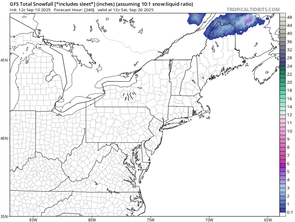
No I meant that it kept lows up. Not ready for cold.
-

2025 Atlantic Hurricane Season
Silver Meteor replied to BarryStantonGBP's topic in Tropical Headquarters
Thank you Cholorob for your intelligent reply. Now, getting back to the tropics, or even sub-tropics ... While everyone has been searching for straws there's a little one (potential yellow down the road?) from here in Eastern North Carolina ... Morehead City NWS Discussion: There are some indications of a weak low forming along the stalled front/coastal trough off the FL/GA/SC coast this coming weekend into early next week as a deep positively tilted trough moves through. It is too soon to tell what impacts, if any, are expected with very low confidence on the timing, track, and intensity of the low should it form. At the minimum, winds should pick up a notch thanks to the tightened pressure gradient. This results in a higher degree of uncertainty for the forecast this weekend onwards. -
It’s been gone but I feel for those that repeatedly called for endless summeh thru cOctober.
-
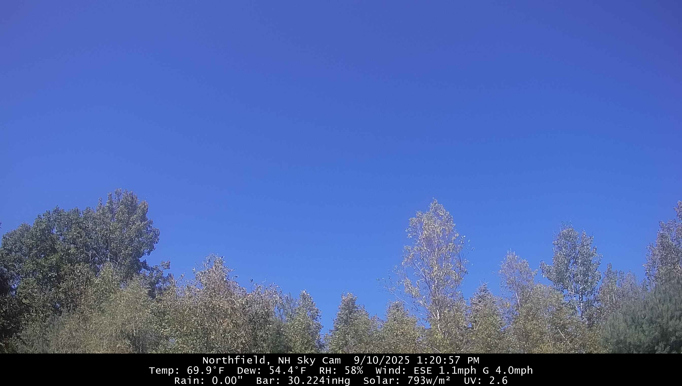
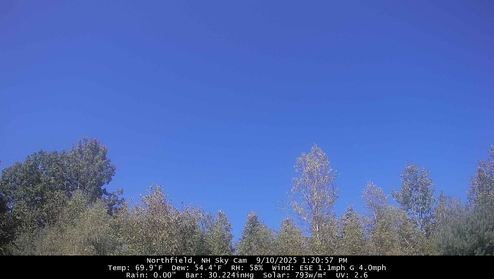
Nice! I've seen almost no deer sign in our woodlot, though our new neighbors (they plan to build next summer, now doing some road and clearing work) have captured does and a nice buck on their trailcams. Another sunny cool day.
-

September 2025 OBS-Discussion centered NYC subforum
psv88 replied to wdrag's topic in New York City Metro
Water levels are high on the north shore. Probably a 1.5 feet above normal. Stiff breeze as well -
We uninstalled. Could’ve done it a week ago.
-
Like the 0Z run had (I didn’t post it), the 12Z UKMET continues with the MDR TS, very likely headed for a recurve in the middle of the ocean: NEW TROPICAL CYCLONE FORECAST TO DEVELOP AFTER 114 HOURS FORECAST POSITION AT T+114 : 13.3N 34.5W LEAD CENTRAL MAXIMUM WIND VERIFYING TIME TIME POSITION PRESSURE (MB) SPEED (KNOTS) -------------- ---- -------- ------------- ------------- 1200UTC 15.09.2025 120 14.2N 35.3W 1008 28 0000UTC 16.09.2025 132 15.1N 38.9W 1007 30 1200UTC 16.09.2025 144 16.7N 41.0W 1006 36 0000UTC 17.09.2025 156 17.7N 42.9W 1005 41 1200UTC 17.09.2025 168 19.2N 45.2W 1003 44
-
gwlh
-
 9th out of the esteemed bunch of 22 isOK Congrats to the top!
 -
-