All Activity
- Past hour
-
 Highs: PHL: 94 TEB: 91 EWR: 90 New Brnswck: 89 TTN: 88 * missing data ISP: 88 LGA: 88 * no intra hour NYC: 88 * no intra hour JFK: 85 * no intra hour highs ACY: 84 BLM: 81
 -
YES , but hearing something like that "live" totally different!
-
Pack it up bozo Rest in piss 98L you won't be missed
- Yesterday
-
The "DO NOT LOOK" possible Fernand. Still there after a couple of model runs. That is all. The eye has appeared on ERIN.
-

Hurricane Erin - 75 mph - 993 mb - WNW @ 17
WxWatcher007 replied to BarryStantonGBP's topic in Tropical Headquarters
VDM puts it at 984mb -
Any chance his idea is the right one?
-
I still believe this winter will be kinda similiar to last winter.It should start out warm and wet as the potential for a -IOD as we get into severe fall,early winter.The MJO right now is fixing to creep along the IO the next several days with a potential strong EWB,this abide should strengten NINA upcoming.Our severe season last year was headed into a top record breaking season until that strong Bearing Sea blocking took shape into early spring,this caused the jet to go further north and brought more severe into the OV
.thumb.png.1cd86810af615a880bc726cfe934097c.png)
-
It happens to me a lot. I tend to start heading ESE around 6 as my customers close so I'll often chase, or be chased by, storms as they work this way. It's a real hoot in the winter as a front is working down and I can watch "the wall" behind me in the mirror. I dunno what juicy, window splattering, paint wrecking, headlight blocking insect-like critters they are but I can tell you that they suck.
-
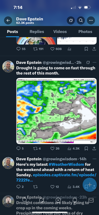
It is never going to rain again. All the grass around is dead deed dead.
-
Always happy for our boy
-
lfg
.thumb.png.8805cd2bedeacfa739bf5674c37dc1a7.png)
-
Flash - bang!! Love it.
-
Hurricane Erin - 75 mph - 993 mb - WNW @ 17
WxWatcher007 replied to BarryStantonGBP's topic in Tropical Headquarters
981.4mb extrapolated -
obligatory la-la land Savannah hit on 18z gfs ...always one per year

-
He’s getting hard, fast ..
-
Looks pretty kewl, thanks for sharing.
-
Hurricane Erin - 75 mph - 993 mb - WNW @ 17
WxWatcher007 replied to BarryStantonGBP's topic in Tropical Headquarters
Right. I’m guessing the central pressure has dropped a few mb since then. This looks primed to take off now. -
Some mexico city views for my fellow heads, fresh snow on the volcanos most mornings, melts off popo (active) during day. Managed a killer hike up into the national park, snow level looked about 16k (summits 17k+) Weather here is incredible this time of year, highly rec View of fresh snow on summit morning after our hike Pyramids also extremely sick S tier food obv Ready for a bit more storm action in the Midwest and ready for fall
-
2025 Atlantic Hurricane Season
WxWatcher007 replied to BarryStantonGBP's topic in Tropical Headquarters
I’ve been sold all year on the SW Atlantic being the seasonal hot spot. Erin was the first real test and we’re seeing how that’s likely to go… This won’t be the last time the east coast is watching a major imo, but waves actually have to get to that part of the basin first. -

Hurricane Erin - 75 mph - 993 mb - WNW @ 17
Wannabehippie replied to BarryStantonGBP's topic in Tropical Headquarters
986mb on first pass of latest recon -
Hurricane Erin - 75 mph - 993 mb - WNW @ 17
WxWatcher007 replied to BarryStantonGBP's topic in Tropical Headquarters
Recon approaching for another center pass. We’ll see just how quickly this is intensifying shortly. -

2025 Atlantic Hurricane Season
LongBeachSurfFreak replied to BarryStantonGBP's topic in Tropical Headquarters
Heading into peak with above normal water temps in all but the far east MDR anything is possible. -
Cedar Rapids getting smoked pretty good
-
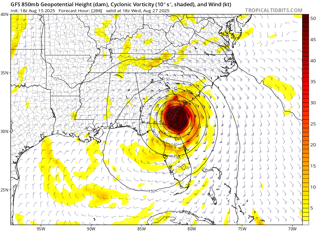
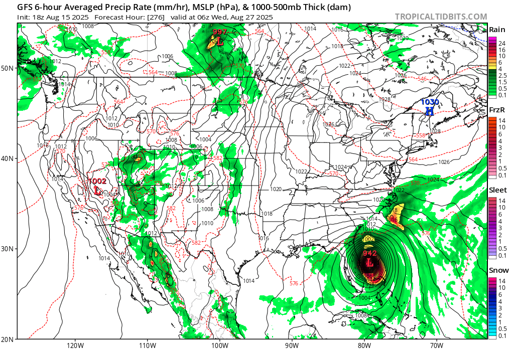
big 'un on the wild 18z gfs

-
IF that happens, the seasonal ACE would reach ~34 as of 8/22. If then another multiday hurricane were to closely follow Erin like the GFS/GEFS are suggesting could occur, having 50ish ACE by the end of August would be a reasonable possibility especially considering there could easily abe an additional weaker storm or two, which would out 2025 notably above the normal ACE through August.


.png.ccdc638214d89d85fbd7058775177c73.png)


.png.993c3e65baa5cf9db92dc3425d84ef86.png)