All Activity
- Past hour
-

11/8-11/10 First Snow and Lake Effect Event
sbnwx85 replied to Geoboy645's topic in Lakes/Ohio Valley
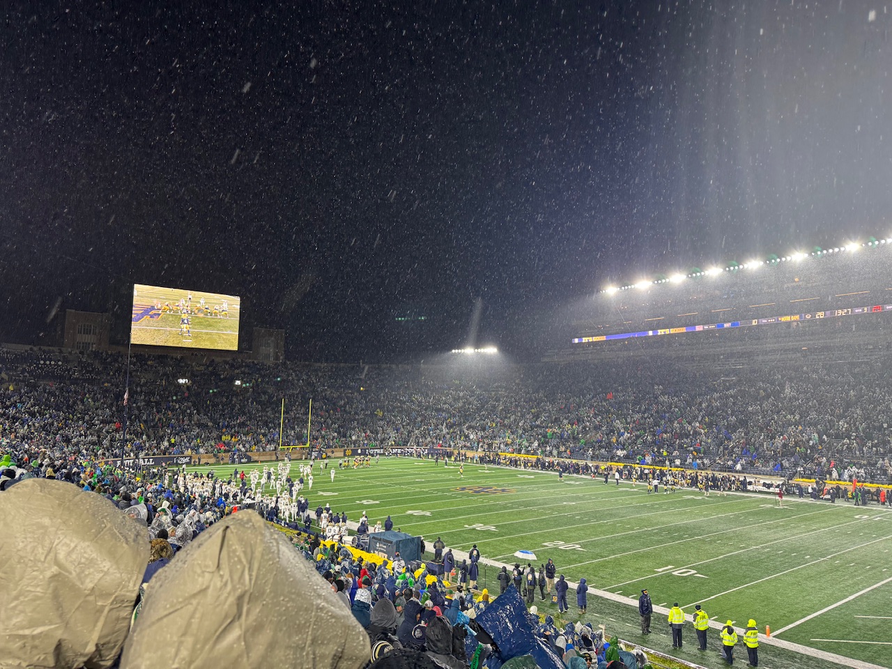
At the Notre Dame game and snow is already mixing in with the rain.
-

11/8-11/10 First Snow and Lake Effect Event
cyclone77 replied to Geoboy645's topic in Lakes/Ohio Valley
First flakes of the season here, as we now have wet flakes mixing in. Temp dropped pretty quickly from near 40 to 35 in the past hour or so. 0.58" rain so far. -
Anyone see the winter storm watches on the TN side of the smokies?
-

November 2025 general discussions and probable topic derailings ...
powderfreak replied to Typhoon Tip's topic in New England
I guess, but it’s like 5 seconds… -
00z HRRR is rather impressive with the frontal passage tomorrow evening. Decent little line and then we get chilly.
-
 But we shouldn’t have to do all this extra work in this day and age. It should automatically happen .
 -

11/8-11/10 First Snow and Lake Effect Event
donsutherland1 replied to Geoboy645's topic in Lakes/Ohio Valley
Ottawa has a snowfall warming for 4"-8". Detroit to Toronto should also see measurable snowfall. Winter is getting off to a good start parts of the Great Lakes Region. From Environment Canada: 4:00 PM EST Saturday 8 November 2025 Snowfall Warning in effect for: Ottawa North - Kanata - Orléans Significant snowfall expected Sunday. What: Snowfall amounts of 10 to 20 cm. When: Beginning Sunday morning and continuing into Sunday night. Additional information: A low pressure system will bring snowfall to parts of southern Ontario on Sunday. Areas near the St. Lawrence River may see snow mix with ice pellets or freezing rain at times Sunday evening, leading to reduced snowfall amounts in that area. Motorists should expect difficult winter driving conditions and adjust travel plans accordingly. Poor weather conditions may contribute to transportation delays. Visibility will likely be reduced at times. -
I think we will have some through Christmas
-
And also the real “Rain Cold” as he is also known. Based on ensemble 2 week progs, the -NAO for Nov overall is quite possibly (or even probably) going to end up the strongest since 2010. 2000 is a Nov strong -NAO, late Nov weak SPV, and active sunspots analog. If the MJO were to keep going and get into 7/8/1/2/3 in Dec, that would also be like 2000.
-

November 2025 general discussions and probable topic derailings ...
kdxken replied to Typhoon Tip's topic in New England
Yeah you just have to post it as plain text. -
Highs: ACY: 71 EWR: 69 PHL: 69 ISP: 68 New Brnswck: 67 BLM: 67 TEB: 67 JFK: 67 LGA: 67 TTN: 67 NYC: 65
-
 snowlover2 changed their profile photo
 -
November 2025 general discussions and probable topic derailings ...
powderfreak replied to Typhoon Tip's topic in New England
Twitter is not that hard… I post them all the time just fine on here. Just change the X.com to Twitter.com and paste it and it’ll embed. We see every single Twitter post from Margarbage on here just fine lol. -

2025-2026 ENSO
40/70 Benchmark replied to 40/70 Benchmark's topic in Weather Forecasting and Discussion
I putting the finishing touches on my stuff....just about done. If not this weekend, Monday, -
November 2025 general discussions and probable topic derailings ...
powderfreak replied to Typhoon Tip's topic in New England
December 2003 -
What id give to see that look a month from now
-
 December 2020?
 -
Ya know... I'd like to know from you what you think is coming? I'm quite curious what's going on in that hay brain of yours.
-

11/8-11/10 First Snow and Lake Effect Event
Sciascia replied to Geoboy645's topic in Lakes/Ohio Valley
Flakes in Poplar Grove. I won’t be in on the lake effect fun, but the first snow of the season is always enjoyable. -

2025-2026 ENSO
michsnowfreak replied to 40/70 Benchmark's topic in Weather Forecasting and Discussion
Todays weeklies are colder than yesterday starting December 1st. They oscillate often. But so far no warm signal at all in December. -
Is that the "real" cold rain?
- Today
-
https://x.com/RealColdRain/status/1987327115432485264?t=YnAHdUtJ1jiwSxkbIsKdpw&s=19
-

November 2025 general discussions and probable topic derailings ...
Ginx snewx replied to Typhoon Tip's topic in New England
Feb2001 -

November 2025 general discussions and probable topic derailings ...
dendrite replied to Typhoon Tip's topic in New England
Nope -
November 2025 general discussions and probable topic derailings ...
Ginx snewx replied to Typhoon Tip's topic in New England
March 2001 -
2025-2026 ENSO
40/70 Benchmark replied to 40/70 Benchmark's topic in Weather Forecasting and Discussion
No surprise to me....I was saying I wasn't at all considering La Niña peaking early when you commented on the subsurface warmth last month. Same thing happened over the summer, and in 2008....which peaked LATE.