All Activity
- Past hour
-
It looks like some models got the qpf right but the thermals wrong at 850. The lighter qpf models look like they're missing but were better on thermals.
-

2025-2026 Fall/Winter Mountain Thread
MotoWeatherman replied to Buckethead's topic in Southeastern States
Finally getting a few random flakes here at 4650 on Beech. HRRR does not look promising to say the least. -
In the long run you’re a lot better off living where you do.
-
I’m sad lol. Least I’ll be at work and maybe see a little something in Jefferson county WV
-

December 4th through 5th 2025
Daniel Boone replied to Holston_River_Rambler's topic in Tennessee Valley
Everything appears to be a bit North of what guidance had been indicating. SEKY across Wise County should do decent Snow wise. -
The sad part is that one inch of snow on a week day cripples this area.
-
Yeah this will accumulate efficiently on roads, especially side roads.
-
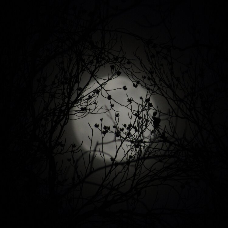
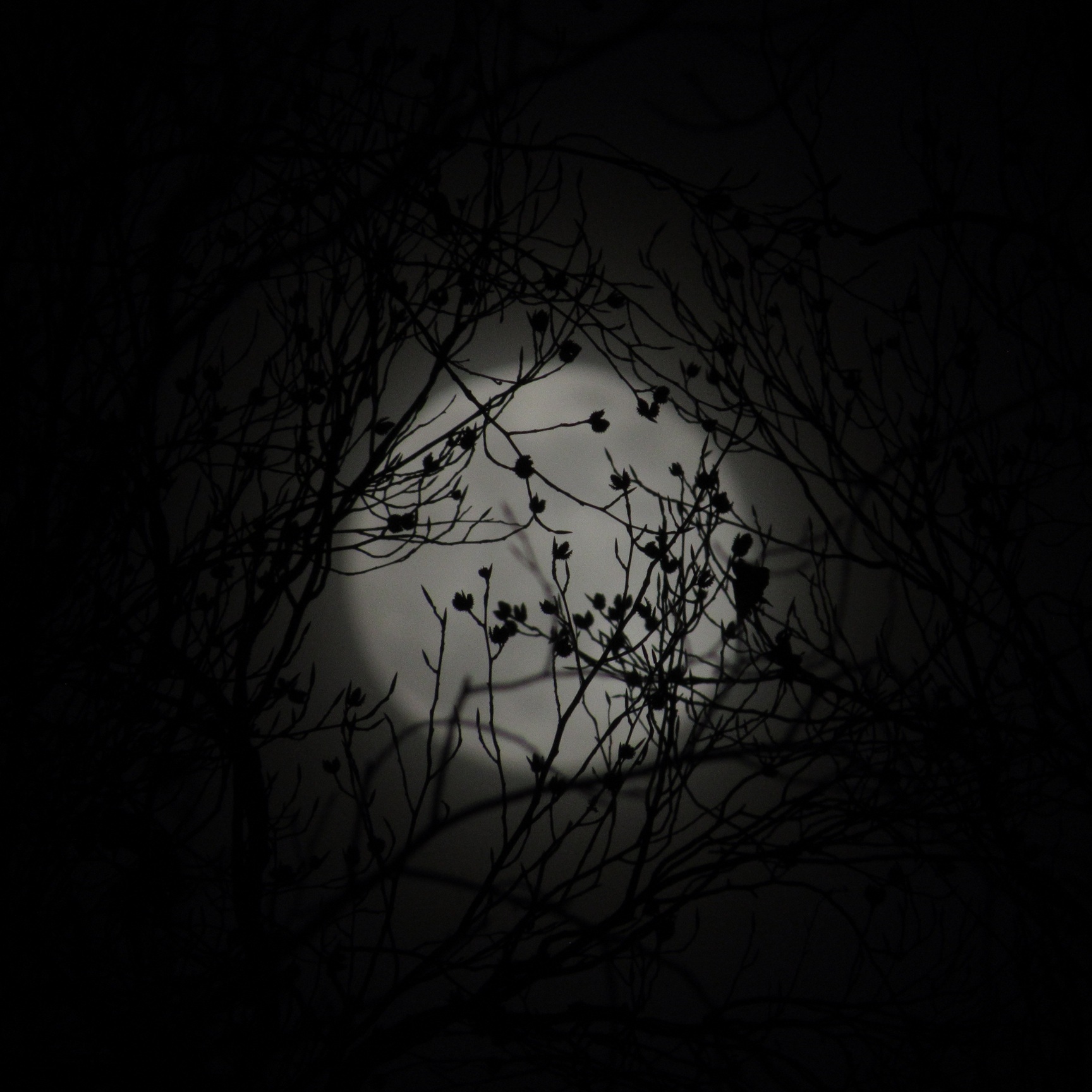
Moon rising through the trees IMBY
-
Take
-
Man that would wreck that morning commute. Cold powder falling at sunrise on cold roads after several days of temps below normal.
-
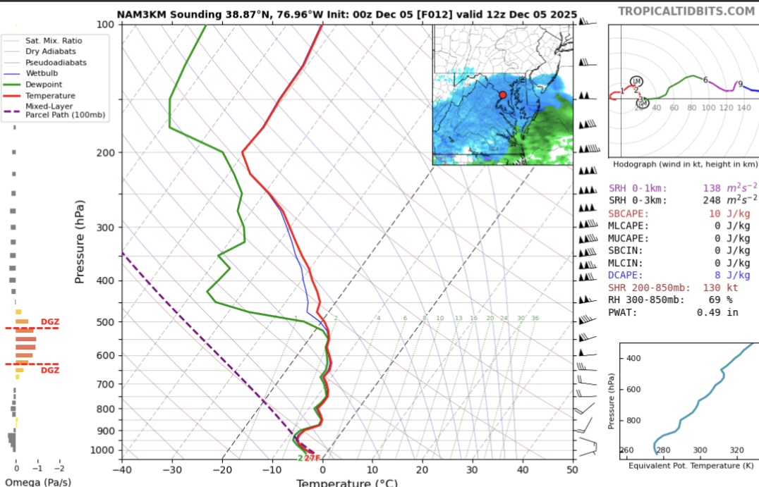
@SnowenOutThere 0z nam 3k soundings look much better for dendrite production. I just looked at DC, but a nice wide DGZ with moderate lift for several hours tomorrow morning. This is 12z for DC.
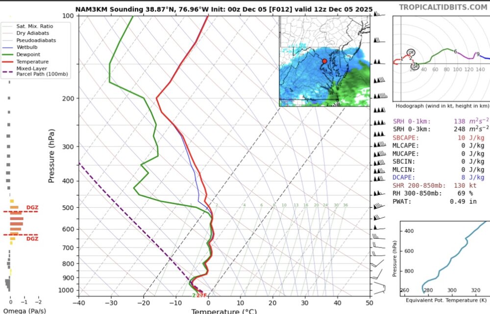
-
Almost a quarter inch QPF in DC. Even lopping off a third for, well, NAM, that still gets you in the 1-2” territory. Looking good.
-
Sign me up for that shit right there
-
You’re telling me
-
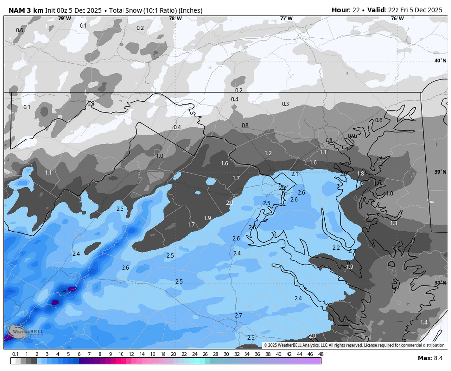
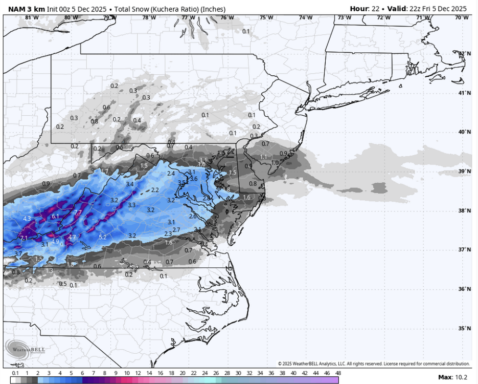
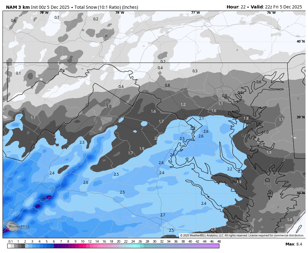
Looks like about 1 to 2 from EZF north...3 down there and like 2" up to the DC metro and an inch to the Federick County southern border I mean, yeah, relative to yesterday's runs, I'd buy and not look back
-
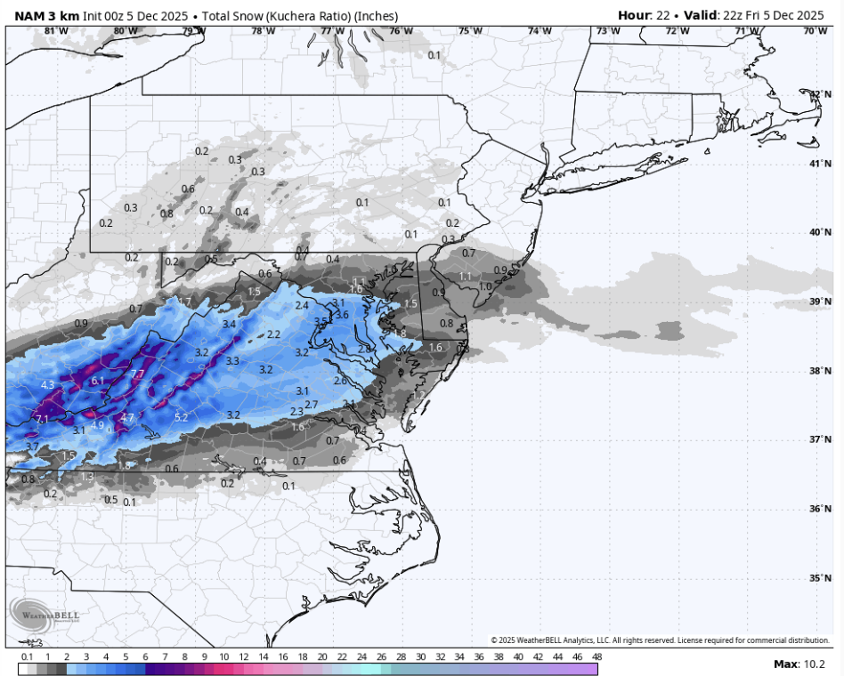
0.2" QPF makes it up to DC, but kuchera advertises 15:1 ratios, so be aware this is likely too high
-
DC went from 0 to maybe 3 inches of snow
-

2025-2026 New England Snow Recordkeeping Thread
bristolri_wx replied to bristolri_wx's topic in New England
@40/70 Benchmark, @tavwtby check your PM for form links. -
24 hours makes a big difference!
.thumb.png.ef9c61e9bf11ec1afe3b982ae65c7f91.png)
.thumb.png.52f269113007f436ac007d61e4dee4c8.png)
-
I’ll sign up for the 3k right now
-

December 2025 regional war/obs/disco thread
WinterWolf replied to Torch Tiger's topic in New England
Poor COC was all confused . -
00z NAM would imply the biggest December in DC this decade?
-
If you went to Danville I think you would have been disappointed. I lived there for 4 years and they tend to bust low with these type of storms. I think they get an inch maybe 2 max and end up mixing or turning over.
-
relative to the expected storm totals is probably what i should've prefaced
-
Let's not get too carried away here


.png.f64ab830f0085c7665e495e48079097c.png)
.png.0cdc486839ec9de39f7e6cf8b8e6859c.png)
