All Activity
- Past hour
-
This. I’ve told you and others this before. Places south of us are not getting more snow than us. I showed you the snowfall the last 10 years in a ton of random southern cities and none have more snow than Baltimore over the last 10 years. Not one. Some had more snow one single season. Others more a different year. This is perception bias. You don’t pay attention to exactly where the storms missing to our south hit. Or the frequency. Yea New Orleans got that big snow last year. But that’s the only damn big snow they got in the last 10 years! Charlotte got one a couple weeks ago. But they’ve only had a few storms over 10 years! Same with Raleigh, Nashville, Dallas, Little Rock, find me one city south of us that actually has more snow. Do some research before you make a declarative theory or statement. Don’t go on perception. Yes we will be like Raleigh and get some southern sliders. So every 3 years we will get one damn snowstorm. But hey we will get that storm that used to go south of us. Winning!!!
-
Central PA Winter 25/26 Discussion and Obs
Blizzard of 93 replied to MAG5035's topic in Upstate New York/Pennsylvania
Under 48 hours, nine times out of 10, once a trend starts, it usually either builds momentum or levels out. These continual all of the place rug pulls are brutal with this potential event. -
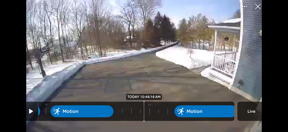
Same. Need sunshine to keep melting my ice dams.
-
I never understood the agenda posters who have to spin. seems exhausting
-

February 2026 OBS & Discussion
donsutherland1 replied to Stormlover74's topic in New York City Metro
Parts of the region saw a dusting of snow overnight. The remainder of the day was mild with the temperature reaching the lower and middle 40s. Tomorrow will be a bit cooler with highs in the upper 30s. A storm tracking to the south could bring some snowfall to the region tomorrow night into Monday. The steadiest precipitation should pass to the south of New York City. Nevertheless, a 1"-2" snowfall appears likely in and around New York City. Lesser amounts are likely north and west of the City. Parts of central New Jersey and Long Island could see somewhat higher amounts. There remains a risk of lower amounts from New York City northward, as the City will be affected by the northern edge of a fairly weak system. Following the light snowfall, the remainder of Monday will see highs in the upper 30s and lower 40s. It will then turn milder for the remainder of the week into the beginning of next weekend. Highs will mainly be in the middle 40s. One or two days with highs in the upper 40s to near 50° are possible. The ENSO Region 1+2 anomaly was +0.3°C and the Region 3.4 anomaly was -0.5°C for the week centered around February 4. For the past six weeks, the ENSO Region 1+2 anomaly has averaged -0.25°C and the ENSO Region 3.4 anomaly has averaged -0.52°C. La Niña conditions will likely continue into at least late winter. The SOI was +20.94 today. The preliminary Arctic Oscillation (AO) was +0.006 today. Based on sensitivity analysis applied to the latest guidance, there is an implied near 95% probability that New York City will have a cooler than normal February (1991-2020 normal). February will likely finish with a mean temperature near 31.5° (4.4° below normal). Supplemental Information: The projected mean would be 3.8° below the 1981-2010 normal monthly value. Overall, Winter 2025-2026 is on track for a seasonal mean temperature of 31.9°. That would be the lowest winter mean temperature since Winter 2014-2015 when the mean temperature was 31.7°. Winter 2025-2026 would only become the fourth winter of the 21st century with a mean temperature of 32.0° or below. -
You and I are on the same side. Pointing out what may go wrong and instead of all positive and cold all the time acknowledging when guidance trends warmer for a certain cycle, then we jump back to cautiously positive on the good cycles.
-
All you gotta do is go to the national weather service Boston site and look at the 4 PM round up. It’s literally right there in front of you. That’s what I looked at to corroborate Seymour.
-
For now, I don’t see anything in the LR to get excited about. If winter is over, looking back on the last 4 seasons, only 22-23 was a true dead ratter. In each of the last 3 consecutive seasons, I have had at least 8” of snow depth. Last two winters maintained around 3 weeks of snow cover, which is not half bad considering the persistent -enso/-pdo base state. Let’s see what the next el nino has in store for us. I suspect it will be a milder winter with no prolonged snow cover, but perhaps we could get more of an active STJ and all we need is a well timed wave with some cold air. Not much to ask considering NC got theirs two winters in a row.
-
Amateur posting in the New York City forum
-

Is we back? February discussion thread
Damage In Tolland replied to mahk_webstah's topic in New England
Man I give up -
Except it’s been made very clear to us that the larger discussion about cyclical v man made and all that is strictly off limits for political reasons. That’s why you don’t hear people commenting on it. It’s off limits. The fact it’s warmer now than 30/50/100 year ago is just a fact and how it affects our snow climo v 30/50/100 years ago isn’t political.
-
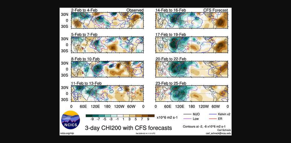
All the tropical forcing coming up looks like our pattern we seen earlier this winter from the WP into the IO,while some RMM'S keep a active MJO signal it seems the MJO signal should/could go into the COD, would seem possible also the MJO signal is getting destructive interference from Rossby and Kelvin Waves But you can honestly look at the models each day and keep seeing a Aleutian/Bearing Sea Rex is gonna establish itself,thats the kiss of death for people in the SE,get ready for severe
-
Minor stat padder. Better than nothing.
-
Lol nice. I only had the 2014 2 door sport s (anvil) but I remember my aunt had a 96 (around that year) red grand Cherokee and it was awesome. I drove it a few times. Those Stellantis prices, though. What are your thoughts on the current base Wranglers with the steel rims? I feel like they look a bit cheap, but I guess they’re more rugged?
-
Honest question, look at my post from earlier other than like two that were clearly joking. Did I go off a cliff about the pattern change?
-
GFS South , Looks like she’s slipping away. Was only hoping for 1-2 , oh well. I know that’s what she said.
-
When Keeping It Real Goes Wrong (like this thread)
-
18z GFS
-
It’s getting scary in here lmao
-
Central PA Winter 25/26 Discussion and Obs
Blizzard of 93 replied to MAG5035's topic in Upstate New York/Pennsylvania
I am so ready to be done tracking this system! 2 weeks ago, many of us started watching this weekend period. It went from potential major storm to no storm to late yesterday looking like a potential recovery to an Advisory event to now who the bleep knows! -
I’m sure it was mostly cloudy up north based on satellite. As you can see it was mostly sunny here til midday. Actual obs showed the overcast moved in between 11-3 across most of CT except far north. The only way to factually back up the temp argument is by the airport high temps which is what I stated at first 36.5-42.5 across the state.


