All Activity
- Past hour
-

Southern Crippler - Get well soon Jimbo Storm Obs
Brick Tamland replied to BooneWX's topic in Southeastern States
The models that showed mostly freezing rain instead of sleet with last night's precip and the precip overnight were wrong, so really no reason to think this will be different. -
Four hours of dumping sleet in Silver Spring. Pretty unbelievable
-
Holding steady at 13 here.
-
I lived through that VD 2007 storm in central PA and it was dumping sleet at maybe 10-12 degrees. What happens at 750 or 800mb is irrrelevant to the surface. If there's strong southerly flow at those levels because of a primary and 700/850 lows in a bad place, those levels will warm up and it will sleet.
-
I think an auger style would chop it right up vs a brushless but report back! I am still surprised how heavy the first 5" were and at the drifting before the sleet took over. This is an impressive amount of sleet. The trails i carved out for the tyke to sled are all but gone.
-

January 25-26 Winter Storm Potential
Violentweatherfan replied to Ralph Wiggum's topic in Philadelphia Region
I still say this is an over performer we got 10+ inches easy if it hangs on for another hour still snowing in Jamison PA -

Southern Crippler - Get well soon Jimbo Storm Obs
SnowDawg replied to BooneWX's topic in Southeastern States
Over 60% without power in Rabun county and rapidly going up. Even with a brief period just above freezing likely later, I'm very concerned about how things get when the heavy winds arrive. -

Central PA Winter 25/26 Discussion and Obs
Mount Joy Snowman replied to MAG5035's topic in Upstate New York/Pennsylvania
You're a damn genius JNS! -

Pittsburgh/Western PA WINTER ‘25/‘26
TimB replied to Burghblizz's topic in Upstate New York/Pennsylvania
About to get into some lighter snow? -
 Forecast: infinity snow Ending? Never!
 -
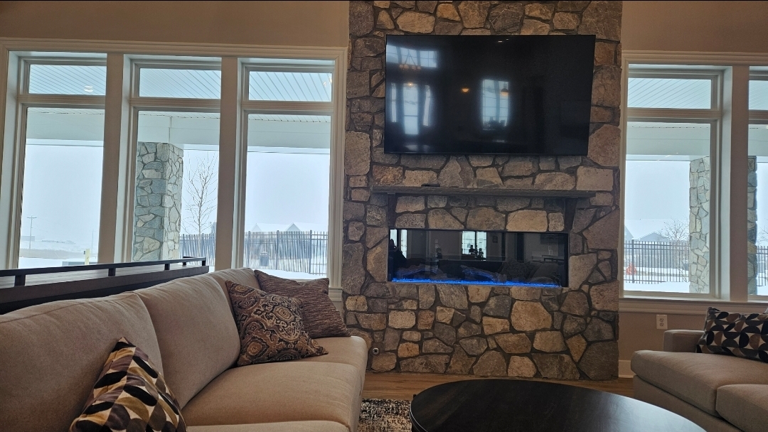
I walked up to our clubhouse...too bad the hot tub isn't open yet

-

Southern Crippler - Get well soon Jimbo Storm Obs
NorthHillsWx replied to BooneWX's topic in Southeastern States
We ain’t talking much lol. Gotta stare at my black truck -
Think im just looking at the euro a few days out and then the nam in the 24 hours up to onset. Ignoring everything else. .
-

January 25-26 Winter Storm Potential
Berks_SnowMan replied to Ralph Wiggum's topic in Philadelphia Region
Sleeting just north of Reading now . -
Temp went from 11 degrees an hour ago to 16 degrees .
-
 Heavy snow with nice big flakes here in Sturbridge. Temp at only 5 Degrees here right now.
 -

Southern Crippler - Get well soon Jimbo Storm Obs
WinstonSalemArlington replied to BooneWX's topic in Southeastern States
Cary https://x.com/hurricanetrack/status/2015442535603216595?s=46&t=5ny5bPgiX5Vy3bQMvYTY5g -

January 25-26 Winter Storm Potential
CoolHandMike replied to Ralph Wiggum's topic in Philadelphia Region
Measured 8.25" on my front step. Starting to sound a little plinky out there, and the flakes are getting larger. Maybe starting to warm up slightly, up from 9 to 9.8°F and 7.3°F DP. -
DCA avoids the bounce problem by plugging in their snow board
-
Southern Crippler - Get well soon Jimbo Storm Obs
NorthHillsWx replied to BooneWX's topic in Southeastern States
Anyone thinking this wedge would break- I got news for you -
Central PA Winter 25/26 Discussion and Obs
Mount Joy Snowman replied to MAG5035's topic in Upstate New York/Pennsylvania
Yes, I'm aware. But he said the next closest guess was well above him, so unless MDT goes well over 10" (seems unlikely), he would be the winner. That's why I said "likely win". All good. -

Central PA Winter 25/26 Discussion and Obs
whiteout replied to MAG5035's topic in Upstate New York/Pennsylvania
Thanks, and Yup, explains it. Tucked into the Doubling Gap area there in extreme NW Cumberland county, we started mixing with sleet about 30mins ago. Guess the NAM was on to it, the only model that got the mixing up and past me. Bummer as many models were showing me at 12”+ easily. Had 7” prior changeover. -
central Suffolk Just under 5” now. heaviest snow of the day. Snow seems to be getting a little less powdery. Sleet line seems to be moving now hope we get to double digits
-

Central PA Winter 25/26 Discussion and Obs
mitchnick replied to MAG5035's topic in Upstate New York/Pennsylvania
And it'll flip back to snow. -
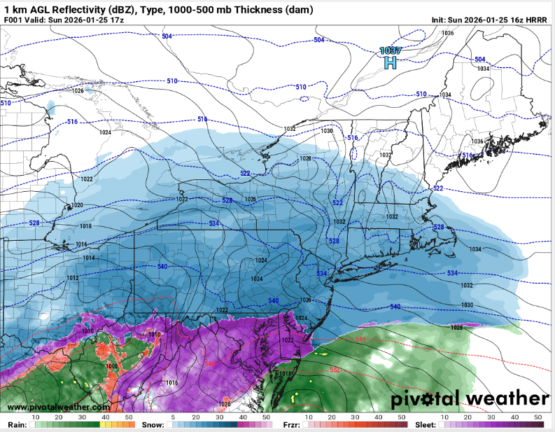
FWIW, HRRR hr 1 (12 PM) is too far south with the sleet line, as it appears to be approaching southern Mercer/Middlesex in NJ (based on CC and mPING). Around 7" so far here, so might be able to pull off low-end double digits with sleet included. But also suspect there will be some compacting with the sleet on top.