All Activity
- Past hour
-

New Years Day 2026 - 1st snows of the new year possible
ORH_wxman replied to Baroclinic Zone's topic in New England
Prob been since 1/28/10 since we had overperforming squalls this good down in SNE. That event was better in western and central areas whereas the squalls this time overperformed in east and southeast areas. -
I mean its been BN temp wise and basically normal snow wise. But after last several winters its great. this hasnt been gangbusters tho
-
Now, I do think the following is possible. We have seen it show up on modeling but without overall consistency ->The cold shot around the 12-13th rolls into the Plains and hangs up over the East. It could hang up over the Ohio river valley, the Tenn River valley, the Apps, or even the East coast. If/when it does, an over-running event seems plausible. Beware the cutoff low over the Southwest. They are tricky, tricky critters. On rare occasions, they will simply set-up shop per the deterministic GFS, spin for days, and just burn out. But IMHO, they kick out about 90% of the time. If it were to set up shop there, when it kicks...the trough should still come into the East. Pay me now or pay me later. The good thing I can see on modeling this morning is the EPO ridge is present. That has not changed. When it reaches into Point Barrow, a cutoff OR split flow could develop underneath it. I suspect we eventually see both - a cutoff/bowling ball and split flow. Details twelve days out are going to be sketchy. So, I started looking at individual 6z GEFS ensemble members - it is the ensemble of the worst case deterministic scenario. I am not done yet sifting through the other ensembles. The 6z GEFS is not as warm as I thought it would be. I scroll right on down to Jan13...and then 14th. Remember, those are BN temps during our coldest climatology. A good number of those troughs stall. That tells me the risk for over-running is very high. If I was sitting in middle and western Tenn...I would want to keep an eye on this, even E TN. I can't get individual 500 height panels for the US, so I resort to looking at the temp maps above. Below is the 500 mean map for the hour above. The individual members tell a different story. Many of them must have kicked the trough eastward as the SER is squashed on roughly 2/3 depending on your definition of "squashed." Many of those cold fronts stall somewhere over the East. Below is the 12z trend map for Jan 12. It looks like that for the rest of the run which implies the ensemble is correcting eastward with the trough.
-

E PA/NJ/DE Winter 2025-26 Obs/Discussion
penndotguy replied to LVblizzard's topic in Philadelphia Region
21F squall total .75” -

New Years Day 2026 - 1st snows of the new year possible
Torch Tiger replied to Baroclinic Zone's topic in New England
Unforgettable event. 3/4" -

New Years Day 2026 - 1st snows of the new year possible
TauntonBlizzard2013 replied to Baroclinic Zone's topic in New England
And the sun is out, just like that -
We managed a very solid, wintry month. January ain't looking too great but who knows how it'll turn out Models change on a dime with how volatile the pattern is
-

January 2026 regional war/obs/disco thread
WxWatcher007 replied to Baroclinic Zone's topic in New England
Eventually that’ll lose out. Perpetual warmth or cold in our region is very hard to accomplish. At least it’s not days and days of 50+ and it is on the front end of a cold reload. -
New Years Day 2026 - 1st snows of the new year possible
ORH_wxman replied to Baroclinic Zone's topic in New England
@amarshall too. -

New Years Day 2026 - 1st snows of the new year possible
bristolri_wx replied to Baroclinic Zone's topic in New England
Had to measure in a few spots due to the wind blowing things around but 2” here, about a 1/2” in the last band. A little bit of a snow hole here during the first part of the storm. -
January 2026 regional war/obs/disco thread
Torch Tiger replied to Baroclinic Zone's topic in New England
Winter is quickly moving along, almost the halfway point! Most of us are very very happy -

12/31-1/1 Possible Snow Showers/Squalls to Start 2026
mappy replied to bncho's topic in Mid Atlantic
Snow
-
New Years Day 2026 - 1st snows of the new year possible
ORH_wxman replied to Baroclinic Zone's topic in New England
@SouthCoastMA must be getting crushed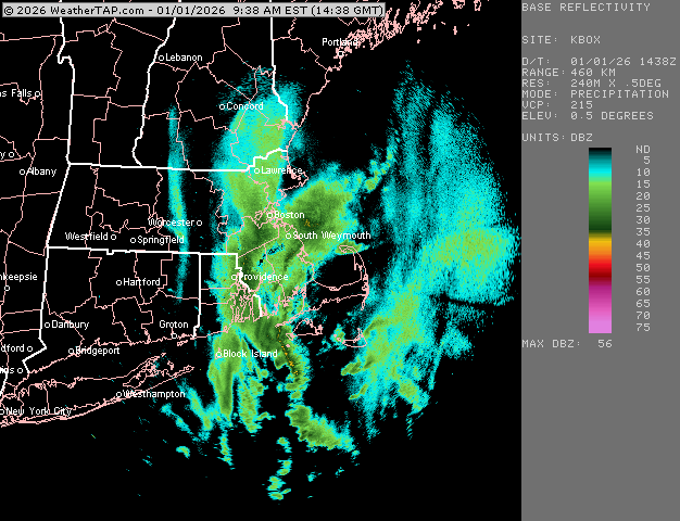
-
Well at least we had one snowy, wintry month this winter. Because January ain't looking so great
-
Dec finished here on si with a -4.7° departure and the 7th coldest in 48 years and the coldest since 2010. Snowfall of 10.4"... Excellent Dec in my opinion.
-
January 2026 regional war/obs/disco thread
ORH_wxman replied to Baroclinic Zone's topic in New England
Even if we have highs of something like low 40s over interior, that is pretty solidly above climo this time of year. We often measure our torches in how much the peak warmth is, but even if we don’t have any days of 50+, it will still be solidly AN for several days. If that system next weekend (around 1/10-1/11) ends up more CADish, then we could mute the warm departures somewhat but they will still be notable. If we warm sector in that system, we’ll make a run at 55+ easily. -
With the EPO going hard negative, not sure how much into positive territory we would want the PNA. The EPO look continues to get closer (ie we arent kicking that teleconnection...it appears real), so a negative pna could even work helping nudge the SER into a gradient zone in the Mid Atl with SW flow events tracking sw->ne along the boundary. Thats with a negative pna or maybe neutral. Strong +PNA with a robust -EPO runs the risk of being bitter cold and dry. Though we always run some sort of risk or another. In short, if the -EPO is real, which it does look to be, I will roll the dice with a slight - or neutral PNA rather than too much of a good thing. YMMV
-
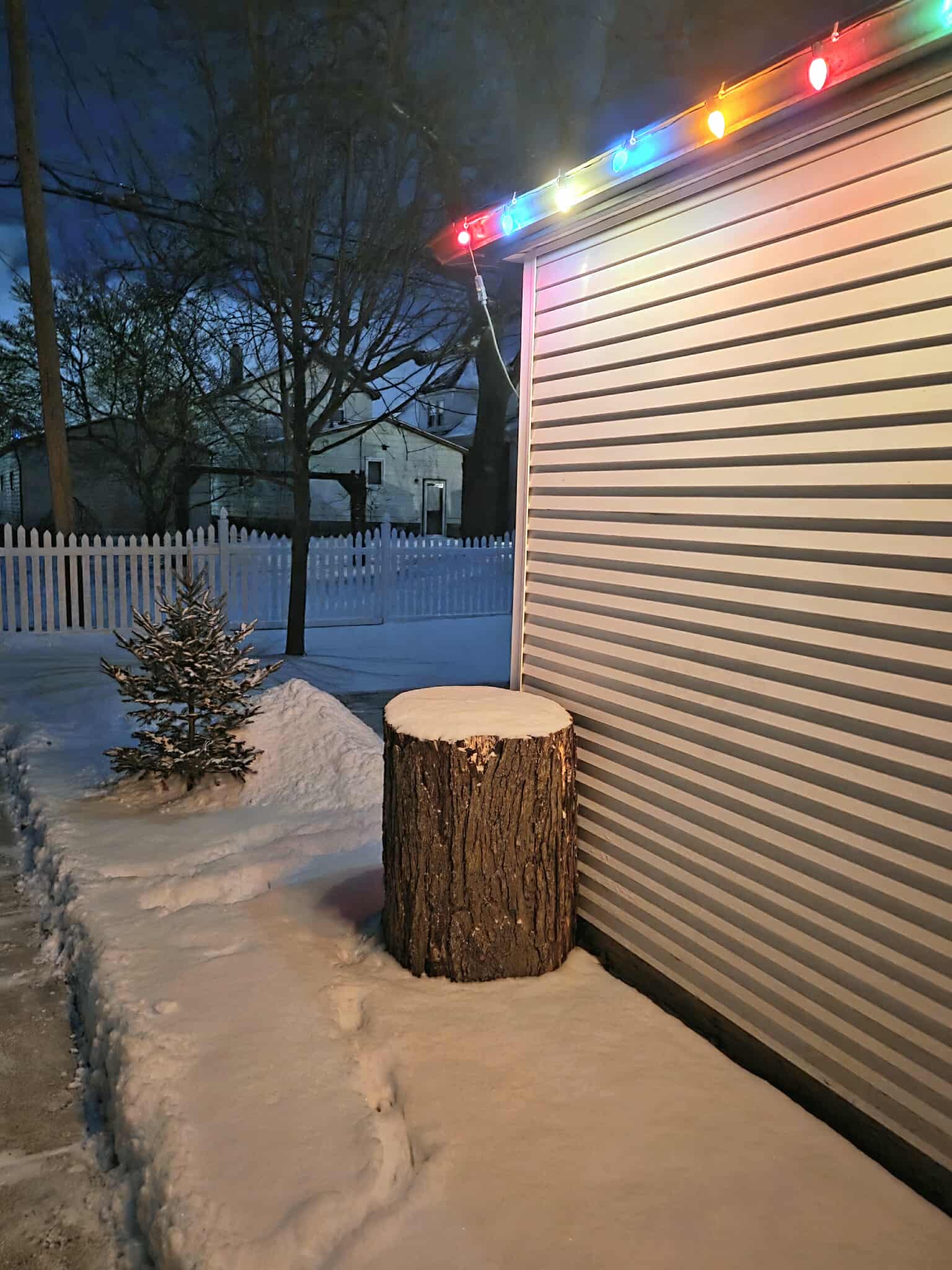
The New Years Eve snow dropped anywhere from 1.5-3" in southeast MI. It was glittery and beautiful. Both here & DTW picked up 2.1" last evening. Its incredible how well we do the nickel and dime. Now time for a big one. December snow totaled 11.6" here, season to date 17.3". At DTW December snow totaled 10.9" with 16.8" season to date.

-

12/31-1/1 Possible Snow Showers/Squalls to Start 2026
GreyHat replied to bncho's topic in Mid Atlantic
Woke up to a nice dusting here as well. Happy New Year -

New Years Day 2026 - 1st snows of the new year possible
Damage In Tolland replied to Baroclinic Zone's topic in New England
I was awake since 5:15. I responded immediately to your text -
Happy New Year!
-

New Years Day 2026 - 1st snows of the new year possible
HoarfrostHubb replied to Baroclinic Zone's topic in New England
Send some my way. My driveway is a rink still. -
I don't sleep well sometimes, but managed to sleep through this, so I missed out too. I did look at the past radar loop. It looked like the thickest, heaviest part of it went just to my south, which would be you. We had exactly 1" here vs your 1.7" - it must have been a sight since it probably only lasted 20-30 minutes, if that. Enjoy.
-

New Years Day 2026 - 1st snows of the new year possible
Baroclinic Zone replied to Baroclinic Zone's topic in New England
The amount of rock salt they dropped in our complex is absurd. I just witnessed the truck make like 8 passes over a parking lot about the size of a baseball diamond and there are a dozed parked vehicles in it. -

New Years Day 2026 - 1st snows of the new year possible
Ginx snewx replied to Baroclinic Zone's topic in New England
You didn't post until we alerted you. Be honest