All Activity
- Past hour
-

September 2025 OBS-Discussion centered NYC subforum
psv88 replied to wdrag's topic in New York City Metro
83 today. Beautiful -
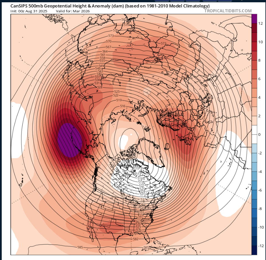
To bad this is CANSIPS this far out,its actually similar to last year to an extent anyways,but this would be nice with an active jet tapping into the GOM,with a -NAO with that Aluetian LOW

-

Saturday 9/6 Strong/Severe storm potential
Damage In Tolland replied to Torch Tiger's topic in New England
Or an IPA. I’d buy cases -
Some intense convection in SW TN earlier,seen this on GOES
-

September 2025 OBS-Discussion centered NYC subforum
IrishRob17 replied to wdrag's topic in New York City Metro
The smoke is coming from the Pacific NW this time, the hrrr has it clearing out tomorrow into Sunday. -
Might make a good name for a rock band. Or for a dessert topping. Or a floor wax.
-
It's humid as all get out and was a good 12 degrees warmer in West Knoxville this evening that it is back home. Looks like the storms are going to hold off until after the game.
-

September 2025 OBS-Discussion centered NYC subforum
steve392 replied to wdrag's topic in New York City Metro
We getting wildfire smoke in our area? Sunset was kinda incredible in the smokey skies -
Thousands probably.
-
Saturday 9/6 Strong/Severe storm potential
Damage In Tolland replied to Torch Tiger's topic in New England
Seems like Tors galore -
It has gotten progressively more gross out. 81/70 at 8 pm
-

September 2025 OBS-Discussion centered NYC subforum
winterwarlock replied to wdrag's topic in New York City Metro
89 Just missed today -
Eversource has been texting and phoning with heads-up warnings about tomorrow's severe potential...
- Yesterday
-
-
yeah.
-
ya, c'mon Wiz.
-
Pretty shocked there isn’t a thread started for tomorrow
-
I’m pretty sure the model was forecasting all of that below average snow because it had a country wide blowtorch. So it was right for the wrong reason pretty much.
-
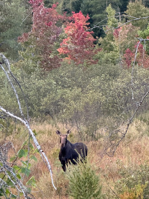
Just saw this lady…
-
Forecast totally changed . Front slowed to crawl and a wave forms on it
-
September 2025 OBS-Discussion centered NYC subforum
IrishRob17 replied to wdrag's topic in New York City Metro
You couldn't tell by looking at the sky this afternoon? -
Woof. Team euro I guess. 0.5” would be nice since it’s probably not going to rain for 10 days after at least.
-
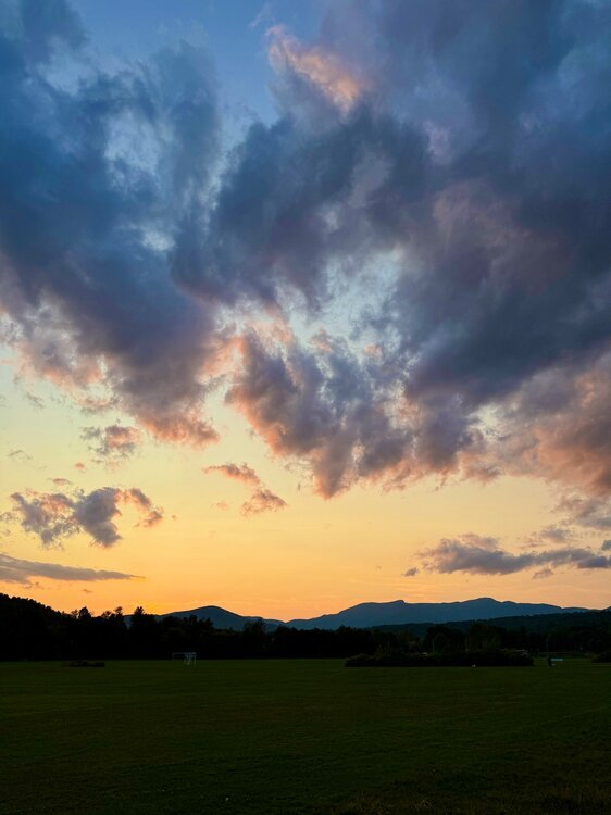
What an evening.
-
That'll suck for my yard/garage sale. Hope it's done early AM.
-
It was the warm storm tracks from Philly to Boston that resulted in the very low snowfall. Very strong Southeast ridge and Pacific Jet on the days when most of the precipitation fell. This has been the main theme since 2018-2019.