All Activity
- Past hour
-
LOLLLLL. https://x.com/bigjoebastardi/status/2087382965235982682?s=46
-

2026-2027 Record-breaking El Nino
GaWx replied to Stormchaserchuck1's topic in Weather Forecasting and Discussion
It is usually either a 3 month or a 1 month avg. -

2026-2027 Record-breaking El Nino
Nomz replied to Stormchaserchuck1's topic in Weather Forecasting and Discussion
Hey y'all. Pretty new to long-range forecasting; had a couple random questions I couldn't get a good answer on: When someone says a model is spitting out a peak of +4.5, for example, is that a single-day peak or a three-month average, as tracked by the NWS? Are we generally discussing RONI or ONI, and which is more predictive? (Does it change with seasons?) -

Spring/Summer 2026 Pattern Discussion Thread
Matthew70 replied to Carvers Gap's topic in Tennessee Valley
I hope all you east TN folks are safe. Here in the Boro I am seeing a lightning storm I have not seen in a very long time. Beautiful but also very scary. It’s constant streaks. -
Mosquito larvae don't care about cold. If you've ever been to the Minnesota or Canadian Northwoods or Alaska in summer you're gonna get swarmed. The joke in Alaska is you need a frying pan to kill them they're so big. And those locations get down to -40 and below. I do know that Mosquito spawning cycles are temperature and moisture dependent but I'm not knowledgeable beyond that.
-
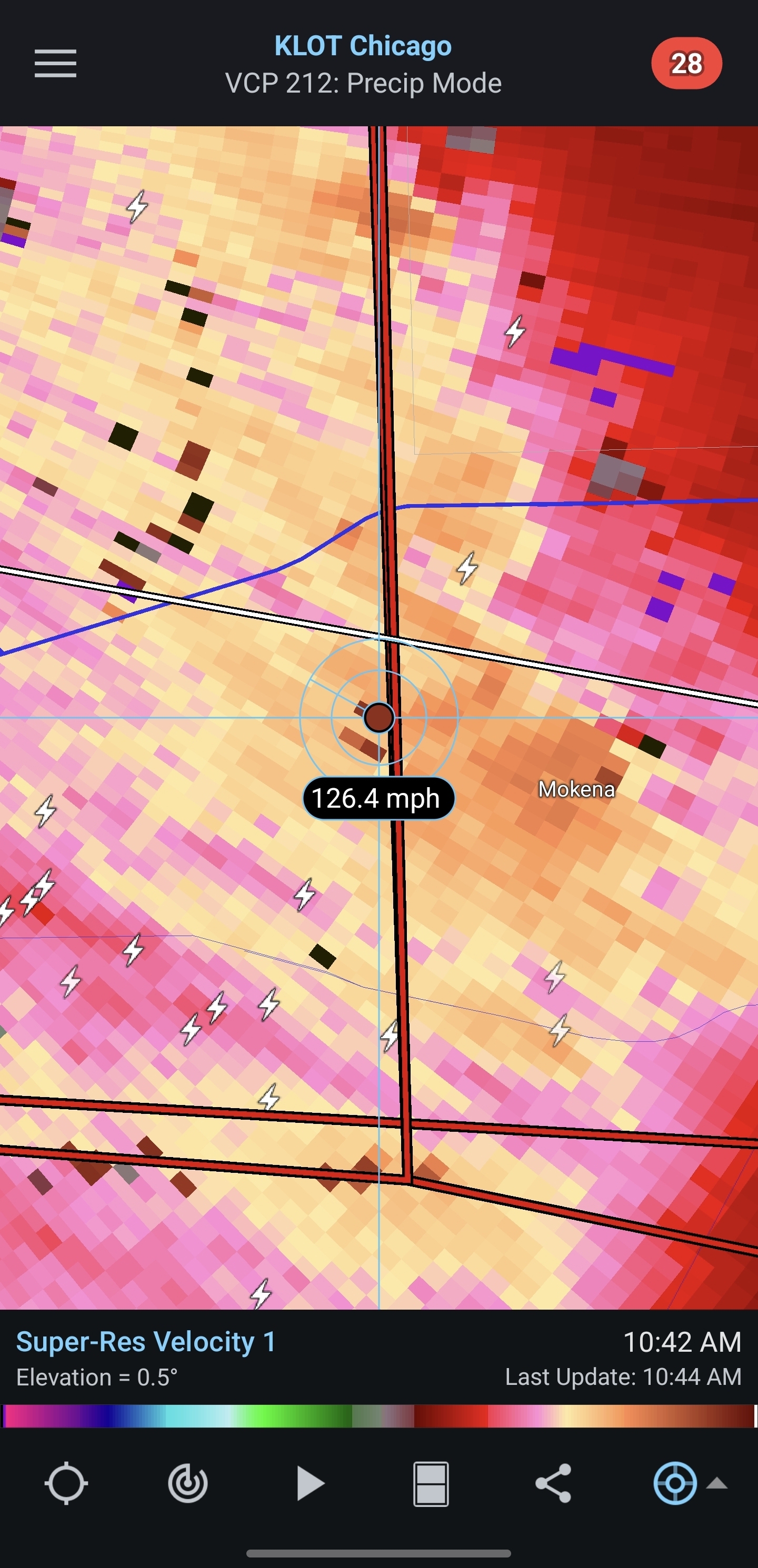
So Illinois will likely surpass the 200 tornado mark with today's action. What would be interesting is to guess how many Illinois tornadoes will occur in 2027. Would make for a fun poll thread.
-
Confirmed EF1 for Mokena
-
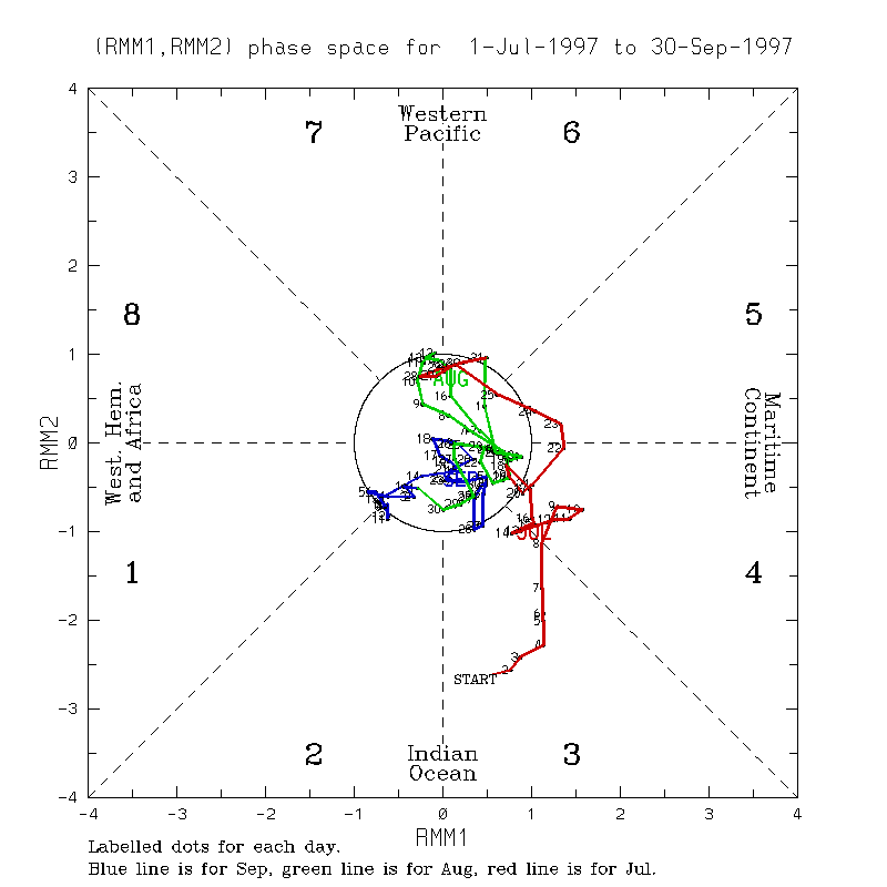
 It is also very interesting to see the MJO just stuck in Phase 6 for nearly a month (with the forecast through the 25th). https://www.cpc.ncep.noaa.gov/products/precip/CWlink/MJO/CLIVAR/clivar_wh.shtml Looking back at 97-98 we were null to even having a La Nina-esque lean to the MJO through summer, I get it less influential in the summer. https://www.bom.gov.au/climate/mjo/#tabs=Monitoring Unfortunately with the cuts to data I can not find reanalysis of VP to prior time periods to match with current times, since current times are not being updated.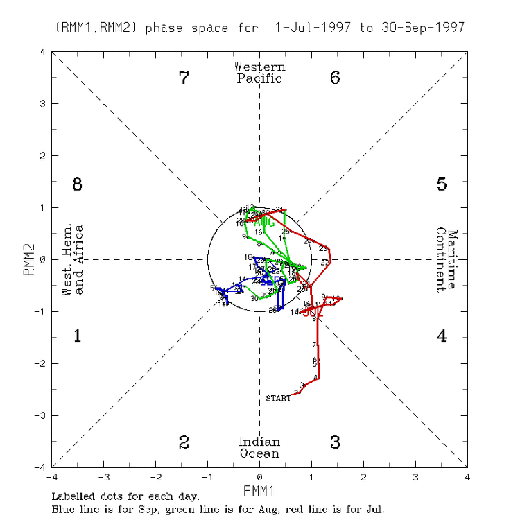
- Today
-
2026-2027 Record-breaking El Nino
GaWx replied to Stormchaserchuck1's topic in Weather Forecasting and Discussion
Thanks, Chuck. The quite cold E US Nino Febs I’m aware of are 2015, 2010, 2003, 1980, 1978, 1958, 1914, 1912, 1905, and 1885.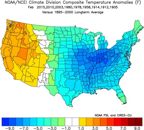
-
Let's save that for Dec 20th - Feb 10th. I'm all for a warm November then we can flip just in time for Christmas and enjoy a nice snowfall for the holidays.
-
If combined they may elevate the gelatin Vienna sausages
-
Nice.
-
Yea we are still lacking quite a bit with the AAM into the northern hemisphere it just cuts off right 30N. So the Nino is thriving in the tropics to subtropics and the southern hemisphere but in the north it is struggling besides little bits and pieces that show up regionally. https://atlas.niu.edu/gwo/
-
 Dec-Jan ONI has higher correlation for Feb than Feb ONI. I don't disagree that El Nino's have been historically cold in Feb though. In fact, I would say the stronger, the greater the cold signal should be. 2018-2025 however was the most -PNA on record for Feb by almost +50%! I'd watch the PDO there.
 -
2026-2027 Record-breaking El Nino
GaWx replied to Stormchaserchuck1's topic in Weather Forecasting and Discussion
It’s very likely overdone, which is why I say it is more like a dream. But IF it were to actually have an inkling of what’s to come, we could be in store for an exciting or possibly even fab Feb. It is essentially going for another Feb of 1958, one of the greatest Febs on record in the E US and this with Feb RONI way up at +1.84! The CFS RONI prog for Feb ‘27 is for a rapid collapse down to +1.5. So, is it likely? No. But is it doable? Yes.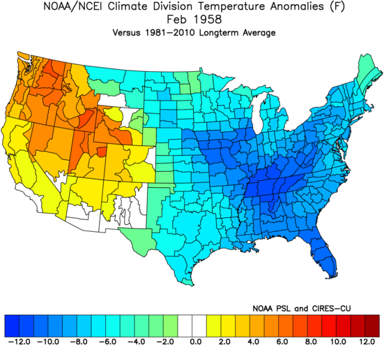
-
A lot of rainfall after these storms.
-

Spring/Summer 2026 Pattern Discussion Thread
John1122 replied to Carvers Gap's topic in Tennessee Valley
It's been absolutely pouring down here for the last hour or so. The light show is amazing. Not anything severe so far here. -
 https://mexisaferx.com/# online pharmacy in mexico
 -
^Just Fwiw, the last 2 years a few runs the CFS has shown -38F anomalies in the NW, US for the month of Dec both times. It didn't happen lol
-
Big rains appear to be incoming. Heavy stuff first and then a lot of light stuff for a while afterwards. The NWS forecast this morning barely mentioned any rainfall threat, and now we are about to have our second round of significant rainfall today.
-
2026-2027 Record-breaking El Nino
GaWx replied to Stormchaserchuck1's topic in Weather Forecasting and Discussion
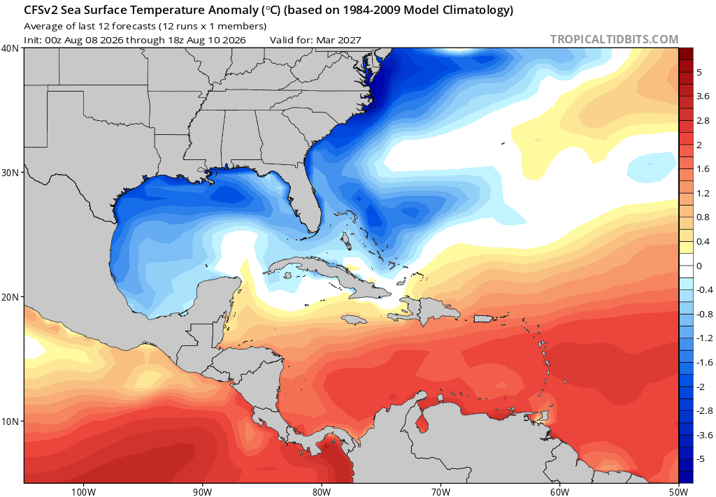
Due to the extreme cold anomalies progged by the CFSv2, look how cold the progged CFSv2 March ‘27 SST anomalies are off the E coast and in the N Gulf! Some areas are -5C/-9F even vs the slightly colder 1984-2009 climo!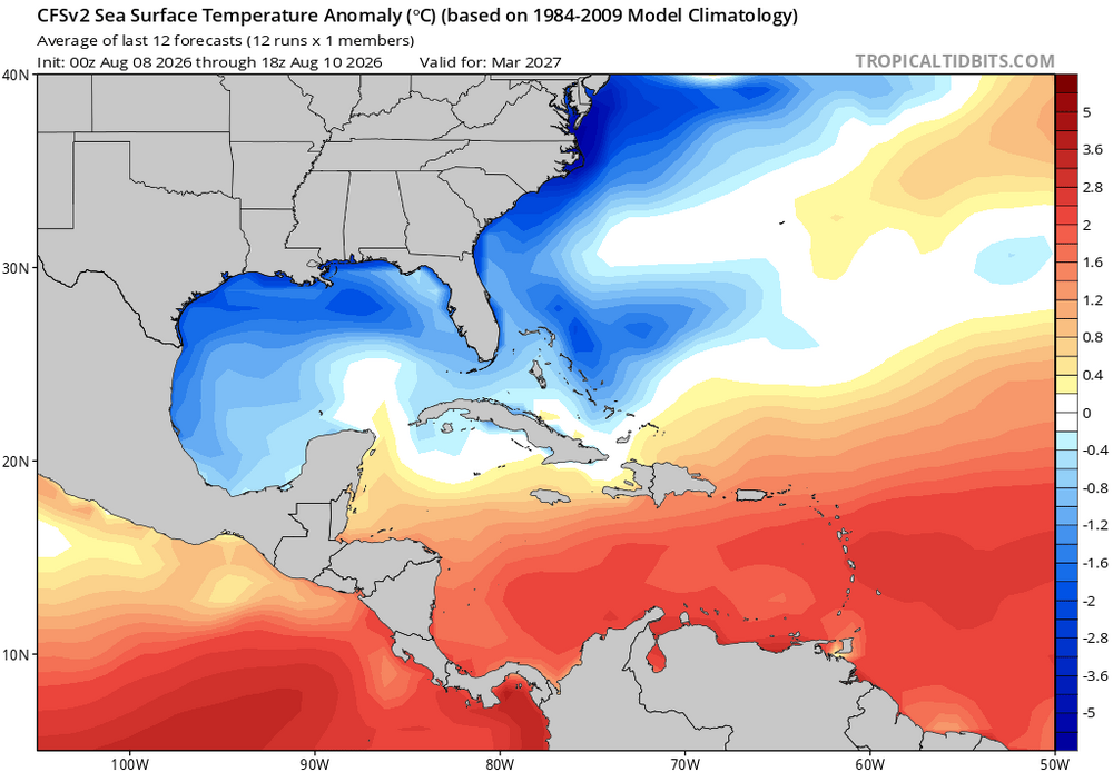
-
Big storms and lots of rainfall coming for most of yall.
-
http://mapletrustrx.com/# best canadian pharmacy to order from
-
Buncombe NC-Haywood NC-Madison NC- 955 PM EDT Tue Aug 11 2026 ...A STRONG THUNDERSTORM WILL IMPACT SOUTHERN MADISON...EAST CENTRAL HAYWOOD AND BUNCOMBE COUNTIES THROUGH 1045 PM EDT... At 955 PM EDT, Doppler radar was tracking a strong thunderstorm near Marshall, moving south at 25 mph. HAZARD...Wind gusts up to 40 mph and pea size hail. SOURCE...Radar indicated. IMPACT...Gusty winds could knock down tree limbs and blow around unsecured objects. Minor hail damage to outdoor objects is possible.
-
Oh, ok. Fwiw, I kind of saw it coming.