All Activity
- Past hour
-
If this was roulette... we would think the wheel was rigged.
-

Winter 2025-2026 Thoughts
jm1220 replied to donsutherland1's topic in Weather Forecasting and Discussion
I would really take any of those winters other than 24-25. 16-17, 17-18 and 21-22 were at least okay here. 17-18 of course was the biggest, 16-17 and 21-22 were okay to good. Thanks for the detailed analysis and thoughts. -
-
-

November 2025 general discussions and probable topic derailings ...
leo2000 replied to Typhoon Tip's topic in New England
Getting a better Pacific as we head into December can't have both a good Atlantic and Pacific have to lose one rather lose the Atlantic anytime over the Pacific anyday. Still a decent atlantic too though it seems. -
-
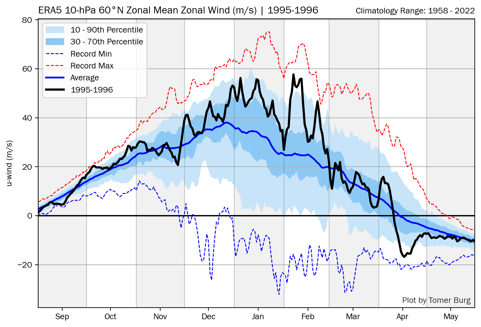
Tell me about it, Ray! For those not knowing about or seeing what we’re talking about, check this craziness out: not a single day in the entire DJF 1995-6 for the 10 mb zonal mean wind at 60N to be below the 1958-2022 mean and with most of Jan/Feb above the 70th percentile:
-
Yessir.
-
 pretty significant -EPO is likely with the Pacific jet retracting and then breaking equatorward. that's going to have some staying power and will be able to tap into true Arctic air
-
2025-2026 ENSO
brooklynwx99 replied to 40/70 Benchmark's topic in Weather Forecasting and Discussion
ensembles are growing more and more aggressive with the -EPO around Thanksgiving thanks to the equatorward movement of the Pacific jet. high confidence in this occurring given the lead time

-
Would absolutely love some TV snow to start the season if we could get some wet flakes to fly...
-

2025-2026 ENSO
40/70 Benchmark replied to 40/70 Benchmark's topic in Weather Forecasting and Discussion
I am stunned 1995-1996 had a stronger than climo PV. -
The wind is pretty persistent today. Again.
-

November 2025 general discussions and probable topic derailings ...
Lava Rock replied to Typhoon Tip's topic in New England
Jay claiming 18" this week. Looks like decent off trail already -
For the 11/17-18 system, EPS shows a weak but not insignificant 11 out of 50 hits (22%) for at least one of the airports in this forum.


-
-
Hopefully we are not beginning the delayed but…crap that have so crippled the models in winter forecasting
-
 Just light non-accumulating snow here. Deep winter feel though with ice dams everywhere lol.
 - Today
-
The avg SPV strength of a winter is by no means anywhere close to an end all be all factor as many of us know. For example, these winters had an SPV on the strong side but still had cool to cold in much of the E US (a bit counter-intuitive): -1980-1 DJ -1983-4 -1995-6 -2013-4 -2024-5 DJ https://acd-ext.gsfc.nasa.gov/Data_services/met/ann_data.html
-
2025-2026 ENSO
40/70 Benchmark replied to 40/70 Benchmark's topic in Weather Forecasting and Discussion
I expect something akin to Dec 2000 (ie no reversal, but significant SSW, nonetheless), which is the best general analog IMO. -

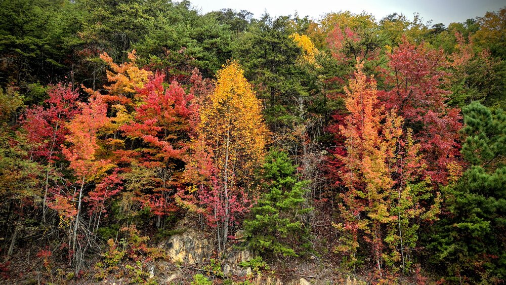
Fall/Winter Banter - Football, Basketball, Snowball?
nrgjeff replied to John1122's topic in Tennessee Valley
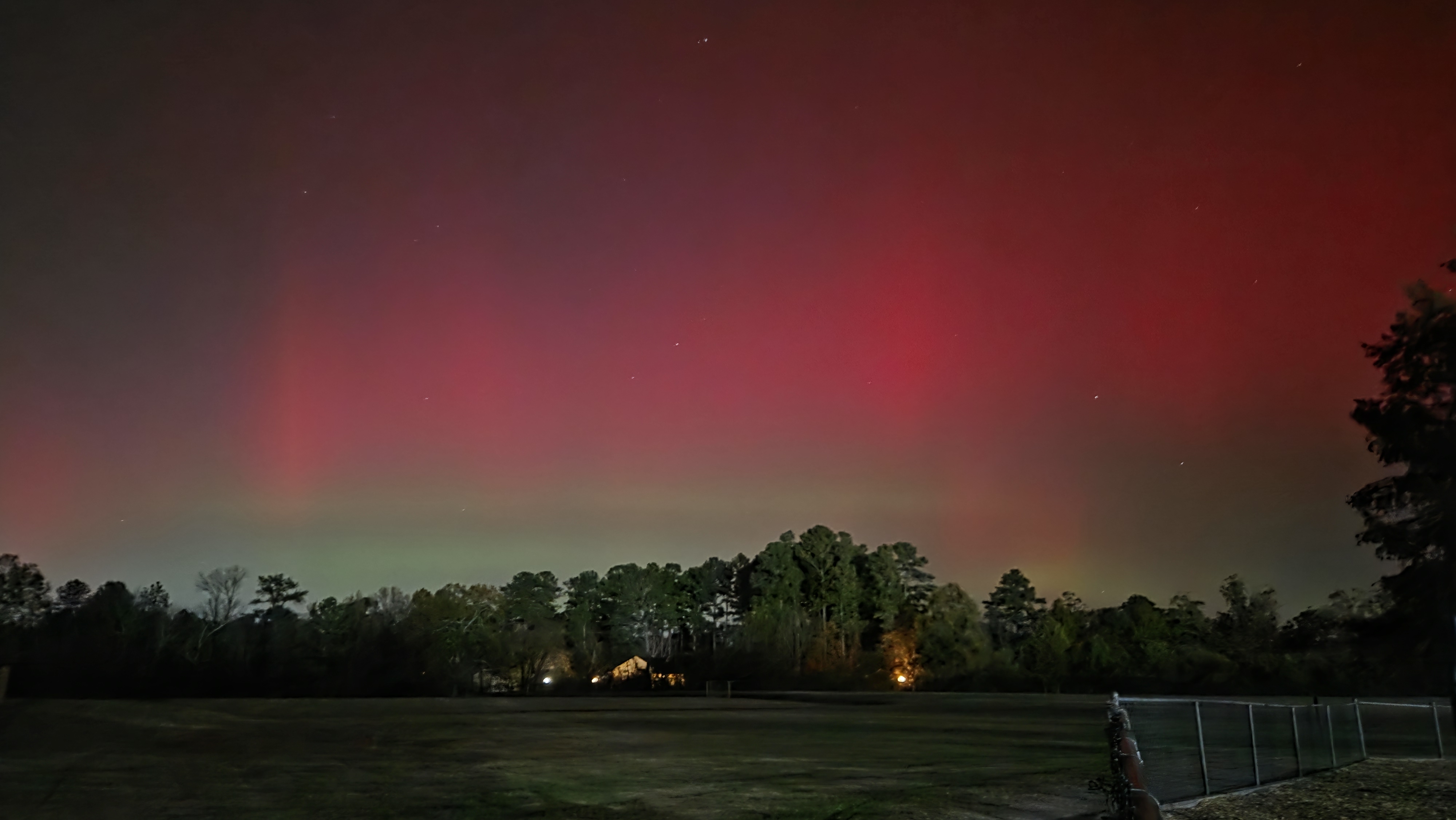
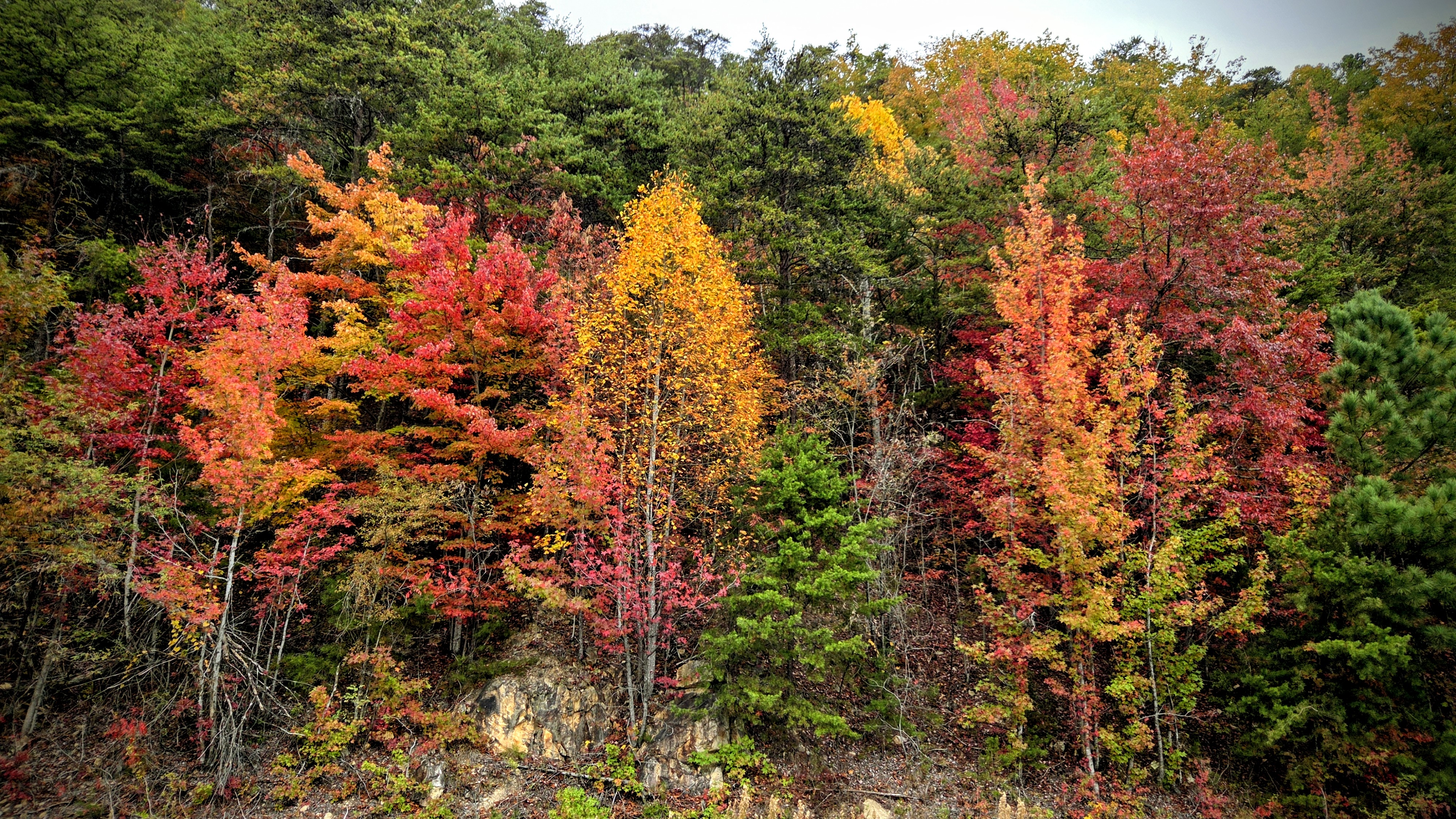
Here is my take from Tuesday night. Northern Lights display for Southern Veterans! Then some fall foliage highlights from Ocoee a couple weeks ago.. And downtown Chattanooga showing off last week. Finally vertical bonus photos. Quite a colorful fall!


-

November 2025 general discussions and probable topic derailings ...
weatherwiz replied to Typhoon Tip's topic in New England
Pretty wild the differences that evolve between the GFS/Euro moving past like D4-5...first with strength/orientation of several features and then flat out how the pattern evolves. Here is to another winter of this crap I guess -

November 2025 general discussions and probable topic derailings ...
powderfreak replied to Typhoon Tip's topic in New England
Already another 4” today at the upper mountain spot. Hammering around 1”/hr. -
Yeah, right when I say the GFS has no company, the EURO pretty much spits out the same outcome. Temps are still bad... wouldn't exactly expect any of this to stick, but it's interesting. If the moisture didn't get totally shredded from 126 - > 132 it might've had more blues.
-

November 2025 general discussions and probable topic derailings ...
rimetree replied to Typhoon Tip's topic in New England
Looks like a nice time up at the cog...