All Activity
- Past hour
-
27.5, the cold air is hard to kill.
-

December 2025 regional war/obs/disco thread
WinterWolf replied to Torch Tiger's topic in New England
That’s not the point. And December is just half over. Another half to go. And All winter((100%) in front of you. -

December 2025 regional war/obs/disco thread
TauntonBlizzard2013 replied to Torch Tiger's topic in New England
2” of snow that’s already evaporated. Get the party poppers out -

December 2025 Short/Medium Range Forecast Thread
John1122 replied to John1122's topic in Tennessee Valley
That NAO depicted above really strengthens around Dec 28th on the CFS. -

December 2025 regional war/obs/disco thread
Damage In Tolland replied to Torch Tiger's topic in New England
Cheeba? -
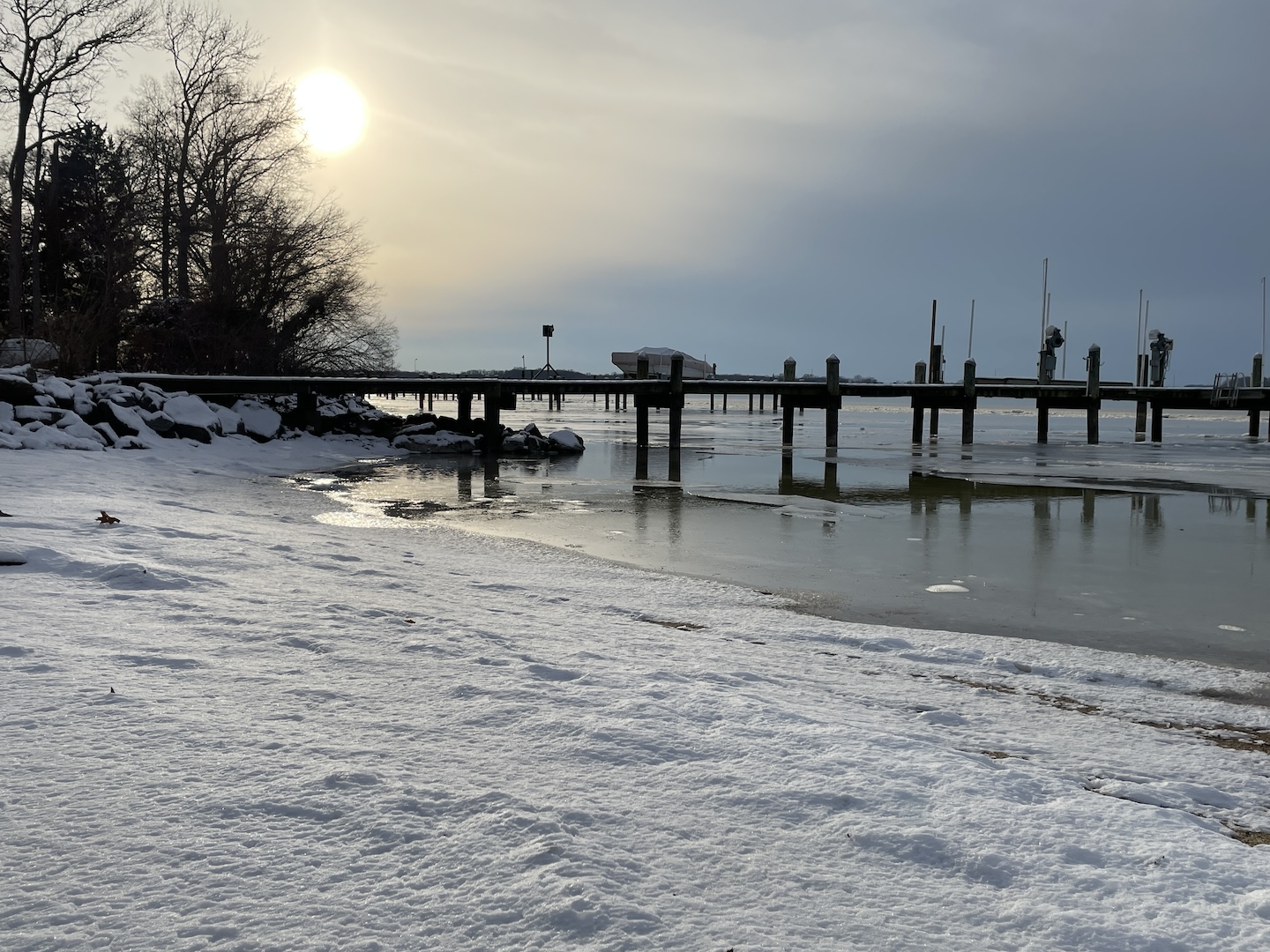
Another ice pic, from yesterday. Sun breaking through abundant clouds/virga made for an eerie light.

-

2025-2026 ENSO
40/70 Benchmark replied to 40/70 Benchmark's topic in Weather Forecasting and Discussion
Doubtful....at least in the mean. -
2025-2026 ENSO
40/70 Benchmark replied to 40/70 Benchmark's topic in Weather Forecasting and Discussion
-
December 2025 regional war/obs/disco thread
WinterWolf replied to Torch Tiger's topic in New England
Out east he believes..SE areas. -
Today was the 20th consecutive day of below normal temperatures at Central Park. Anyone know where to find out how long its been since we've had such a streak?
-
December 2025 regional war/obs/disco thread
WinterWolf replied to Torch Tiger's topic in New England
I think we could probably go back and find you saying the same about December too…hmmm. -

December 2025 Short/Medium Range Forecast Thread
Carvers Gap replied to John1122's topic in Tennessee Valley
The 18z AIFS has a -EPO ridge at the end of its run. A lot of this looks like SSW signals - hints of HL blocking. -

December 2025 regional war/obs/disco thread
Ginx snewx replied to Torch Tiger's topic in New England
Thoughts on wind Friday? -
We dissected this pattern enough I think. I just hope we are on the right side of things, but it’s concerning.
-
Thanks. For some reason I've never noticed it there.
-
Went from 38 at 4 pm to 28 at 5:15 as the sun slipped behind the mountain this afternoon. Currently 26.4/12.0 at 8 pm.
-

December 2025 regional war/obs/disco thread
weatherwiz replied to Torch Tiger's topic in New England
Weeklies are warm for January? big month of cold and snow incoming -

2025-2026 ENSO
donsutherland1 replied to 40/70 Benchmark's topic in Weather Forecasting and Discussion
I have no big changes from yesterday. Going forward, the WPO- is likely to become less negative and the EPO could go negative for a time, which would blunt the full effects of warming across the northern tier of the U.S. and especially Canada. The PNA will remain persistently negative. The changes favor a Southeast ridge, strong trough in the Pacific Northwest, and a weakening trough over the Northeast and eastern Canada. Thus, the southern tier of the U.S. and perhaps most of the CONUS could see a warmer than normal December 20-31 period overall. The warmup could take time to develop in New England and the upper Midwest. Canada should remain broadly colder than normal for the period overall. There's a chance that the warmth could finally overspread the Northeast as December concludes and January starts. Should an EPO+/AO+ pattern develop, that would increase prospects for warmth in the Northeast. The EPS favors a near neutral AO while the GEFS favors a negative one. -
Every time we are supposed to wake up to snow, I have a dream that I wake up to nothing. Never fails.
-
December 2025 regional war/obs/disco thread
Ginx snewx replied to Torch Tiger's topic in New England
46 day Weeklies hmm, normal to BN for all of New England with 5 to 7 inches of precipitation. Look it up. -
You can see it on tropical tidbits too albeit later vs pivotal weather.
-
December 2025 regional war/obs/disco thread
TauntonBlizzard2013 replied to Torch Tiger's topic in New England
Higher odds of me suiting up at fullback on Sunday night for the pats than a below normal January. -

Saturday night/Sunday 12/13-12/14 Jawn
MGorse replied to Ralph Wiggum's topic in Philadelphia Region
Yeah that report and probably a few others should have been removed from the final PNS. Just remember though, reports in PNSs and LSRs are all considered preliminary (not official). -
I was going to ask about donuts, But...........
-
The last few pages were entertaining, Especially Brians new bio, I lol'd at several of those and tossed several others with a