All Activity
- Past hour
-
 -1.4 _ -1.4 _ -1.7 __ -2.3 _ -2.5 _+0.9 ___ +1.5 _ +3.5 _ +0.8
 - Today
-
Sugar maples are my favorite!
-

Spooky Season (October Disco Thread)
Bryan63 replied to Prismshine Productions's topic in New England
Can't imagine landing at Logan is much fun tonight, number of flights circling, some even being diverted. -

Spooky Season (October Disco Thread)
WxWatcher007 replied to Prismshine Productions's topic in New England
Gusted to 30 and my anemometer is at 7ft. -
New CanSips looks pretty good for DJF. Dec looks really good & Jan not shabby either. I would share but I cannot get anything to share on this forum anymore. Everything is too big. Good grief, it is 2025.
-
Looks awesome, man. Love that the windows on the cupola open.
-

Mid to long range discussion- 2025
WinstonSalemArlington replied to wncsnow's topic in Southeastern States
-
It is very windy around here at times and those fast growing maples don't always stand up to the wind as well. I have a few sugar maples around the yard. Not as brilliant but the orange is about as beautiful as the reds on the autumn blaze maples.
-

Spooky Season (October Disco Thread)
dendrite replied to Prismshine Productions's topic in New England
Mitch is down to 33.5° Must be snowing there. -

Spooky Season (October Disco Thread)
AstronomyEnjoyer replied to Prismshine Productions's topic in New England
This is what I get for making stupid jokes. My power just cut for a few minutes, and I have literally no cell service at my house, as in, I can't even send SMS messages without the internet, lol. -
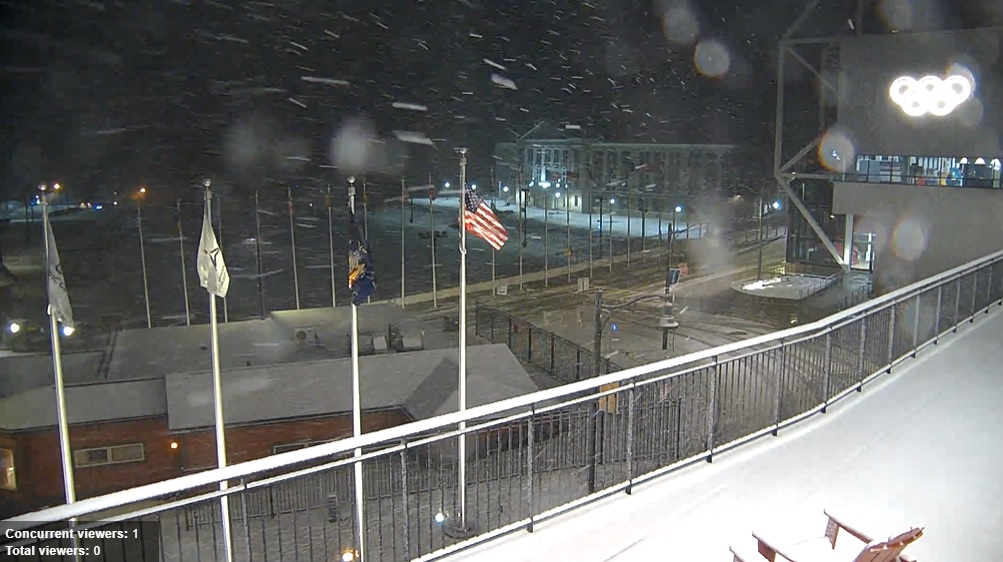
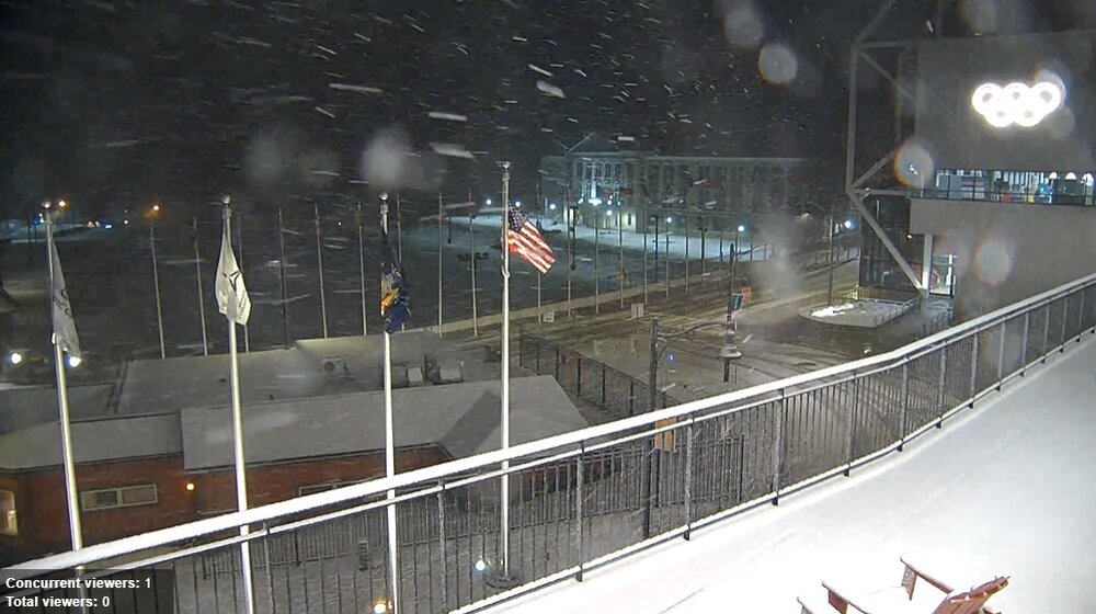
Lake Placid Village at the Olympic Complex is snowy.
-

Spooky Season (October Disco Thread)
CoastalWx replied to Prismshine Productions's topic in New England
Man gusts -
I just know that @George BM has already typed up his forecast, so I think he should drop it in here anyway.
-
Why is this ending?
-
Well, if the NNE Cold Season thread is back, then we really must be moving into snow season. I know we had those first snows back about a week ago, but it’s been fun to see some of the comments from the BTV NWS crew as this next event has approached. You could really feel some of the “pro snow” mentality in yesterday’s discussion: Area Forecast Discussion National Weather Service Burlington VT 216 PM EDT Thu Oct 30 2025 NEAR TERM /THROUGH FRIDAY/... Trends have been our friend if you are looking for snowfall with changeover occurring in the central/northern Greens btwn 8 PM and 11 PM Friday evening. Snow level look to drop to around 1000 feet by 12z Sat, as progged 925mb temps drop btwn -2C and -3C, while progged 850mb temps are in the -3C to -5C. The ingredients look favorable for a period of upslope rain and snow showers on Friday night with good 850 to 700mb rh >80%, strong 850mb winds of 35 to 45 knots, and moderately strong caa. This wl help to enhance precip with highest pops/qpf acrs the favorable upslope areas of northern Dacks and central/northern Greens. Snow accumulations range from dusting to 2 inches btwn 1000 and 2000 feet and 1 to 3 inches btwn 2000 and 3500 feet and up to 4 or 5 inches above 3500 feet by mid morning Sat. I have tried to highlight this thinking in the latest storm total snow grids. Did utilize the NAM3KM hourly temps in grids to show cooler air moving into the area faster, especially acrs the higher trrn on Friday evening. SHORT TERM /FRIDAY NIGHT THROUGH SATURDAY NIGHT/... As of 216 PM EDT Thursday...Upslope rain and snow showers wl slowly taper off on Sat with blustery and chilly conditions prevailing. Highs generally in the mid 30s to mid 40s, except only upper 20s summits. Could we see the guns fire atop Killington this weekend? Otherwise a general drying trend is anticipated by Sat night with lows back in the lower 20s to mid 30s. Actually, after a really pleasant stretch of fall through much of September and October, it looks like we’ve had quite a shift in the level of weather activity in this last third of the month. Here at our site there’s been rain on 10 out of the last 12 days, and it pushed us past 5 inches of liquid for October. That’s still a bit below average, but it’s definitely a shift from earlier in the fall. The pattern looks like it continues to be active well into November. If one includes this current storm, a quick run through the GFS and other medium-range models out through mid-month shows 7 to 8 systems coming through the area, and all of them have the potential to offer some snow. It’s not especially cold for November, but those 850 mb temperatures spend plenty of time at or below 32 F. It looks like a lot of systems scooting through in the northern stream, and we know what that means around here.

-
Spooky Season (October Disco Thread)
AstronomyEnjoyer replied to Prismshine Productions's topic in New England
Not to brag, but my anemometer recorded a massive gust of 20.6 mph earlier today. Massive damage too. One of my plastic Adirondack chairs tipped over. -

Spooky Season (October Disco Thread)
Prismshine Productions replied to Prismshine Productions's topic in New England
All of Brattleboro briefly lost power an hour ago Sent from my SM-S166V using Tapatalk -

Spooky Season (October Disco Thread)
Nova737 replied to Prismshine Productions's topic in New England
Barely any wind here. -

Major Hurricane Melissa - 892mb - 185mph Jamaica landfall
Coach McGuirk replied to GaWx's topic in Tropical Headquarters
It was a small storm but powerful storm, fortunately it hit a smally populated area on landfall. -
.thumb.png.4150b06c63a21f61052e47a612bf1818.png)
Spooky Season (October Disco Thread)
HIPPYVALLEY replied to Prismshine Productions's topic in New England
Best non-convective winds here in quite some time. -
Going to be a cold one tonight. Temp already down to 37.
-
-
Spooky Season (October Disco Thread)
HIPPYVALLEY replied to Prismshine Productions's topic in New England
Roaring wind right now. Grateful it held off for trick-or-treating, but it sounds like a freight train up high. The hill towns must be getting hammered. -
Spooky Season (October Disco Thread)
dendrite replied to Prismshine Productions's topic in New England
ORH 44…meh Looks like mostly 30s and 40s for gusts except higher SE MA. ACK just hit 61. -
A different world from CT. A completely different world being at that elevation, but in a valley surrounded by big terrain too. Elevational snows and radiational cold mins combined.