All Activity
- Past hour
-
GFS/Canadian/Ukie Vs. Euro's - the HP location will have the final say IMO
-
 One of those somewhat rare deals where interior has more wind issues than coast with this in terms of trees and lines out of a direction trees are not used to gusts from that direction.
 -

2026 C and E Pacific tropical activity
WxWatcher007 replied to GaWx's topic in Tropical Headquarters
And there’s your update Hurricane Polo Tropical Cyclone Update NWS National Hurricane Center Miami FL EP172026 100 PM CST Tue Sep 22 2026 ...HURRICANE HUNTER AIRCRAFT FINDS POLO HAS STRENGTHENED EVEN MORE... Reports from a NOAA Hurricane Hunter aircraft indicate that the maximum winds in Hurricane Polo have increased to near 180 mph (285 km/h) with higher gusts. The minimum central pressure has dropped to 892 mb...26.34 inches. Polo is nearly stationary but is expected to move generally west-northwestward over the next couple of days. SUMMARY OF 620 AM AST...1020 UTC...INFORMATION ---------------------------------------------- LOCATION...14.6N 101.5W ABOUT 210 MI...335 KM S OF ZIHUATANEJO MEXICO ABOUT 360 MI...575 KM SSE OF MANZANILLO MEXICO MAXIMUM SUSTAINED WINDS...180 MPH...285 KM/H PRESENT MOVEMENT...STATIONARY MINIMUM CENTRAL PRESSURE...892 MB...29.59 INCHES $$ Forecaster Pasch/Hagen -
Where are you located now?
-
Full moon too. Yes it would be ugly for the coasts.
-

October Comes Early: Late September Multi-Hazard Hybrid Storm
Bostonseminole replied to WxWatcher007's topic in New England
yeah maybe 40-50 max gusts -

October Comes Early: Late September Multi-Hazard Hybrid Storm
ineedsnow replied to WxWatcher007's topic in New England
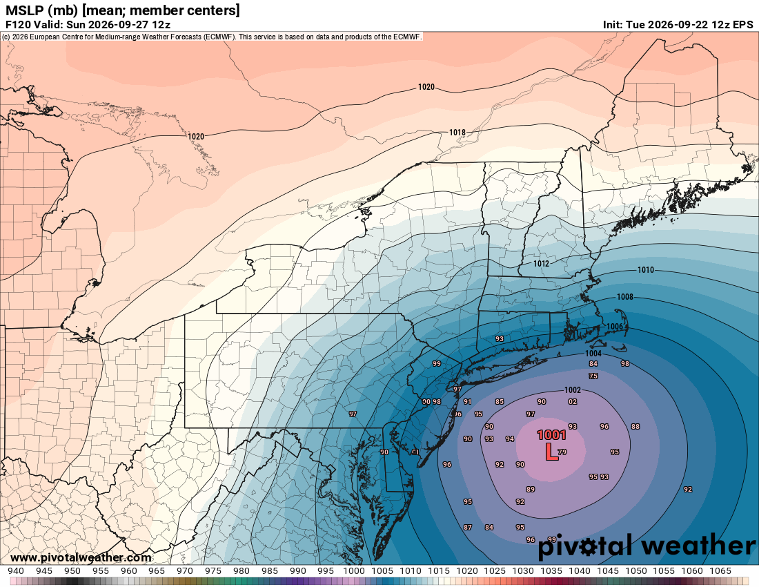
EPS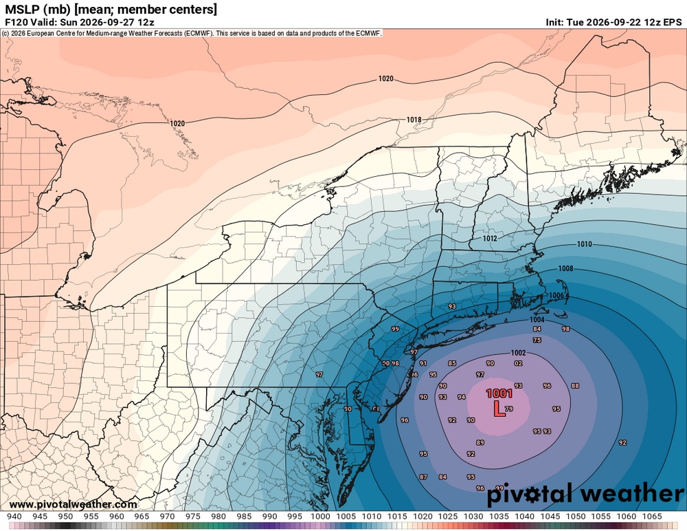
-

October Comes Early: Late September Multi-Hazard Hybrid Storm
CoastalWx replied to WxWatcher007's topic in New England
It would cause outages, but it’s nothing we haven’t seen before in October when there still is leaves on the trees. At least on the coast. Obviously, inland it matters. -
.79" today + 1.12" yesterday. No complaints!
-

October Comes Early: Late September Multi-Hazard Hybrid Storm
SouthCoastMA replied to WxWatcher007's topic in New England
yea there will be some damage especially in areas further west..the trees are pretty hardy in this region though. twigs and maybe some limbs possible with that. -

October Comes Early: Late September Multi-Hazard Hybrid Storm
MJO812 replied to WxWatcher007's topic in New England
Eps is further west -
Eps is further west
-
0.06 here from some passing light showers. Benign pattern going forward so should dry out over the next 7-10 days.
-
M0.6" just off Academy Ave in Reisterstown as of 7am this morning.
-

October Comes Early: Late September Multi-Hazard Hybrid Storm
weatherwiz replied to WxWatcher007's topic in New England
40-60 mph gusts is a pretty big deal when you have fully leaves trees, especially when you're talking about a long-duration of those gusts. Summer thunderstorms which gust in that range for like 20 seconds knock down tree limbs and power lines -
See it , hear it, feel it
-
October Comes Early: Late September Multi-Hazard Hybrid Storm
SouthCoastMA replied to WxWatcher007's topic in New England
40-60mph gusts is a typical October nor'easter around here. Seems like a big deal becuase it has been boring as ****. -

2026-2027 Record-breaking El Nino
LakePaste25 replied to Stormchaserchuck1's topic in Weather Forecasting and Discussion
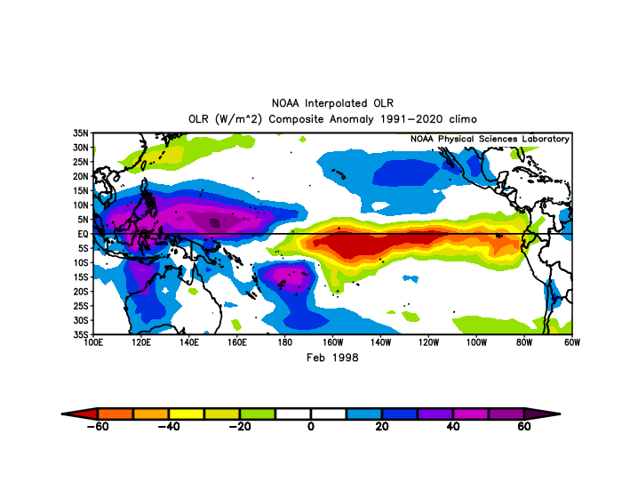
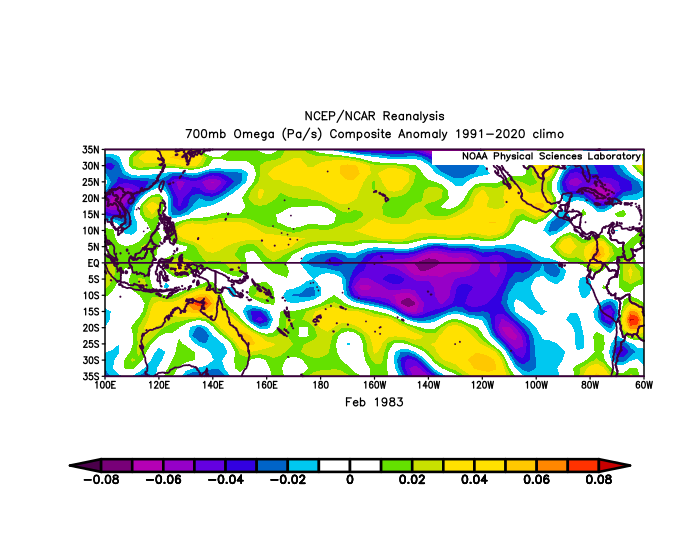
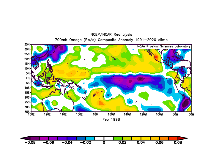
Can really see the difference here: Both had convection pretty far east, but 1983 was more concentrated just east of the dateline during February, while 1998 had more periods of Eastern Pacific forcing.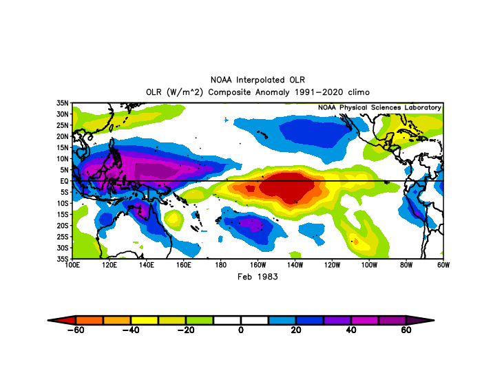
-
October Comes Early: Late September Multi-Hazard Hybrid Storm
CoastalWx replied to WxWatcher007's topic in New England
I don’t see 70 right now. -
To answer your question…absof******lutely! Considering I haven’t experienced a snowstorm over 6 inches since 2016. I’ve seen everything else since 2016. Brutal cold stretches leading to frozen bodies of water, frequent light snow events, a moderate snow event that sticks around for weeks due to the cold that followed. I need the big dog. I would easily sacrifice 90% of the winter to get one MECS/HECS. I need that feeling again. It’s been so long. I will say that I come into the season with a different perspective than you overall, though. I don’t consider this to be the most depressing 6 months of the year. I’d take October-March over April-September pretty much every time, no matter what the specific winter weather circumstances are.
-
Big Infrastructure issues Let’s do this . Except coasts will gust 70+.
-
 prednisone over the counter uk: Axeryl - prednisone purchase online
 -
On the Euro, you would be looking at a potentially major coastal flooding event. Tides are already running above average because of the persistent Easterly flow and you would be looking at 30-40kts winds beginning Thursday evening, increasing to 40-45kts by Friday evening. Winds subside over the weekend but the Easterly flow remains so the water really has no chance to drain out. It looks particularly bad on the Sound.
-
October Comes Early: Late September Multi-Hazard Hybrid Storm
CoastalWx replied to WxWatcher007's topic in New England
Think gradient is more N to NE there. -
We're up to 9 consecutive days with measurable precipitation in DeKalb. Makes it difficult to mow the lawn that sprang back to life...