All Activity
- Past hour
-
Do you think this pattern is permanent because it looks like it.
-
Looks like a solid 1-2" Snow for northern NC/southern VA with some locally getting 3".
-
But Nam 3k destroys our soul
-
Hrrr took everything away but then the Nam destroys us
- Today
-
Not a single post about ANY of the 00z runs of the models tonight. Just a massive snorefest.
-

December 2025 Short/Medium Range Forecast Thread
John1122 replied to John1122's topic in Tennessee Valley
-
December 2025 Short/Medium Range Forecast Thread
John1122 replied to John1122's topic in Tennessee Valley
OHX has issued WWA for snow, sleet, and freezing rain for their Plateau areas. -

December 2025 regional war/obs/disco thread
Torch Tiger replied to Torch Tiger's topic in New England
0z gefs etc. look (relatively) cold through 12/20 -
December 2025 regional war/obs/disco thread
Torch Tiger replied to Torch Tiger's topic in New England
or bust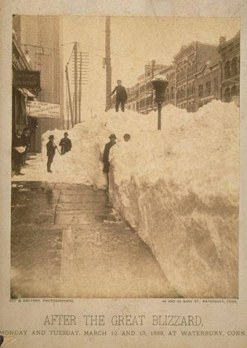
-

Occasional Thoughts on Climate Change
frontranger8 replied to donsutherland1's topic in Climate Change
Nature Retracts Study Predicting Catastrophic Climate Toll - The New York Times https://share.google/xRSyFAwbx54BMddiW -
-
Touche
-
Interesting, the dam is actually on the north side of town but they're low elevation so maybe that explains the lower total? I'd say close to 2" where I am but not entirely sure because it flipped to rain way before I got home.
-
If you complained twice a year you could comment.
-
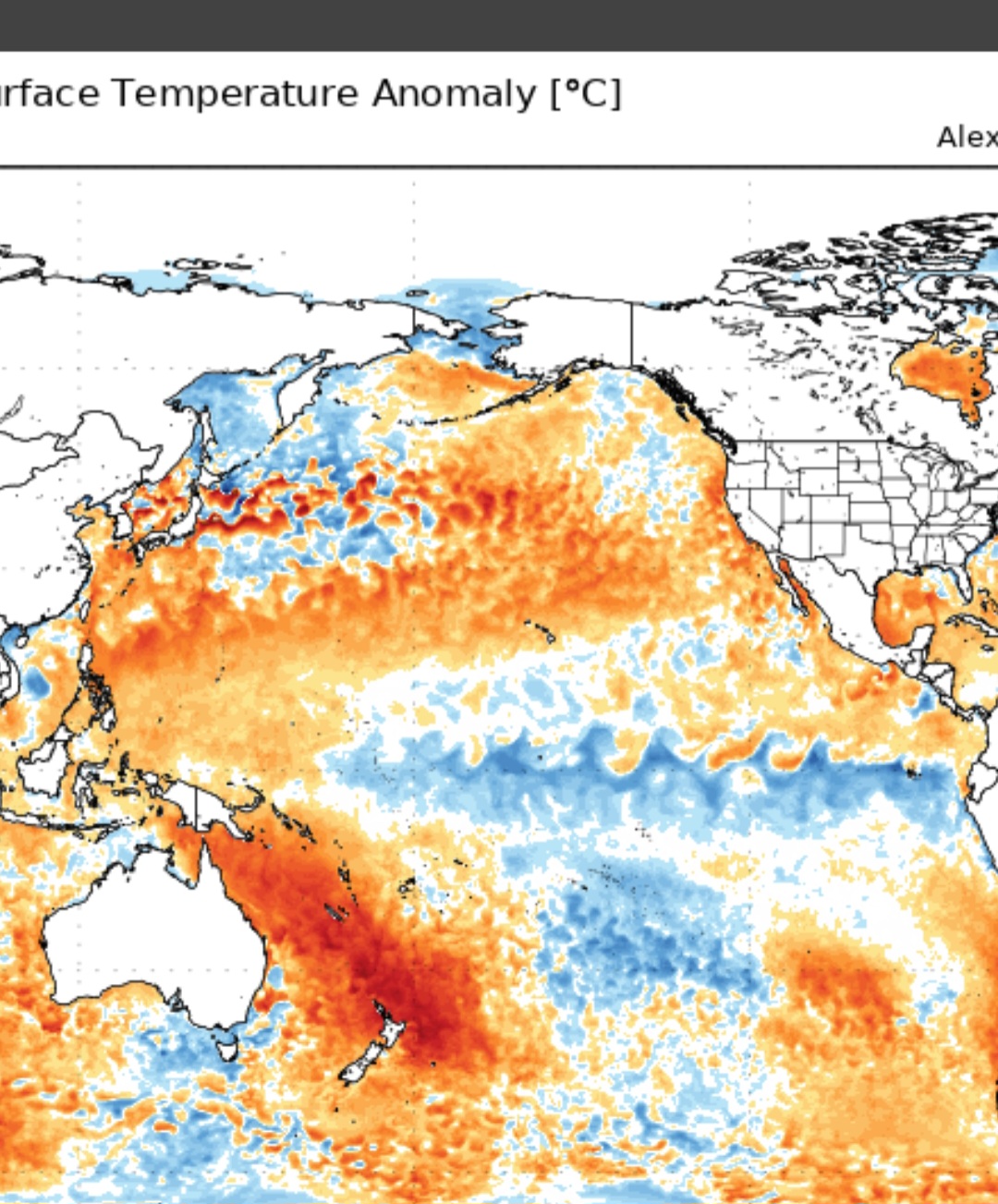
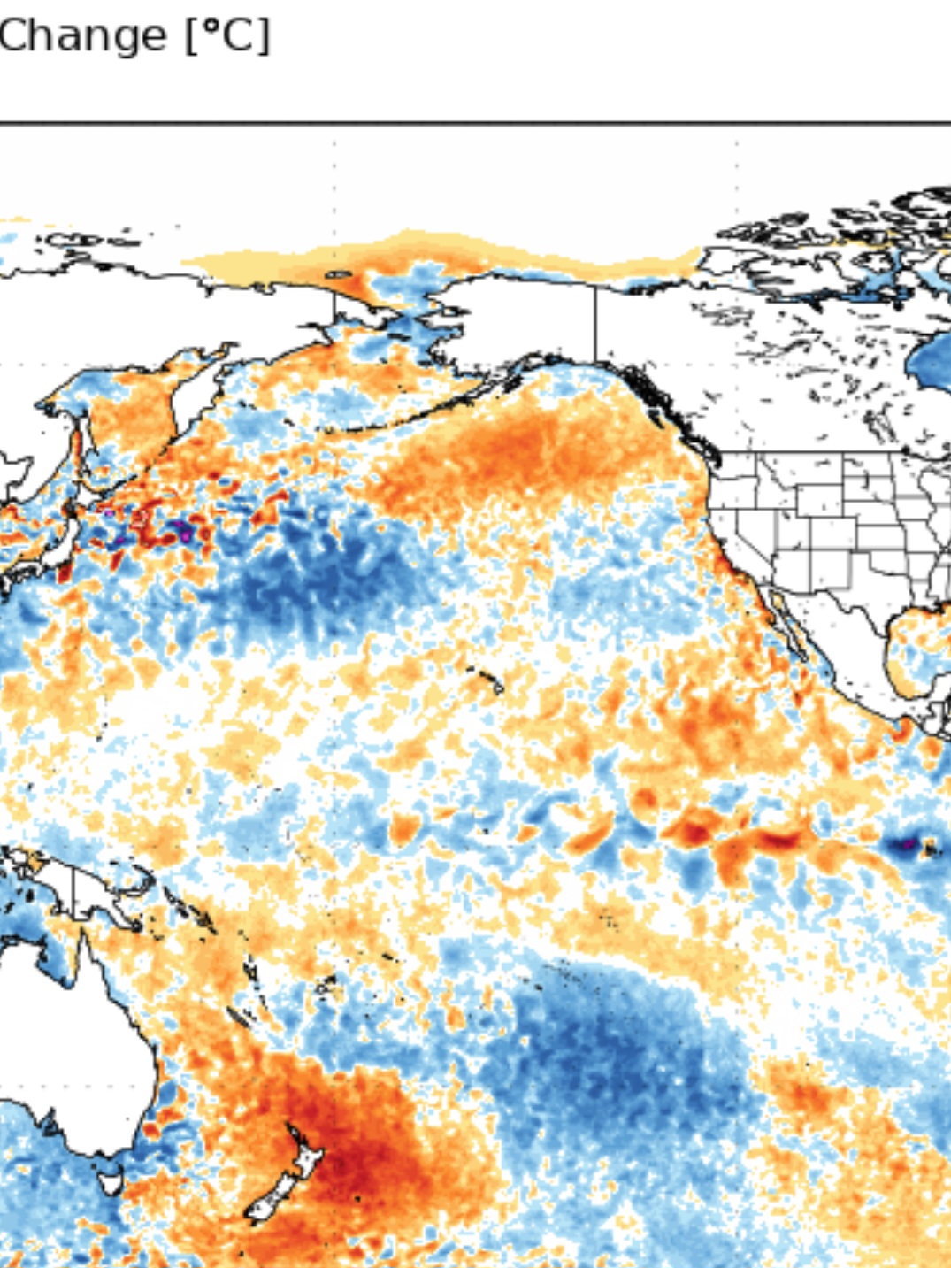
N. PAC Current 30 day change


-
Yeah but you just complained though
-
December 2025 regional war/obs/disco thread
Torch Tiger replied to Torch Tiger's topic in New England
what is? maybe forum melts, not sure you get more than 50" tbh. Hope you get 100" though -
December 2025 regional war/obs/disco thread
Torch Tiger replied to Torch Tiger's topic in New England
That was quite the wintry 0z gfs run. days n days like ineedsnow mentioned. It's been showing up and hopefully comes to fruition. Also hoses NYC south so it's an added bonus! -
It's the moon.
-
29.8, I hope we get some snow Friday morning.
-

Mountain West Discussion
mayjawintastawm replied to mayjawintastawm's topic in Central/Western States
Saw this and thought "GFS is hallucinating again", now I can't get that map and "Lucy in the Sky with Diamonds" out of my head. Groovy. -
Last few GFS runs have been really neat. We're breaking the color chart. Yesterday's 00z gfs actually gave W Yellowstone 100" lol.
-
Our best chance to see some snow this month may be from a quick hitting Alberta Clipper or associated cold front. But of course we're talking light snow and nothing major. The trough is just too far east and the flow too flat. There isn't enough room or time for anything to really dig and slow down, gather moisture, and trigger a major winter storm as the maps look now. But it's early still and the models are not that good. Subtle adjustments and you just know they're going to happen could change things. We watch and wait. Most of my prior threat dates are now not so near misses. WX/PT
-
00z GFS Model – Total Snowfall (10:1 SLR) for Southeast U.S. | Tropical Tidbits
- 1 reply
-
- 1
-

-

2025-2026 ENSO
so_whats_happening replied to 40/70 Benchmark's topic in Weather Forecasting and Discussion
Nice looks like the call for a trimonthly of ~ -0.6 was a good call. Should continue to rise from here slowly. Unfortunately I do not think this will be an 'official' La Nina based on ONI numbers but darn close like last year. Still liking my call of about the week of Christmas into the new year being the warm up time frame leaving the tail end of phase 8 into 1. Here is an updated subsurface from beginning of October to December 1st. Also @donsutherland1 I'm still working on chatting with you about RONI. I may just create a different thread and tag you instead of keeping it in this one, we will see. Hope to be done by this weekend. Work and life just taking precedence right now unfortunately..thumb.gif.fef884beb57aaa9892dc228e3b124baa.gif)


.gif.59f481e87ce86cba7dd7edf152c4f8e7.gif)