All Activity
- Past hour
-
What you just described in the last paragraph is exactly the definition of a fake airmass.
-
Looks humid end of next week
-
I’m not going to get angry….but there’s nothing fake about it. Is it radiational? Absolutely. But not fake. When it snows only at elevation, is it fake snow? I think we know the answer to that. So when I see fake cold….gonna push back every time. Such a stupid term…you guys should be ashamed of yourselves. Trees, plants, animals and people don’t know the sensible difference if it’s 29 at the surface, and 36 at 1000ft.
-
At least we have endless Indian Summer. Low 70s Friday.
-
No worries about the record ElNino.... APPARENTLY AN INCOMING SSWE IS GONNA SAVE US ALL !!!
-
Hilltops don’t do fake cold which is what this entire last few weeks has been. You know when it warms 30-45 degrees during the day it’s fake . We get cold on CAA. Cooler daytime highs as well in this fake stuff . You must be like Hunch is, in an elevated valley between hills
-
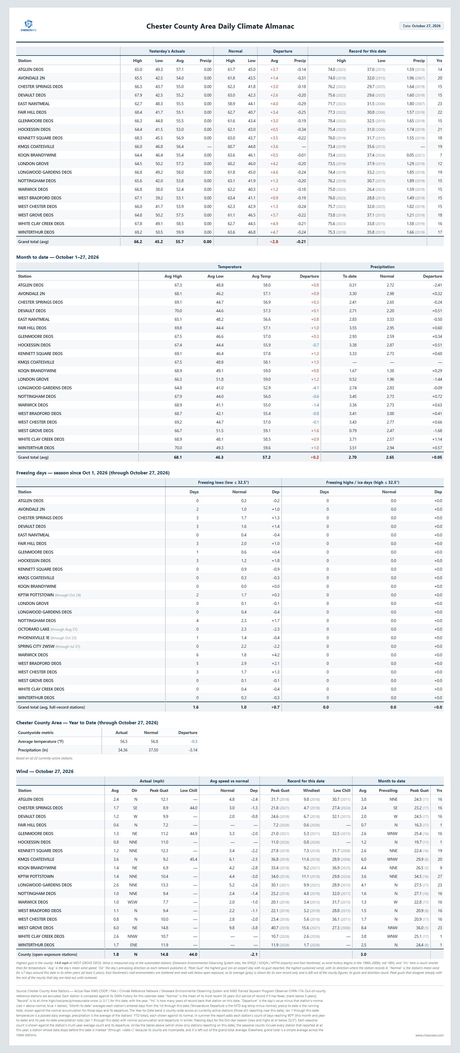
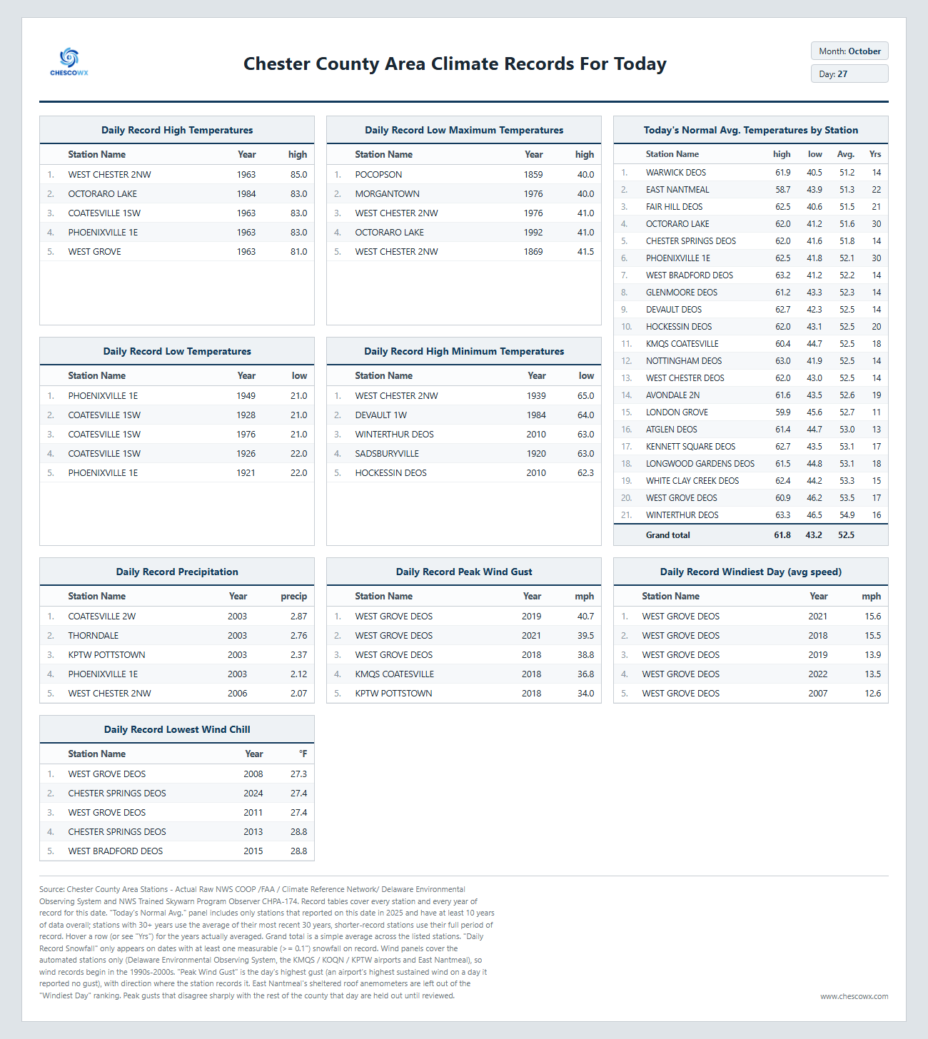
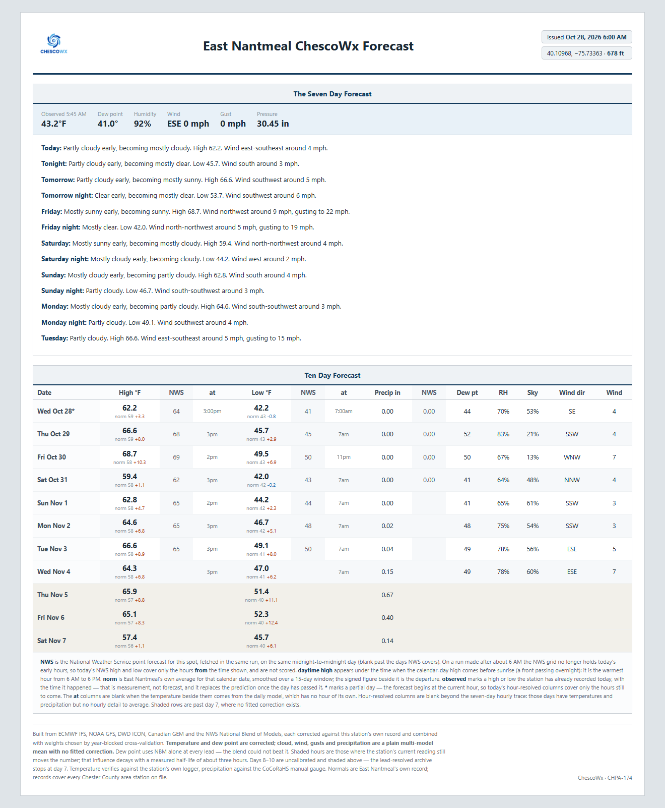
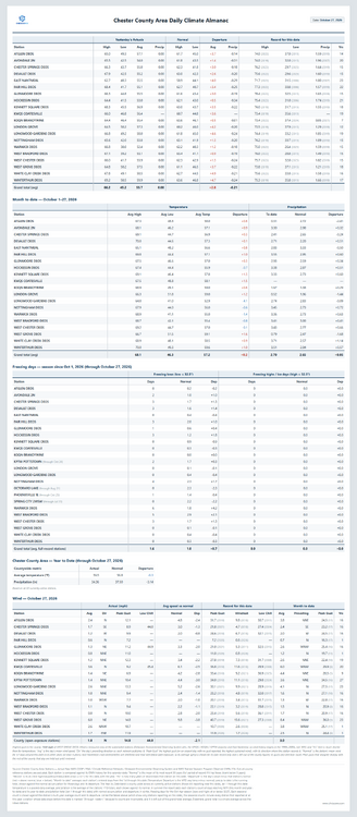
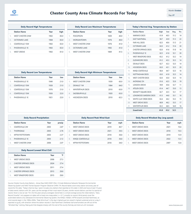
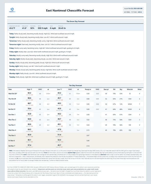
Today we should see highs from low 60's in ridge locations to the mid 60's in valley spots with lows tonight in the low to mid 40's. Highs will reach well into the 60's to near 70 degrees through Friday which is 5 to 9 degrees above normal before we chill down a bit to near normal by Saturday for the trick or treaters, but by Sunday we warm to the mid 60's which is 4 to 8 degrees above normal. It has been a while since our last rain but a chance of a shower or two next Wednesday according to the ChescoWx model. Of note 14 years ago today back in 2012 the Chester County Area was at the start of a 3 day storm that left as much as 6.97" of rain at the Nottingham DEOS. This was the remnants of Hurricane Sandy which tracked within about 20 miles of the county.
-

E PA/NJ/DE Autumn 2026 Obs/Discussion
ChescoWx replied to PhiEaglesfan712's topic in Philadelphia Region
Today we should see highs from low 60's in ridge locations to the mid 60's in valley spots with lows tonight in the low to mid 40's. Highs will reach well into the 60's to near 70 degrees through Friday which is 5 to 9 degrees above normal before we chill down a bit to near normal by Saturday for the trick or treaters, but by Sunday we warm to the mid 60's which is 4 to 8 degrees above normal. It has been a while since our last rain but a chance of a shower or two next Wednesday according to the ChescoWx model. Of note 14 years ago today back in 2012 the Chester County Area was at the start of a 3 day storm that left as much as 6.97" of rain at the Nottingham DEOS. This was the remnants of Hurricane Sandy which tracked within about 20 miles of the county.
-
Be more specific. how to piss off @CoastalWx!
-
2026-2027 Record-breaking El Nino
EasternLI replied to Stormchaserchuck1's topic in Weather Forecasting and Discussion
Would be consistent with a move towards a negative AO... -
It would be lol. Watch it be dryer and colder than last winter. It seems like it's always the opposite of what humans think will happen. I've been humbled by mother nature so many times.
-
If anyone seen latest cfs monthlies on Tropical tidbits went complete torch and way drier. Storm systems just seem so hard to come by anymore. Hope it was just a crap run and starts to go back the other way and not keep getting worse lol.
-

October 2026 general discussion
Prismshine Productions replied to Typhoon Tip's topic in New England
I know, still fun to look at however Sent from my SM-S176V using Tapatalk -
Because it’s fakiational cooking. Look at ORH.
-
Going to be funny when it just stays dry all winter too lol
-

2026-2027 Record-breaking El Nino
mitchnick replied to Stormchaserchuck1's topic in Weather Forecasting and Discussion
All the ensembles have been heading toward a SE trough (or weakening of heights as a possible precursor of the trough) in one form/location/strength or another consistent with seasonal modeling. Of course, they maybe, like so often, early with the pattern. But it's encouraging to see it happening nonetheless. -
32 degrees this morning but no frost. Had to get up early and make a local airport run for my Aunt who flew up to visit and see the leaves. She’s heading to Charlotte.
-
low of 28, some frost
-
2026-2027 Record-breaking El Nino
EasternLI replied to Stormchaserchuck1's topic in Weather Forecasting and Discussion
Nice big +EAMT leading to a Pacific jet extension on the 11-15 day EPS. - Today
-
same here. oaks are starting to shed the leaves, had very few on the ground until Monday, now the lawn is covered with them.
-
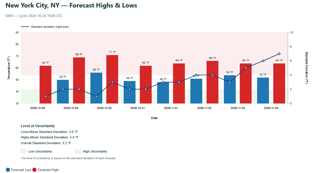
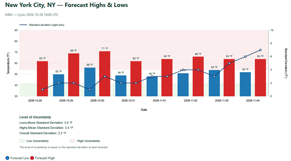
The latest NBM remains very mild for the start of November. Uncertainty increases at the end of the run.
-
His spot really amazes me.. I've had frost just about every morning.. not sure why his spot is always warmer.
-
37.4 for the low and FTW
-

2026-2027 Record-breaking El Nino
LakePaste25 replied to Stormchaserchuck1's topic in Weather Forecasting and Discussion
Nice to see Eric latch on to this idea! I’ve been saying this for awhile now and so has @40/70 Benchmark. The shutdown of MC forcing combined with stronger E pac forcing could enhance the eastward extent of the southern stream in the E US, which would keep the ridge further north in Canada. -
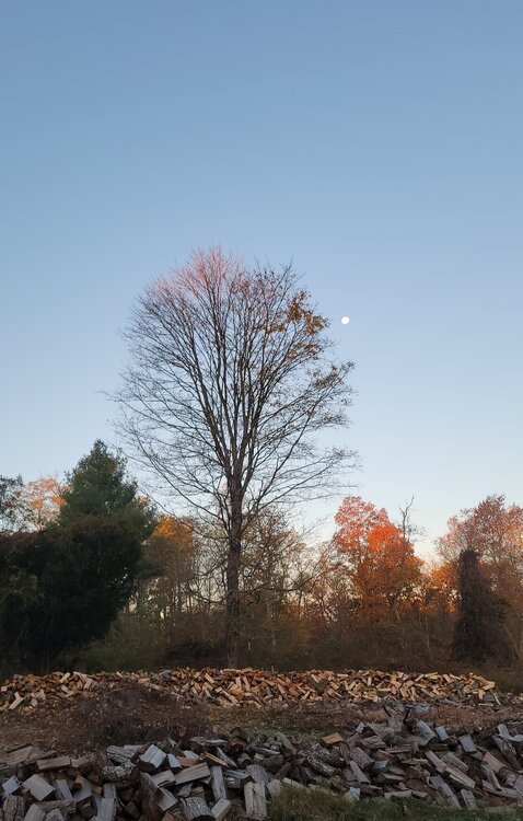
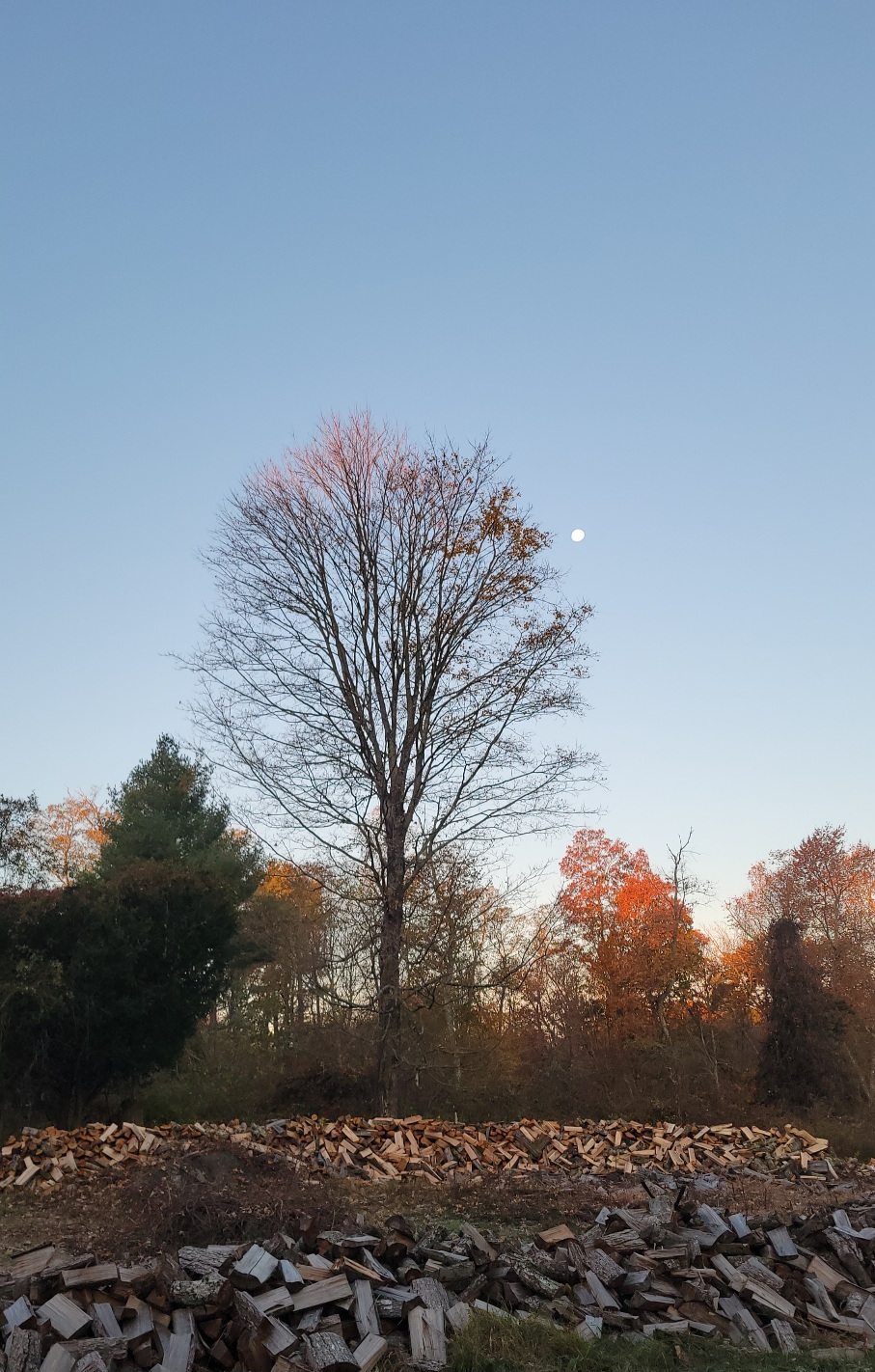
Pretty morning.