All Activity
- Past hour
-
Probably because those jogging shorts make it far easier for the weed wacker to reach its intended target
-
NAM nailed the last one! .
-
Need the clipper this weekend to trend stronger A-la the euro to ward off scary evil spirits (the baroclinic zone). Stronger lead wave suppresses everything that follows it leading to a less amplified, further SW storm track.
-
A little blocking could work too to keep that high anchored in...
-
Less than 48 hours away and we have the NAM 3k with no accumulation north of Richmond and the Euro with 0.3” in NYC.
-
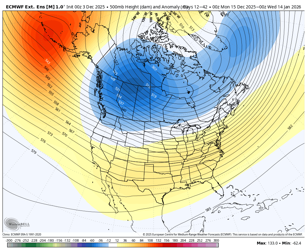
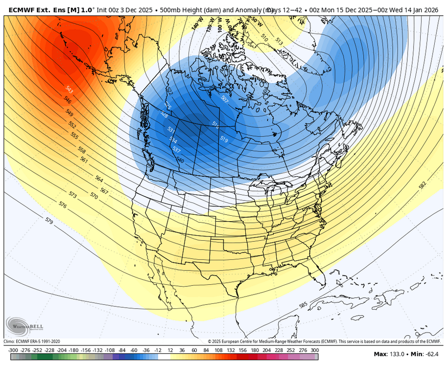
Monster +PDO in a warm neutral/moderate nino. NYC's not seeing a KU till the pac jet is utterly defeated.
-

2025-2026 ENSO
brooklynwx99 replied to 40/70 Benchmark's topic in Weather Forecasting and Discussion
the weeklies usually defer to ENSO climo as you head later into the winter anyway -
This past one at the surface had a good track but the high was booted out like no one’s business and the surface winds turned SE ahead of it at the coast. Also it was on the move so fast that the mid levels could not develop a CCB and wrap cold air in after the surface to mid levels were torched. Maybe in Feb with the coldest waters of the season and preexisting deep cold air mass this could’ve worked.
-
I see. So your forecast...despite this you're sticking with it? I'm trying to figure out how we get to an 18-20" total given what you just laid out.
-
Load the 3k
-
I’m assuming this Euro Weeklies H5 has a good chance to verify way off in the E US considering the projected MJO as well as PNA analogs that suggest a +PNA would be likely in Jan and also that the Euro has been correcting for a too strong SER recently:
-
Looks lighter on the accumulations though
-
I wasn't trying to be snarky or confrontational...I am sorry if it came off that way.
-
With a weaker STJ and a stronger NS (both typical in a Nina base state) it's not unusual for a lot of these waves to end up too weak or suppressed. There is a reason the snowfall minimum (wrt averages) is pretty much right over us in a Nina. There is a better chance of more snow wrt average if you go in any direction...we are too far south for the NS dominant systems and too far north for the weaker STJ systems in a nina pattern. This is a generalization and not to be applied to every situation...but it's going to end up truth in the means over the longer periods...what we have seen is not some bad luck, its what happens in this type of pattern. We need to get out of it.
-
was it over when the Germans bombed pearl harbor?
-
You can claim to examine my psychology as much as you want but I'm sure you'd agree the smartest forecast one can do these days is aim low on I95 snow
-
Thanks
-
Where have we seen the pacific ruining I95 snow chances before ? Oh wait.
-
Colder, juicier nam run
-
Hey I lived in Nova so I gotta cover the VA public schools as that’s where nearly every single one of them went. If you have a map that includes MD I’ll happy use that instead thougu!
-
Feel like we can just play history here and say it's staying south and this model blend will correct that way (unfortunately)
-

December 2025 regional war/obs/disco thread
WinterWolf replied to Torch Tiger's topic in New England
That thing sucks…lol. But ok. -
That was the max on 12/25/2020 at CAR. +35 anyone?
-
18z Nam's a wreck. I think we're better off if the 12/5 threat fizzled and left some energy behind for our next long shot.
-
1.4" snow/sleet .. total event QPF 1.07"