All Activity
- Past hour
-
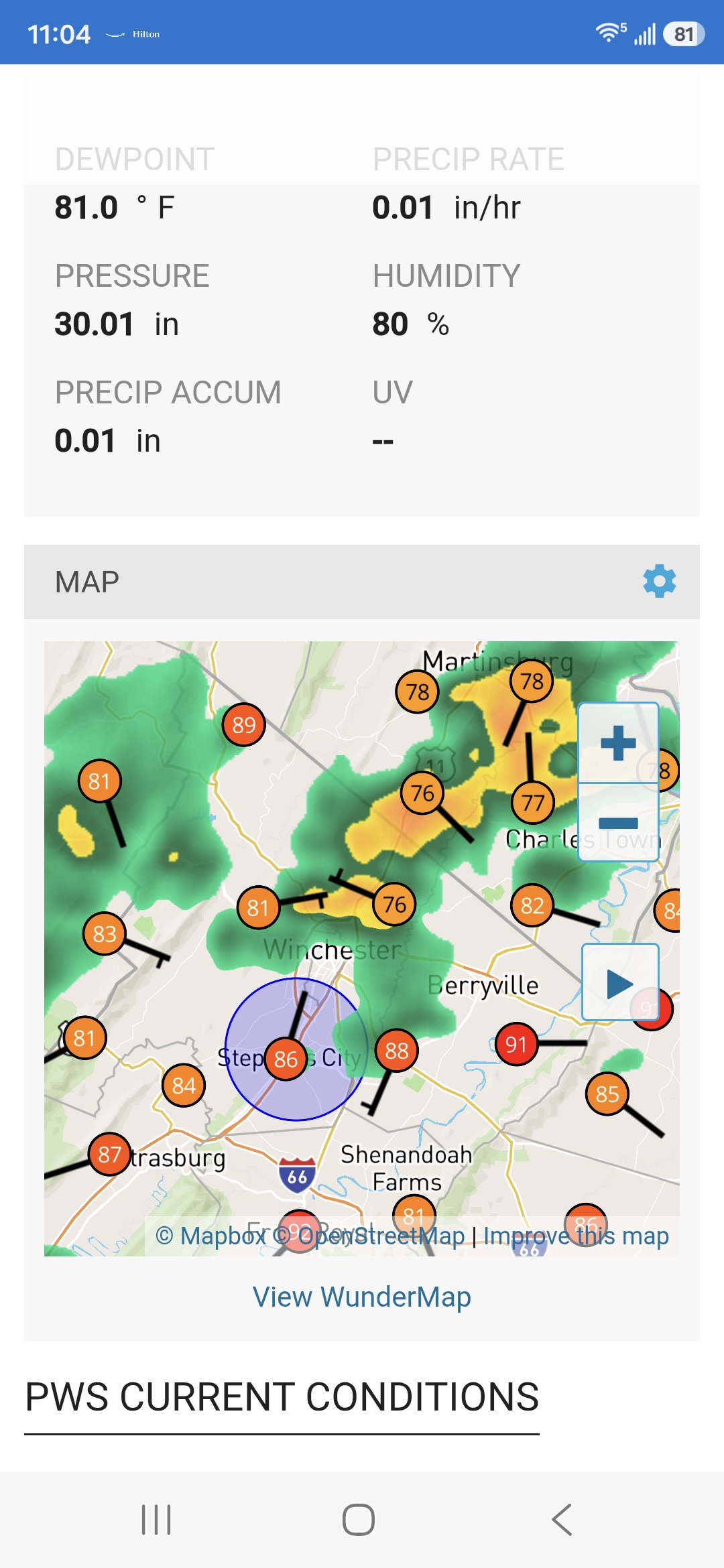
Just missed some heavy rain by feet...still managed to pick up 0.11 by accident
-

Central PA Summer 2026 Discussion/Obs Thread
Itstrainingtime replied to Voyager's topic in Upstate New York/Pennsylvania
Northern York county seems to be ground zero right now. -
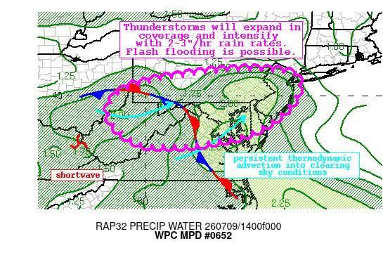
BULLETIN - EAS ACTIVATION REQUESTED Flash Flood Warning National Weather Service New York NY 119 PM EDT Thu Jul 9 2026 The National Weather Service in Upton has issued a * Flash Flood Warning for... Kings (Brooklyn) County in southeastern New York... Richmond (Staten Island) County in southeastern New York... * Until 415 PM EDT. * At 119 PM EDT, Doppler radar indicated thunderstorms producing heavy rain across the warned area. The expected rainfall rate is 1.5 to 2.5 inches in 1 hour. Additional rainfall amounts of 1 to 3 inches are possible in the warned area. Flash flooding is ongoing or expected to begin shortly. HAZARD...Flash flooding caused by thunderstorms. SOURCE...Radar. IMPACT...Flash flooding of small creeks and streams, urban areas, highways, streets and underpasses as well as other poor drainage and low-lying areas. * Some locations that will experience flash flooding include... Flatbush, Coney Island, Todt Hill, Crown Heights, The Verrazano Narrows Bridge, Huguenot, Canarsie, Bay Ridge, Port Richmond, Tottenville, Tompkinsville, Bensonhurst, Oakwood, Park Slope, Sheepshead Bay, Annadale, New Dorp, Grasmere, Heartland Village and Greenridge.
-
Yeah I'm right on the northern fringe of it. Low end heavy rain right now. I've been watching the lightning in the southern sky. Slow moving downpours that can cause flooding, but as you said it appears the worst will stay just to our south. Keeping an eye on radar though to see if any of this shifts north.
-
Need a turning of the worm here
-
.thumb.gif.f92b16c631a1d15d405ed77b33f0710d.gif) Perfect!
Perfect! -

2026-2027 Super El Nino
LakePaste25 replied to Stormchaserchuck1's topic in Weather Forecasting and Discussion
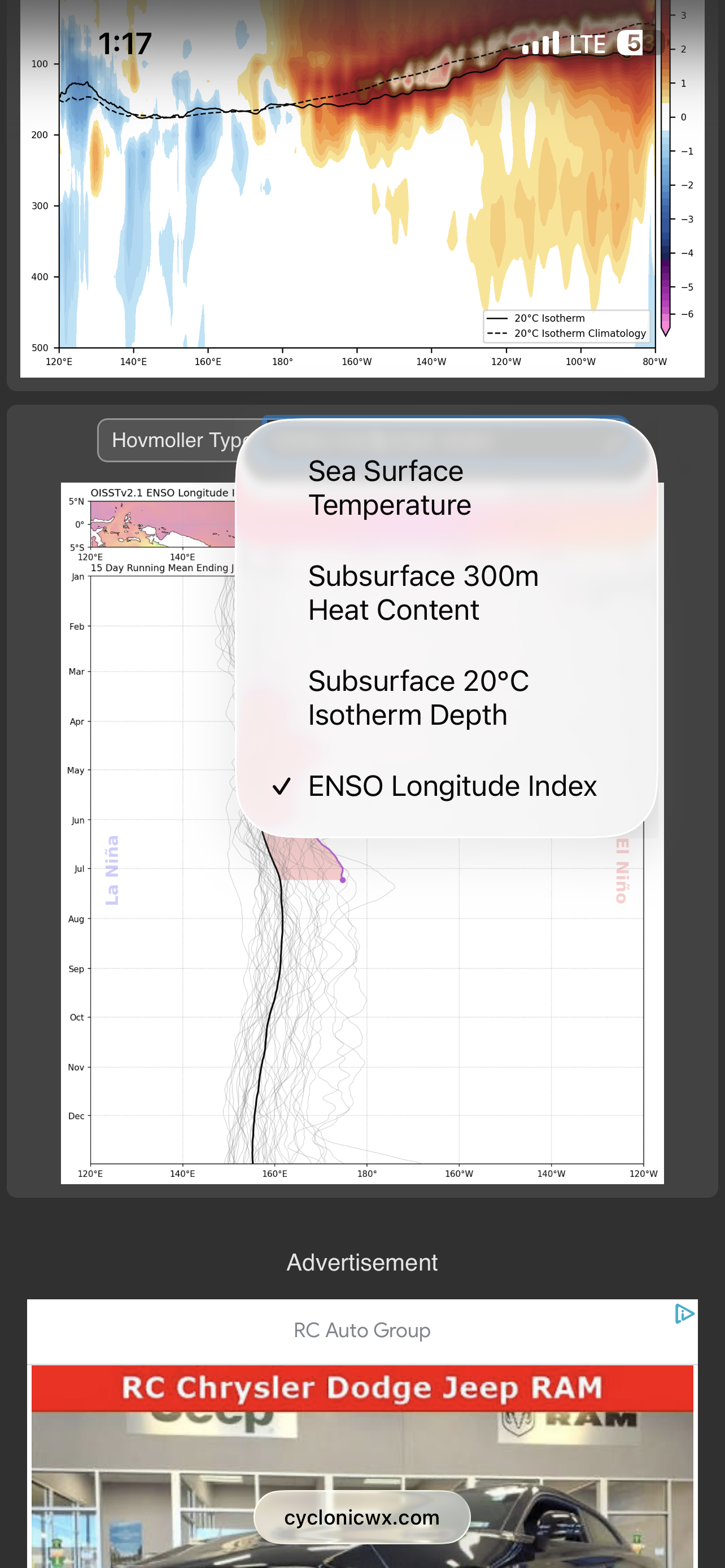
It’s free on Alex Boreham’s site (cyclonicwx.com) SST page. That second link I posted is from a forecaster that went and tabulated it for past ENSO events which isn’t paywalled either.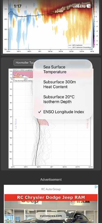
-
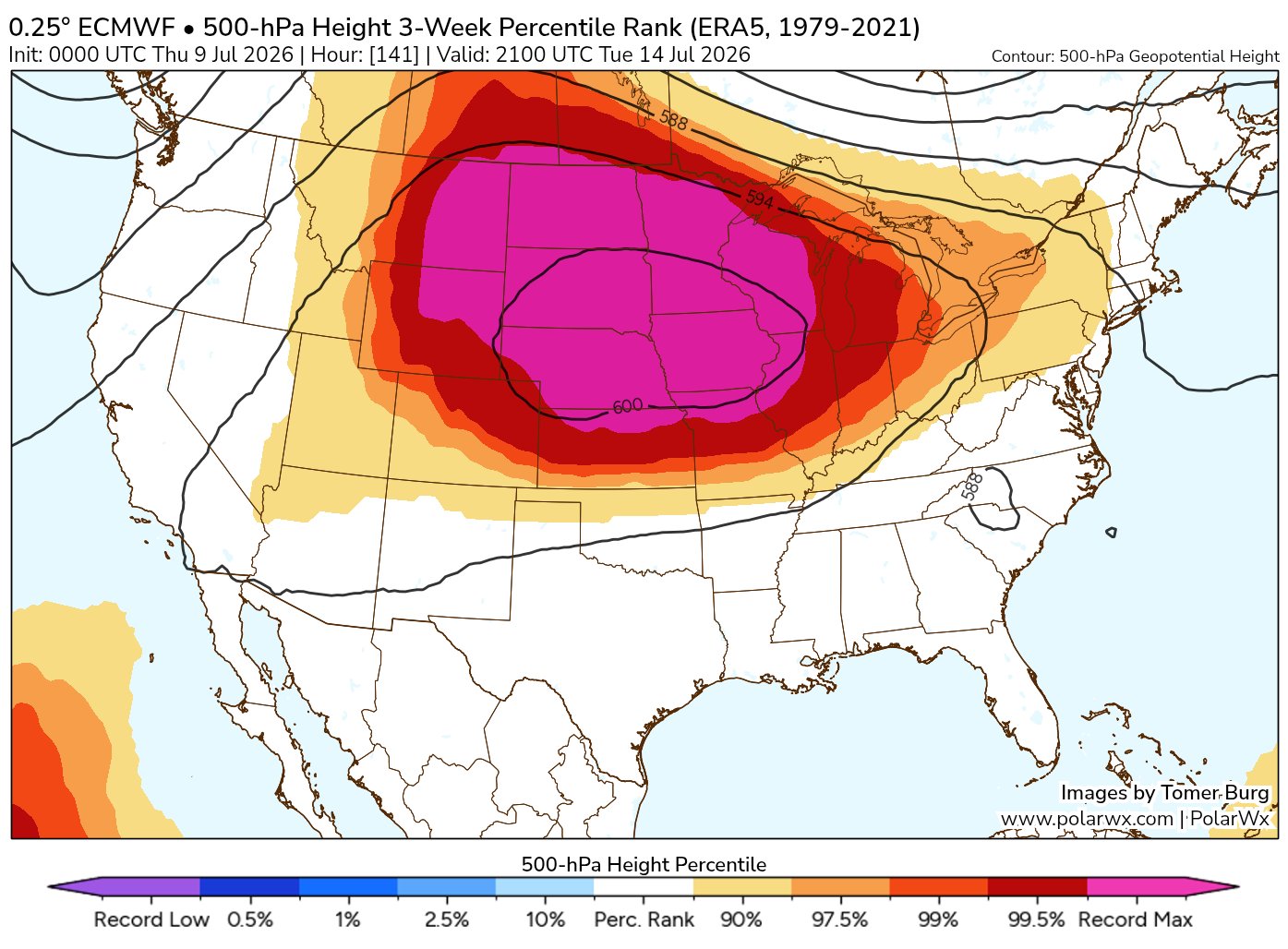
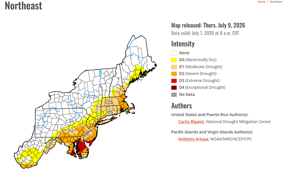
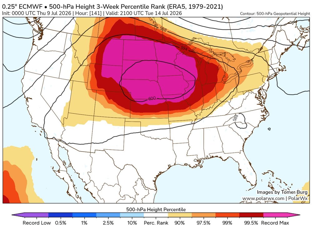
While we enjoy temps in the low to mid 80s this weekend (albeit still a bit sticky), the West bakes with temps as high as 110 at lower elevations and all time records possibly broken
-
The cell is aimed right for me at work in Brooklyn. Hoping it holds!
-
Surprised Mt holly hasn't put out anything Upton has for S.I.
-
Can hear a lot of thunder in the distance from that cell over Middlesex county.
-

Central PA Summer 2026 Discussion/Obs Thread
Voyager replied to Voyager's topic in Upstate New York/Pennsylvania
Out of area, but I'm at work. The sun came out here in Allentown, and it got instantly hot and humid... -
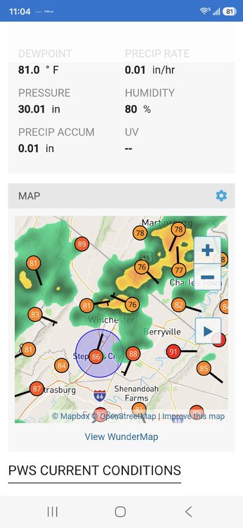
As the heat builds out here in Montana, I thought that I'd check in on how things were going back home. I see not a damn thing has changed.
-

Central PA Summer 2026 Discussion/Obs Thread
Jns2183 replied to Voyager's topic in Upstate New York/Pennsylvania
My forcast went to zilch Sent from my SM-S731U using Tapatalk -
We're getting slammed right now. Might get 2-3" out of this.
-
This hitting you pretty good? I'm right on the northern cutoff, so only some light rain, but can hear all of the thunder
-
Lots of lightning with that cell in central NJ
-
 Yeah with little wind, it's a hot one. I have 92.
 -
Storming good here again.
-
This is very detailed and seems emphatic that extremely heavy rain will occur. what I’m probably uneducated about is this recent spate of flood watches . I always thought we were “watching” for an enhanced probability, but not certainty, of heavy rain for the forecast area included in the watch. Seems like the feedback I got lately is if a 4 mile by 4 mile area gets flooding rain then the watch for a much much larger area was confirmed?
-
That big cell is so close but probably won't make it here Lots of thunder for sure
-
The latest, issued today. https://www.cpc.ncep.noaa.gov/products/analysis_monitoring/enso_advisory/ensodisc.shtml
-

2026-2027 Super El Nino
40/70 Benchmark replied to Stormchaserchuck1's topic in Weather Forecasting and Discussion
Wow, cool...so it's more precise then simply viewing a VP or OLR composite. Is the latest data behind a paywall? I'd love to incorporate that... -

Central PA Summer 2026 Discussion/Obs Thread
Superstorm replied to Voyager's topic in Upstate New York/Pennsylvania
Looks like storms are starting to fire up. .