All Activity
- Past hour
-

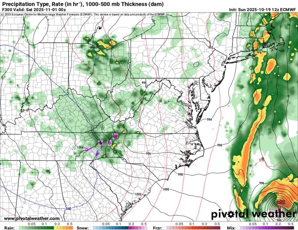
Monday, October 20, 2025 Squall Line Potential
metagraphica replied to weatherwiz's topic in New England
30-40 out of the SE in my hood and I'll lose power. Again. -
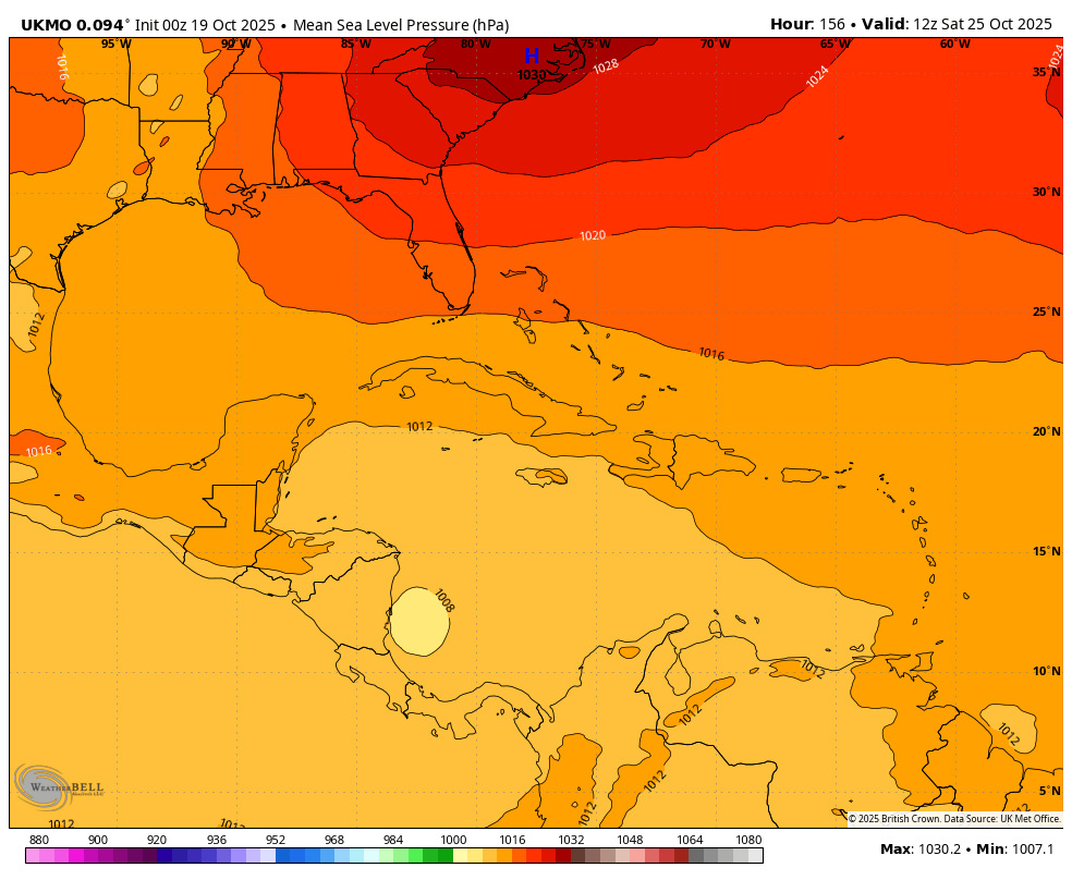
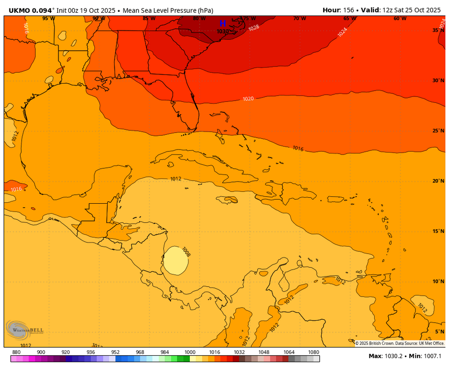
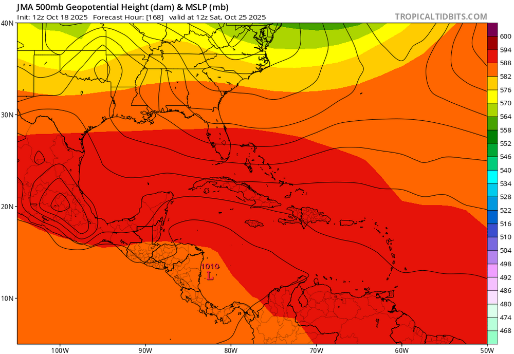
Followup: -12Z UKMET is still another headed into Nicaragua with a weak low -12Z JMA: after four 12z runs in a row of weak low into Nicaragua, today’s is slightly further N with a Mitch-like track that skims N coast of Honduras
-

Mid to long range discussion- 2025
WinstonSalemArlington replied to wncsnow's topic in Southeastern States
Monday morning wind chills -
70.6
-

Monday, October 20, 2025 Squall Line Potential
Damage In Tolland replied to weatherwiz's topic in New England
Clubs ripped out of bags and thrown into pond? -

Central PA Fall Discussions and Obs
Jns2183 replied to ChescoWx's topic in Upstate New York/Pennsylvania
I love this wind. It makes it fall for me. I nice south easter Sent from my SM-G970U1 using Tapatalk -
Yep! Sent from my SM-G998U using Tapatalk
-

Monday, October 20, 2025 Squall Line Potential
Chrisrotary12 replied to weatherwiz's topic in New England
Still waiting for my 10a golf tournament in Dover, NH to be cancelled. Otherwise it’s going to be wild. -
70 the high here today
- Today
-
Under mostly sunny skies, much of the region saw temperatures reach or exceed 70° today. Highs included: Atlantic City: 70° Bridgeport: 70° Islip: 70° New Haven: 71° New York City-Central Park: 70° New York City-JFK Airport: 70° New York City-LaGuardia Airport: 71° Newark: 73° Philadelphia: 72° A cold front will move across the region tonight into tomorrow morning. Low pressure will likely form along the front and move across the region. Periods of rain and perhaps some thunderstorms are likely into tomorrow. A period of severe weather is possible. A general 0.25"-0.75" rainfall with locally higher amounts appears likely. Following the frontal and storm passage, temperatures will top out in the lower and middle 60s through midweek. A stronger push of cold air could arrive afterward. Cool temperatures will likely persist through next weekend. The ENSO Region 1+2 anomaly was -0.1°C and the Region 3.4 anomaly was -0.3°C for the week centered around October 8. For the past six weeks, the ENSO Region 1+2 anomaly has averaged -0.12°C and the ENSO Region 3.4 anomaly has averaged -0.42°C. La Niña conditions will likely continue through mid-winter. The SOI was +7.60 today. The preliminary Arctic Oscillation (AO) was -0.919 today. Based on sensitivity analysis applied to the latest guidance, there is an implied 63% probability that New York City will have a warmer than normal October (1991-2020 normal). October will likely finish with a mean temperature near 58.5° (0.6° above normal). Supplemental Information: The projected mean would be 1.6° above the 1981-2010 normal monthly value.
-

Monday, October 20, 2025 Squall Line Potential
CoastalWx replied to weatherwiz's topic in New England
Ahh the clowns -
No. Not clear if it will be either. Some people want it to remain natural and not blocked off again.
-
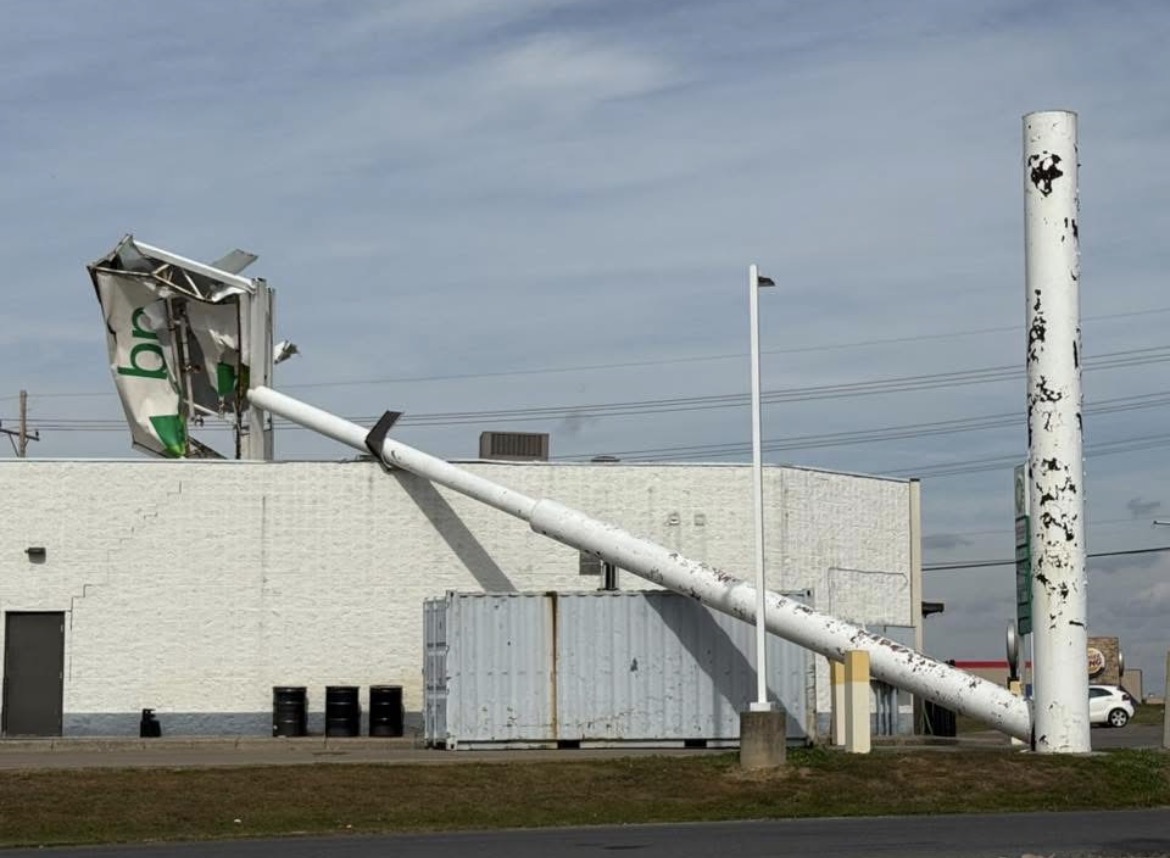
That's impressive yet also quite sad. Highest gusts have only been 40-45 at most. That sign was begging to die.
-
lenticulars
-
Front to WPA
-
Monday, October 20, 2025 Squall Line Potential
Damage In Tolland replied to weatherwiz's topic in New England
HRRR has some big rips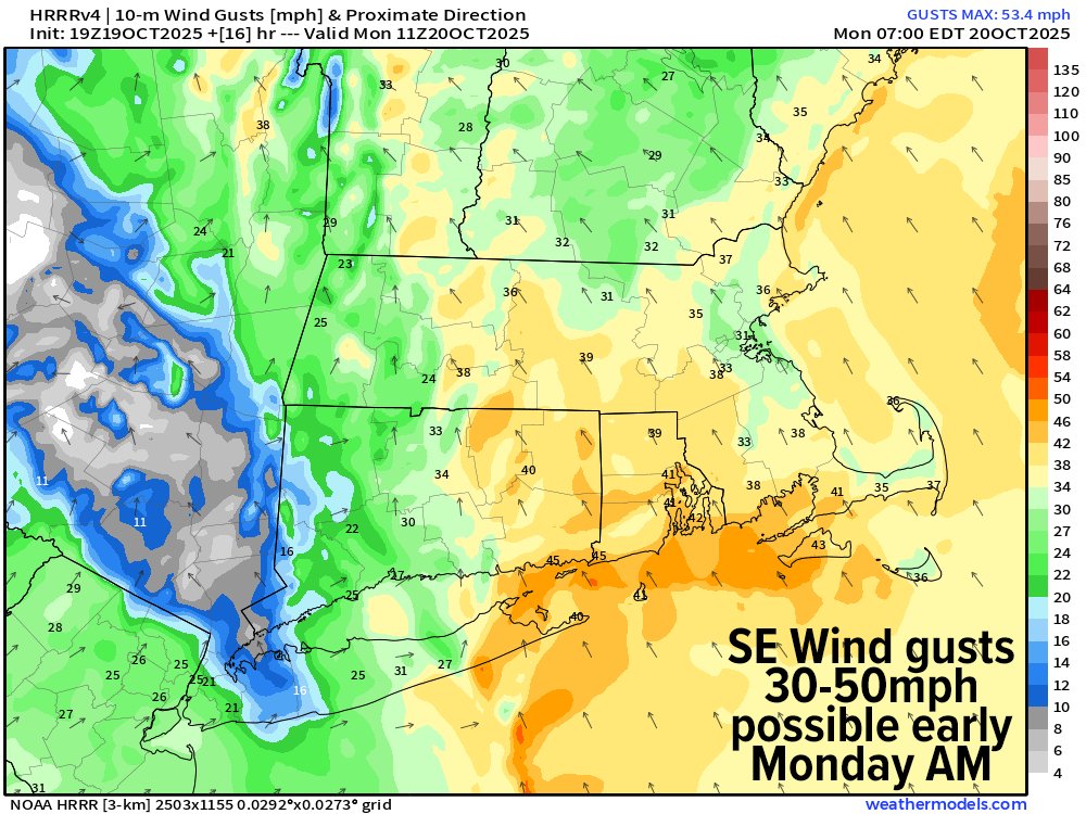
-
That is pretty pleasant fall like October temperatures enjoy Daniel Boone mostly to partly cloudy here windy and cool .
-
So the dam was never rebuilt?
-

2025-2026 Fall/Winter Mountain Thread
Buckethead replied to Buckethead's topic in Southeastern States
Down to 45 here after topping out at 56. I see the euro is beginning to hint at the first flakes of the season around Halloween. Sent from my SM-S908U using Tapatalk -
Yes, that seems to have been an exception, prominent as it was.
-
This doesn’t mean anything in October
-
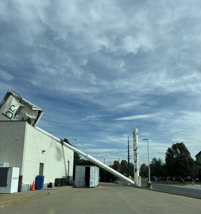
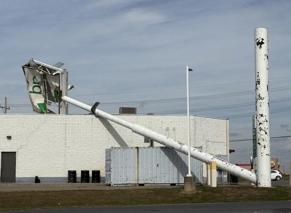
Wind blew down the BP gas station sign near me. Knocked down part of the roof of the convenience store when it fell.
-
Massive flooding which broke a dam which formed the lake.
-
Temp now down to 56..we've dropped about 10 degrees in an hour.
-
Only 13% of winters since 1980 have had a sub -0.25 DJF averaged NAO and they were all within 2 years of a sunspot minimum. All 4 sunspot minimums since the mid 80s have had either 1 or 2 sub -0.25 NAO winters. They were way more common from the late 1950s through late 1970s. This is despite Octobers pretty heavily favoring -NAO the last 15 or so years!