All Activity
- Past hour
-
Yup just one of the models
-

“Cory’s in NYC! Let’s HECS!” Feb. 22-24 Disco
EastonSN+ replied to TheSnowman's topic in New England
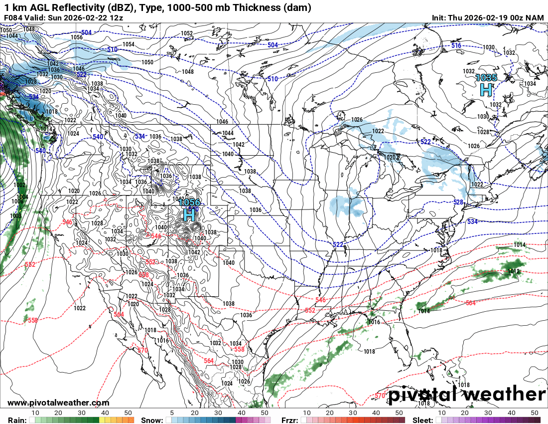
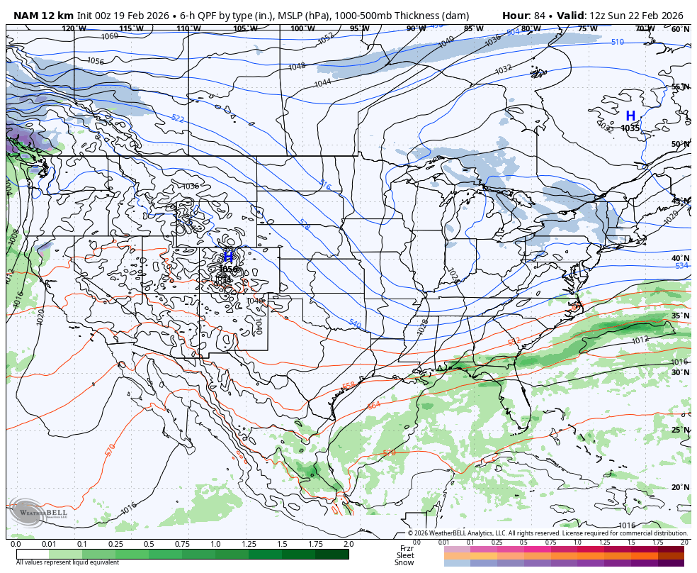
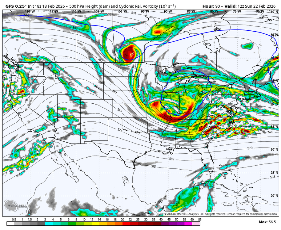
NAM first up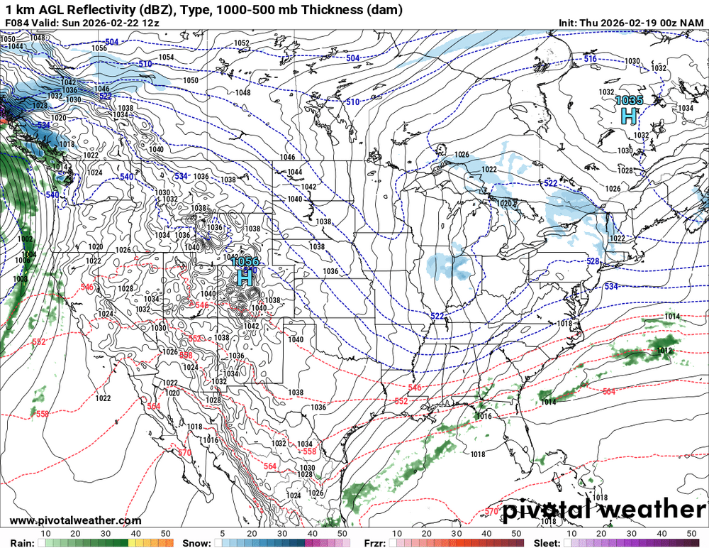
-
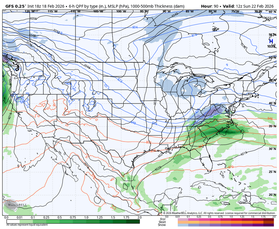
Compares to the GFS at the same range its much flatter or slower.
-
It's the long range nam doesn't mean anything yet.
-
There are going to be some Low CAPE/high shear showers and thunderstorms for N. Illinois to N. Ohio. The SPC has a slight risk of tornadoes for the lower Ohio Valley, which is south of the areas just mentioned. Convection-allowing models vary on coverage and placement of rain showers.
-

“Cory’s in NYC! Let’s HECS!” Feb. 22-24 Disco
TauntonBlizzard2013 replied to TheSnowman's topic in New England
-
Fridays rain should put a big dent in it
-
First up NAM end of run.

-
A bald man in Tolland stirs in his sleep…
-
Praying for good 0z
-

Feb 22nd/23rd "There's no way..." Storm Thread
Weather Will replied to Maestrobjwa's topic in Mid Atlantic
Off to a bad start...WB 12K NAM at 7am Sunday is a dud; nothing like the GFS at 18Z.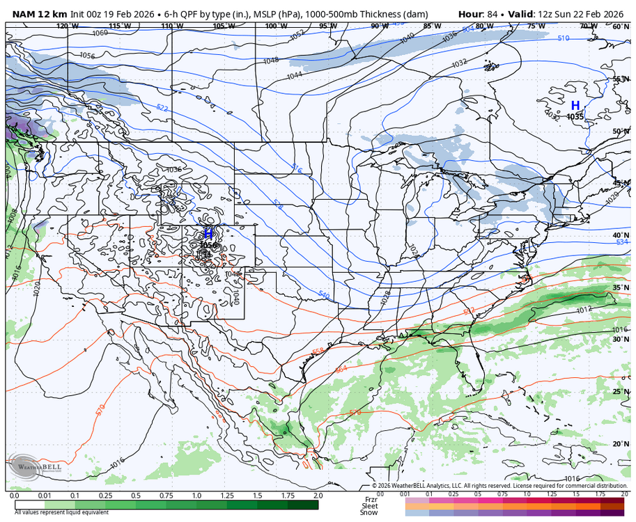
-
Nam warmest of all guidance but some nice hang back snows Saturday.
-
Yikes

-
If only the storms would happen in the mid term it would be spot on, But alas.
-

“Cory’s in NYC! Let’s HECS!” Feb. 22-24 Disco
40/70 Benchmark replied to TheSnowman's topic in New England
Not in tonight's (non) event. -
Feb 22nd/23rd "There's no way..." Storm Thread
Weather Will replied to Maestrobjwa's topic in Mid Atlantic
I will stay up for the EURO if the early 0Z suites continue to improve...agree writing on the wall if the ICON/GFS/CMC fizzle at 0Z. -
What NorthHills said. In addition, dewpoints are relatively high (mid 50s). So, even with clear skies, the high RH (70%+) isn’t conducive for strong radiational cooling as the water vapor acts as a blanket (kind of what you were speculating).
-
00z runs of the gfs cmc and icon will be telling. They're either going to trend 50 miles nw and put us back in the game or 50 miles SE and take us out of it. I'm fully prepared for the later of the two.
-
This thing died out for almost everyone in upstate NY and New England. Hope the Friday event doesn't for their sake. Looks like we're a hair too south in HV for significant Friday snow.
-
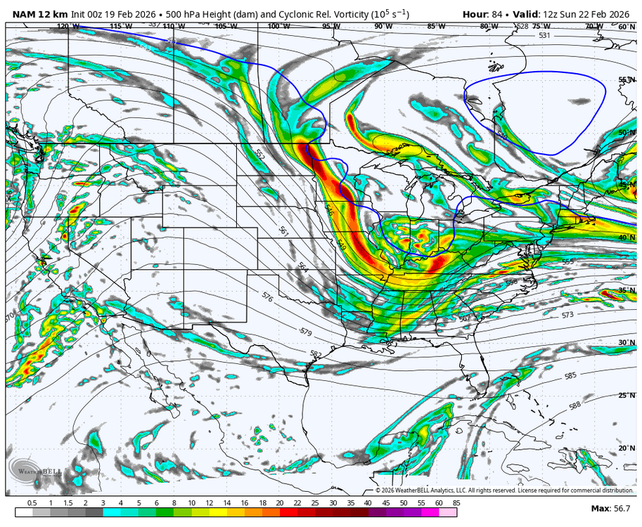
NAM is usually good at finding the warm tongues.
-
Feb 22nd/23rd "There's no way..." Storm Thread
Weather Will replied to Maestrobjwa's topic in Mid Atlantic
We are all hoping that that GFS/CMC combo is correct; but the current blend forecast keeps the coastal too far east to hit areas west of the Bay. The trough coming in from the west could give areas west of the Bay a light event. Reality sucks but it is what it is. Hopefully the NBM will look better by 0Z tomorrow. -
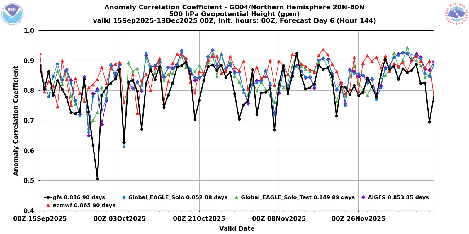
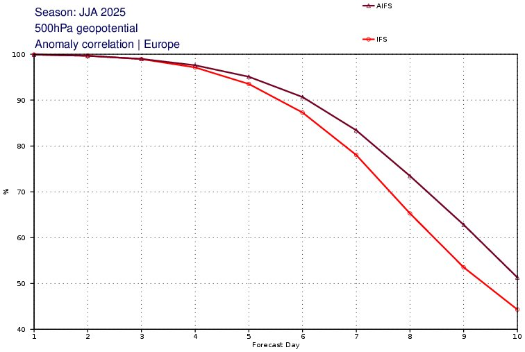
looking for more updated data.. but yea the AI models have been impressive at H5 compared to the traditional models. Here's D6 data with GFS vs AIGFS from late 2025 and AIFS vs IFS July-Aug 2025

-
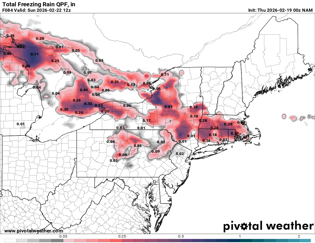
Nam looks warmer aloft. Timing is a bit later. More Zr and sleet and less snow in interior SNE.
-
Uh oh its snowing and blowing again, HARD https://www.mammothmountain.com/on-the-mountain/mammoth-webcam/woolly-cam It WAS so nice there today only a little snow, 15 mph gentle wind, now its straight outta Compton again. Snow is blowing furiously off the snowpack right back onto the plowed Woolly Lot! This storm is mocking man's puny attempts to cope with its works! It's got five feet of fluffy snow to pick up and hurl across the resort! Its only ten degrees and that wind chill is so cold! This is so bad and foreboding I am even beginning to wonder if the storm is backbuilding, returning for a second engagement with Mammoth Ski Resort. To be honest I am not so sure Mammoth personnel can deal with any more snow right now, they have pretty much got their hands full with what is already on the ground. Now I know what you guys feel like about watching those models. I am exhausted from pretty much staying up three nights in a row watching snow lmao.
-
Think about who you're replying to. Will posting a map. He probably clears his attachment space once every 45 minutes.