All Activity
- Past hour
-
And a shovel if Scott gets his way!
-
Sure does. Sat outside for 7 hours watching my kids softball games. Cold, windy, damp. Had some sun for like 45 mins then it disappeared and it got cold again haha. On the plus side they won the tournament. I'm sure I will be complaining about sitting in 95 degree humid trash air in a month though!
- Today
-
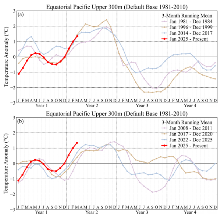
Tracking 1997 closely in the upper ocean. Currently well above recent non-super El Nino years. Chart from James Hansen as of March. https://mailchi.mp/caa/super-duper-el-nino
- Yesterday
-
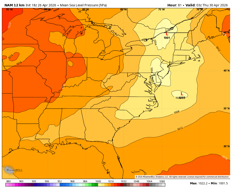
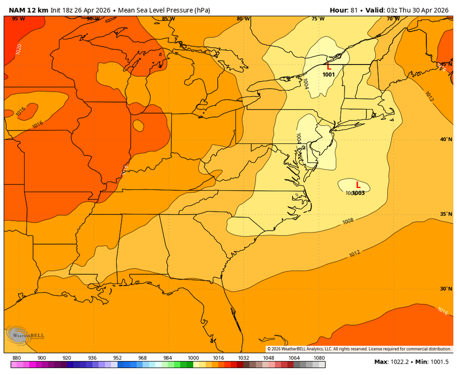
The "worst" in this case driest model is usually correct in the mid Atlantic.. Anyone know when the NAM will finally be put to bed?
-
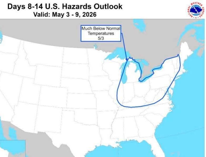
Man, I don't want a cool May. It's also our most cloudy month of the year, so below average also means more clouds
-
Is this like comparing sugar to shit?
-
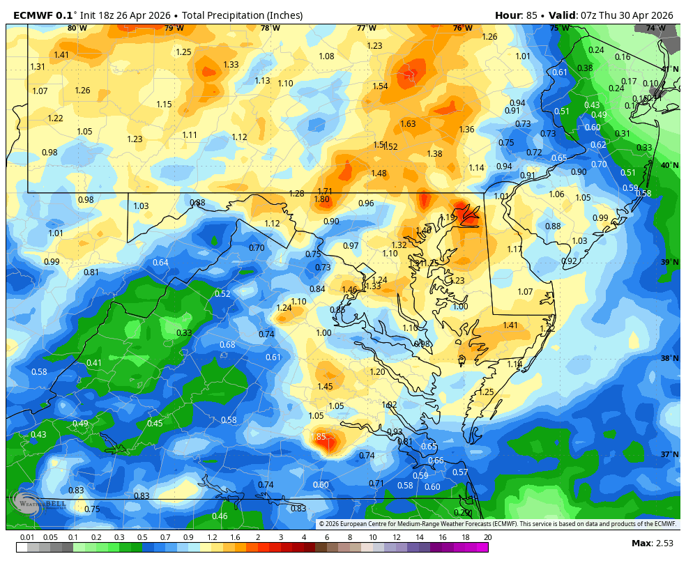
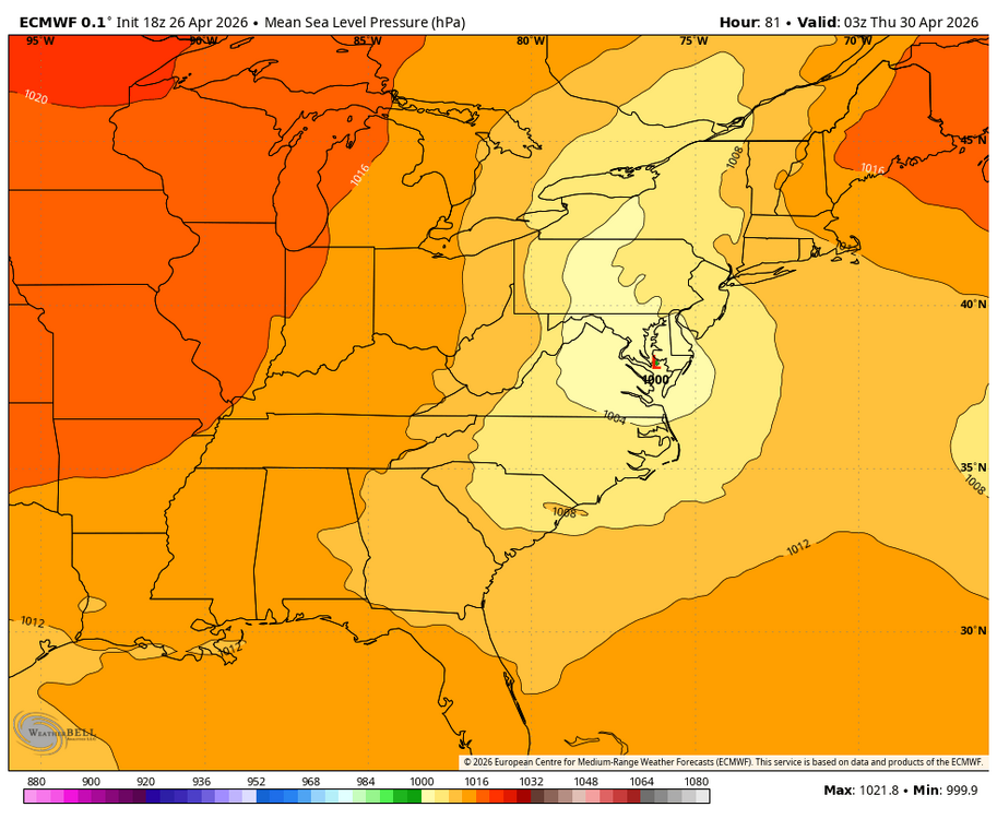
WB 18Z EURO for mid week.

-

Central PA Spring 2026 Discussion/Obs Thread
mahantango#1 replied to Voyager's topic in Upstate New York/Pennsylvania
63 for the high today. Forecast high was 59. -
OHC and buoys both show sharp warming since early April: OHC: only ~+1.6 early April OHC: ~+2.0 to +2.1 mid April!
-
Hey @jaxjagman thank you for checkin yeah @vortexse93 is safe but he got a hell of a show! Monday looks late and west. Oh joy* , late is a Southern tradition in spring like football is in the fall. One of those is not like the other. In fact with my MLB team(s) so far, how long until fall football? Tuesday is my main interest. SPC notes the MO/KY boundary which is more the sinking synoptic front. It looks active; could be messy; and, could be nasty. However I'm a lot more interested in Arkansas. Well I would be if I was free. Tuesday Arkansas should be home to a farther south outflow boundary OFB from Monday. That OFB could be draped from GA/AL/MS curling back up into Arkansas, and intersecting the synoptic boundary in western Arkansas. Said OFB is currently forecast to get free of rain early in the day - and cook well into Tuesday afternoon. Unlike some previous scenarios, the wind shear is present in the South. Speed and turning are noted from the LLJ to the upper jet. Storm motions might not be crazy either. We'll see. Oh yeah Arkansas isn't technically our state. Well, the whole mess of clusters, blobs and discrete supercells will roll into Tennessee on Tuesday night. Joy!* *Sarcasm part of my signature is very relevant for overnight severe.
-
Skies cleared here for a while late afternoon with the clearing line moving from E to W for a change.
-
I think they started blooming very end of Morch .
-
Models that are wetter for midweek are showing a quicker northern and southern phase. We know how that normally plays out in winter for us but we will know in a few days.... Compare the dry WB 18Z 12K NAM to the much wetter 18Z EURO,
-
We fairly frequently get snowpack with 1-2" water content but rarely more than that. The most water content i can recall was 2014 with about 4-5" water content by late Feb.
-
Yikes. Hope this doesn't pan out.
-
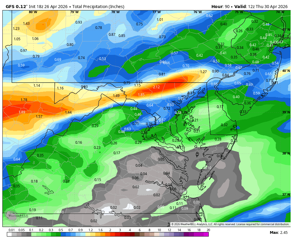
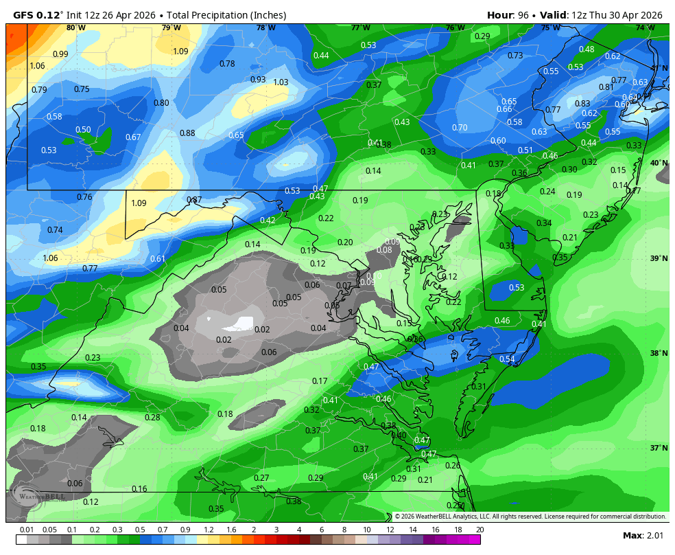
WB 18Z GFS is wetter this run compared to 12Z; mid week watch continues.

-
Is there a potential frost on tap next weekend? Can't think of a worse time for farmers who have been hit hard this spring.

-
Not a chance. It will be the same crickets as during the cold winter. Unless the west continues to bake.
-

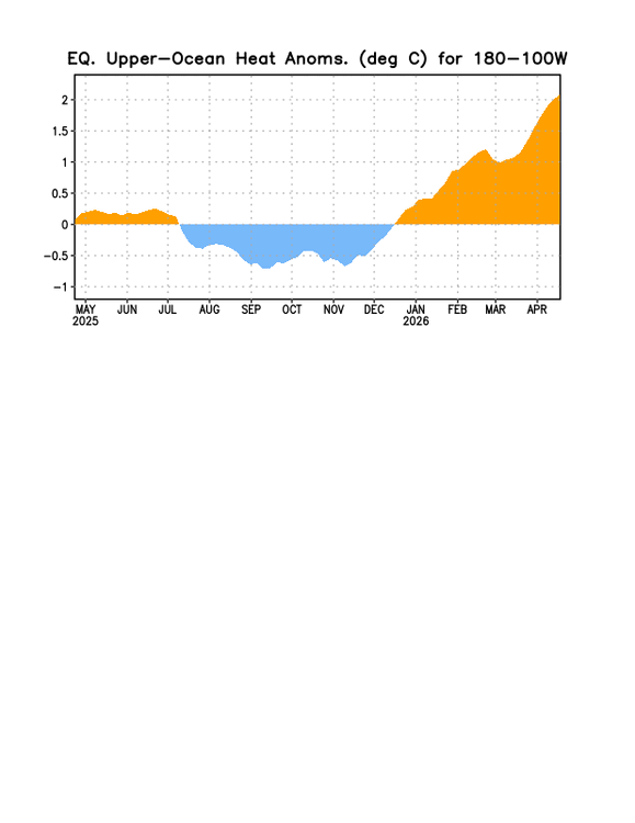
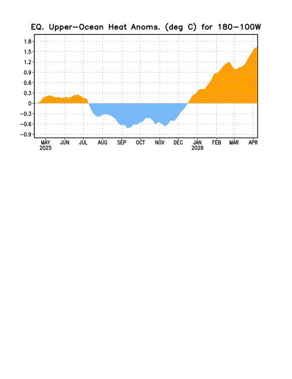
2026-2027 El Nino
Stormchaserchuck1 replied to Stormchaserchuck1's topic in Weather Forecasting and Discussion
2 days of strong -SOI, moving the 30-day average to the lowest since 23-24 El Nino 26 Apr 2026 1010.40 1011.90 -28.05 -9.61 3.89 25 Apr 2026 1010.94 1012.50 -28.48 -9.08 4.09 -

E PA/NJ/DE Spring 2026 Obs/Discussion
RedSky replied to PhiEaglesfan712's topic in Philadelphia Region
Frost advisory -
Bob Ryan came into my shop on Saturday. Nice guy!
-
I'll take it. With the race at Indy coming a bit early this year a cool to chilly May makes for crazy fast cars!
-
Could be a blip but 18z gfs looks better midweek for many. I don’t know anything about the RDPS but the gfs kind of has the same look of what Will posted earlier
-
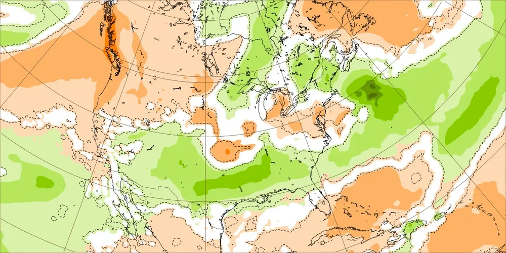
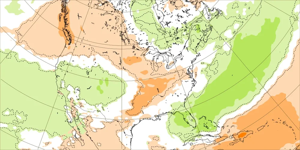
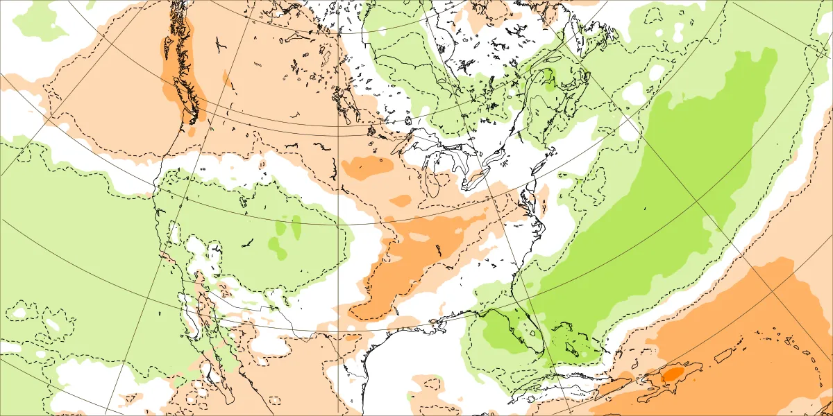
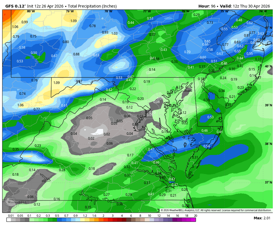
Today’s EW rainfall next 2 weeks: 4/27-5/3: AN to NN SE; ATL 1.5-1.75” 5/4-10: NN in SE (ATL 0.75”); wetter FL